New P.E.I. climate risk map predicts future coastal erosion and flooding
A new interactive map created by a UPEI climate scientist allows users to explore the likely future impacts of climate change on the Island's coastline, as well as inland.
The P.E.I. Climate Hazard & Risk Information System, or CHRIS, is part of a larger climate adaptation project by the provincial government, in partnership with UPEI and the federal government.
DON'T MISS: Can EV batteries handle Canada's changing climate? Experts weigh in
Peter Nishimura, manager of climate adaptation for the P.E.I. Department of Environment, Energy and Climate Action, said the province already had an online mapping platform for the Island for several years.
He said the previous software — the Coastal Hazards Information Platform (CHIP) — shows flood and erosion vulnerability.
But the newly released CHRIS tool adds important new features, including flood maps with water depth predictions, and rates of coastal erosion.
"We've started to move beyond just coastal hazards into inland hazards — what we call pluvial flood maps — that show the extent of of flooding due to heavy rainfall," Nishimura explained. "And it's also going to give us an opportunity to expand on other areas of climate hazards."
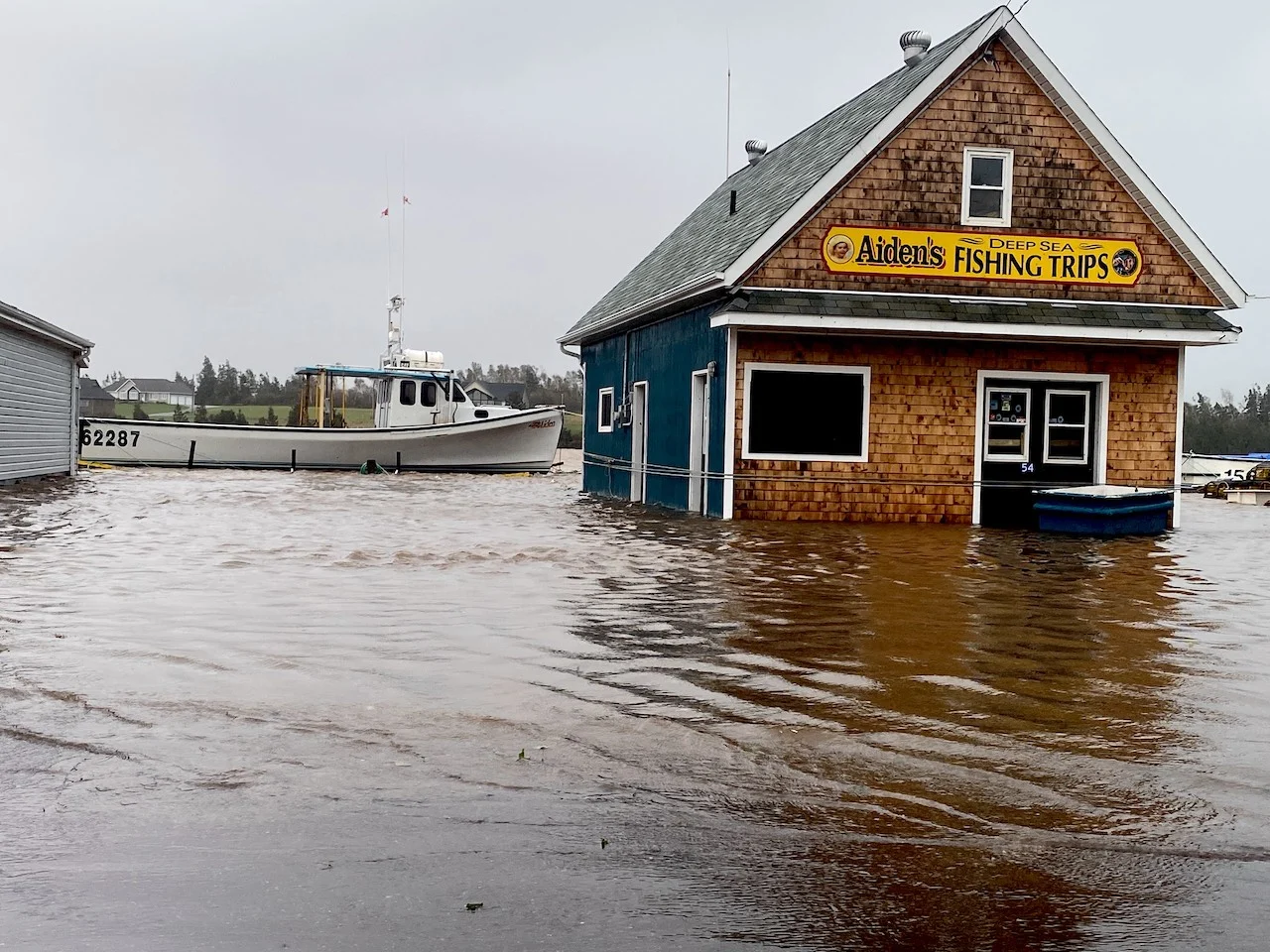
(Jaclyn Whittal/The Weather Network)
'Informed decisions'
Nishimura hopes CHRIS will be especially useful to First Nations and municipalities in making decisions about development, where to plan and build infrastructure, and how it could be designed.
He said it would also be valuable for other Island residents, both homeowners and tenants, looking for information about how vulnerable their area is to flooding. And it could be of interest to home buyers as well.
"We have a lot of people coming to P.E.I. who might be new to the area," Nishimura said. "They're looking for information about what hazards might be present.
"This way they can make an informed decision around where they might want to buy or build."
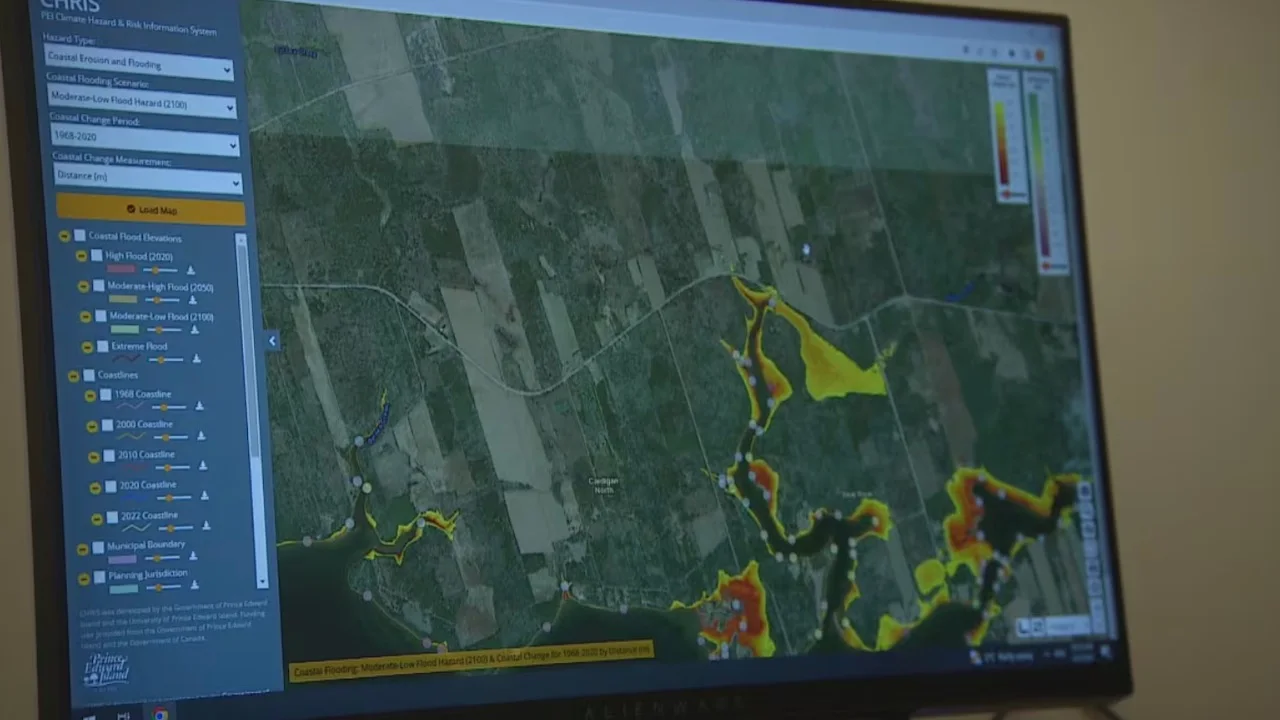
The PEI Climate Hazard & Risk Information System (CHRIS) includes projections for future weather events. (Ken Linton/CBC)
The CHRIS tool includes a disclaimer against any liability claims from anyone using the program.
Nishimura said the software should be seen as "a piece of the puzzle" helping Islanders learn about climate hazards and risks.
"One of the climate hazards that I think people are becoming more familiar with now is flooding due to heavy rainfall," he explained. "These maps will show people where that rainfall tends to collect.
"I think it can inform property owners with regard to their risk."
Nishimura said he and his staff have started taking CHRIS into communities around P.E.I., including presentations to city staff in Summerside and Charlottetown.
He said there are also plans to add more climate hazards to CHRIS, for example heat maps.
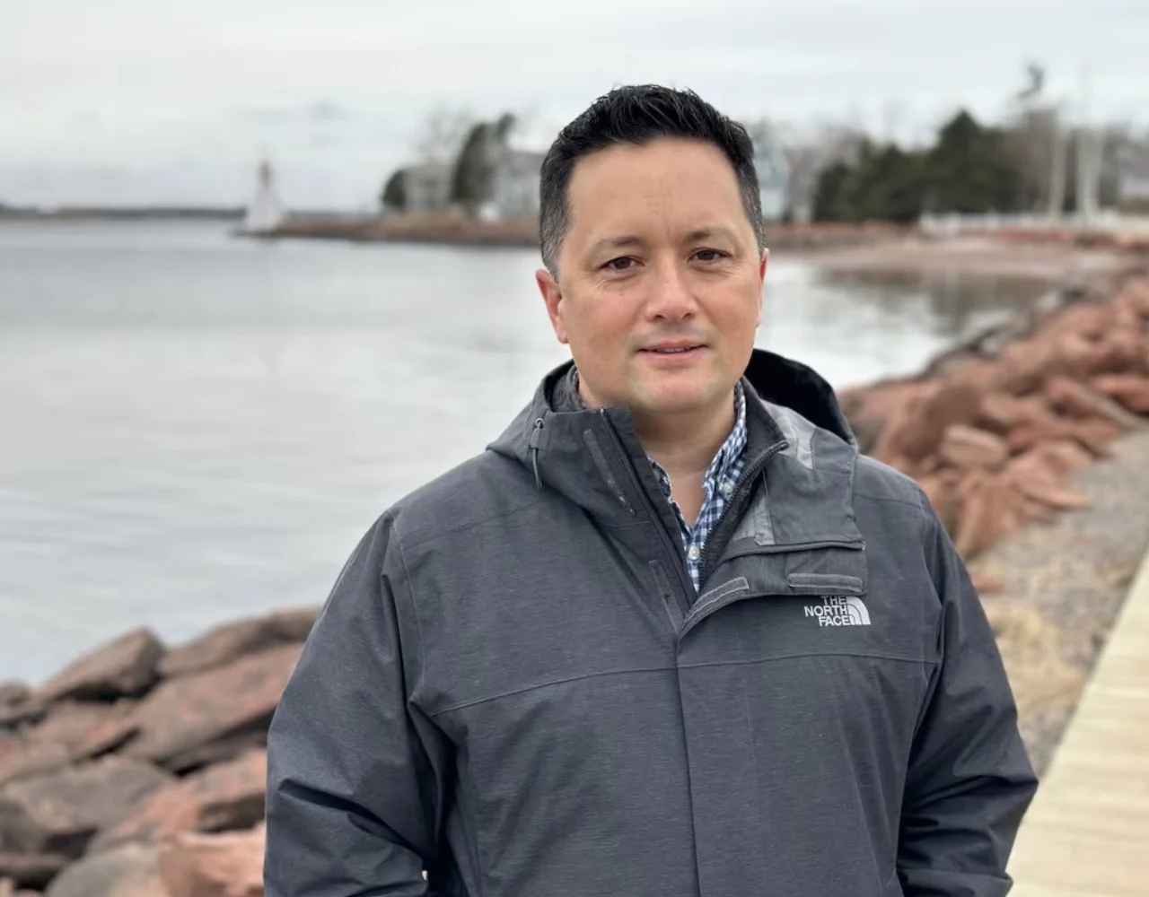
Peter Nishimura, manager of climate adaptation for the P.E.I. Department of Environment, Energy and Climate Action, said the project was funded in part by the federal government, in partnership with UPEI. (Aaron Adetuyi/CBC)
Big picture
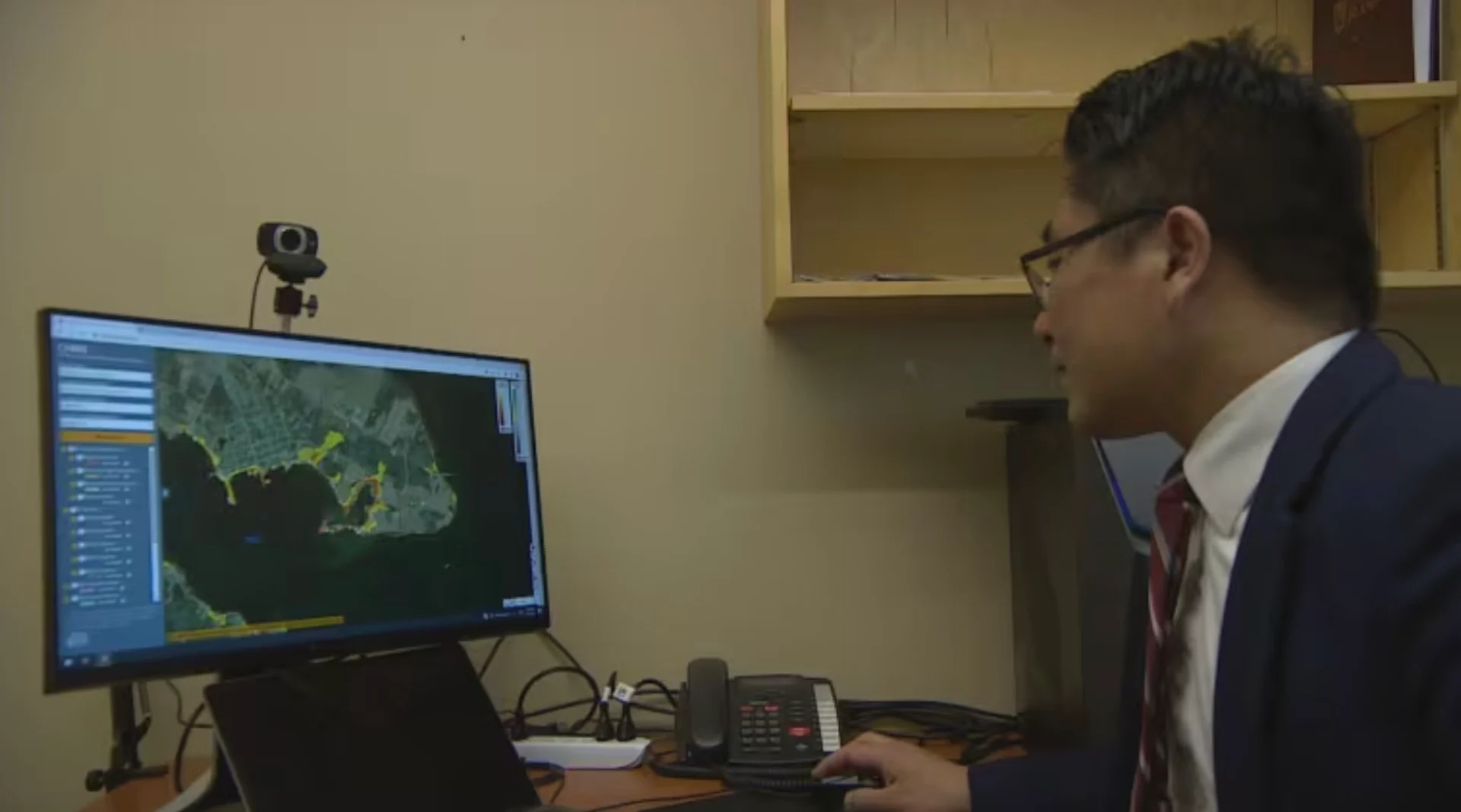
CHRIS is the creation of Xander Wang, who directs the Climate Smart Lab at UPEI's Canadian Centre for Climate Change and Adaptation.
He said it's important people use the tool the way it is intended — as a source of information to help guide decision making.
"Certainly there are some limitations for CHRIS," Wang said. "These are all based on our computer models.
"We cannot say our computer models are 100 per cent accurate. They are useful, but they're not 100 per cent accurate."
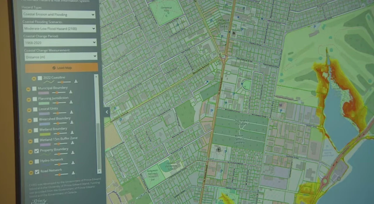
The map can show municipal boundaries, property id numbers, buffer zones and many other features. (Ken Linton/CBC)
"Certainly for individual properties, it's really important to contact some professional engineers to do some detailed assessment," Wang said. "The purpose of CHRIS is to provide a general large-scale patterns assessment, so that people can get a sense of the big picture about flooding. "But for individual properties, we do encourage people to reach out to some professionals."
Wang said researchers are always looking for ways to measure how accurate their models are.
For example, he said, the CHRIS team has collected information about inland flooding, to see how the model stacks up to real-world data, such as the September 2020 floods in Charlottetown.
"We collected some social media video footage from Facebook about the flooding in the Holland College parking lot," Wang said. "We use that video footage to verify our model, and it turns out our model is working very well in simulating the flooding depths in that area.
"So these is some information we use to really verify our model, to make sure those results we are producing are as reliable as possible."
WATCH: Climate change is accelerating flooding potential from glacial lakes
Thumbnail courtesy of Ken Linton/CBC.
The story was originally written by Nancy Russell and published for CBC News.


