
A very soggy pattern is finally set to break for Eastern Canada
Round after round of heavy rain across the eastern half of the country will finally come to an end as a pattern shift arrives for the end of April
There’s good news in the forecast for folks across Eastern Canada tired of the soggy pattern locked over the region for the past few weeks.
A steady parade of storms and plumes of tropical moisture have brought waves of soaking rains and occasional snows to the eastern half of the country. Some towns are on track to see one of their wettest starts to spring on record.
Change is on the way. A transition toward a calmer pattern is in progress that’ll break the conga line of active systems and deliver a much-needed drying trend.
DON’T MISS: Canada's weather traffic jam traced back to an Omega and Rex block
A very wet March and April for Eastern Canada
Abundant rains have filled the gauges from the Great Lakes to the Great Northern Peninsula over the past six weeks as one system after another tracked through the region.
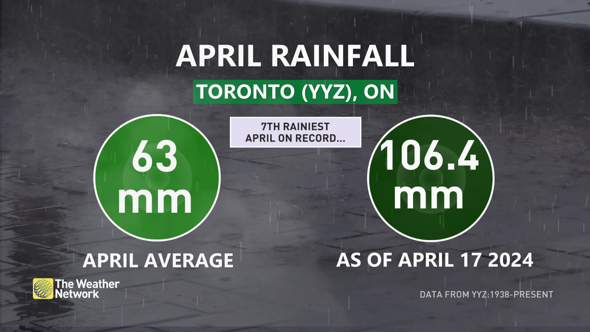
Toronto has seen nearly 170 percent of its normal April rainfall in just two and a half weeks. The airport picks up about 63 mm of rain in a typical April; this month, though, we’ve already seen 106.4 mm of rain through April 17.
The persistent bouts of precipitation across Ontario weren’t all bad news. All the heavy rain of late may improve the province’s standing heading into wildfire season.
It’s a similar story toward Atlantic Canada, where downpours even caused damaging floods in New Brunswick and Newfoundland at the end of March.
MUST SEE: La Niña will make a comeback this summer as El Niño finally fades
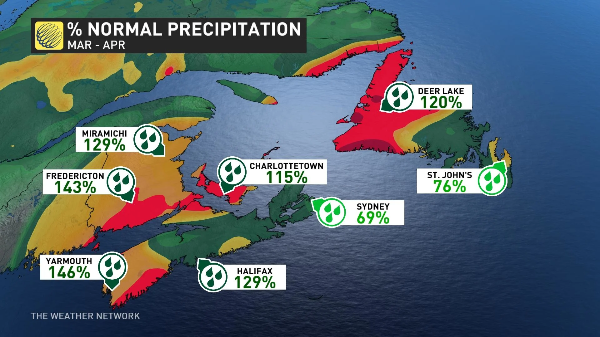
While pockets of Atlantic Canada have missed out on the prolific rains, many communities have seen above-normal totals since early March.
Fredericton, N.B., has seen its third-wettest March and April combined through this week, and the city is only 16 mm away from securing the top spot.
Yarmouth, N.S., has seen its sixth-wettest March and April so far, with Halifax; Miramichi, N.B.; and Deer Lake, N.L., all registering high on their respective lists.
The jet stream smooths out to round out April
Strong troughs in the jet stream, along with a strong centre of high pressure over the Atlantic near Bermuda, helped funnel moisture north of the border and drive this extended period of wetter-than-normal weather.
RELATED: Soggy April in southern Ontario could ease drought, wildfire concerns
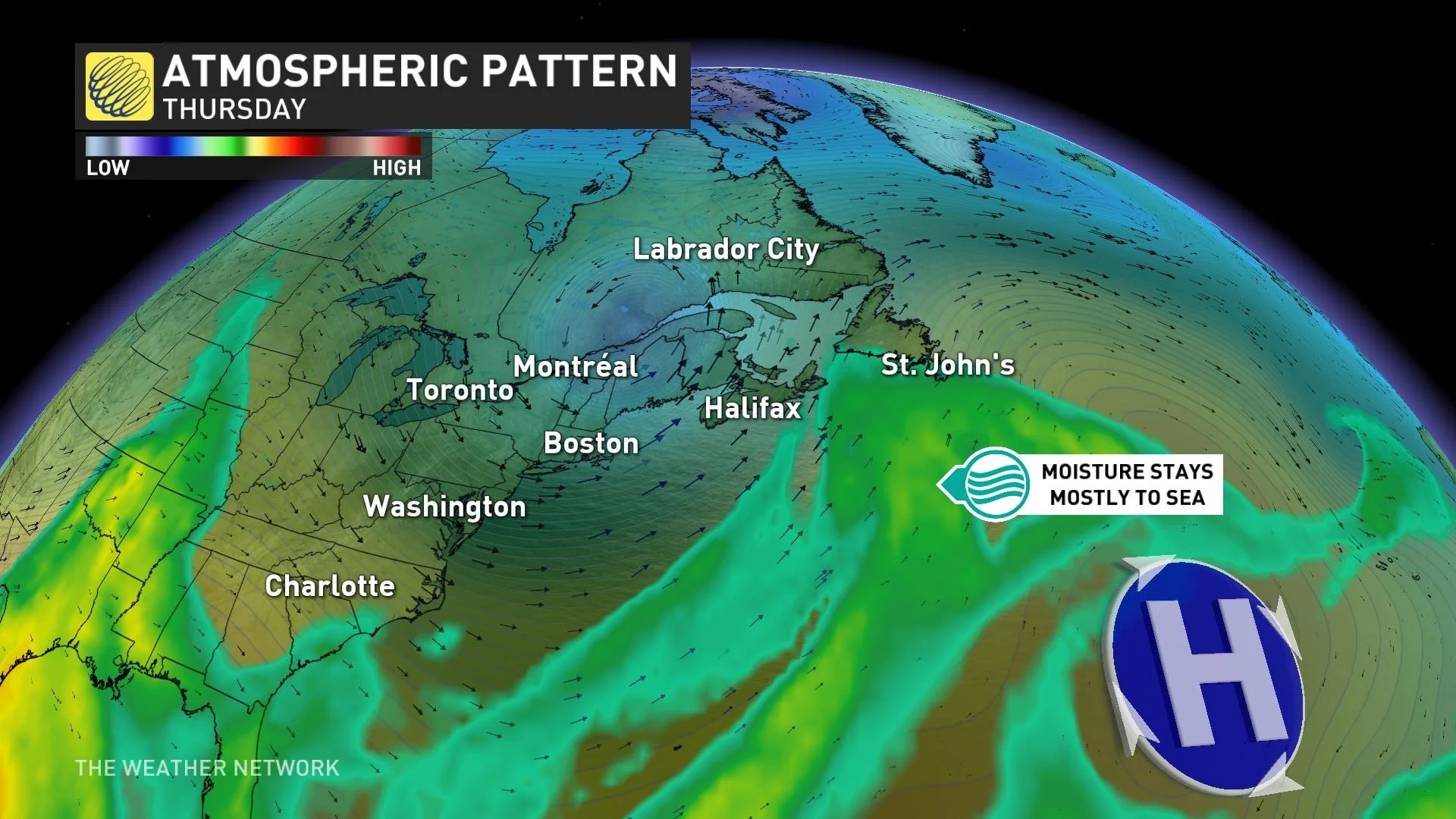
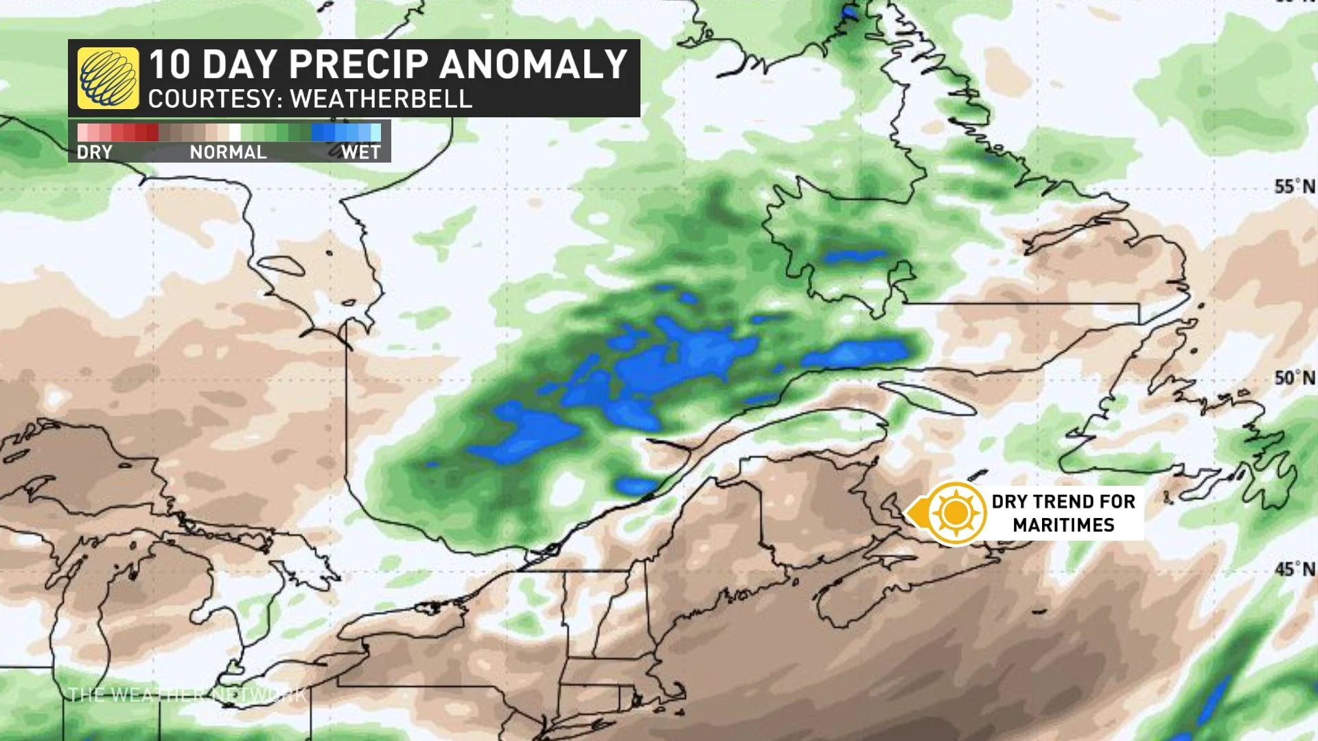
Rounding out the last half of April, though, we’re watching a pattern shift that’ll help mellow out the jet stream—and finally break the drumbeat of downpours.
Forecasters see a drier pattern building over Eastern Canada as the Bermuda high moves farther offshore and the jet stream aloft calms down and smooths out.
Systems that trek over the region for the next few weeks should be a bit lighter in terms of precipitation, and they won’t feature back-to-back marathons of active weather.