La Niña will make a comeback this summer as El Niño finally fades
The revised forecasts issued by scientists have been revealed, and the verdict is clear: La Niña will make a comeback
While El Niño has dominated in recent months, it will soon be La Niña's turn to take over.
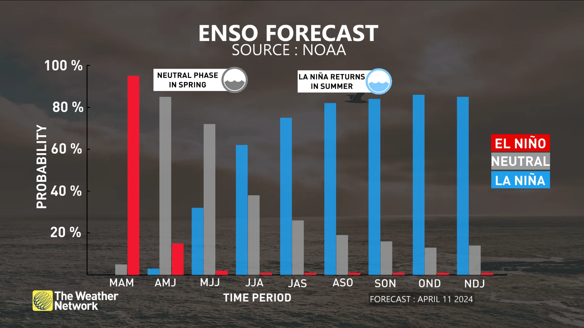
In March, National Oceanic and Atmospheric Administration (NOAA) scientists predicted the rapid return of La Niña as early as this summer, and the new projections point in the same direction.
RELATED: What is La Niña? And how does it impact global weather?
The transition between El Niño and La Niña will occur quickly. La Niña will dominate this summer after a short period of neutral phase of the El Niño–Southern Oscillation (ENSO).
SEE ALSO: Experts predict an extremely active 2024 Atlantic hurricane season
Consequences, even at home
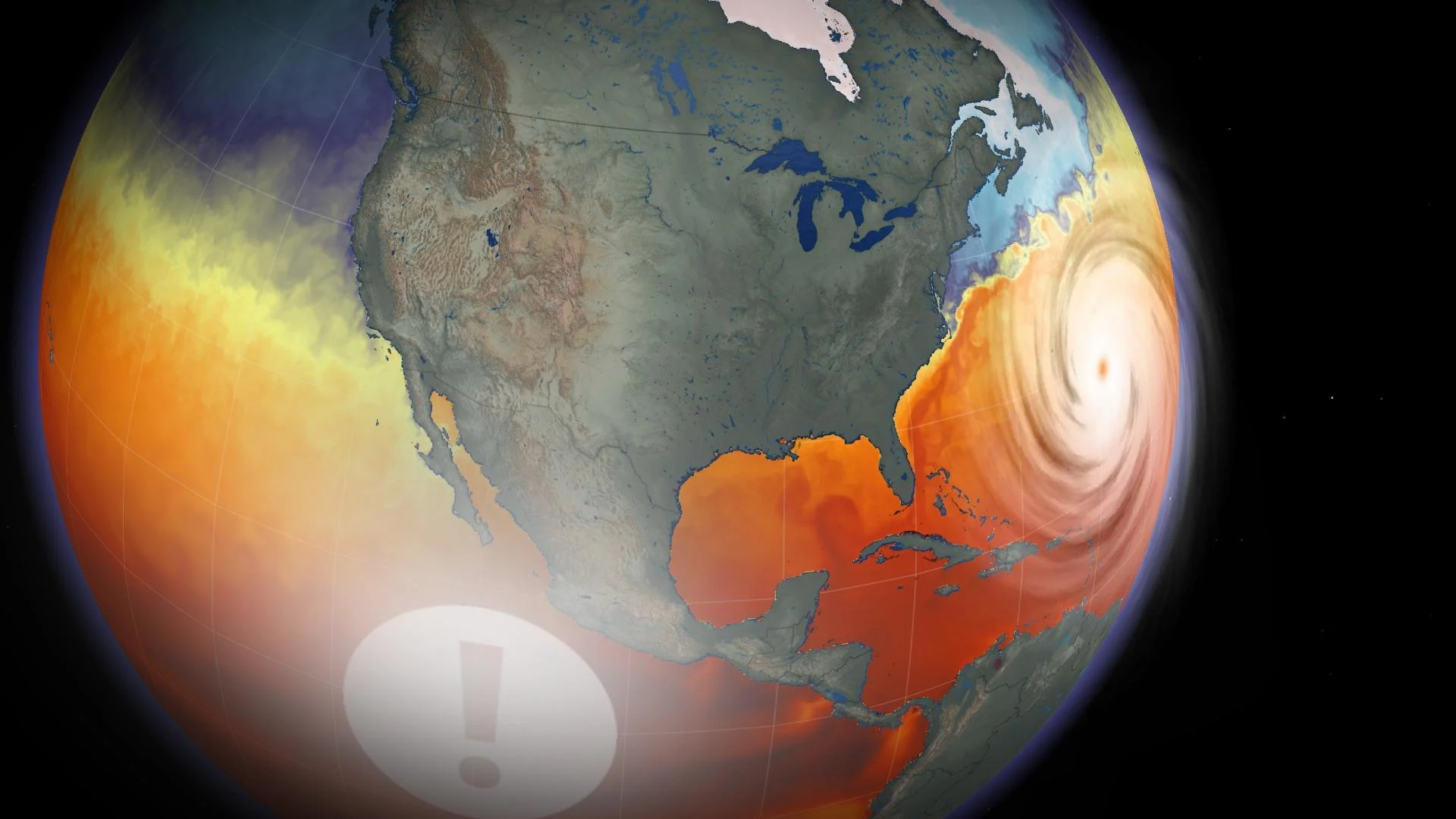
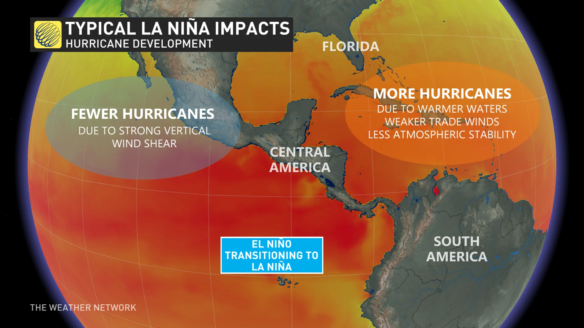
When La Niña reigns, it is the Atlantic Ocean that becomes the scene of particularly active weather. Warm water and low wind shear make it easier for storms to develop. Conversely, the presence of wind shear makes it harder for hurricanes to develop in the Pacific Ocean.
It should be noted that the upcoming summer season promises to be particularly intense in the Atlantic basin.
The high level of cyclonic activity means that hurricanes will be more numerous and more powerful. As a result, Eastern Canada is not immune to the impact of these tropical storms.
WATCH: 60-second explainer, what are El Niño and La Niña?
The article was originally written by David Tremblay, content creator and presenter at MétéoMédia Canada, and translated to English by Matt Grinter, a meteorologist at The Weather Network.


