Rare widespread chill to hit Canada, kicking off an active pattern
A chilly weekend will spread across much of Canada as an active pattern churns through the end of March
Chilly air shouldn’t be rare in Canada—even at the beginning of spring.
A changeable pattern will align just right this weekend to bring the country something we only saw once this winter: below-seasonal temperatures spread from coast to coast.
This weekend’s atmospheric arrangement will allow cooler temperatures to stretch from British Columbia to Nova Scotia. Conditions are likely to stay chilly and active for most through the end of the month.
DON'T MISS: Everything you need to know for April's spectacular and rare solar eclipse
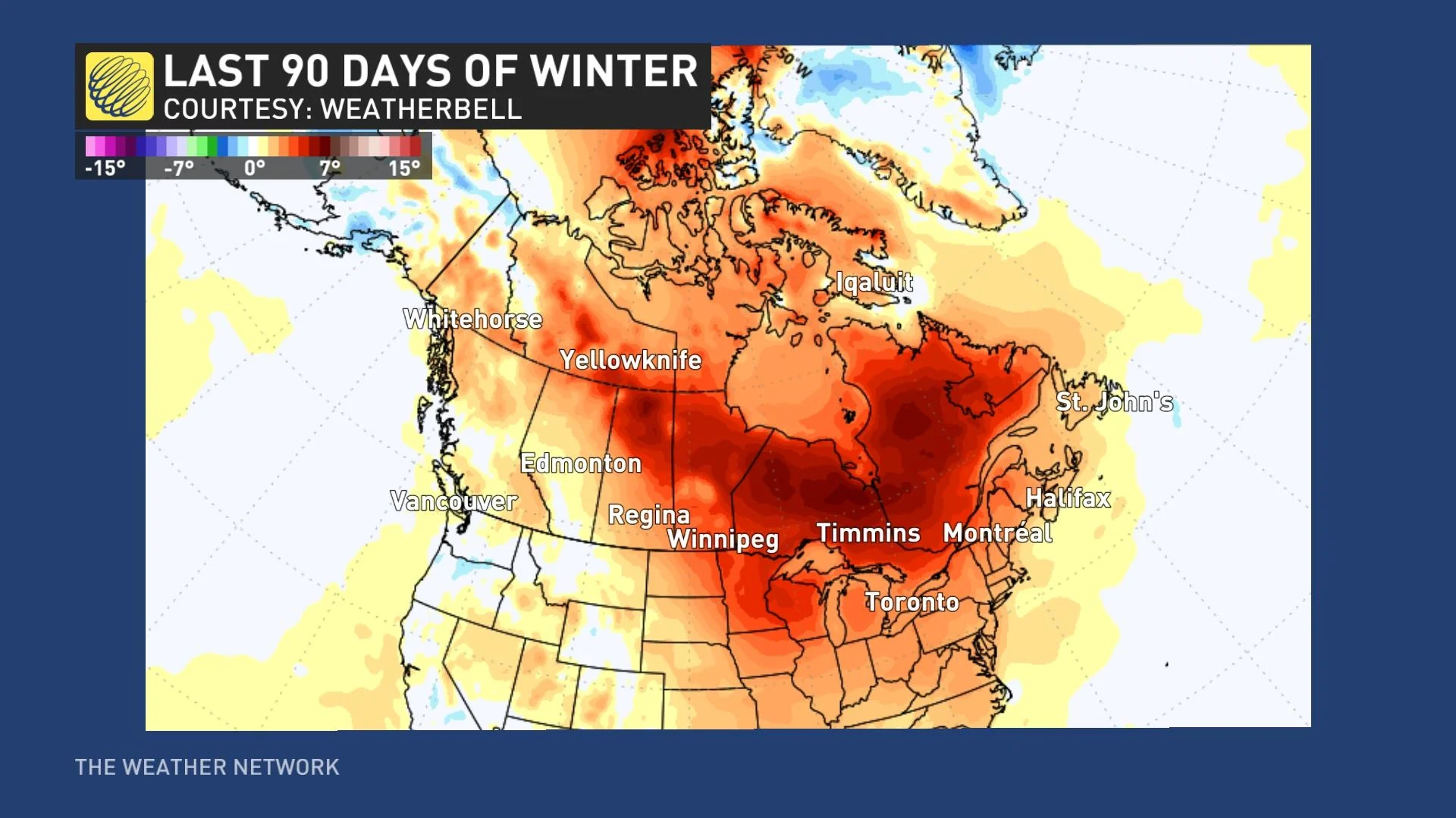
We’re trudging toward the end of a ‘cool season’ across Canada that wasn’t all that cool.
Despite the occasional Prairies cold snap and East Coast snowstorm, this season landed in the books as Canada’s warmest winter ever recorded. El Niño played a large role in dominating the winter with above-seasonal temperatures.
Even the most stubborn pattern occasionally breaks down, though, and we’re going to see one of those reversals play out in the days ahead.
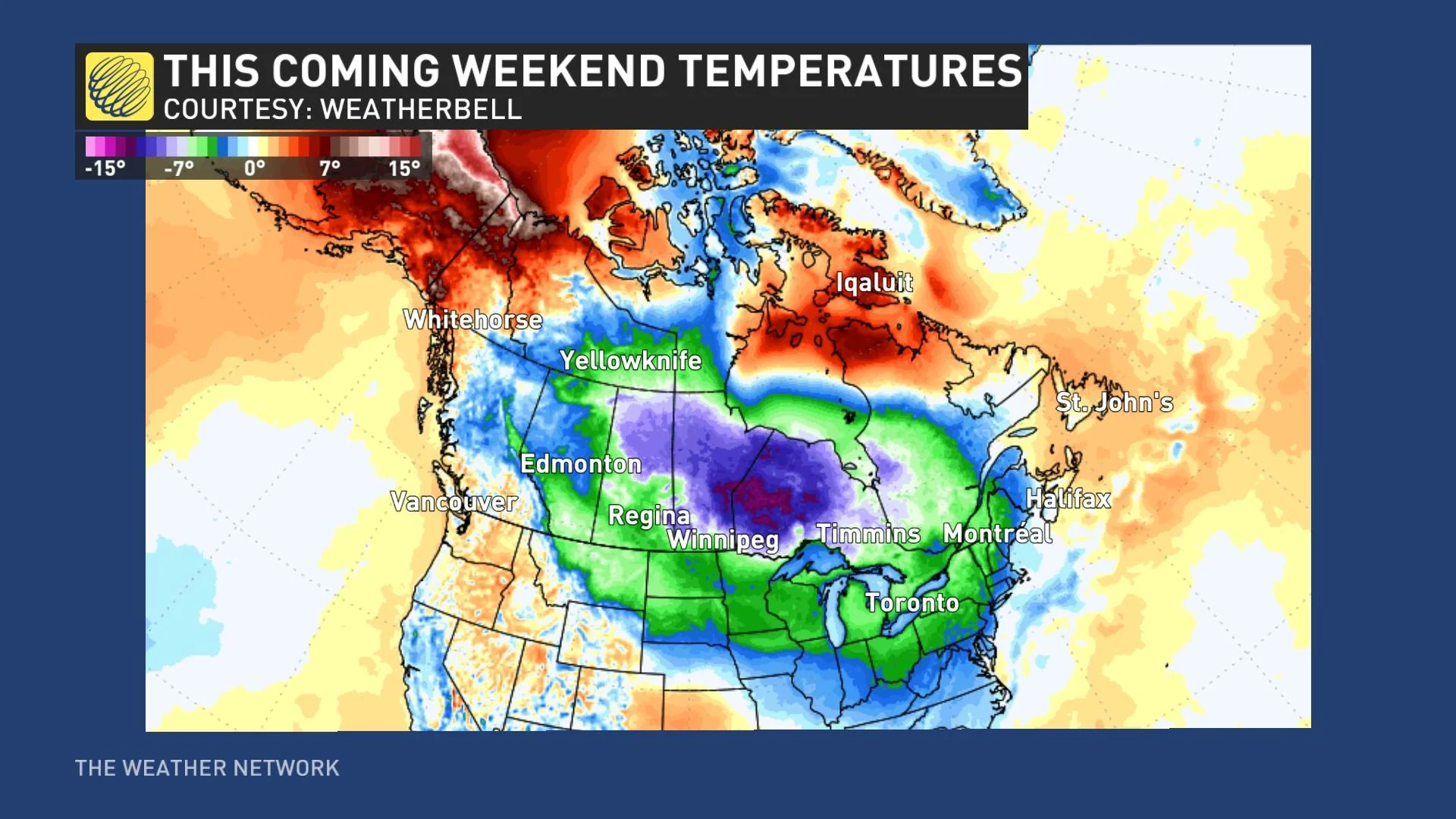
The overall setup we’ll see this weekend features a broad ridge of high pressure building over the Arctic latitudes. Arctic ridges tend to displace cold air toward the south. The Far North will see warmer-than-usual temperatures as the chill moves south this weekend.
Seasonal temperatures change in a hurry this time of year, and below seasonal isn’t quite the bone-chilling prospect it might be in the middle of January.
MUST SEE: Warmest winter ever: Canada's record season reaches new heights
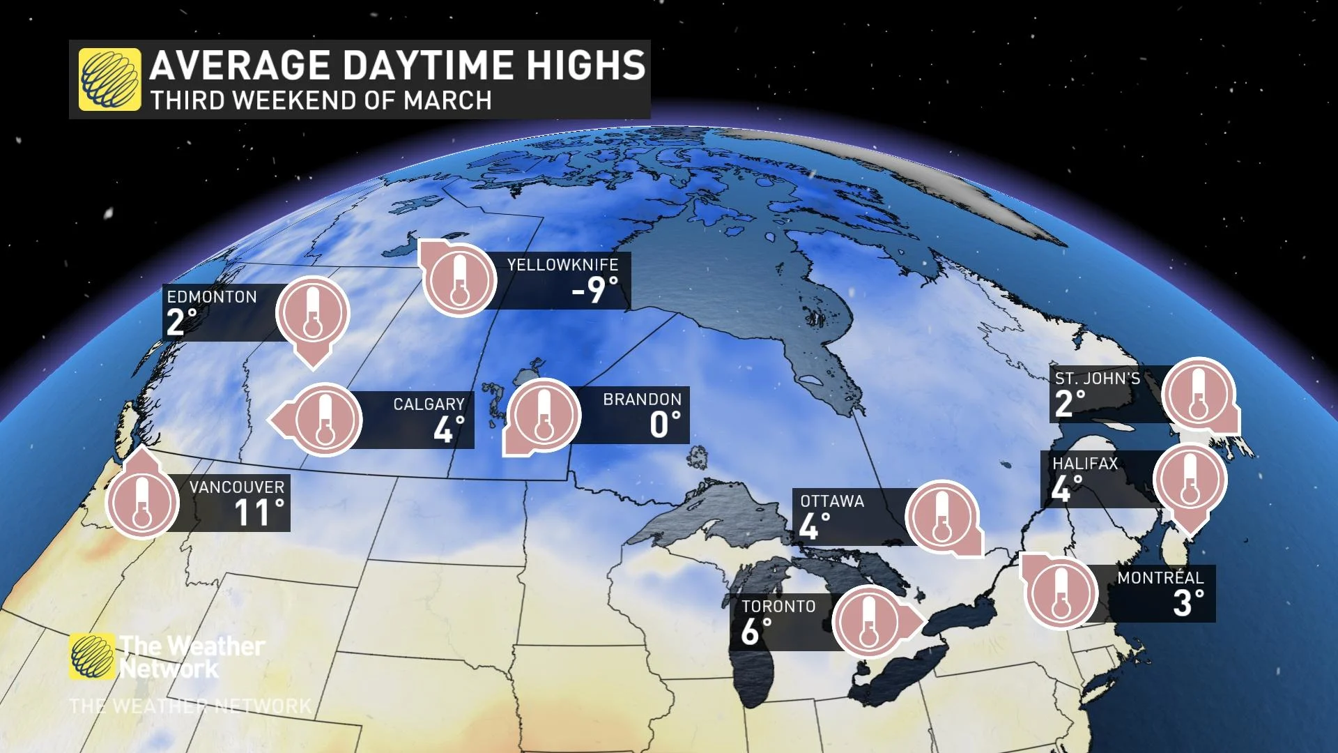
Average daytime highs for the third weekend in March range from the lower to the mid-single digits for most of the country’s population centres. Normal highs are starting to climb out of minus territory on the Prairies. Vancouver enjoys the mildest air with a typical late-March high just above 10 degrees.
Our looming pattern flip will bathe the Prairies with below-freezing daytime highs this weekend. Everyone from Calgary to Winnipeg will endure afternoon temperatures solidly below zero, even with the relatively warm sun rising in the skies over Saskatchewan and Manitoba.
SEE ALSO: How weather could impact the spread of the measles virus
A touch of gloom will arrive on the West Coast on Saturday, with clouds and rain keeping temperatures a few degrees below seasonal on Vancouver Island and the South Coast.
Back east, chilly air will funnel into the Great Lakes and Eastern Canada. Even typically balmy Windsor, Ontario, will see a high temperature on Saturday just barely climbing above freezing. Folks farther north toward Montreal see snow with afternoon highs nearly ten degrees below seasonal.
This chilly and active pattern isn’t heading anywhere in a hurry, either. The long-range forecast holds the potential for several disruptive storms rolling across the country through the last full week of March. Periods of warmer conditions are likely for some as passing storms drag in warm air from the south.
Widespread wintry weather is possible, with the precise track of each storm and the position of cool air determining who sees rain, snow, or a wintry mix.
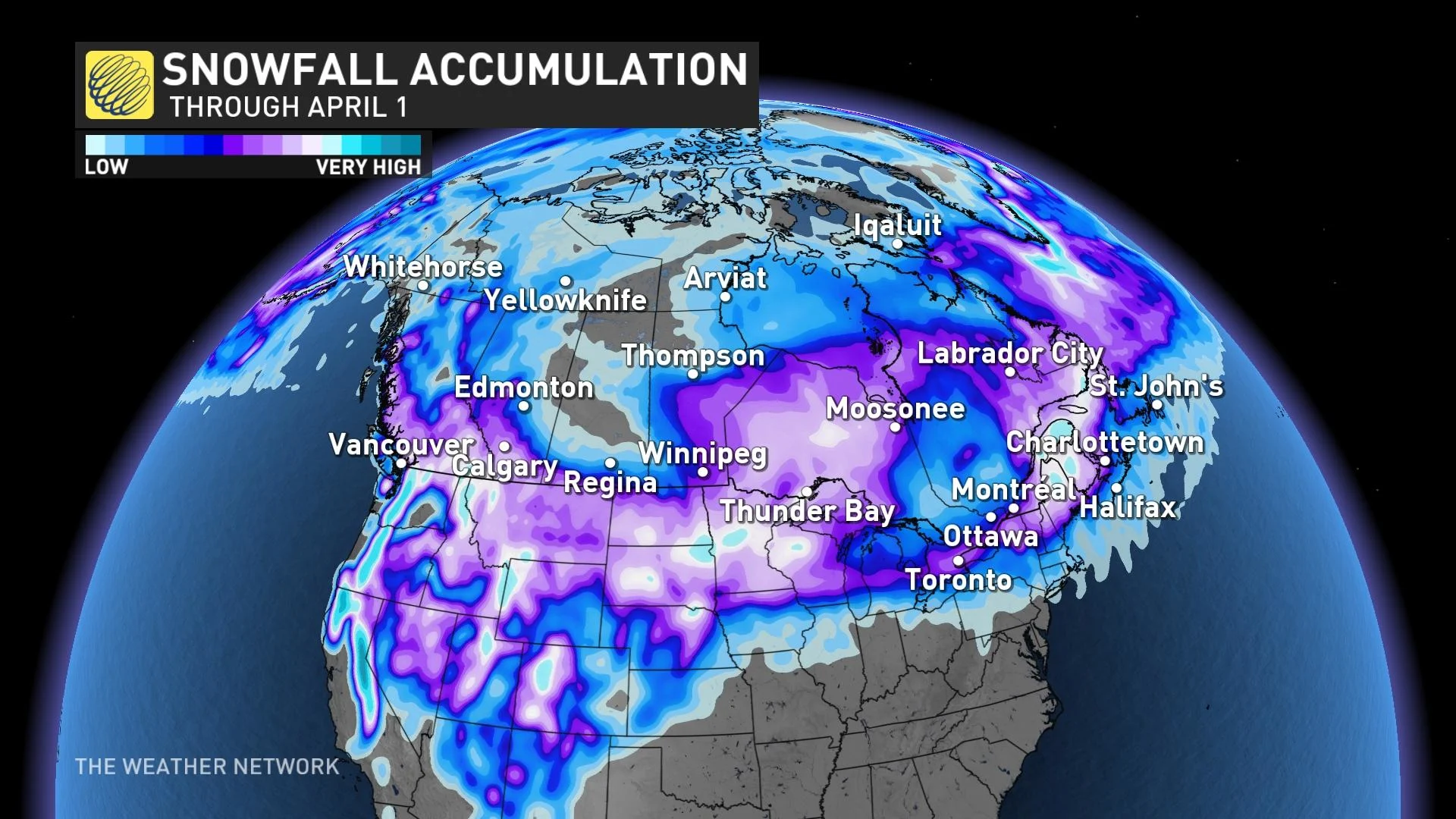
It’s no surprise that we’re still fending off intrusions of winter weather even after the equinox. It’s easy to lose sight of the fact that many communities across Canada average decent snows during the month of April.
A normal April in Calgary holds 21 cm of snow, while everyone from Ottawa to St. John’s picks up double-digit snow totals during an average April.


