Winter takes a breather in major Canadian cities with January thaw

Millions of Canadians will experience an extended January thaw this week, and there are signals it will get even more 'intense' as we head into February
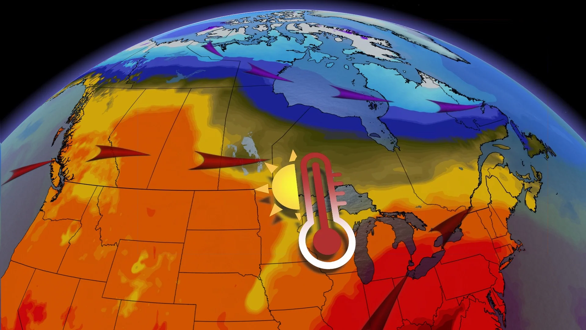
A national pattern reversal is upon us, as some parts of the country break out of the unbearable deep freeze and head into an extended, and dramatic, January thaw.
While a quick shot of Arctic air will interrupt the warm-up during the first half of the week, especially from Quebec to Atlantic Canada, by the end of the week, we will once again have above-seasonal temperatures across most of Canada as mild Pacific air replaces the recent Arctic chill. A few notable cities will be especially warm, and will notice a big change from the winter weather.
MUST SEE: Sick of winter? Look on the bright side: we’re halfway to spring!
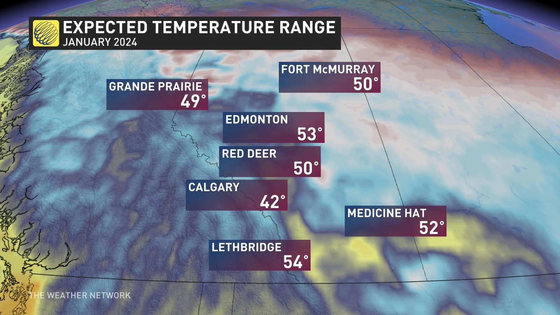
The above-normal temperatures will begin to spread into parts of Western Canada beginning Tuesday. While we're not looking at all-time, record-breaking warmth for January, the thaw will be pretty long-lived.

For both Calgary and Edmonton, Alta., this will certainly be the warmest air of the year by far, especially after being stuck in the extreme cold of the polar vortex for so long.
An extended stretch of above freezing temperatures will start out on Tuesday in Calgary, and persist until the start of February at least.
In Calgary, you will need to look out for Chinook wind events, which could potentially increase the temperature forecast even further. It could also result in more temperature inversions, however, which would lead to the risk for poor air quality setups. The sharp density difference between cold air below and warm air aloft acts like a ceiling that caps the atmosphere, trapping all that pollution close to the ground.
SEE ALSO: Air quality alerts in Calgary as inversion traps smog near ground
Edmonton will finally break the 24-day streak below freezing on Thursday, a frigid stretch that has lasted for nearly all of January. The average daytime high this week is -8°C, but by Thursday, the city will be sitting with daytime highs 10-20°C above normal. This pattern sticks until early February, as well.
The average daytime high for this week in Toronto, Ont., is -2°C, but temperatures are set to soar 5-10°C above normal. That's after a far more wintry start to the week -- one that features rounds of snow, ice and the threat for difficult travel.

Don't expect the snow to stick around across the Greater Toronto Area (GTA), as the temperatures rise and a mild and active rainy pattern sets in.
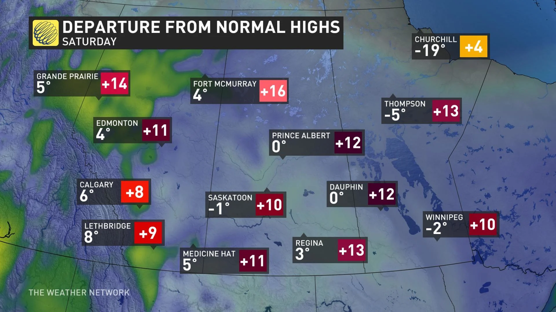
For Winnipeg, Man., the average daytime high is even colder for this time of year, sitting at a frigid -13°C. The region can expect quite the dramatic thaw, as temperatures soar 10-20°C above normal this week.
By next week, an even stronger heat signal will see daytime highs sitting above the freezing mark as we start out the month of February, possibly kicking off the snowmelt for parts of the province.
This warming pattern will closely resemble what we saw during December and the first week of January, but for different reasons.
RELATED: Record-breaking: El Niño stole winter from Ontario in December
While the El Niño pattern can still be seen on the ocean water temperatures, the atmospheric pattern is currently disconnected from this, and actually has some La Niña-like characteristics.
Is this it for winter? Or can we expect more consistent cold to come? Be sure to check back on Feb. 1 for our exclusive look at the month ahead.