Amid 20-degree highs, a ridiculously resilient ridge envelops B.C.

Chilly temperatures are in the rearview mirror, amidst a ridge of high pressure expected to last longer than normal.
Parts of British Columbia have recorded their first 20°C high of the year, including the South Coast – about when you'd expect it.
Weeks of often chillier weather have since gone down the drain, replaced with a resilient and robust ridge of high pressure not set to budge for days on end.
Here is the unusual part of the story: the duration of warmth is on the fringes of what one would expect for this time of year.
The rarity of a high-pressure ridge of this magnitude is approximately once every ten years during mid-April. After sifting through the climate record, it appears this April heat event will be profound and memorable based on its duration.
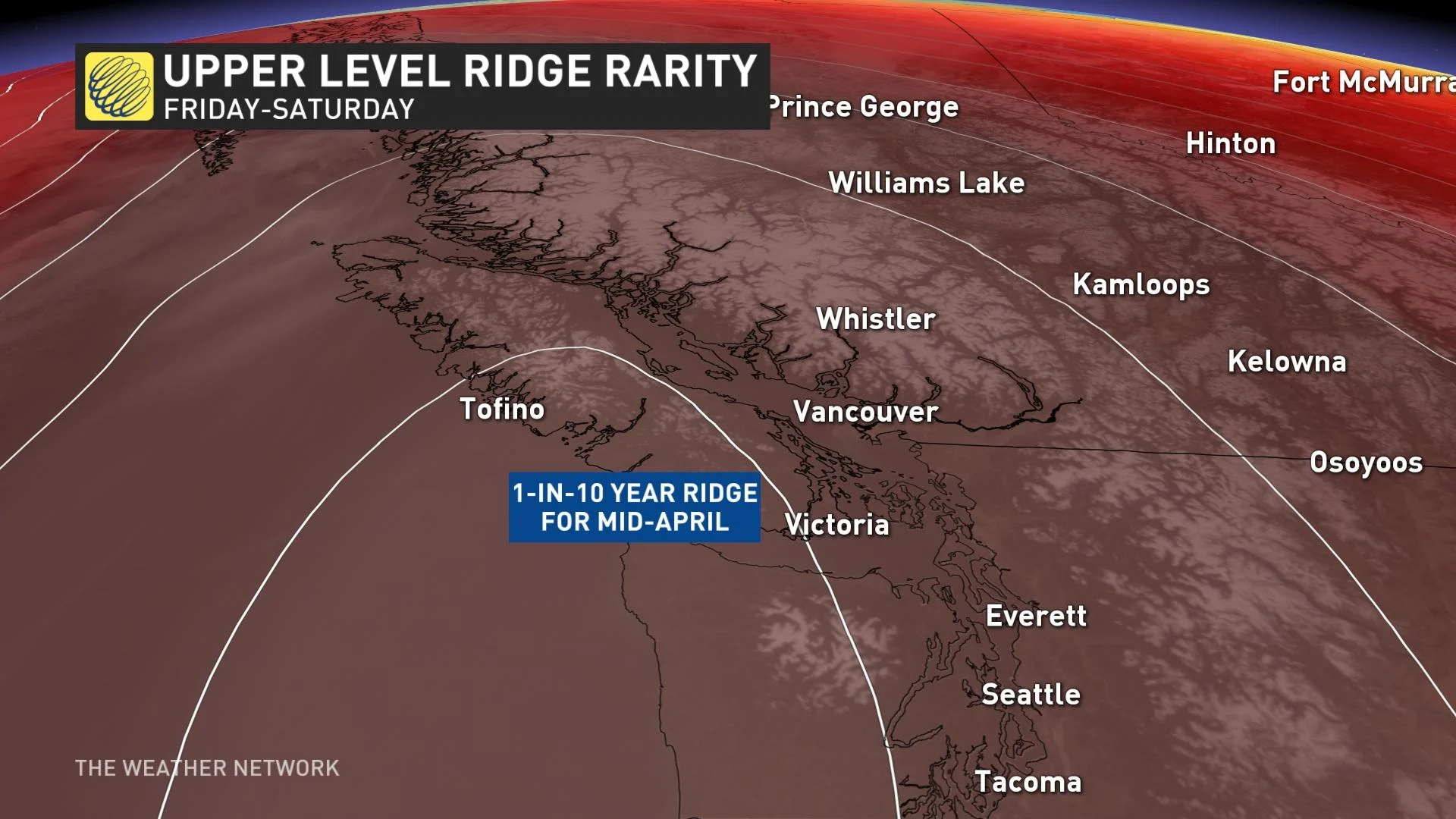
Take a look at Abbotsford, far enough inland to avoid influence from the 9°C water of the Salish Sea, the giant temperature moderator for the South Coast.
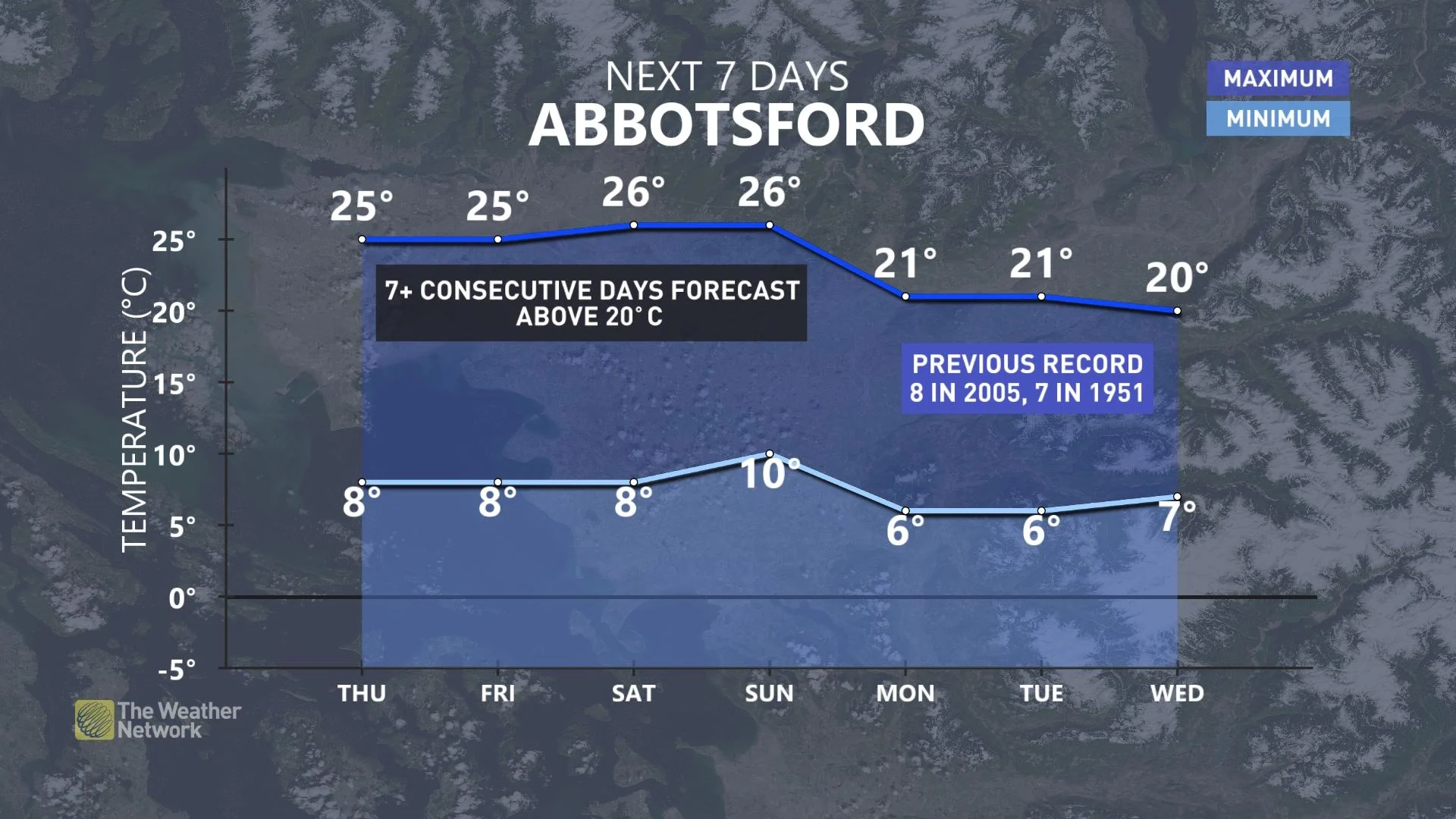
The 20°C streaks commenced for inland sections on Wednesday, while the crescendo of heat arrives by Saturday, spilling well into next week.
The Fraser Valley is perfectly situated to reach the maximum temperature possible with some assistance from topography.
Just as the Fraser Valley deals with chilly outflow conditions in the winter, the air warms and dries as it descends towards sea level – known as outflow or offshore flow.
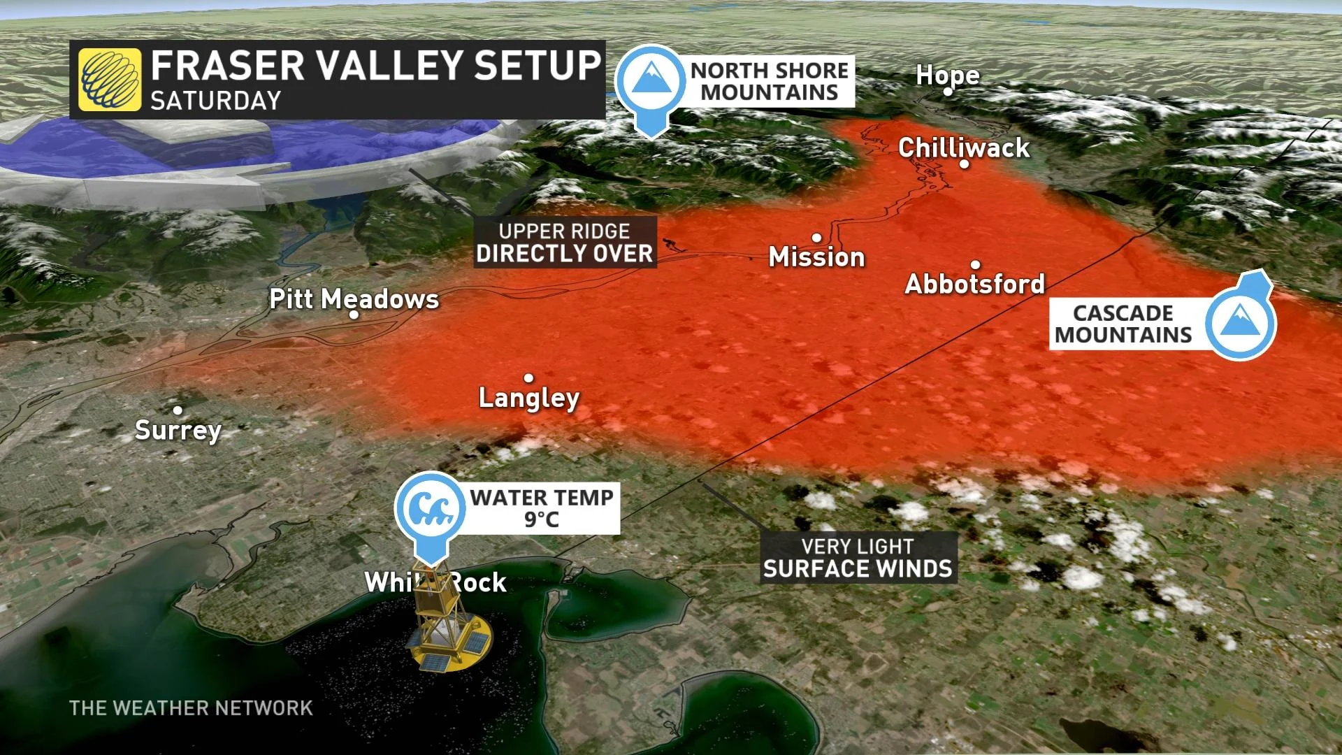
But, here’s the kicker: there's really not much flow at all on Saturday, with a ridge directly overhead, so the air mass is set to bake, and it'll only take a couple of kilometres away from the beaches to feel the dramatic difference.
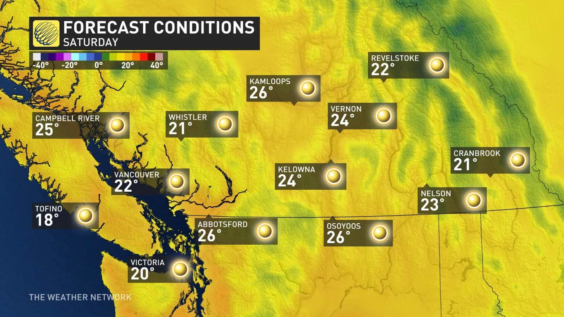
The temperatures in the Interior are seasonably warm but a little less abnormal than in coastal communities. Temperatures are forecast to surge into the low 20's across the Caribou region and places along the Bella Coola, located on the Central Coast.


