Atlantic Canada: Major winter-like storm tracks into the region

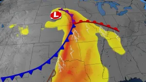
A powerful winter-like storm that has had a major impact on Ontario and Quebec was already spreading snow over parts of New Brunswick Monday night. But unlike those provinces, the East Coast is set to get a wide mix depending on where you are -- heavy snow, pounding rain, a dash of freezing rain or ice pellets, and even temperatures that will likely be the warmest in Canada. What to expect, and where, down below.
WEATHER HIGHLIGHTS:
Mostly snow for New Brunswick, heavy rain for Nova Scotia
Winds will gust expected to hit 50-70 km/h or higher in parts of Nova Scotia, Newfoundland
Brief periods of freezing rain and ice pellets possible
Warmest in Nova Scotia Tuesday, but temperatures will take a nosedive by Wednesday for Maritimes, will rebound in Newfoundland
Stay up-to-date on the ALERTS in your area
WATCH BELOW: WHEN RAIN AND SNOW WILL IMPACT ATLANTIC CANADA
The snow was coming down in earnest across much of New Brunswick Monday evening, and it will last longest in northern New Brunswick, still falling for some people by Tuesday evening.
Across the Gulf, people can expect the snow by Tuesday morning, but largely confined to the western half of the island, and heaviest on the Great Northern Peninsula.
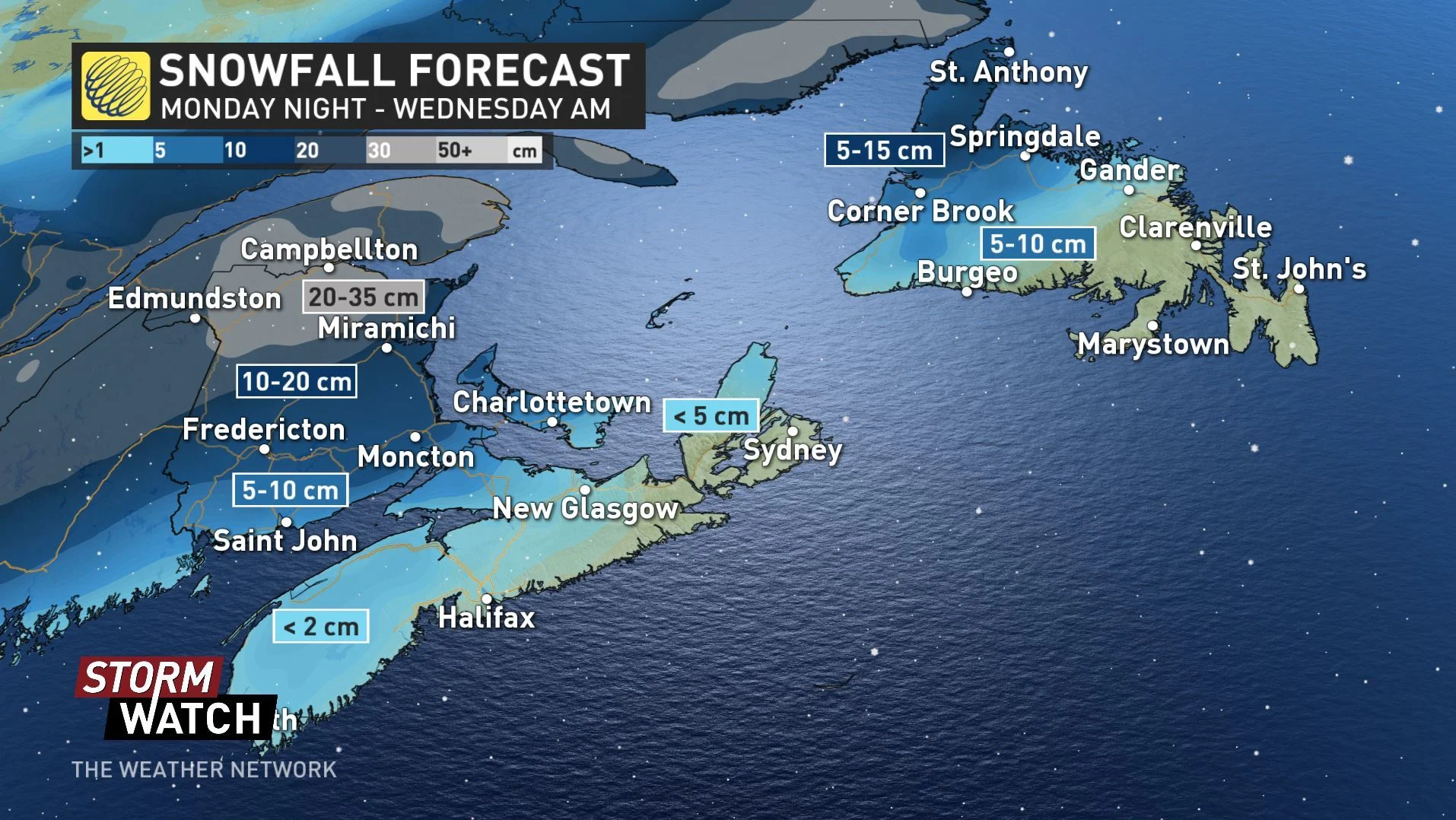
Nova Scotia will escape with little more than a trace, with a blink-and-you'll-miss-it quality, for a number of reasons, not least of which will be the fact it'll be a small part of that province's experience with this storm, which will be dominated by at-times heavy rain.
Rain will continue from the overnight into Tuesday morning for most of Nova Scotia, lasting through the day in most places. In Newfoundland, the heaviest downpours will be in the western part of the island.
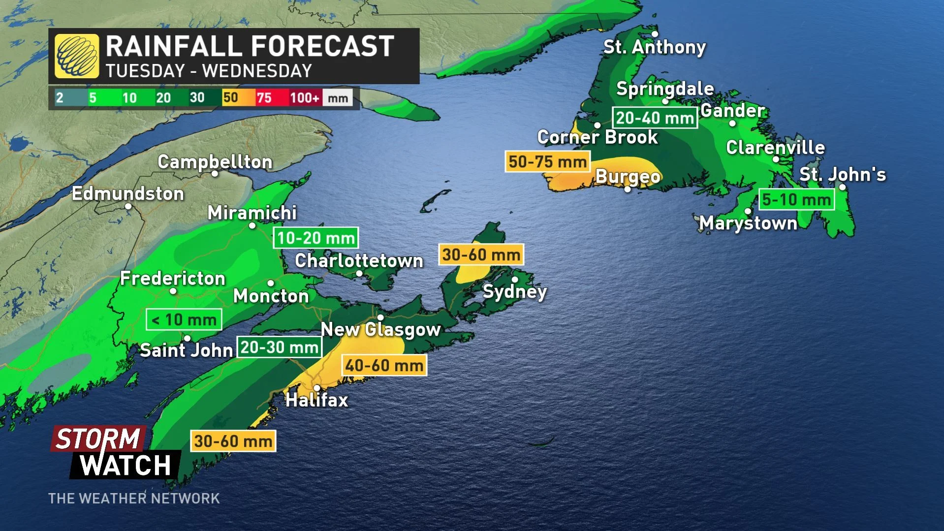
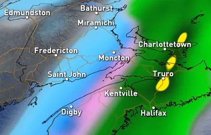
By the morning, however, an encroaching warm front will slide through the region, and as it bisects New Brunswick, southern areas of that province around the Bay of Fundy will see a switchover to rain. However, a transition of freezing rain or ice pellets is possible, particularly long-lived in central and northern parts of New Brunswick before a possible second shot of snow into the evening.
In Newfoundland, freezing rain and/or ice pellets arrive in the western part of the island by the early afternoon:
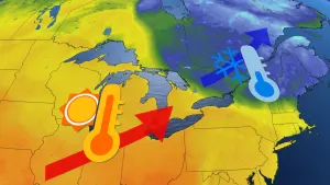
That aforementioned warm front will set the Atlantic region apart of Ontario and Quebec in one other way: It will push temperatures above zero for most of the region, and neatly into the teens for Nova Scotia.
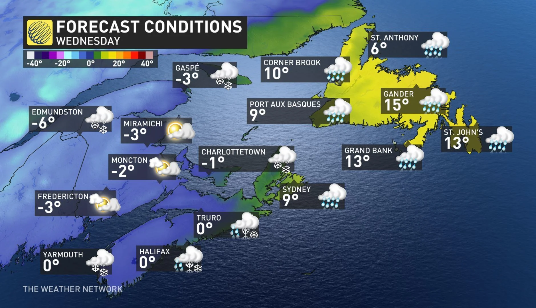
Once the system moves out by Wednesday morning, a switch in temperatures will take place across Atlantic Canada. Most of the Maritimes will see a sharp reduction in temperatures with mostly single digits in store. Newfoundland however, will see a bounce back to the mid-teens for most southern areas on Wednesday.
"A system tracking to the north will drag another cold front across the region Friday night and Saturday with rain and snow showers expected once again," says meteorologist Dr. Doug Gillham.
Stay tuned to The Weather Network for the latest forecasts.