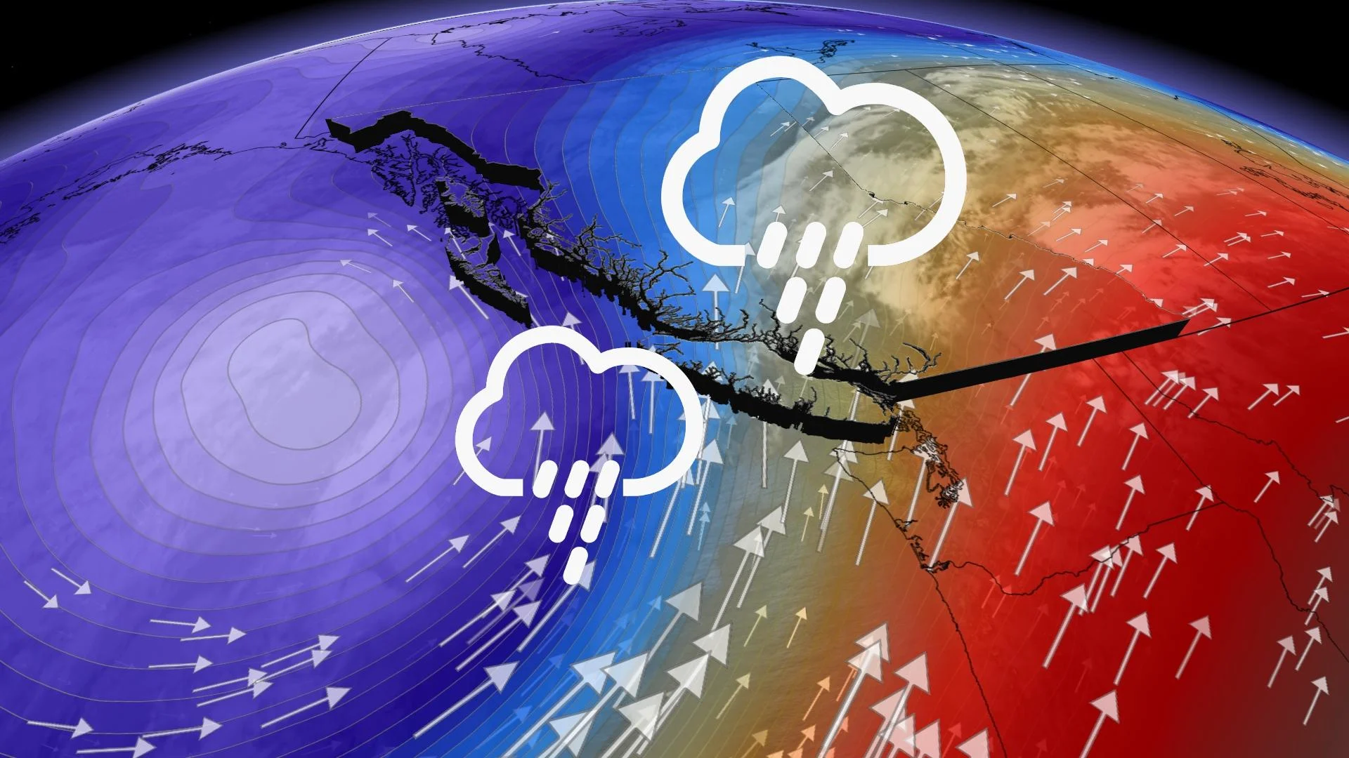
Ample Pacific moisture flows into B.C., may yield 100+ mm of rain

British Columbia is at the beginning of a pattern that will leave much of Vancouver Island and the Lower Mainland very thoroughly drenched. The first raindrops of round one already began Saturday for the northern and central coasts, and Sunday is when it reaches more southern areas. The wet weather will continue into next week, with another wave expected mid- and late-week. It may also bring intense wind gusts. A closer look, below.
THROUGH EARLY NEXT WEEK: FIRST PUSH OF SOGGY WEATHER
The north and central coasts already saw the first waves of this main low-pressure system Saturday.
As the system moves further ashore, rainfall rates are expected to intensify Sunday afternoon into the evening hours across the Lower Mainland and Vancouver Island, as the jet stream dips down to reach the South Coast, holding steady into early Tuesday, perhaps.
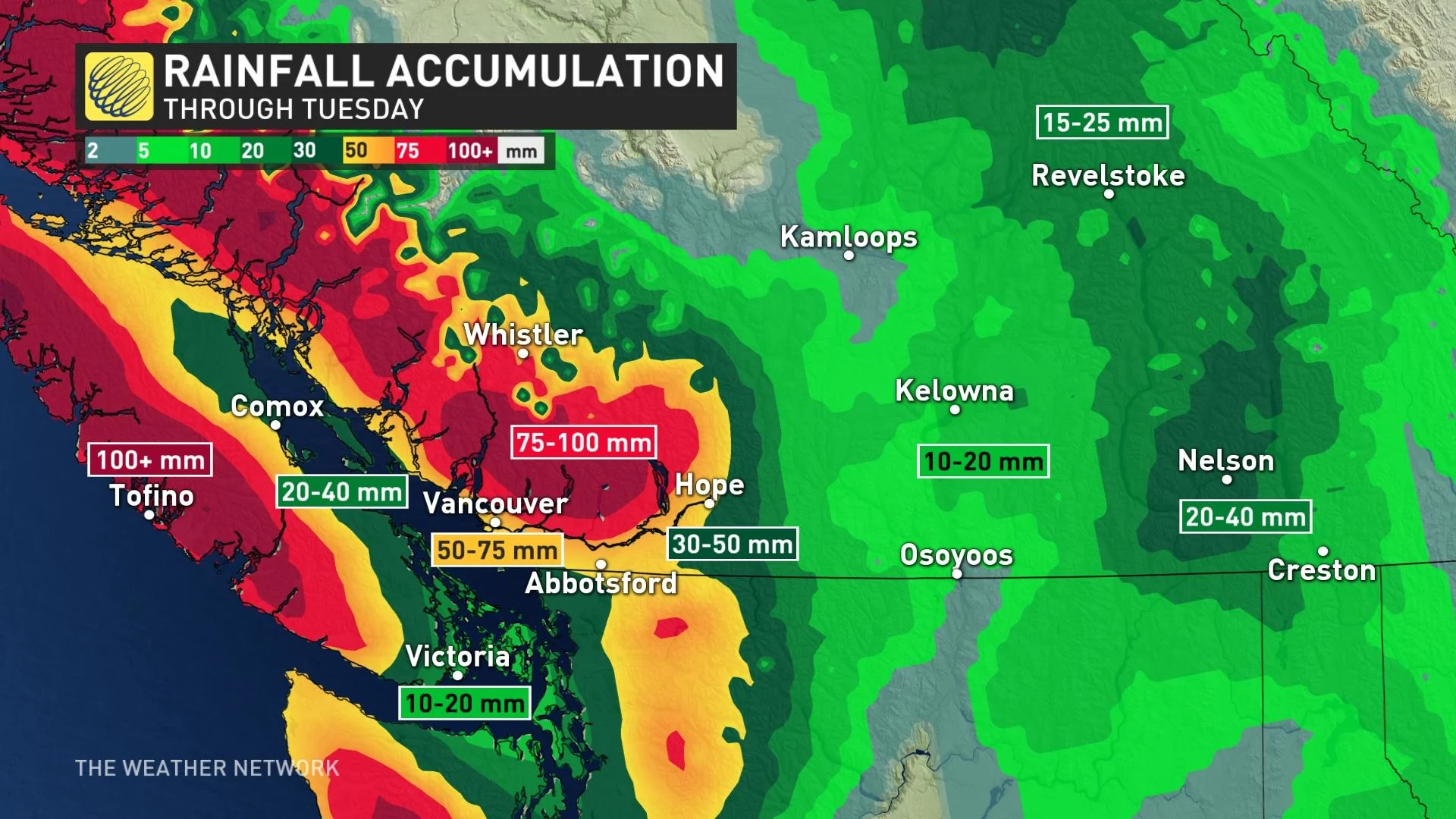
Locally, 50-75+ mm of rainfall is anticipated with the first round -- Sunday to Tuesday – for the Metro Vancouver area, 100+ mm for coastal Vancouver Island. The heaviest will largely be confined to Sunday, but with a few showers Monday, and even the slight risk of a thunderstorm or two.
Freezing levels will remain quite high with this system, therefore high-elevation snow is not a concern.
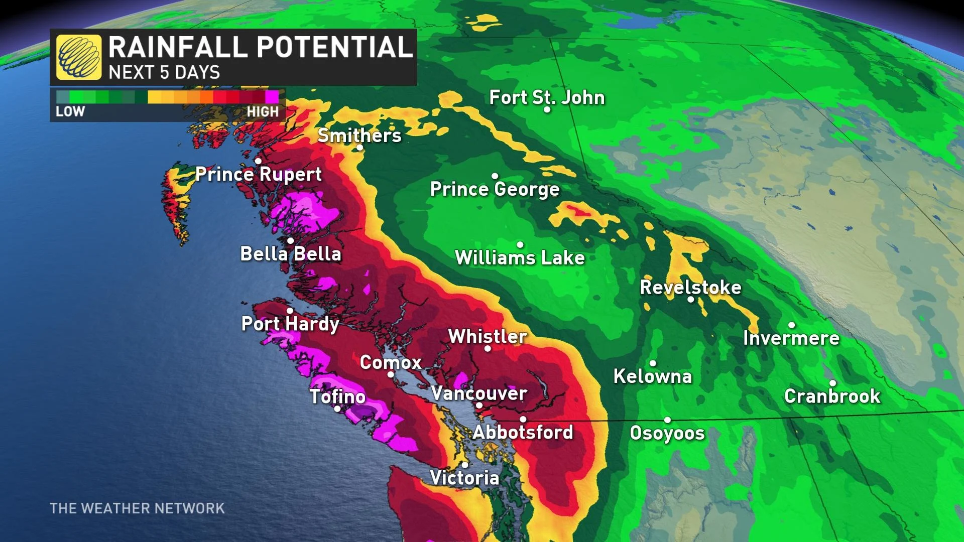
NEXT WEEK: COOL, UNSETTLED, BLUSTERY, WITH MORE RAIN
Next week also looks quite soggy, with an active and wet pattern settling in. Eyes look ahead to mid- to late-week with a secondary trough moving onshore.
This will not only bring another round of rain, it has the potential to deliver widespread strong winds. They are likely to reach urban areas across the South Coast and for much of Vancouver Island. While it's tricky to say whether or not the intense winds will impact Metro Vancouver, but some models are hinting at 60-70+ km/h, even 80+ km/h for areas inland.
It's certainly been a wet start to the fall season, coming on the last days of the summer having already been fall-like in terms of stormy weather for the coasts.
"Vancouver has already seen close to double its average rainfall for the month of September and the final week of the month will bring close to their average rainfall for the entire month of September once again," Weather Network meteorologist Dr. Doug Gillham says.
As well, near or below seasonal temperatures are expected through the end of next week and into the first few days of October.
Check back for updates as the situation evolves.


