Late-summer chill, mountain snow covers parts of the Prairies

With the release of the Fall Forecast Tuesday, it didn’t take long for parts of the Prairies to begin experiencing weather reflective of the autumn season. A trough digging into western sections of the region brought some chilly temperatures Wednesday morning for Alberta – with single digits starting the day in some areas. Higher elevations of the foothills could even see some snowflakes Wednesday. Temperatures will be a bit warmer through the day as you head into Saskatchewan and Manitoba. The potential for frost will return late week for some areas. More on what's ahead for this last stretch of summer, below.
Visit our Complete Guide to Fall 2021 for an in-depth look at the Fall Forecast, tips to plan for it and much more!
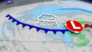
WEDNESDAY: POTENTIAL FOR EARLY SEASON SNOWFLAKES AND PLUNGING TEMPERATURES
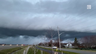
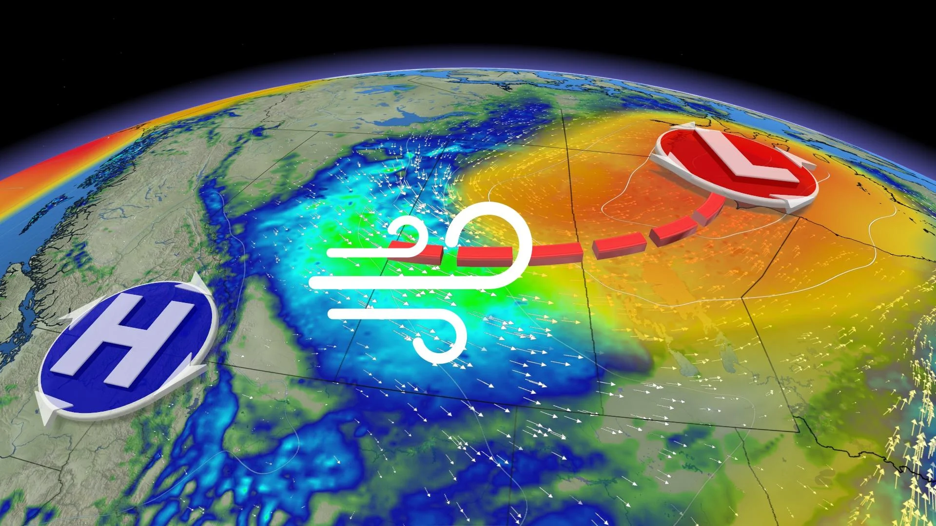
A temperature plummet brought chilly early morning temperatures across Alberta Wednesday, with some early season snowflakes even forecast along the higher elevations of the foothills.
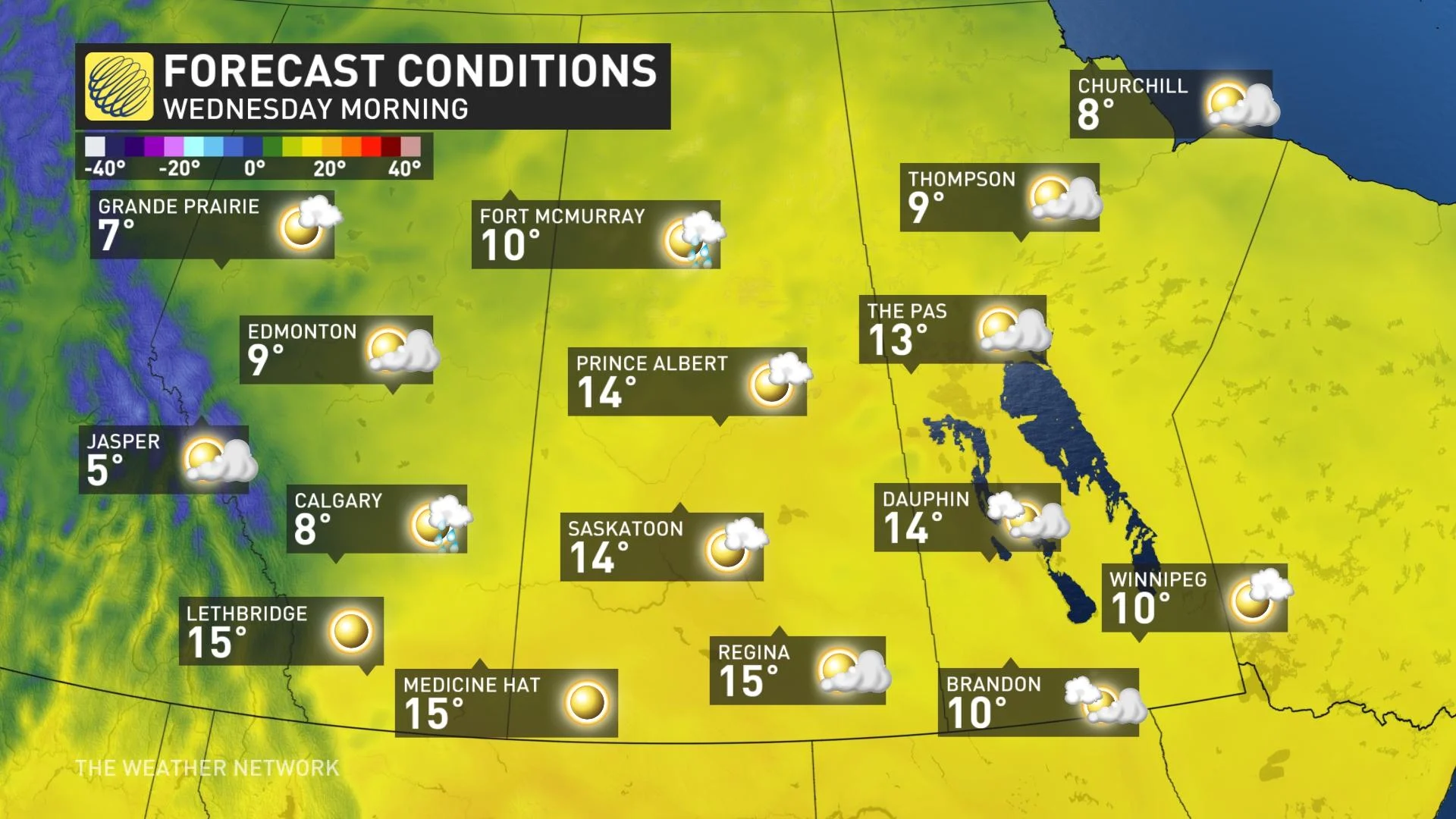
By the afternoon, Alberta will warm up slightly, but still will be a few degrees cooler than seasonal. By the time you hit southwestern Saskatchewan and southern Manitoba, daytime highs Wednesday will be into the 20s.
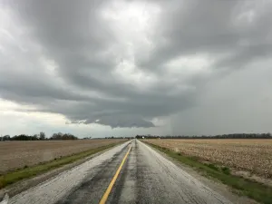
Meanwhile, on the eastern side of the Prairies, showers and thunderstorms are expected with the cold front for southern Manitoba Wednesday afternoon
By Wednesday night, temperatures will drop back down into the single digits in Alberta and Saskatchewan. Parts of the former may see overnight lows hover around the freezing mark.
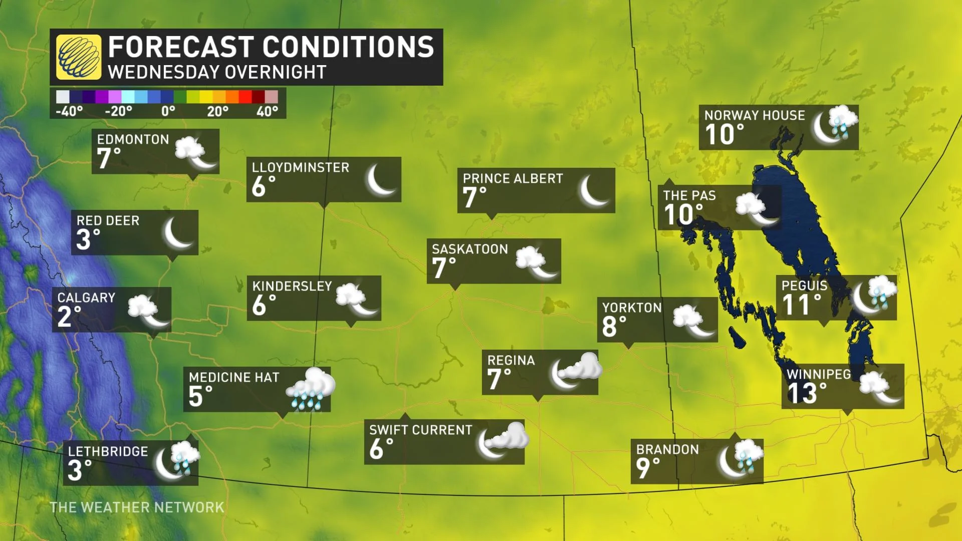
Some of the higher-elevation snow along the foothills may trickle into lower-elevation regions as temperatures will dip close to the freezing mark.
LOOK AHEAD: STAYING COOL IN ALBERTA, ANOTHER THREAT FOR FROST, BRIEF SURGE OF WARMTH FOR SOME
Beyond Wednesday, a shot of chilly weather across the region late week with the first frost/freeze for many areas.
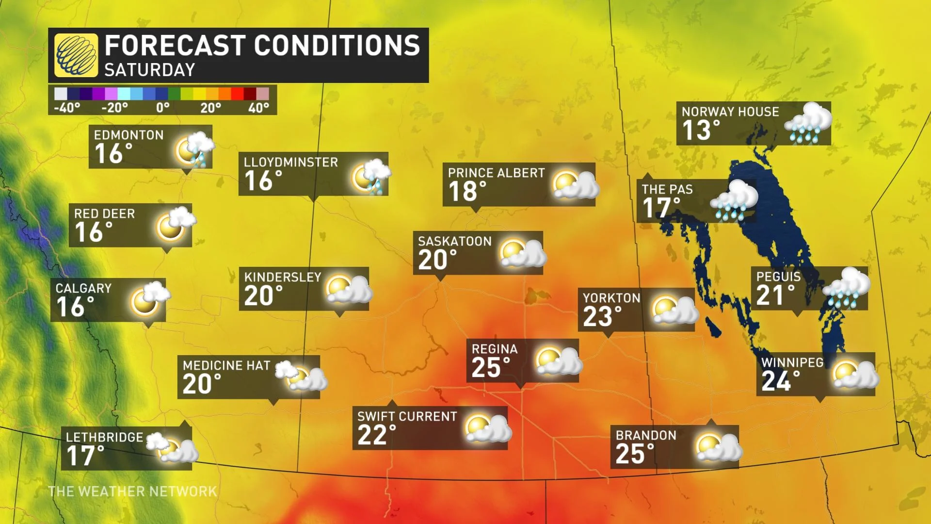
A brief warm-up for southern Saskatchewan and Manitoba on Saturday, with temperatures briefly surging into the mid- to upper 20s and a few spots will even reach 30°C.
Cooler weather is expected early next week across the region, with a another threat for frost/freeze for parts of the region.
Despite this cooler end to summer however, not all hope is lost for the fall season ahead.
"A few shots of cold weather are likely early in the season, bringing a heightened risk for an early-season freeze, and an end to a what has been a very difficult growing season," says Dr. Doug Gillham, a meteorologist at The Weather Network. "However, we expect that the arrival of consistent cold will be delayed with above normal temperatures expected for December."
Read more on the season ahead in the official 2021 Fall Forecast, here.
Be sure to check back for the latest forecast updates across the Prairies.