Breaking down Ontario’s ‘messiest summer’: A storm chaser's POV

Despite any ‘mind-blowing storm structure’, this year was one of the busiest seasons in terms of storm chasing, according to Weather Network meteorologist, Mark Robinson.
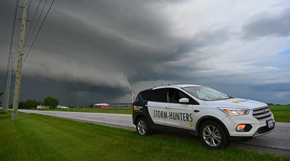
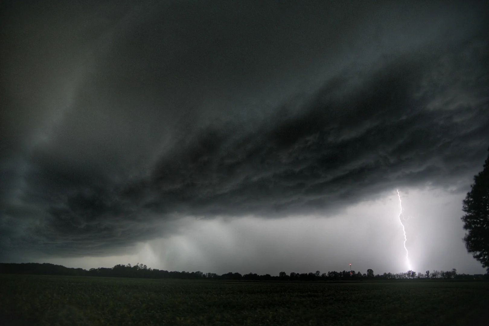
The darkness vanished for a moment, replaced by a flash that covered the countryside around me into blue fire. The Weather Network vehicle was illuminated so brightly that I could see the myriad of tiny hail dents that spoke to the number of storms and kilometres I’d put under the wheels this summer. The roar that followed was more like a wall of sound that felt like the auditory equivalent of the blinding flash that had preceded it.
That was how my storm chase in London, Ont., began on September 6. It was one of the last storms I covered for The Weather Network this summer season, and in typical Ontario fashion (the land of near impossible forecasts), the lack of easily distinguished features and the rapid motion of the line made it difficult to tell exactly what the storm was doing.
Courtesy: Mark Robinson
Visit our Complete Guide to Fall 2020 for an in depth look at the Fall Forecast, tips to plan for it and a sneak peek at the winter ahead
I’m still trying to catch up on all the sleep I lost during the summer of 2020, thanks to one of the more active storm tracks I’ve seen in a while. Not that I’m complaining; getting underneath a supercell thunderstorm spun up into a majestic barber pole towering twice the height of Mount Everest is what chasing is all about, but sleeping once in a while is good too.
Courtesy: Mark Robinson
Normally, I’d head down to Tornado Alley in the U.S. in May to get my fill of beauty storms moving slowly across green fields, but this year, the virus prevented any movement across the border. That meant a year of all Canadian storms as opposed to me doing any cross-border shopping.
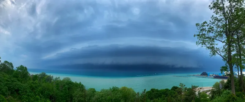
So, as I looked to Ontario, I had to take into account a few important things, namely, the giant bodies of water that surround most of the southern part of the province: the Great Lakes.
These massive lakes have a major effect on thunderstorms in that they can either kill them off or supercharge them depending on where the storm is.
Lake Erie, Huron, and Ontario are deep and cold bodies of water, and all that (relatively) cold water can cool down the air travelling over it. Storms need warm air as fuel, so storms tend to die as they traverse the lakes. At the same time, that cold air can sweep in over land, and act as a boundary that can trigger storms and supercharge already existing ones.
Courtesy: Mark Robinson
The summer of 2020 was rife with hot and humid days in Ontario, and that meant lots of fuel for storms. All that was needed was a trigger. And, on days that didn't feature a cold front, the lake breezes served as that trigger.
Courtesy: Mark Robinson
While the Great Lakes serve as a trigger, they also serve to add extra moisture to the air mass over the province, and in turn, creates messy, high precipitation storms. At the same time, the low pressure systems that create the shear that spins up storms moved through the northern part of the province, reducing the needed shear and pulling the storms into long lines.
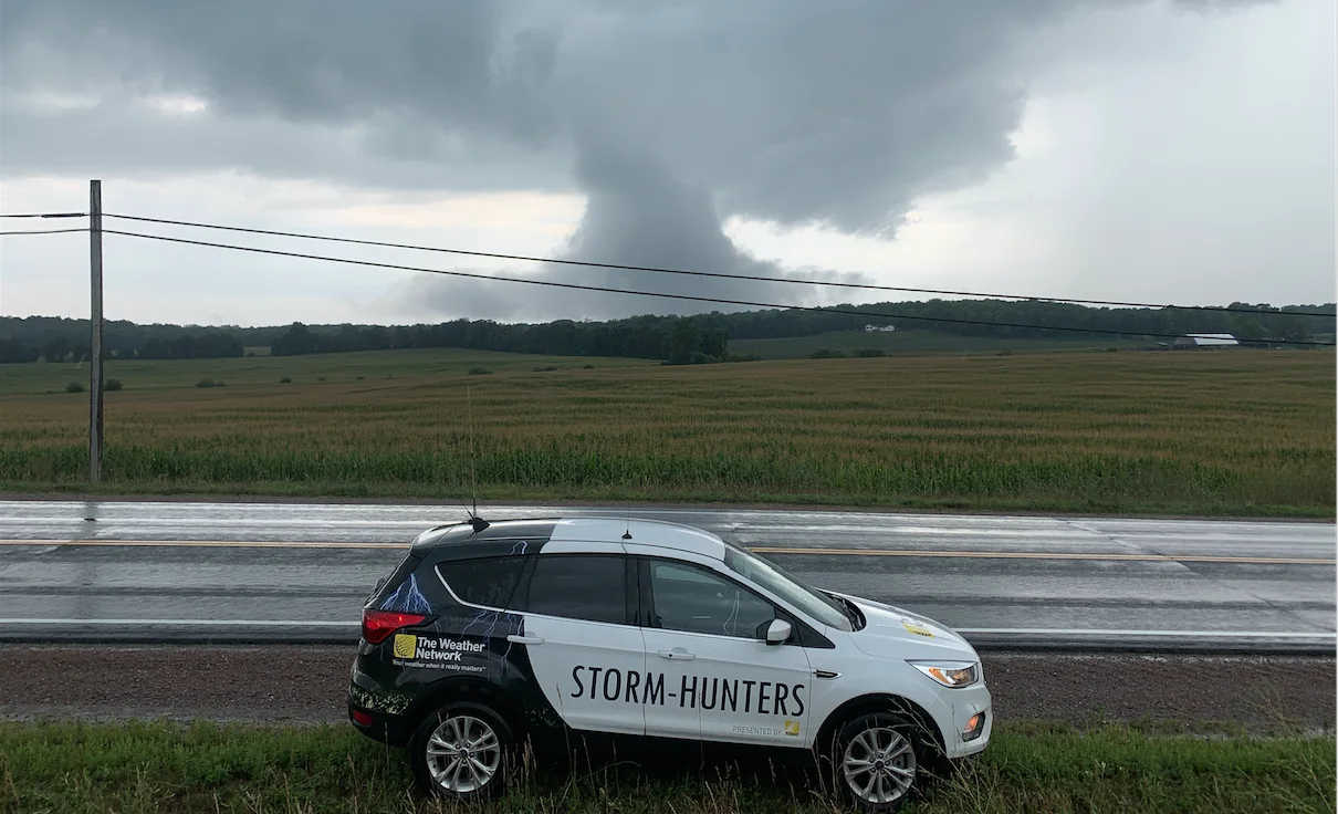
Combine these, and you get long, messy lines of storms constantly dragging across the province, rather than isolated, powerful supercells. However, many of those lines had embedded areas of spin, which ended up producing 30 tornadoes from cottage country to Windsor, well over our average of 8-12.
RELATED: Ontario's 2020 tornado total nearly double the yearly average
Dr. David Sills, from the Northern Tornadoes Project (NTP) of Western University suggested that the high number may be more true to the real number of tornadoes that Ontario sees. He thinks that with the proliferation of cell phones and greater awareness of tornadoes in the general public, along with a verification agency like NTP, fewer tornadoes are escaping notice.
WATCH BELOW: SPOT A TORNADO IN CANADA? REPORT IT TO THE NORTHERN TORNADOES PROJECT
Either way, I only managed to see two of the 30, despite my near constant running from one end of the province to the other. I think my spine has permanently reshaped itself.
Now, that isn’t to say that I never made it to any of the tornadic storms. To the contrary, I managed to put myself in front of a number of the storms that were tornado warned, but all I could see was a wall of rain and, sometimes, just to break things up a bit, a wall of rain and dust. And wind. At least twice, hail.
But mostly just grey, almost featureless clouds and rain.
When you’re out on the Plains of the U.S. or the Prairies in Canada, you can move yourself to the east or west to ensure that the storms you see happen during the day. If you’re stuck in Ontario because of COVID, that ability goes away, and you have to take what you can get. Which means that if the storms come at night, I’d better have a lot of energy drinks (I don’t like coffee) at the ready.
WATCH BELOW: CAN ONTARIO EXPERIENCE TORNADO OUTBREAKS LIKE TORNADO ALLEY IN THE U.S.?
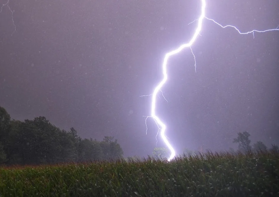
But that wasn’t entirely a bad thing for me. One thing that the storms did produce, with spectacular results, was lightning.
Lightning is created through a process that’s so complicated that we don’t yet have a full grasp of how it all works, but a simple version is this: ice crystals bang into each other in the storm and that serves to create areas in the storm cloud that are negatively and positively charged. Since balance is favoured in the universe, electrical currents in the form of lightning strokes are created to balance these charges and return everything to a neutral state.
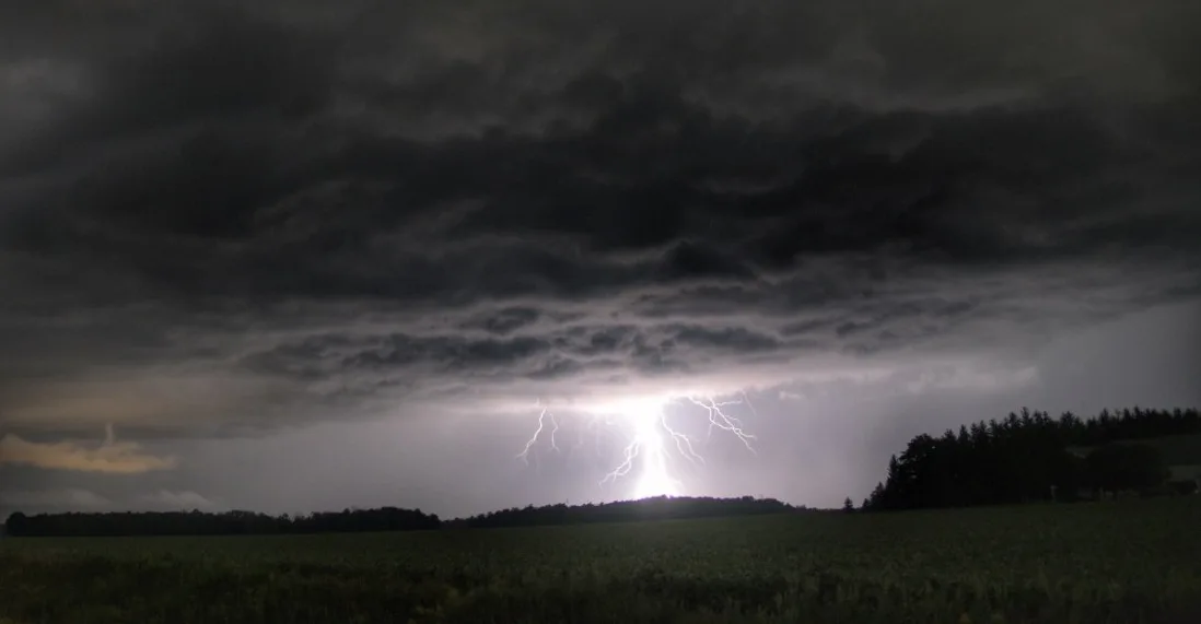
Courtesy: Mark Robinson
The important part (for us in Ontario this year) is the ice crystal part. Despite the heat on the surface (from the 30+ C degree days), a lot of storm days featured very cold air in the upper atmosphere and thus, more ice, which then translated to more lightning. One line of storms in early September featured 20 lightning strokes per second hitting the ground.
All in all, it was one of the busiest seasons I’d ever been out on, but the overall quality of the storms (if you want to document mind-blowing storm structure) was lacking. Still, it did let me live in my car (yes, there’s a sleeping bag in the back) for days at a time.
Wait, is that a bad or a good thing?
Well, either way, on to autumn storms! Wind, waves and seasickness! And cold, cold water.


