
Atmospheric river brings extreme rainfall to parts of the Maritimes

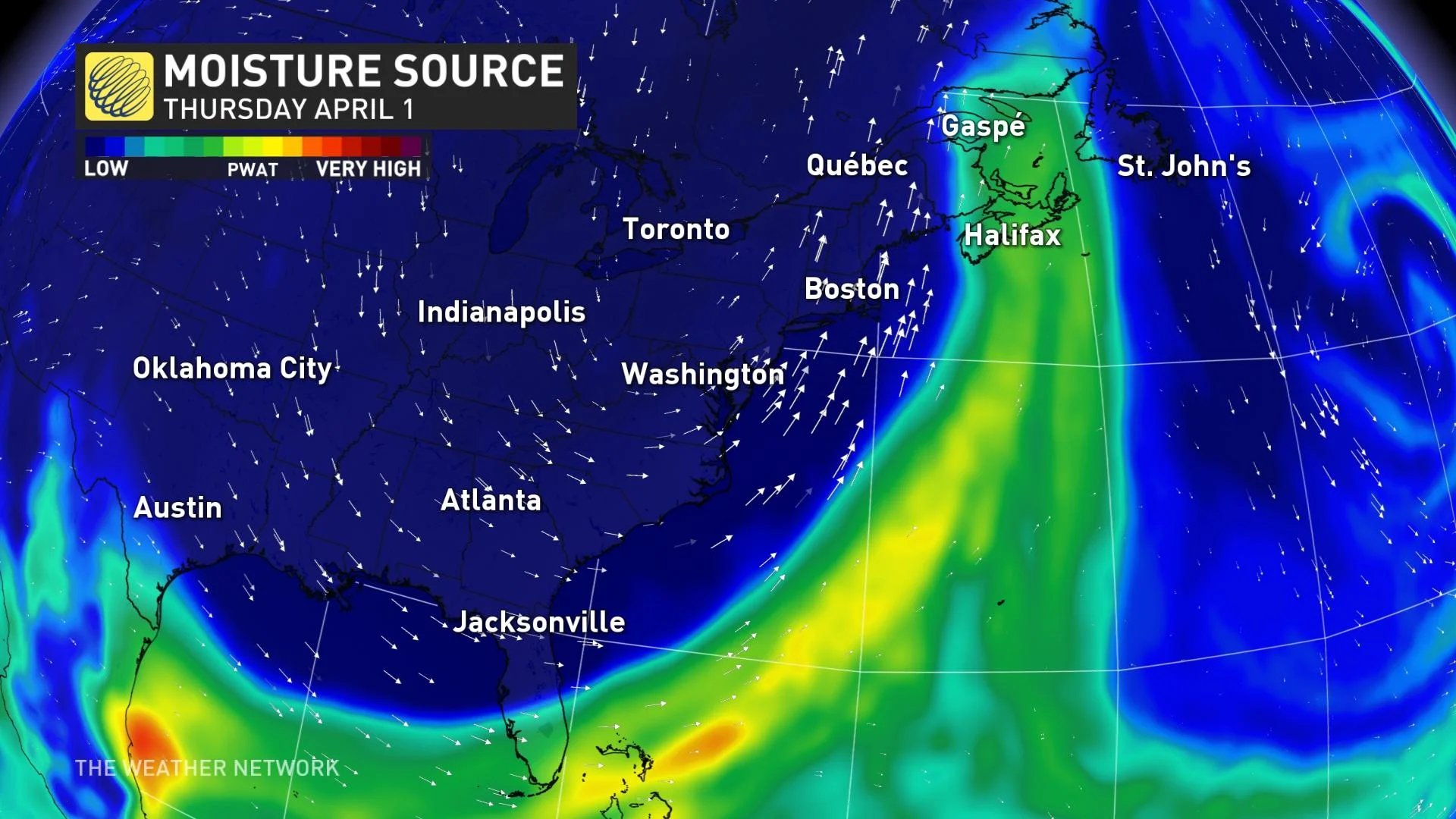
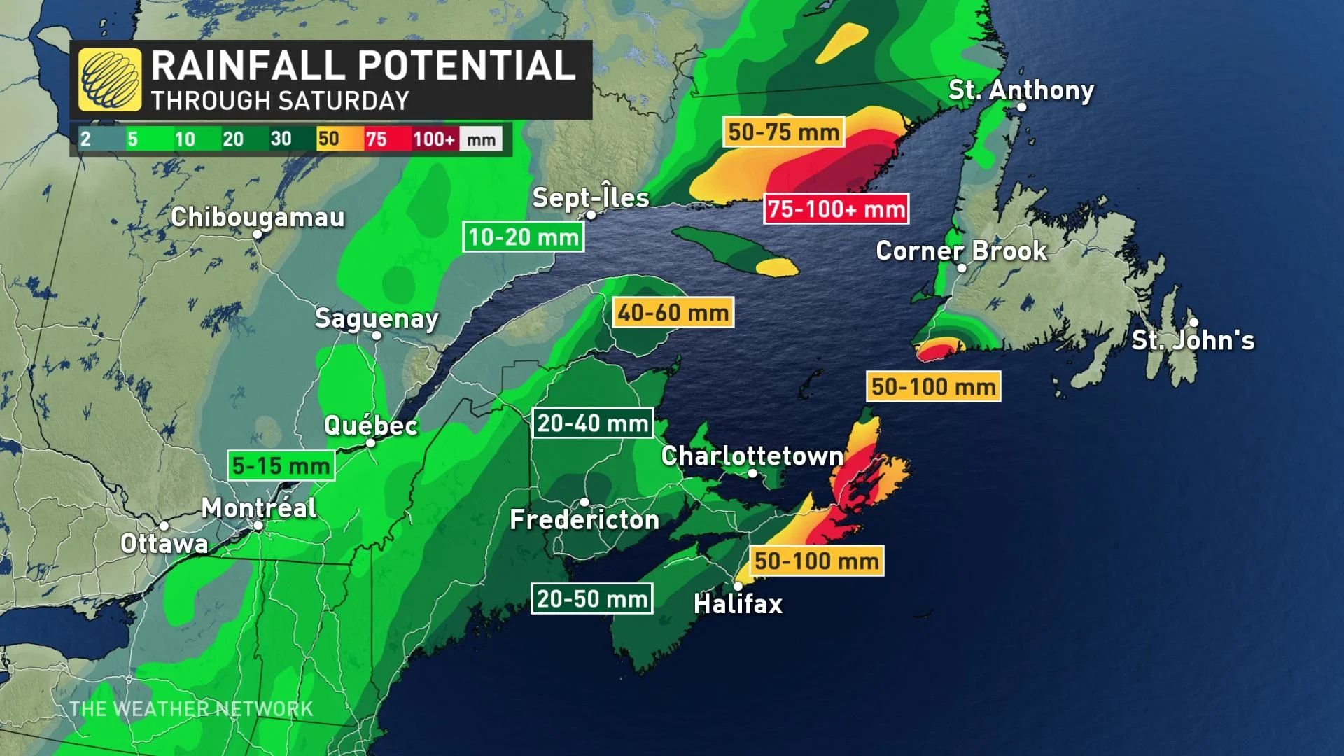
The first downpours of a multi-day deluge began Thursday in the Maritimes, set to last through much of the weekend, as an atmospheric river funnels abundant Gulf moisture to the region. In all, some 50-100 mm of rain by Saturday, a serious flood threat on its own before considering the already heightened risk for some areas. Worsening matters, a blocking pattern will drastically slow the system's passage, hence the heightened amounts. More on the timing and impact, below, plus a look at a second system that threatens a 'white Easter' for parts of the region this weekend.
WEATHER HIGHLIGHTS:
Prolonged period of heavy rain for the Maritimes began Thursday and continues into the weekend
50-100 mm for parts of Nova Scotia, some freezing rain risk for parts of New Brunswick
Threat for unsettled weather for the eastern Maritimes and into Newfoundland during the weekend and through early next week
INTO THE WEEKEND: ATMOSPHERIC RIVER DRENCHES THE MARITIMES
The first drops of what will be an absolute soaking for parts of the Maritimes began to fall Thursday, as an atmospheric river funnels moisture directly from the Gulf of Mexico up toward the Atlantic provinces.
Worsening matters will be a blocking pattern that will cause the low to all but stall for multiple days – plenty of opportunity for that moisture to be unleashed.
MUST SEE: Will Canada's strong start to spring persist? Exclusive April outlook revealed
Much of eastern Nova Scotia and the Lower North Shore of Quebec can expect some 50-100 mm of rain throughout the duration of this event. While most of Newfoundland initially looked to escape with negligible amounts, forecasters now say some of the deluge will be aimed at the province's extreme southwest.
Meanwhile, a widespread 20-40 mm of rain is likely to fall across New Brunswick, with locally heavier amounts for northern sections as well.
RAIN AND WIND LASH NOVA SCOTIA, UMBRELLAS MIGHT NOT STAND A CHANCE
HEIGHTENED FLOOD THREAT IN ALREADY VULNERABLE AREAS
This rain comes on the heels of an ice jam in the Perth-Andover area of New Brunswick, where water levels were already about 1 metre from flood levels earlier this week.
SEE ALSO: Fredericton forecast to hit flood stage Saturday, but no risk to properties
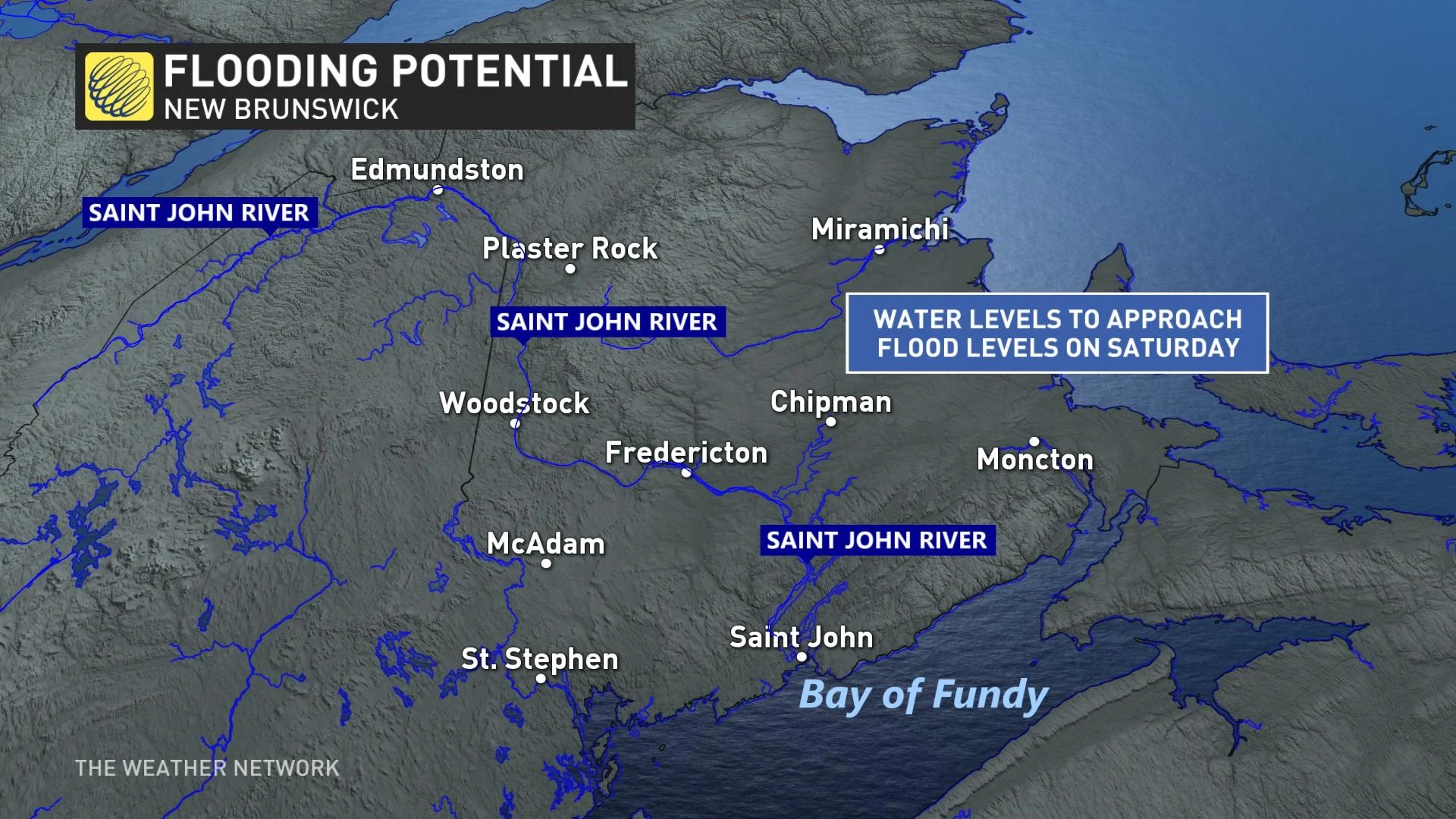
"As some areas in northern New Brunswick still have snow on the ground, the combination of snow melt along with the heavy rain is going to increase water levels over the coming days," warns Weather Network meteorologist Matt Grinter.
Residents along the Saint John River are being advised to stay up to date on any advisories or alerts for the risk of flooding through the weekend.
WATCHING THE THREAT FOR A WHITE EASTER
Forecasters are watching for another area of low pressure that will develop over the Atlantic and track north into the region, bringing additional rainfall through the weekend and into early next week.
Some wet snow is also expected for New Brunswick on Easter with widespread totals of 5-10 cm possible. The precipitation looks to stay as rain elsewhere, with totals of 25-50+ mm likely, but locally 50-100+ mm for parts of central and eastern Nova Scotia, PEI and eastern Quebec.
Be sure to check back for updates on the moisture-filled system for Atlantic Canada.


