Surge of warmth brings epic downpours to the doorstop of Canada's Arctic

December 1st marks the start of meteorological winter in the northern hemisphere, but of course, the season doesn't have much respect for the calendar, particularly in Canada's north.
While people in the southern provinces have been experiencing the normal seasonal back-and-forth in recent weeks, by this time of year, there's usually no doubt that winter is already here. The sun set for the last time in 2020 for some far-northern communities in November, and Canada has already seen its first recorded -40°C, in the village of Mayo, Yukon.
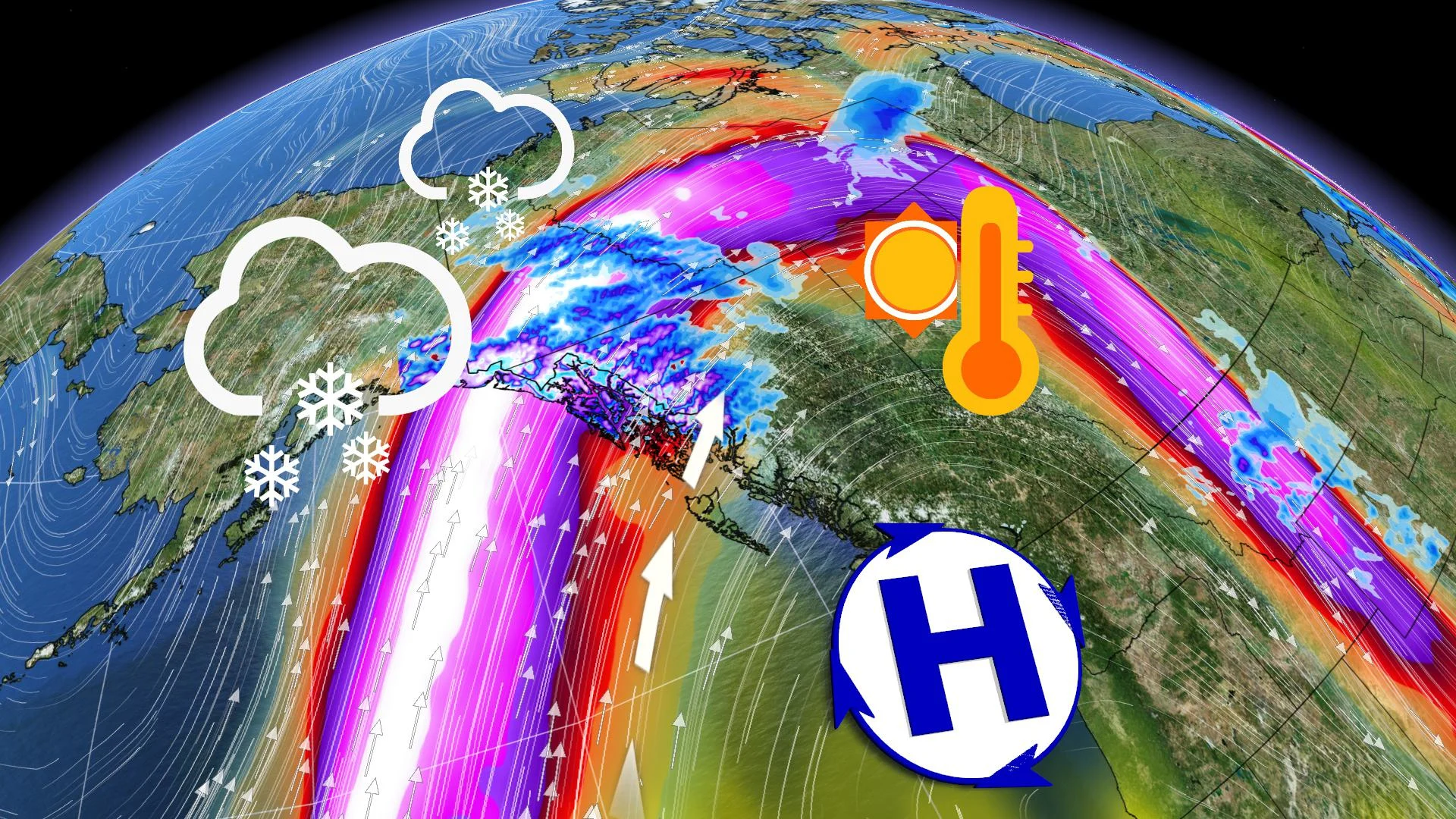
However, a particular atmospheric setup is going to bring some very unseasonal warmth to the Yukon, along with some very heavy downpours better suited to a B.C. fall than to the doorstep of Canada's Arctic.
It all begins with a ridge of high pressure building over Western Canada, keeping skies clear and low-pressure systems out. Instead, they will "slide" over the ridge northward, so that the kind of moisture-laden storms common to B.C. at this time of the year will be directed instead to northern B.C. and Yukon.
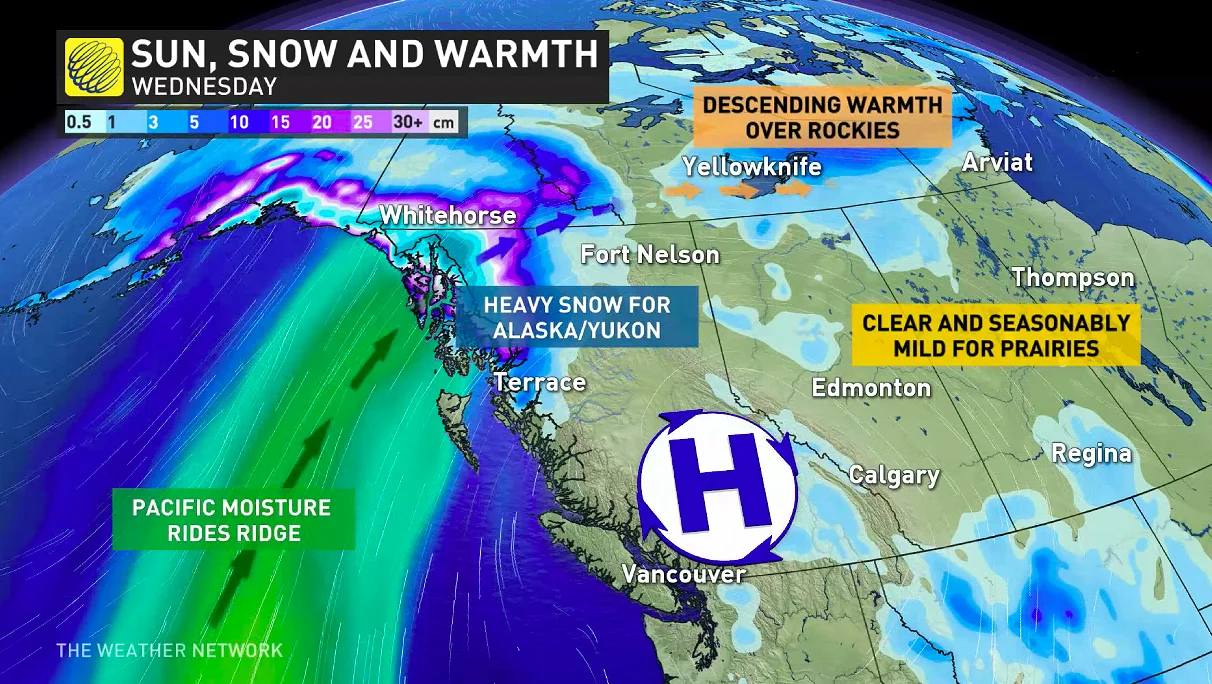
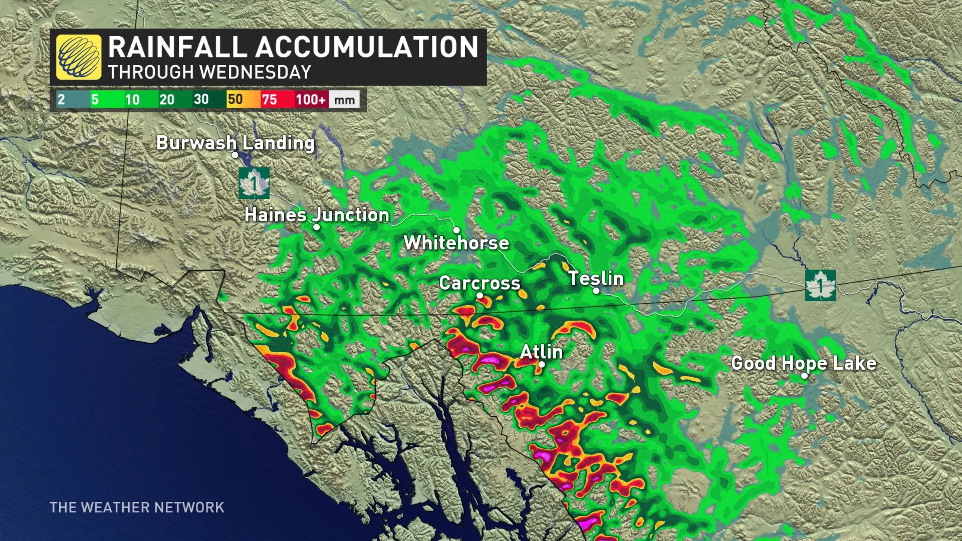
That's set to happen Tuesday, with that copious moisture precipitating initially as very heavy snow, as much as 50 cm locally for parts of southern Yukon.
However, a surge of warmth will move in soon after, sending freezing levels soaring above 1,000 metres. Overnight Tuesday, all that moisture will begin to change over to a steady rain, in the 50-75 mm range for the valleys of northern B.C. and southern Yukon into Wednesday – amounts normally unheard of for the territory at the beginning of December.
By Wednesday, Whitehorse is looking at a daytime high of 9°C, about 18 degrees warmer than seasonal.
By Thursday, the ridge that will have brought that warmth will subside somewhat, and those temperatures dive down to a forecast 1°C – though even then, that's still 10 degrees above seasonal for the territory.


