Tornado watches and warnings end after severe storms roll through Ontario

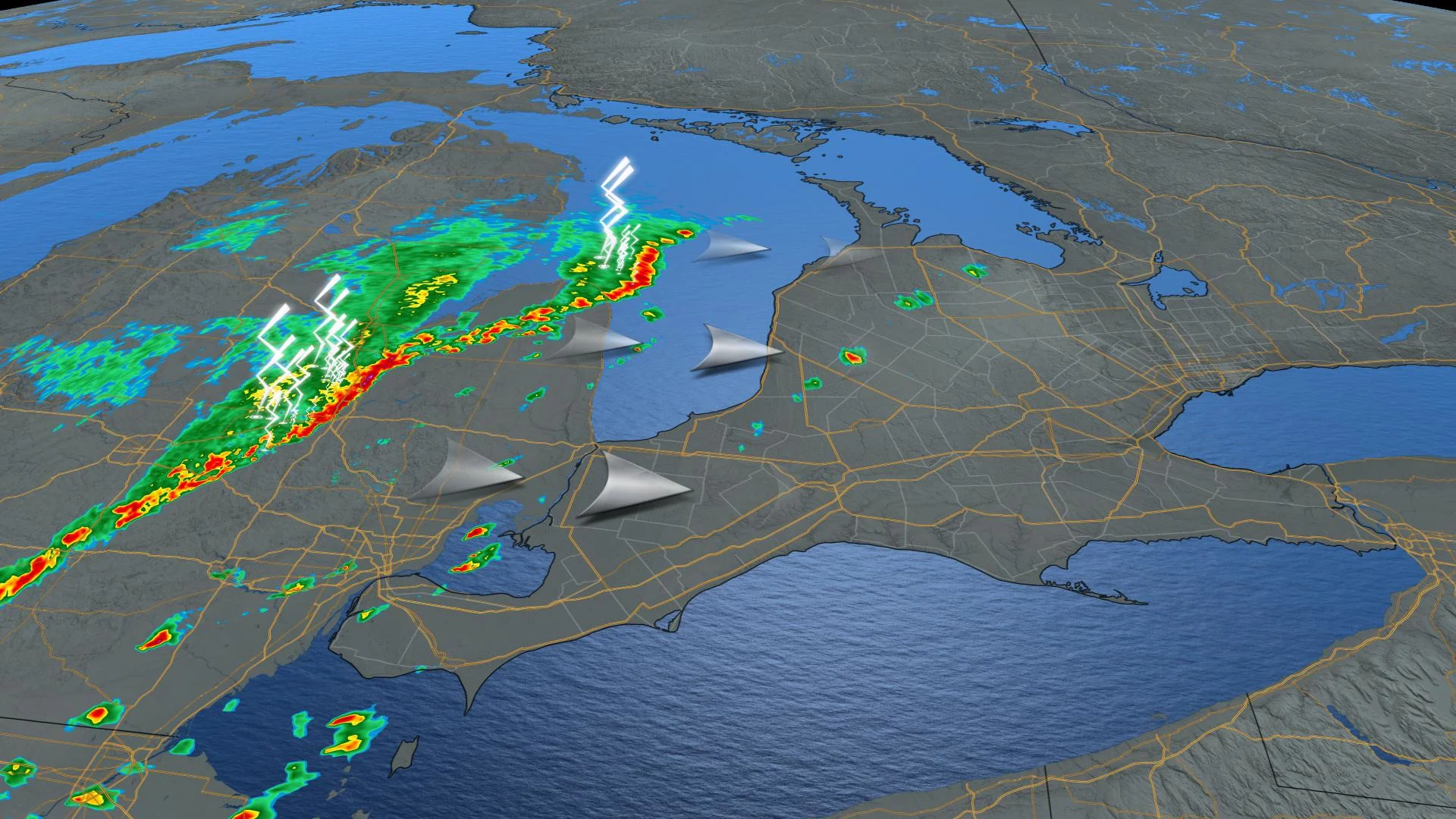
Friday felt very summer-like across much of southern Ontario, complete with some very summer-like storms that triggered widespread tornado watches and warnings ranging from the Bruce Peninsula through to Georgian Bay and north of Lake Simcoe. Those dropped by the early evening, but the cold front that triggered those storms will send temperatures plunging from Friday's rosy 20-plus-degree highs. A look ahead, below.
WEATHER HIGHLIGHTS
Tornado watches and warnings ended, showers possible through the evening for parts of the south
Snow ends in the evening for the Nickel Belt.
Chilly but clear weekend
FRIDAY: LATE-SEASON WARMTH FUELS LATE-SEASON STORMS
Summer's somewhat seasonally displaced last gasp was upon southern Ontario Friday afternoon. Temperatures crept above the 20°C mark, feeling like the mid-20s for some, a great last hurrah for anyone fortunate enough to step outside.
However, a cold front destined to bring temperatures back down to earth began impacting the province, triggering severe thunderstorms as it sank southward.
With all the heat and humidity in its path, conditions were ripe for tornadoes, and indeed, widespread tornado watches were issued mid-afternoon, with some in the Bruce, Georgian Bay and Lake Simcoe areas being upgraded to full-fledged tornado warnings.
Those have since dropped, and no tornadoes have yet been confirmed, but the storms did produce strong winds, local downpours, and mid-sized hail. Severe thunderstorm warnings lingered for some time after the tornado threat ended.
SEE ALSO: Significant shift in the pattern ends national weather divide
LONG RANGE: WIDESPREAD CHILLY WEATHER RETURNS
That cold front will usher in some markedly colder temperatures for the weekend. Daytime highs will be mostly in the single-digits, below seasonal, and the chill will dominate through the end of next week and into the first days of November as well.
"However, much milder weather to our west is expected to slowly spread into our region later in the week and we are watching the potential for a stretch of above seasonal temperatures heading into the second week of November," adds Gillham. "Of course, seasonal temperatures by that time are cooler so it is unlikely that we will see 20°C again."
Stay tuned to The Weather Network for the latest forecast details.