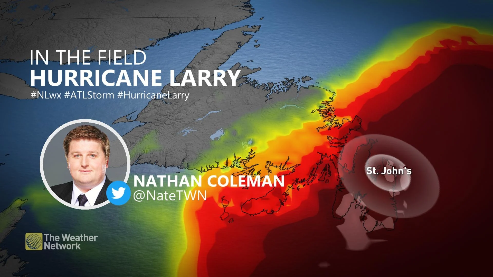
Damage, outages reported after Hurricane Larry lashes Newfoundland

Hurricane Larry made landfall near the isthmus of the Avalon Peninsula in Newfoundland around 1:15 a.m. local time on Saturday. The system rolled ashore as a Category 1 with maximum sustained winds of 130 km/h. The hurricane lashed the island with powerful winds, leading to widespread power outages and even some structural damage. Conditions improved dramatically through the morning, as Larry raced north toward Greenland.
LARRY MADE LANDFALL AS A CATEGORY 1 STORM
Hurricane Larry’s long journey that began off the western coast of Africa more than ten days ago came to an end late Friday night and early Saturday morning as the storm brought powerful winds, heavy rain, and rough surf to Newfoundland.
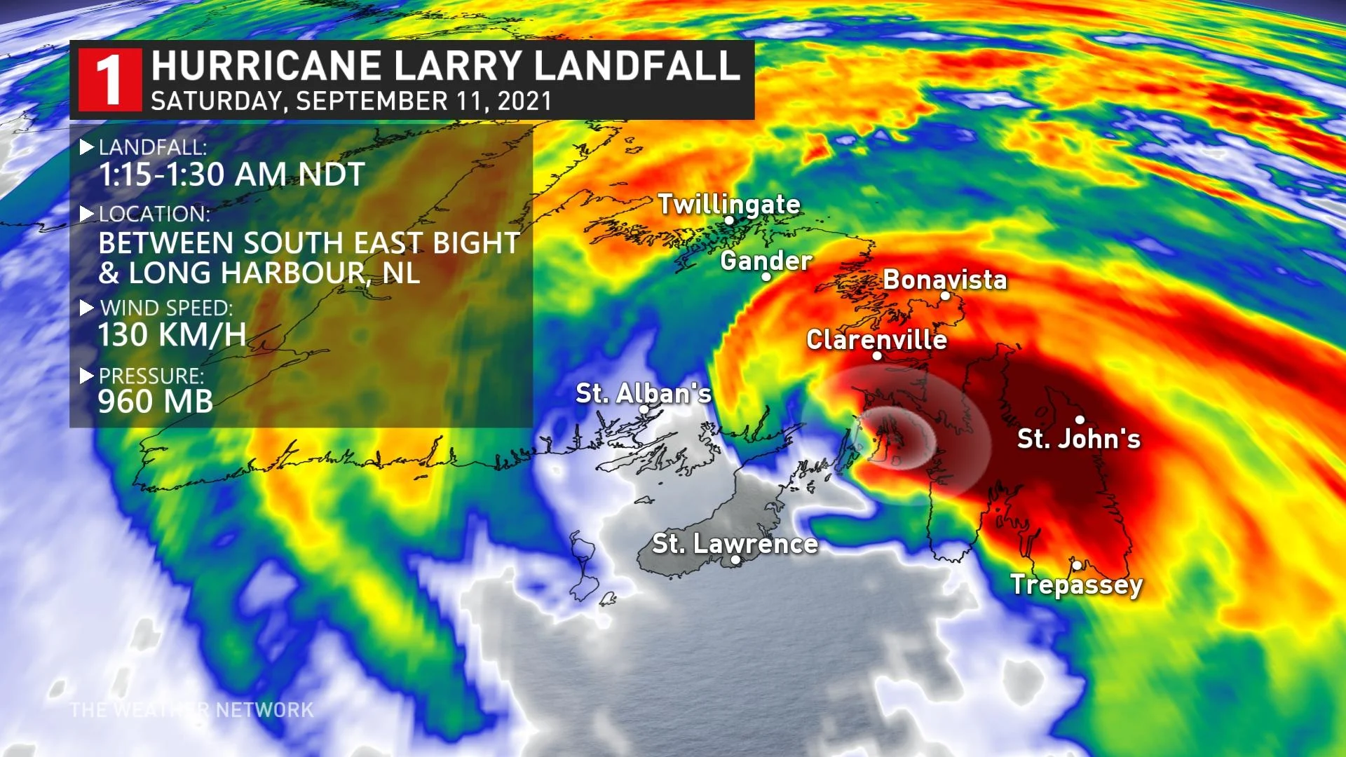
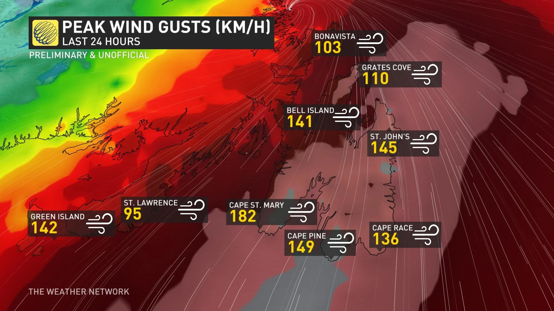
The storm came ashore as a Category 1 with maximum sustained winds of 130 km/h, but Larry’s impacts started well before it made landfall. Wind gusts in the 130-150 km/h range were recorded over much of the southern Avalon.
PHOTOS: Hurricane Larry slams Newfoundland with powerful winds
An unofficial gust of 182 km/h was recorded at Cape St. Mary and St. John's International Airport recorded a gust of 145 km/h during the peak of the storm.
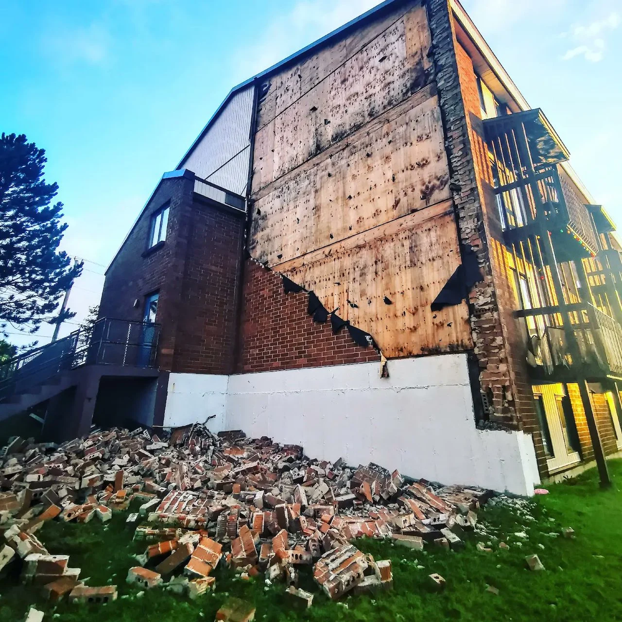
Structural damage was reported during the overnight hours, along with many reports of downed trees and power lines. The CBC reported on Saturday morning that there were still about 46,000 customers without power in eastern Newfoundland by 10:00 a.m. local time, down from nearly 60,000 outages at the peak of the hurricane.
Newfoundland is used to strong winds during the winter storms that roll through the region. However, Larry was a different kind of storm due to the time of year. Most of the region’s windstorms occur during the winter months after the leaves have fallen. Trees here are still covered in foliage, which acts as a sail to more easily bring down branches as trees as Larry’s winds spread over the region.
The storm’s strong and broad wind field pushed a dangerous storm surge into Newfoundland’s southern coasts. A storm surge is seawater pushed inland by a storm’s persistent winds.
Portions of the Burin and southern Avalon experienced a notable storm surge event coinciding with high tide earlier in the night. A tide gauge at Argentia recorded a peak water level of 150 cm higher than what is normal during high tide.
The worst of the storm was over Saturday morning, and conditions eased throughout the day, though gusty winds continued somewhat through the afternoon as the storm moved northward toward Greenland.
Hurricane Larry was a large and powerful storm that left the Atlantic Ocean churning in its wake. Dangerous surf and rip currents will remain a hazard for coastal areas across Atlantic Canada through the weekend.
The remnants of Larry will go on to produce blizzard conditions in Greenland over the next couple of days.
With files from the CBC.
Thumbnail courtesy of Maria/@Maria38145259, taken in St. John's, N.L.
Stay tuned to The Weather Network for the latest updates on Hurricane Larry.