Rain to cease in Maritimes as storm eyes Newfoundland with downpours

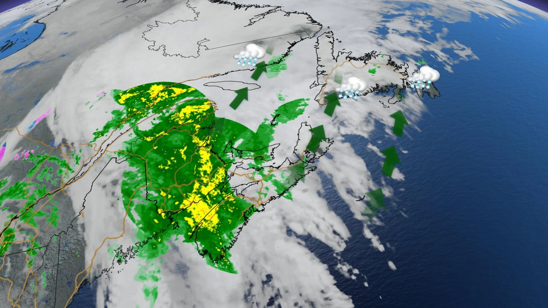
The Maritimes has been battered by extreme, potentially dangerous rainfall this week, with another 60-80 mm expected in parts of New Brunswick and Nova Scotia by Wednesday morning. This may lead to localized flooding and road washouts in these regions, making for horrible travelling conditions. The good news is the sluggish system is finally preparing to exit the Maritimes, and will track into Newfoundland in the afternoon. Rainfall will be heavy on the island, but nowhere near as extreme as in the Maritimes. For a more detailed look, see below.
WEATHER HIGHLIGHTS
Rain reaches southern Newfoundland Wednesday afternoon, tapers in the Maritimes in the morning
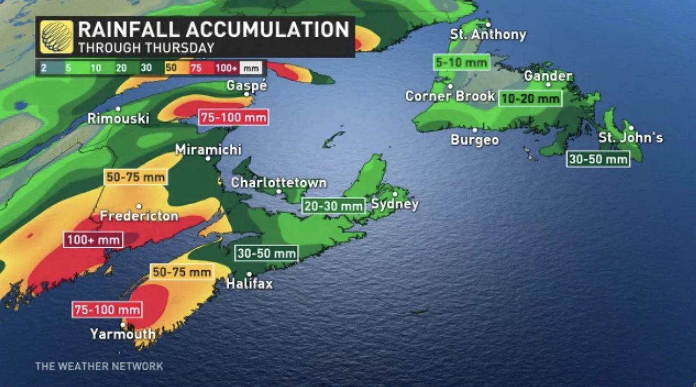
Amounts could exceed 100 mm in Maritimes, localized flooding possible
Mild temperatures hang on through the weekend
WEDNESDAY: RAINS TAPER OFF IN MARITIMES, MOVES INTO NEWFOUNDLAND
Rainfall amounts up to 75 mm have already fallen across southwestern New Brunswick, with further amounts of 30-60 mm, even up to 80 mm locally, are possible through Wednesday morning, when it is expected to subside.
Meanwhile in southwestern Nova Scotia, 25 to 40 mm has already amounted, with an additional 30-50 mm, locally up to 70 mm in the heaviest rain bands, expected during the same time period.
"Heavy downpours can cause flash floods and water pooling on roads. Localized flooding in low-lying areas is possible. Don't approach washouts near rivers, creeks and culverts," warns Environment Canada in the rainfall warning.
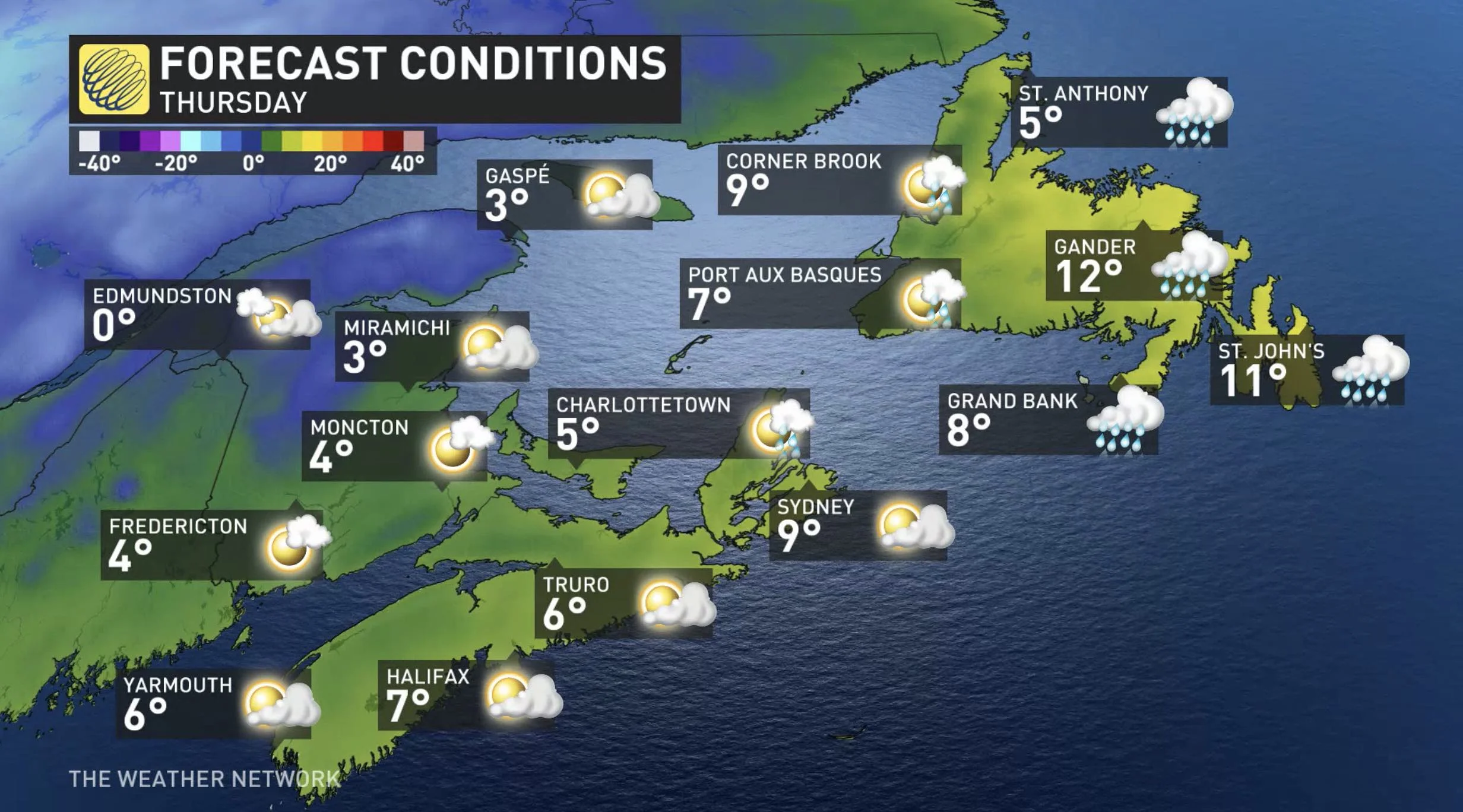
Temperature-wise, daytime highs stay in the double digits Wednesday, and though the Maritimes see a cooldown Thursday, Newfoundland stays on the warmer side.
After soaking the Maritimes since Monday night, the slow-moving low will finally push rain into Newfoundland in the afternoon. Amounts won't be nearly as heavy for the island, with the system bringing some 30-50 mm for parts of the Avalon and Burin peninsulas, as well as the island's south shore, ending by Thursday afternoon.
Beyond, temperatures will remain above-seasonal for the late week into the weekend. In fact, most of Newfoundland may see double-digit temperatures on Thursday, and again on the weekend for eastern areas.
As for storms, forecasters see the potential for a more active pattern early next week. At this point, it is too early to have confidence in the track and impacts, but this should bring strong winds and a wide variety of weather to the region.
Check back as we continue to monitor the passage of this system.


