Beneficial rains break through drought barrier on parts of the Prairies

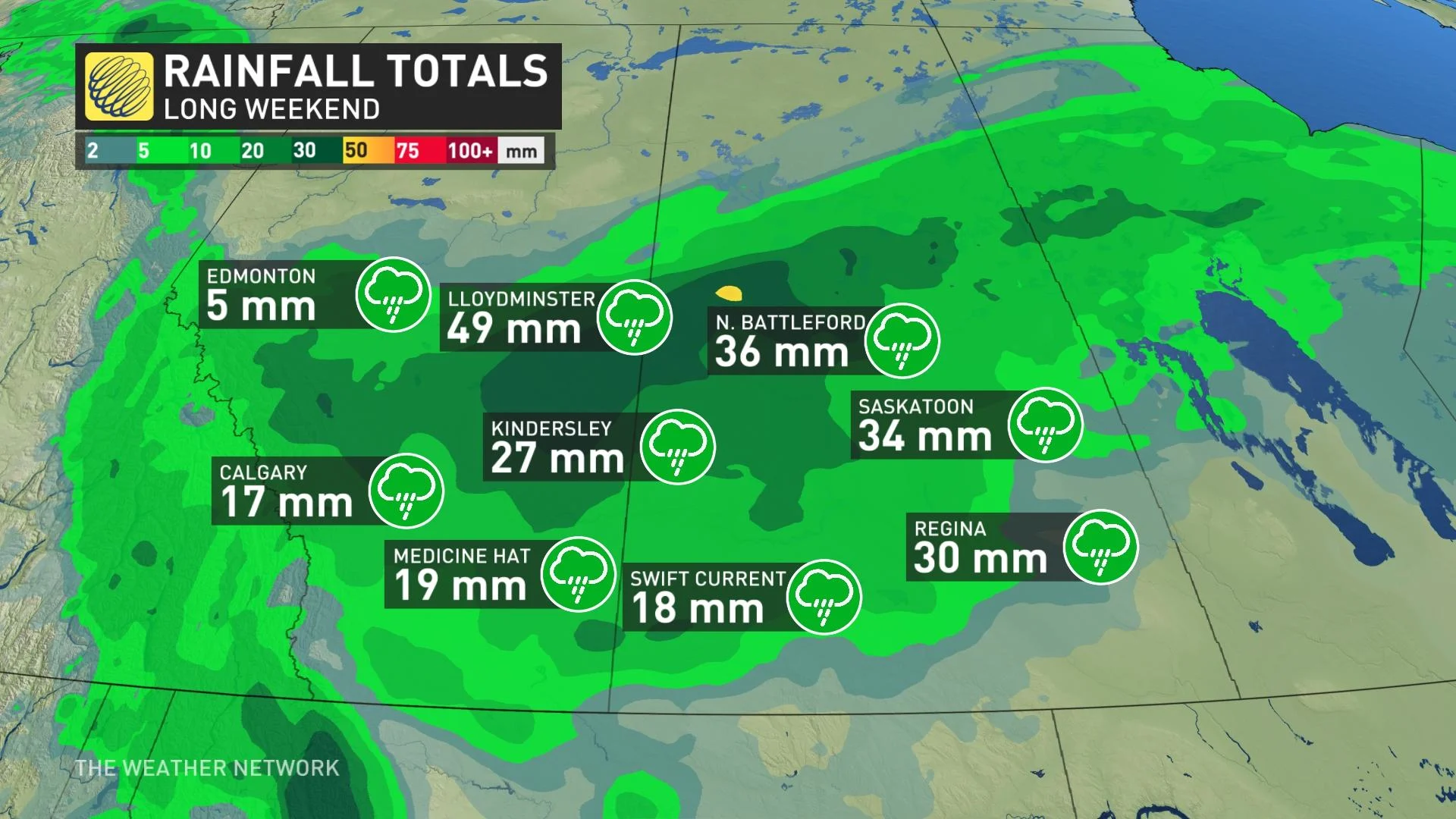
Though the rounds of rain put a damper on parts of the May long weekend across the Prairies, the soggy conditions also helped to bump up average rainfall amounts in what's been a desperately dry season so far.
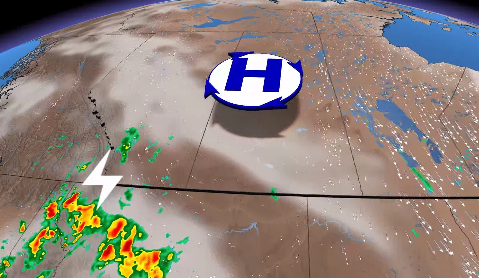
Last week saw two systems move across the Prairies, one through northern Alberta and the other through southern Manitoba. Unfortunately, neither of these storms managed to bring any sort of drought relief to central and western Saskatchewan.
"The Victoria Day storm on Monday, however, finally brought a sigh of relief to many farmers in the driest areas from Calgary to Saskatoon," says Kevin MacKay, a meteorologist at The Weather Network.
During this growing season, which starts April 1, North Battleford, Sask. had only seen five per cent of its average rainfall. According to the Canadian Drought Monitor, most of southern Saskatchewan was dealing with either "severe" or "extreme" drought conditions ahead of this recent rain.
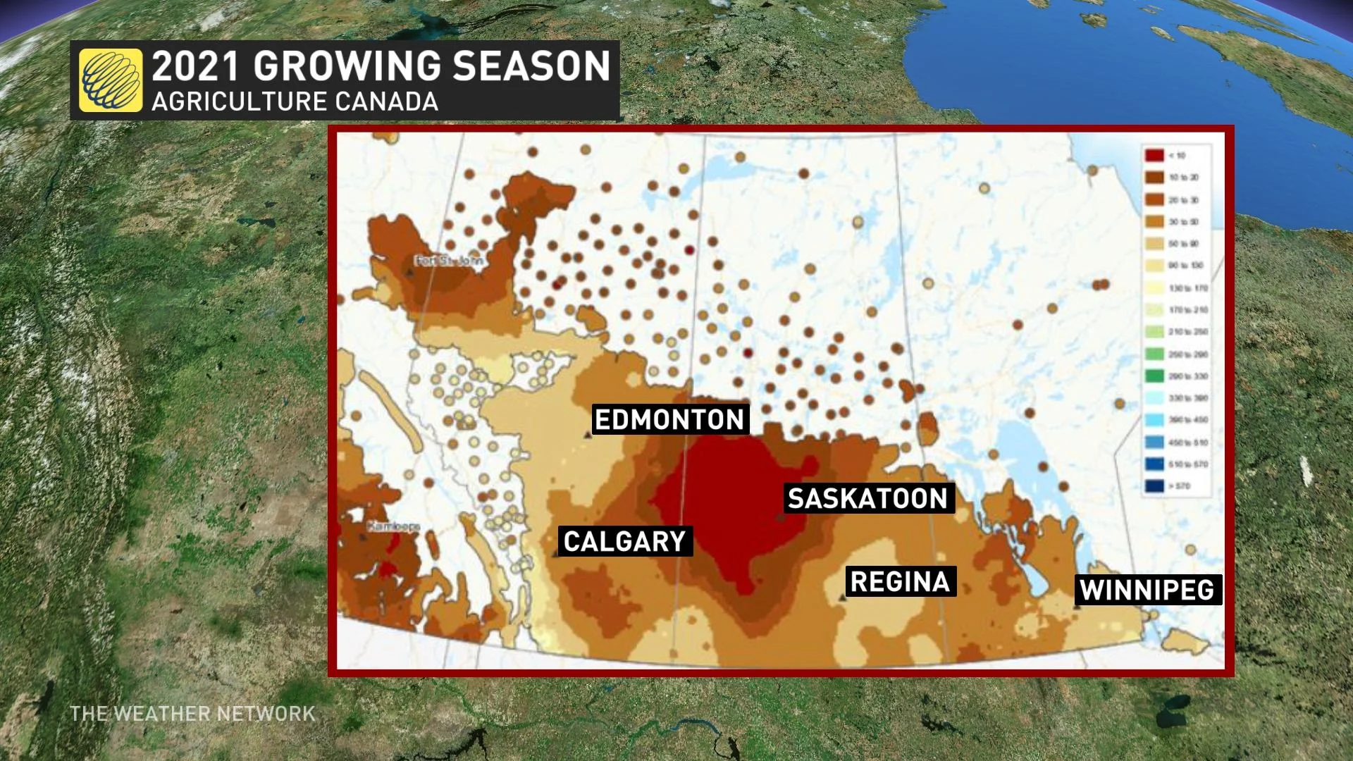
Monday's storm brought 39 mm of rain, however, bumping the region up to 66 per cent of its average.
Regina has also been very dry, seeing less than 5 mm of rain since April 1. Between the rounds of rain from last week and into the May 24 weekend, as well, about 30 mm had fallen collectively, bumping it to 91 per cent of the average.
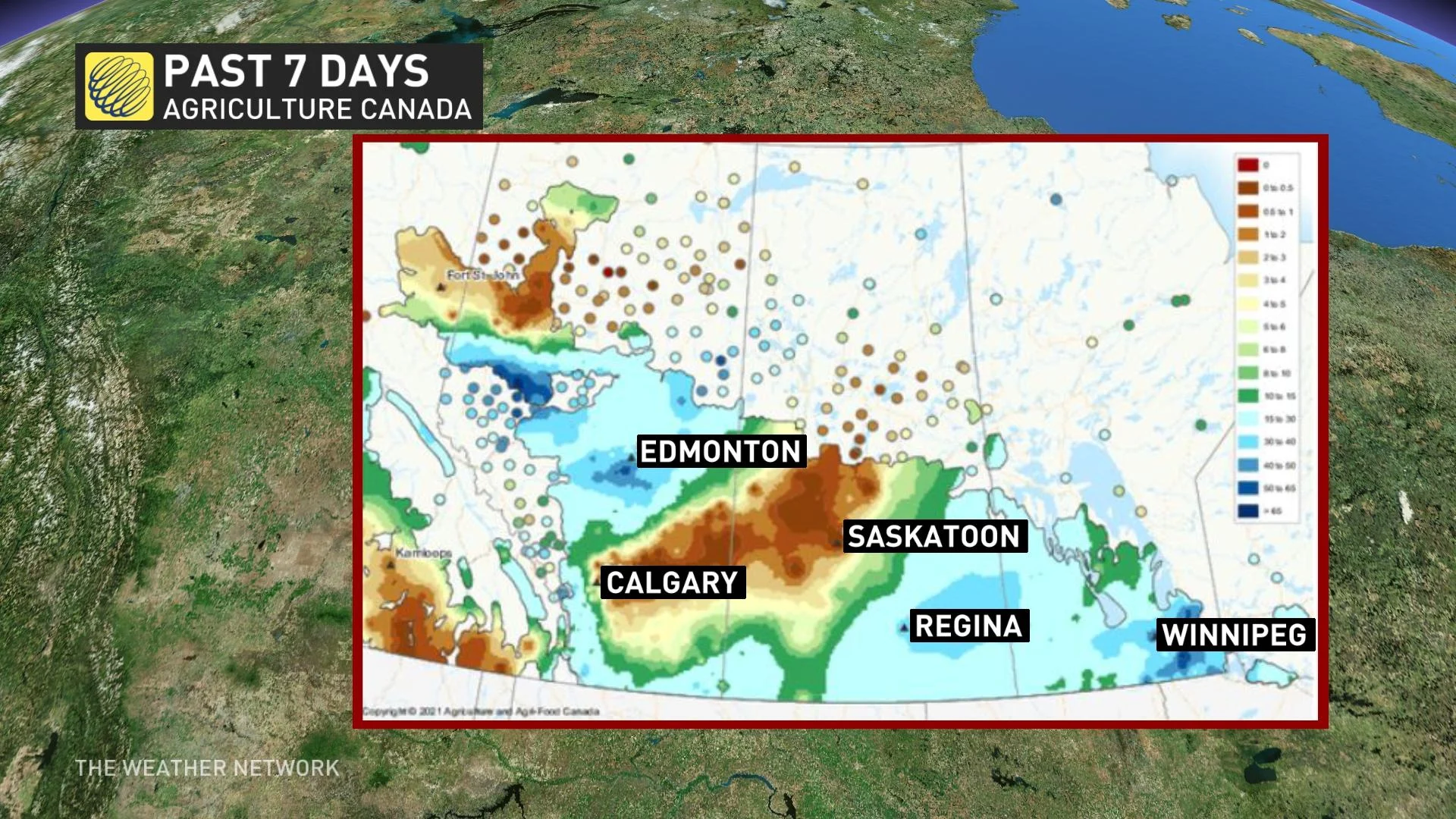
"Although every farm across the Prairies has been impacted by at least one of these weather systems over the past week, it isn't enough to bring an end to the drought," MacKay says. "Retaining this water and avoiding too much of a good thing will be the focus for the coming days."
LOOK AHEAD: ALBERTA SEES THUNDERSTORM RISK WEDNESDAY, MORE RAIN LATE WEEK
While southwestern Alberta has the risk for non-severe thunderstorms Wednesday, thanks to some instability, the next chance of widespread scattered showers will be Thursday night. However, the heaviest rain will remain in northern sections of the Prairies until Saturday.
The forthcoming late-week system may also bring thunderstorms to the southern sections of the Prairies, but most areas won’t see any substantial rainfall amounts with it.
Temperature-wise, daytime highs will do a flip in the region Wednesday — with Winnipeg, Man., seeing a considerable nosedive down to the single digits, well below the normal of 22°C. Meanwhile, Alberta will see a slight warm-up Wednesday
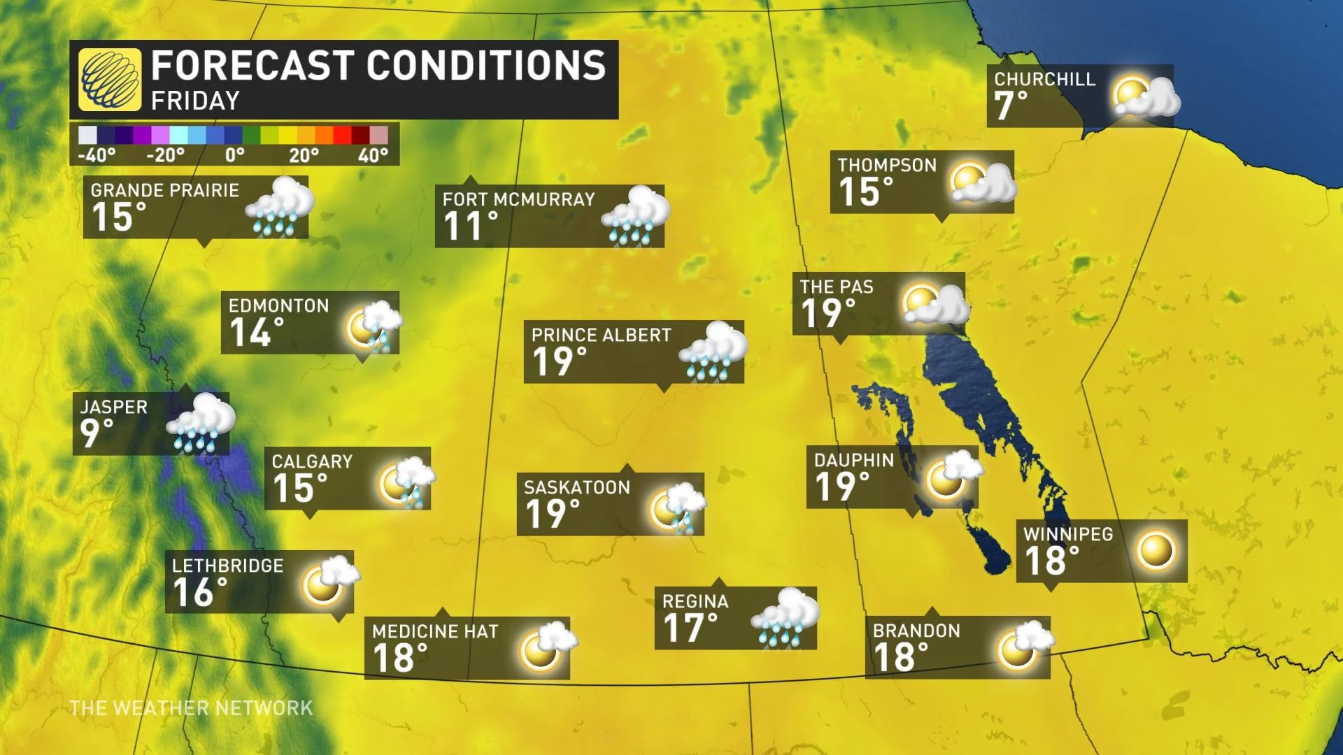
A quick shot of cooler weather will also spread across the region Friday and Saturday, but a warming trend starts on Sunday and continues into the middle of next week. Widespread temperatures in the mid to upper 20s are expected to return by next Tuesday as well.
Abundant sunshine will also persist through the middle of next week, with the potential for a more active pattern to develop by the late week mark.
Be sure to check back for the latest updates on the temperature pattern and drough relief across the Prairies.


