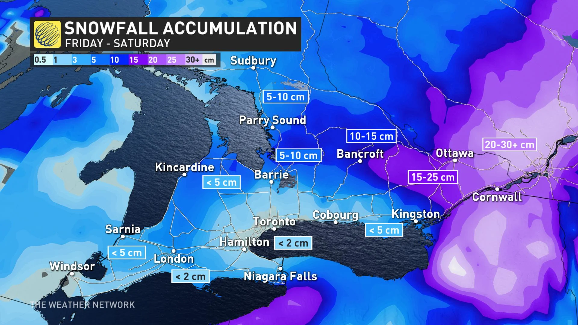
Heavy snow lasts though Saturday for the east, 15-25 cm likely

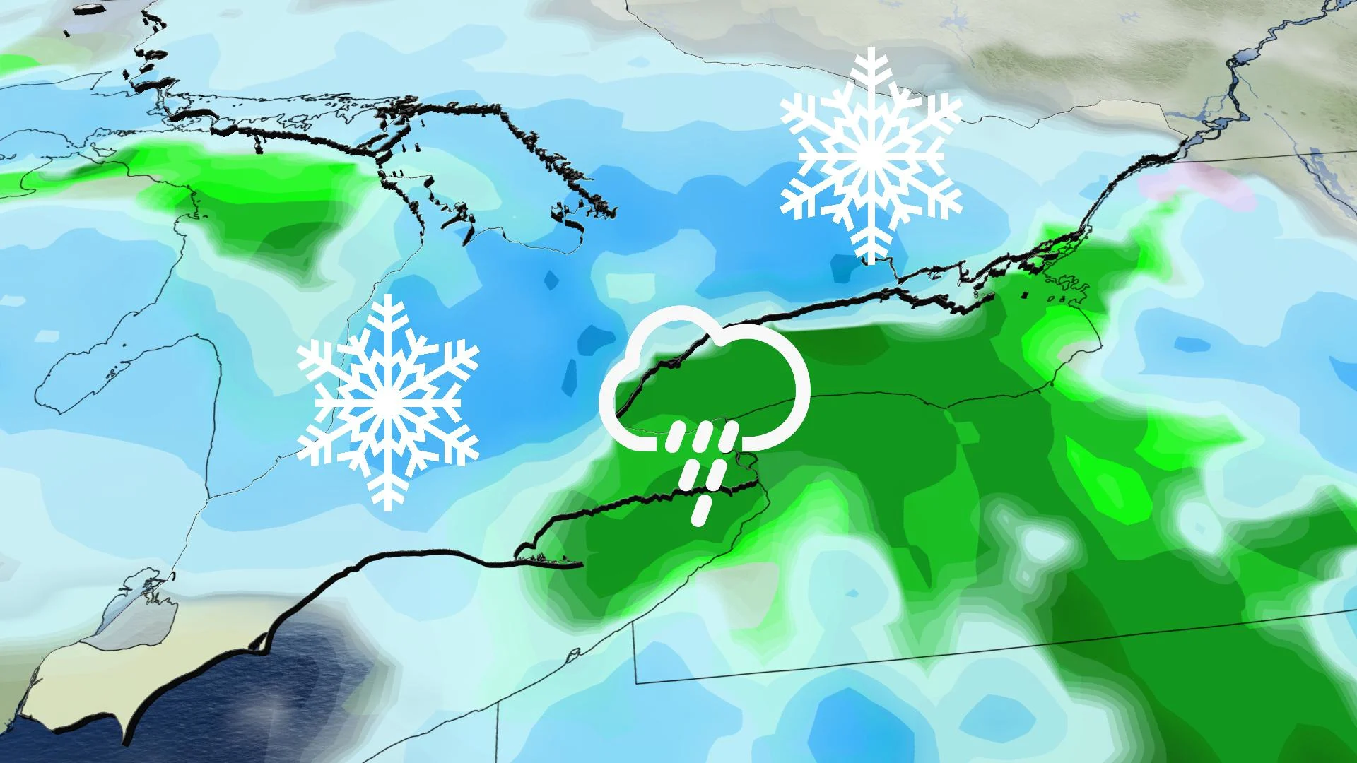
The return of winter weather was gentle for most of Ontario Friday, with barely a trace of snow for the GTA and only around 5-10 cm for higher areas as a system moved in from the Prairies later in the day. But it's a different story in eastern Ontario, where 15-25 cm is set to fall through to Saturday night, including for Ottawa. Beyond, some brief shots of lake effect snow precede a marked fall in temperatures early next week. For a closer look, see below.
WEATHER HIGHLIGHTS:
Heavy snow continues most of Saturday for eastern Ontario, 15-25 cm possible by the overnight
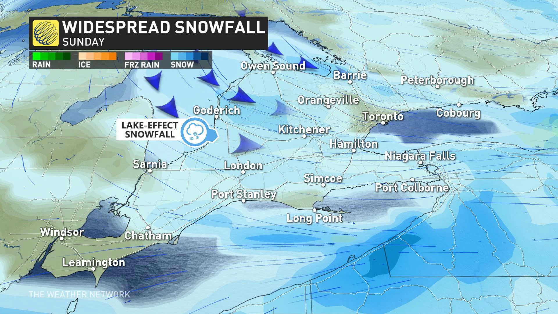
Lake-effect flurries expected southwest of Georgian Bay Sunday and early Monday, negligible amounts
Long range features temperatures closer to seasonal than in recent days
INTO THE WEEKEND: HEAVY SNOW SATURDAY IN THE EAST
From its origins on the Prairies, this system had lost most of its strength by the time it began impacting southern Ontario later Friday. The GTA saw just a trace of snow, if not rain or a rain/snow mix, while higher elevations of the southwest were in the 5-10 cm rain.
By Saturday morning the only part of Ontario that will still be seeing snow will be the east, where amounts are expected to be sharply higher, in the 15-25 cm range, including for Ottawa. The snow continues through most of the day there, heaviest in the afternoon before tapering to light snow overnight into Sunday.
For the rest of the province, occasional flurries with a gusty wind are likely on Saturday, with temperatures continuing on the mild side of seasonal. Wet snow showers will develop later in the day, especially for areas north of the GTA once again.
Forecasters are also watching the potential for some accumulating snow for southern Ontario for Sunday and again Monday morning, with 2-5 cm of snow possible from Sarnia to Niagara and into the southern GTA.
NEXT WEEK: COOLER TEMPERATURES FINALLY SETTLE IN
Near-seasonal temperatures will return to southern Ontario for the start of next week, as lake-effect snow develops southeast of Georgian Bay.
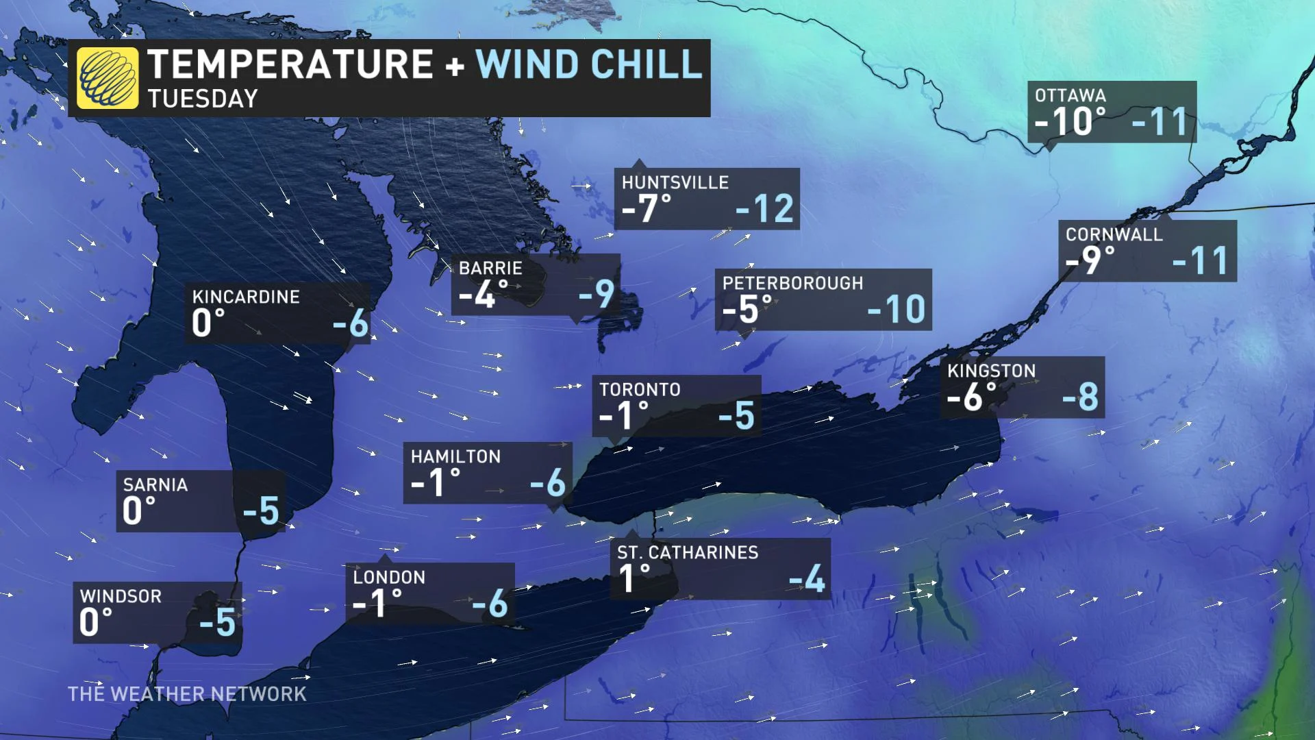
By Tuesday, a sharp difference between east and west will settle in, with eastern Ontario flirting with the negative single digits, and feeling colder still with the wind chill.
Weatherwise, another clipper system that's set to cross the region on Tuesday also shows the chance for a widespread 2-5 cm of snow, though it's still several days away, and thus too soon for concrete certainty.
"The end of January will bring a higher potential for more typical wintry weather, however, there are no extended periods of frigid weather in sight," says Weather Network meteorologist Dr. Doug Gillham. "The pattern will become more active with the potential for messy winter storms, but it is unlikely that we will see more than a few days with colder than seasonal temperatures."
Be sure to check back for the latest updates on the pattern changes in Ontario.