
PHOTOS: Intense winds shake ground, send debris flying in Ontario

Heavy rain, fierce winds and severe thunderstorms whipped through much of southern Ontario Sunday, courtesy of a potent Colorado low with widespread impact felt right across the province.
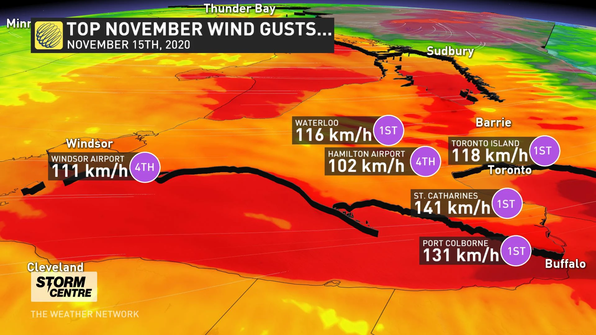
Record-breaking winds were reported throughout the day, including a gust of 118 km/h at Toronto Island and an impressive 141 km/h gust in St. Catharines. Those were both strong enough to set new all-time records for the month of November.
Seismologist John Cassidy flagged an unusual signal on the sensitive seismographs placed along the Leslie Street Spit in Toronto.
"The wind speed was strong enough to be tracked on the data plot from the output of the seismometer Sunday evening," explains Weather Network meteorologist Tyler Hamilton.
__WHAT'S NEXT? Arctic air, bands of lake-effect snow follow damaging wind storm __
The blustery conditions also created flooding along shorelines and a flood warning was issued for Lake Erie by the Long Point Region Conservation Authority (LPRCA). The Port Stanley Buoy in Lake Erie recorded waves of 4.7 metres (15.4 feet).
At the height of the storm Sunday evening, over 230,000 Hydro One customers were without power due to trees being blown over and tearing down power lines. According to officials, crews are working as quickly and as safely as possible to restore power to all customers.
Some of the storm damage is also indicative of a possible tornado, as survey teams from the Northern Tornadoes Project are called to assess the damage track and destruction.
Here’s a closer look at the impacts from the potent storm that slammed southern Ontario:

Credit: Karen Zimmerman, St. Thomas, ON


