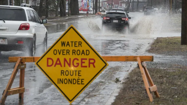
Fredericton forecast to hit flood stage Saturday, but no risk to properties
Fredericton and other communities along the St. John River are forecast to hit flood level by this weekend, but no risk of property damage is expected to occur, says the province's Emergency Measures Organization.
The Department of Environment and Local Government's five-day St. John River forecast shows the river's water is expected to be 6.6 metres in Fredericton on Saturday — 0.1 metre higher than the 6.5-metre flood stage. It's forecast to then drop to 6 metres on Sunday.
FORECAST: Conveyor belt of moisture streams into the Maritimes for Easter long weekend
Meanwhile, Gagetown's flood level is 4 metres and the river is expected to rise there to 4.2 metres on Saturday and 4.5 metres on Sunday.
And in Jemseg, the level of the river will match its flood stage height of 4.3 metres on Sunday.
Despite those forecasts, Geoffrey Downey, spokesperson for the New Brunswick Emergency Measures Organization, said no properties or roadways are expected to be affected.
"It shouldn't have any real impact. That's simply not significant enough to end up with any road closures or anything," Downey said.
"But again, it's a forecast. There's plenty of rain coming, so, you know, hopefully it sticks to that."
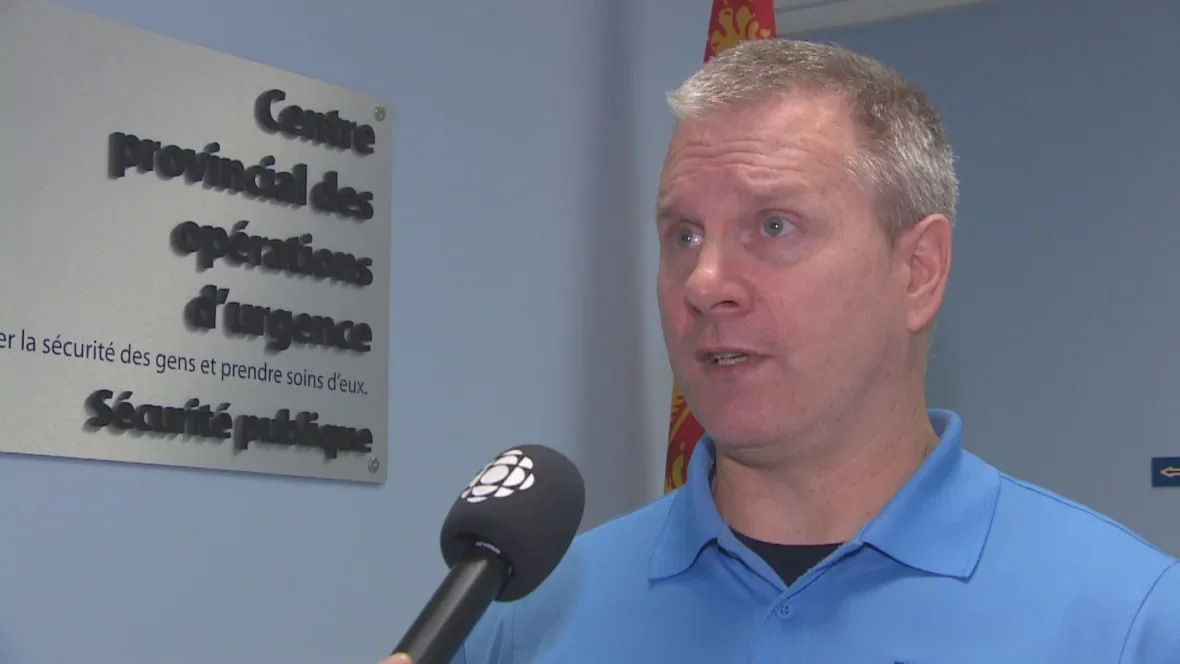
New Brunswick EMO spokesperson Geoffrey Downey said some rain is expected in the province this week, which could impact the forecasts. (Radio-Canada)
INCOMING RAIN COULD HAVE AN IMPACT
On Tuesday afternoon Environment Canada issued a special weather statement for the south-western part of the province, calling for 25 to 50 mm of rain on Thursday and Friday.
"Rain at times heavy will begin early Thursday morning across most of western and southern New Brunswick and will gradually end on Friday," the agency said.
"Total rainfall amounts from 25 to 50 millimetres can be expected for those areas, although regions along the Fundy coast are likely to see total amounts exceeding 50 millimetres."
Downey said the flood forecasts are based on expected rain, as well as the effect rising temperatures will have on snow in northern parts of the province.
Downey said those predictions could still change.
"We've been fairly fortunate so far... but certainly over the next couple of days, there's going to be some rain and some extended warm periods, so that's what's driving the rising water levels," he said.
NO FLOODING, BUT ICE JAM STILL HOLDING
Higher up the river in Perth-Andover, an ice jam had that community on edge as the buildup of ice led to rising waters.
On the province's online River Watch platform, the river was shown to have dropped slightly below the flood watch stage there on Tuesday.
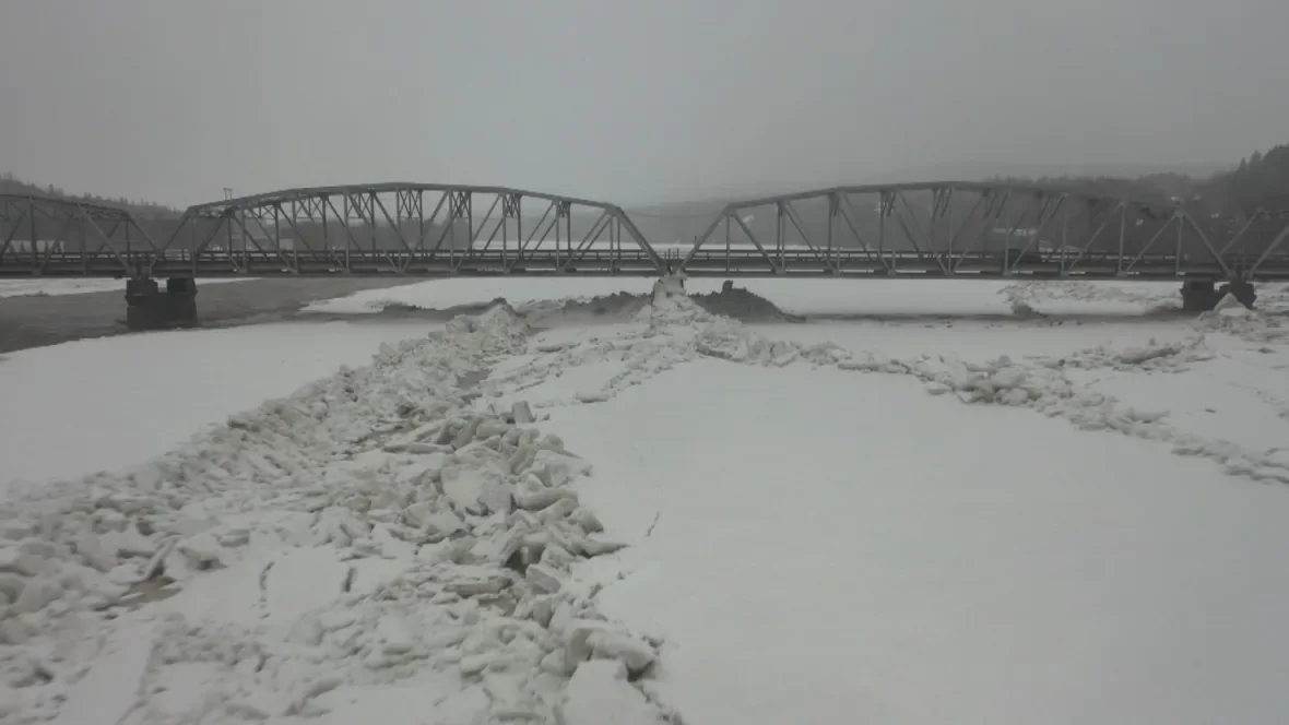
An ice jam in Perth-Andover raised water levels in the St. John River to less than a metre of the flood stage on Monday, March 29, 2021, but the river was back down below flood watch stage as of Tuesday. (Shane Fowler/CBC)
Downey said the ice jam is still in place, and at this point the province is watching and waiting to see what happens.
"There's some rain and some warm weather in the forecast … that's often enough to get it to move with the water rising. Or will ice from further up the river come down and make it longer? It's anyone's guess."
Downey said there has been no effect on properties in Perth-Andover, but Route 105 between the village and Tobique First Nation is still closed as it's covered in water.
Anglophone School District West said Andover Elementary School, Perth-Andover Middle School, and Southern Victoria High School will be reopening on Wednesday. They were also closed Monday and Tuesday due to the risk of flooding.
This article was originally published by CBC News and written by Aidan Cox


