Blast of early-season wet snow snarls travel, triggers outages in B.C.

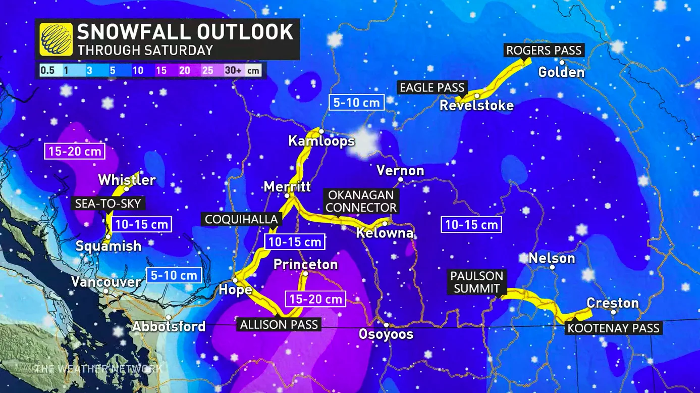
Pacific moisture colliding with B.C.'s frigid air resulted in a fair bit of snow for the upper and mid-elevations of the province, with the highest mountain passes for 5-15 cm by Saturday morning. A closer look at final expected amounts, and what's ahead, below.
WEATHER HIGHLIGHTS
Snow continues through early Saturday morning for some communities
Cold pattern persists into next week, but a warmup is on the horizon
FRIDAY INTO SATURDAY: LOW FREEZING LEVELS FUELLED WIDESPREAD HIGH AND MID-ELEVATION SNOW
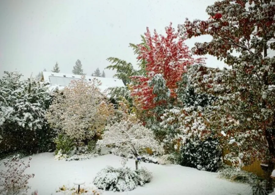
Cold air flooded southward into B.C. Thursday, sticking around through Friday. When a moisture-laden system began rolling into Vancouver Island Thursday night, that combination made for some substantial snow for parts of the province, given freezing levels at only a few hundred metres.
The snow came at a time when a lot of trees would still be in full leaf, making it more likely branches would break from the weight of the snow. As a result, several thousand power outages were reported across the Southern Interior over the course of the day. In the mountain passes, difficult travel conditions and some road closures were reported.
By Saturday morning, across the southern Interior, some 1-3 cm is possible for the valleys, with some mid-elevation communities possibly seeing local amounts of around 5 cm.
For the alpine and mountain passes, 5-10 cm is forecast, while the coastal mountains may be a little higher, with 5-15 cm, including for the North Shore Mountains, Allison Pass and the Coquihalla.
SEE ALSO: Significant shift in the pattern ends national weather divide
BEYOND: VERY COLD PATTERN CONTINUES THROUGH THE WEEKEND
Freezing levels remain low into Saturday, though they pick up again through the end of the weekend, and rosier conditions look to return before long.
"The cold pattern should finally relax during next week, with near and possibly above-seasonal temperatures during the second half of next week and weekend," Weather Network meteorologist Dr. Doug Gillham says.
Check back as we continue to monitor the approach of this system.
Thumbnail image courtesy of: Richard Allison/Kelowna, B.C.