Freezing rain, blowing snow will make for slick roads in Alberta Thursday

News that is worth celebrating in Alberta: The extreme cold is coming to an end shortly. The news that isn't so positive: Warming temperatures and an influx of moisture that will bring in snow and freezing rain into the province Thursday. With the snow in the north, the freezing precipitation chance will slide into Edmonton and areas east along the Yellowhead Highway. By Thursday evening, the freezing rain risk will move into western Saskatchewan, extending south to the U.S.-Canada border. This will result in difficult travel as roads will be slippery from the snow and/or freezing rain. Motorists are urged to exercise caution when travelling. Freezing rain warnings are in place. More on the snow and freezing rain risk Thursday, and what to expect on the weekend, below.
THURSDAY: SNOW, FREEZING RAIN THREAT AS TEMPERATURES WARM UP
The extreme cold in Alberta moderated Wednesday afternoon, with wind chills near -40 expected in the evening before ending overnight as temperatures begin to rise.
As more rain and snow push into B.C., that means more moisture is set to move into Alberta and the Prairies. In the pre-dawn hours Thursday morning, snow and freezing rain move into Peace River Country, persisting through the morning as it moves east. The snow threat will stay in the north as the potential for freezing rain pushes into Edmonton and east along the Yellowhead Highway. Freezing rain warnings are in place in parts of Alberta.
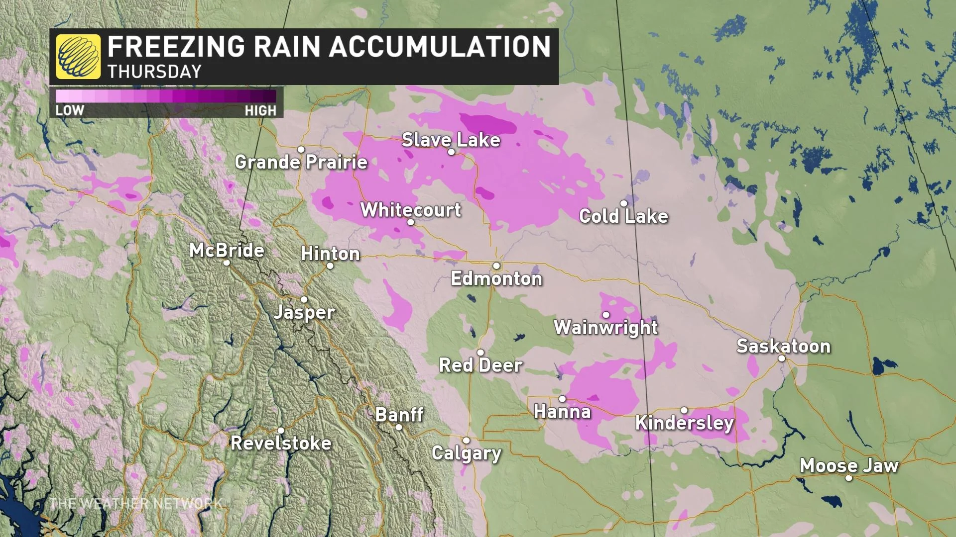
This will continue through the afternoon, and by the evening, it will push into western Saskatchewan from Lloydminster to the U.S.-Canada border.
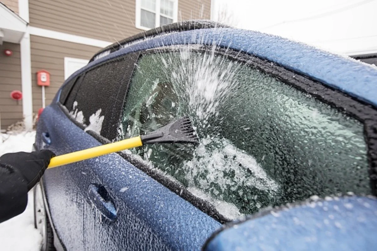
"Surfaces such as highways, roads, walkways and parking lots will become icy, slippery and hazardous. Consider postponing non-essential travel until conditions improve," Environment and Climate Change Canada (ECCC) says in the freezing rain warning.
The good part with this system is that it will bring in a Pacific air mass pushing those frigid temperatures out of the way. Needless to say, road conditions will be slippery and icy on Thursday, so motorists are urged to be mindful before heading out on the roads.
LOOK AHEAD: WARMING UP IN ALBERTA THIS WEEKEND WHILE THE EASTERN PRAIRIES SEES ARCTIC CHILL
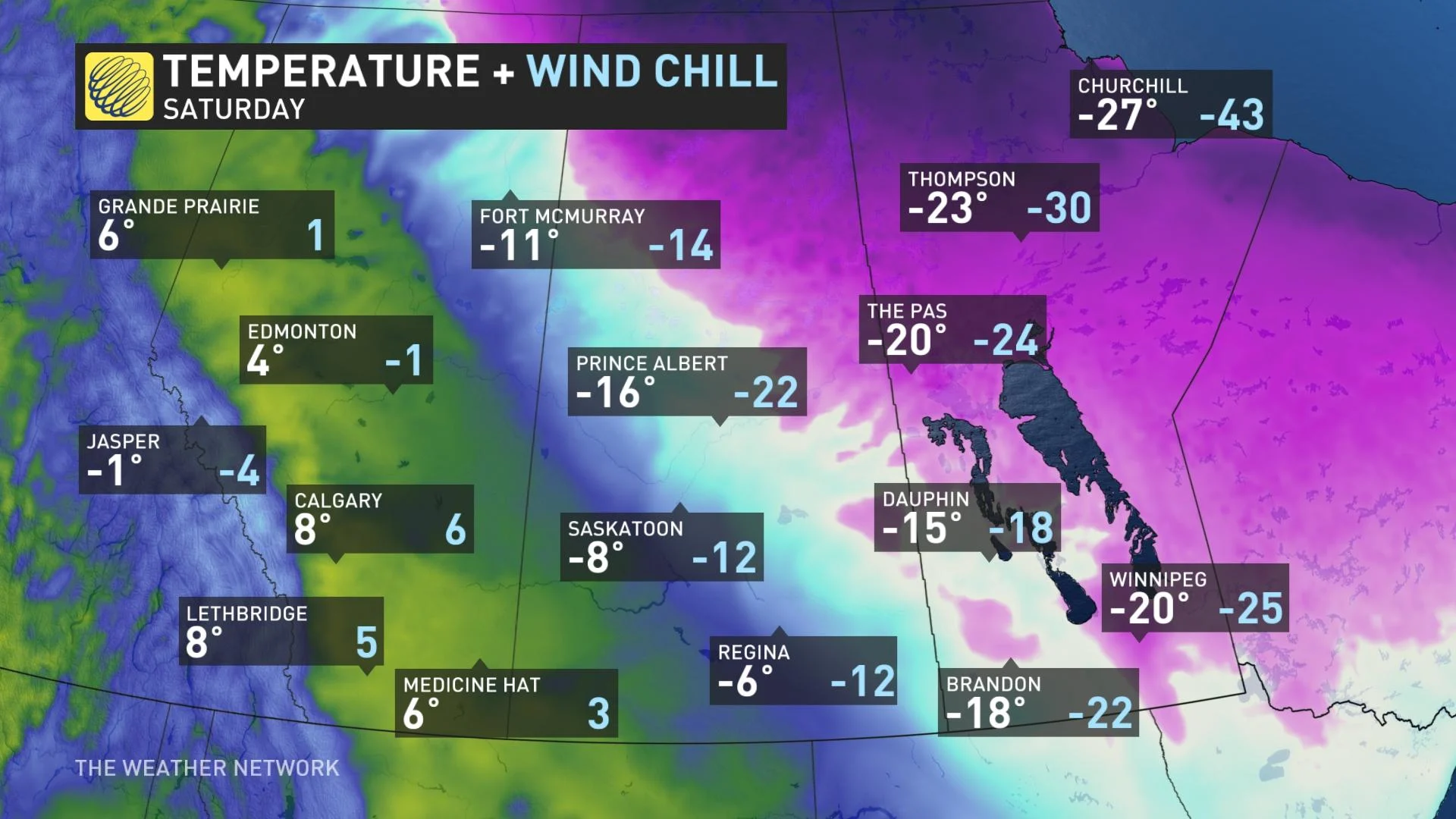
Beyond, temperatures will remain mild in Alberta this weekend with temperatures climbing well above freezing again. Meanwhile, another blast of Arctic air across the eastern Prairies, persisting Saturday and Sunday with another shot early next week. This will give us a very impressive contrast in temperatures with western Prairies versus eastern Prairies.
A strong clipper is then expected to track from northern Alberta on Sunday to south of Manitoba on Monday with a swath of 5-10 cm. This could include Fort McMurray, Lloydminster, Regina and Brandon.
Check back for the latest updates on conditions across Alberta and Saskatchewan.


