Atlantic hurricane seasons may face some changes

Here's how hurricane development and intensity could change over the years.
As greenhouse gas emissions escalate globally, so do temperatures over our continents and oceans. The excess energy resulting from Earth's greenhouse amplification can affect multiple atmosphere-ocean processes, and one of them is vertical wind shear, a key ingredient for hurricane formation and intensification.
New model simulations performed at Lamont-Doherty Earth Observatory and at NOAA's National Centers for Environmental Information, have been used to study the future of Atlantic hurricane seasons. The simulations were based on a hypothetical pathway of greenhouse gas emissions, in which carbon dioxide and other greenhouse gas emissions continue increasing at a relatively high rate in coming decades.
The results suggest that a richer greenhouse gas atmosphere will reduce vertical wind shear in some regions while increasing it in others.
Summer revealed! Visit our Complete Guide to Summer 2019 for an in depth look at the Summer Forecast, tips to plan for it and much more
As shown in the map below, one region where wind shear is expected to drop significantly is in the eastern U.S. including the Atlantic seaboard. This is a frequent destination for hurricanes that normally veer away from the Caribbean or other tropical Atlantic regions.
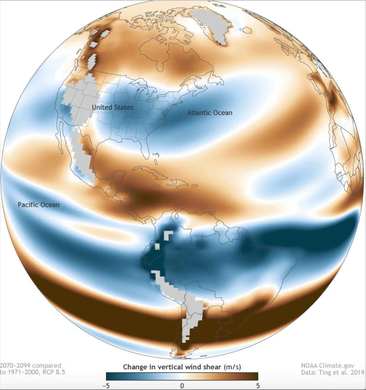
(Courtesy: NOAA)
During more active hurricane years, the eastern U.S. coastline is frequently affected by high vertical wind shear conditions. These act as a break for hurricanes that can potentially make landfall somewhere along the coast -- anywhere from Florida to Atlantic Canada. With high wind shear values, hurricanes are typically less likely to rapidly intensify before coming onshore, reducing their impact.
However, if model predictions are correct, future scenarios could be quite different sometime later this century.
As seen in the map above, vertical wind shear values towards the end of the 21st century (2070-2099) are expected to change compared to those seen during the end of the 20th century (1971-2000). Blue colours on the map indicate those regions where wind shear is projected to decrease. Much of the eastern U.S. and the western North Atlantic would be included in that swath.
SEE ALSO: Severe weather events are a new Canadian normal
On another note, from the equatorial South Atlantic, across northern South America and into the equatorial Pacific, vertical wind shear would also display lower numbers.
An interesting thing to note is how high wind shear values would affect much of the tropical Atlantic into the Caribbean and Central America regions. This could also be seen as a reduction of the frequency of hurricanes in the region, with effects on the intensity of some of the storms depending on their tracks.
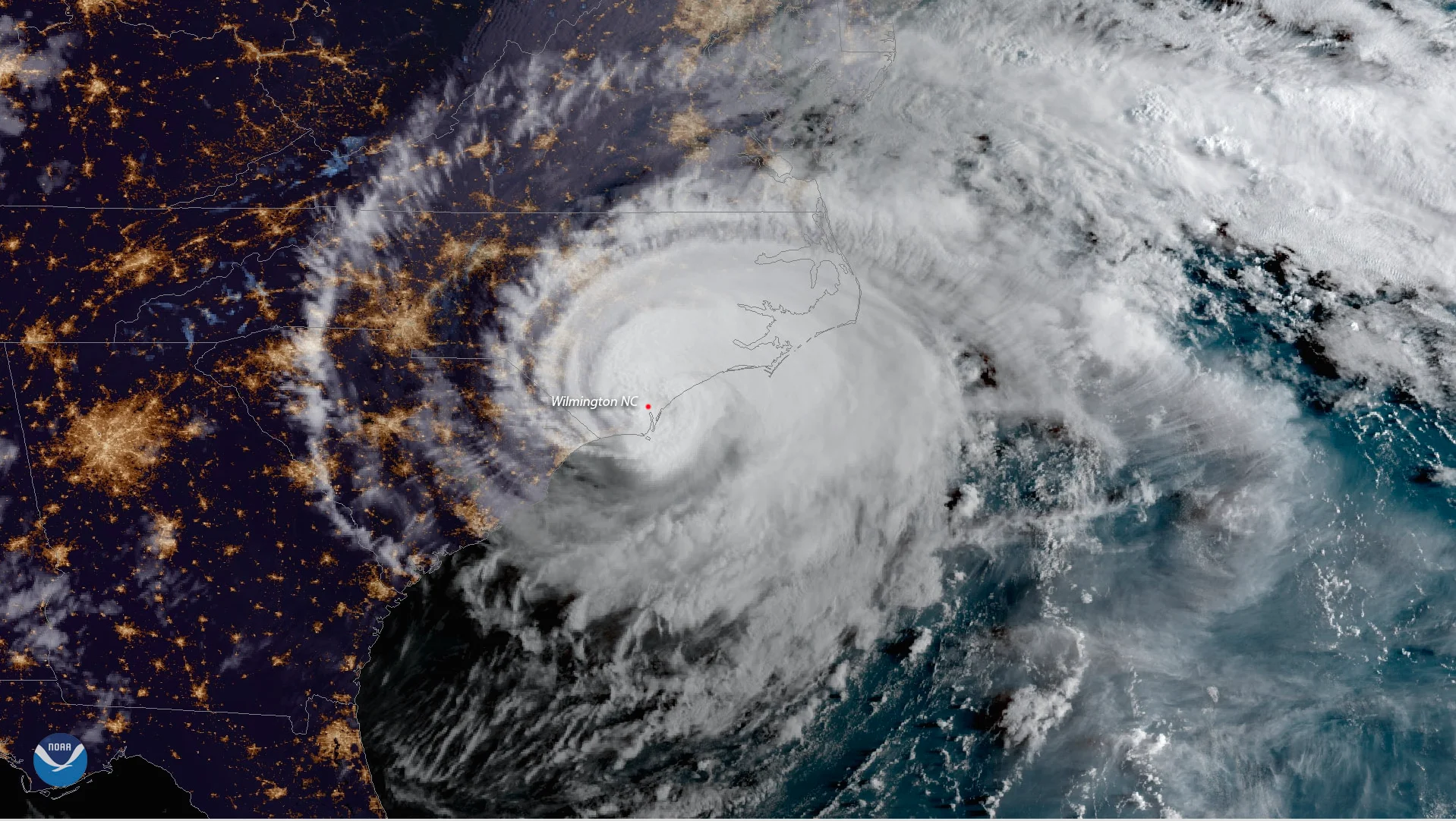
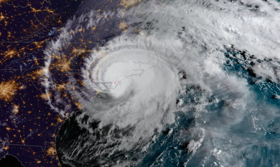
(Image: Hurricane Florence making landfall near Wrightsville Beach, North Carolina. Courtesy of NOAA)
A third of the model runs examined in the study agree that lower vertical wind shear would dominate the U.S. Atlantic seaboard during the peak hurricane season (August-October). Warm sea surface temperatures and low wind shear are two fundamental ingredients for tropical storm development. When atmosphere-ocean conditions in the usual hurricane development-prone regions of the Atlantic are favourable, conditions tend to be simultaneously less favourable across the U.S. East Coast.
That could change in the future if relatively warm ocean waters together with low wind shear values intensify storms just before making landfall along the heavily populated Atlantic coastline of North America. Stronger winds, higher storm surges and heavier precipitation are all part of the future hurricane scenario East Coast residents might have to live with towards the end of this century.


