January Outlook: Canada's mild temperature trend is at a crossroads
Our Winter Forecast has come to a crossroads.
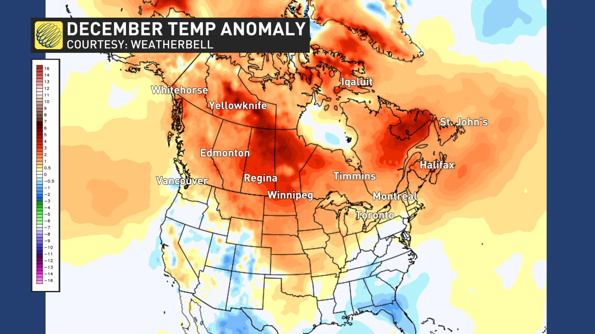
The early part of the winter season has featured above normal temperatures across Canada. The map below shows temperature anomalies during the month of December, and the various shades of orange and red highlight just how widespread the mild temperatures have been.
However, December also provided examples of how high impact winter weather can still occur within a mild pattern. While we have not seen any sustained cold weather, a few quick shots of cold air have been associated with major winter storms. Also, most of Canada can still be cold enough for snow even when temperatures are above seasonal.
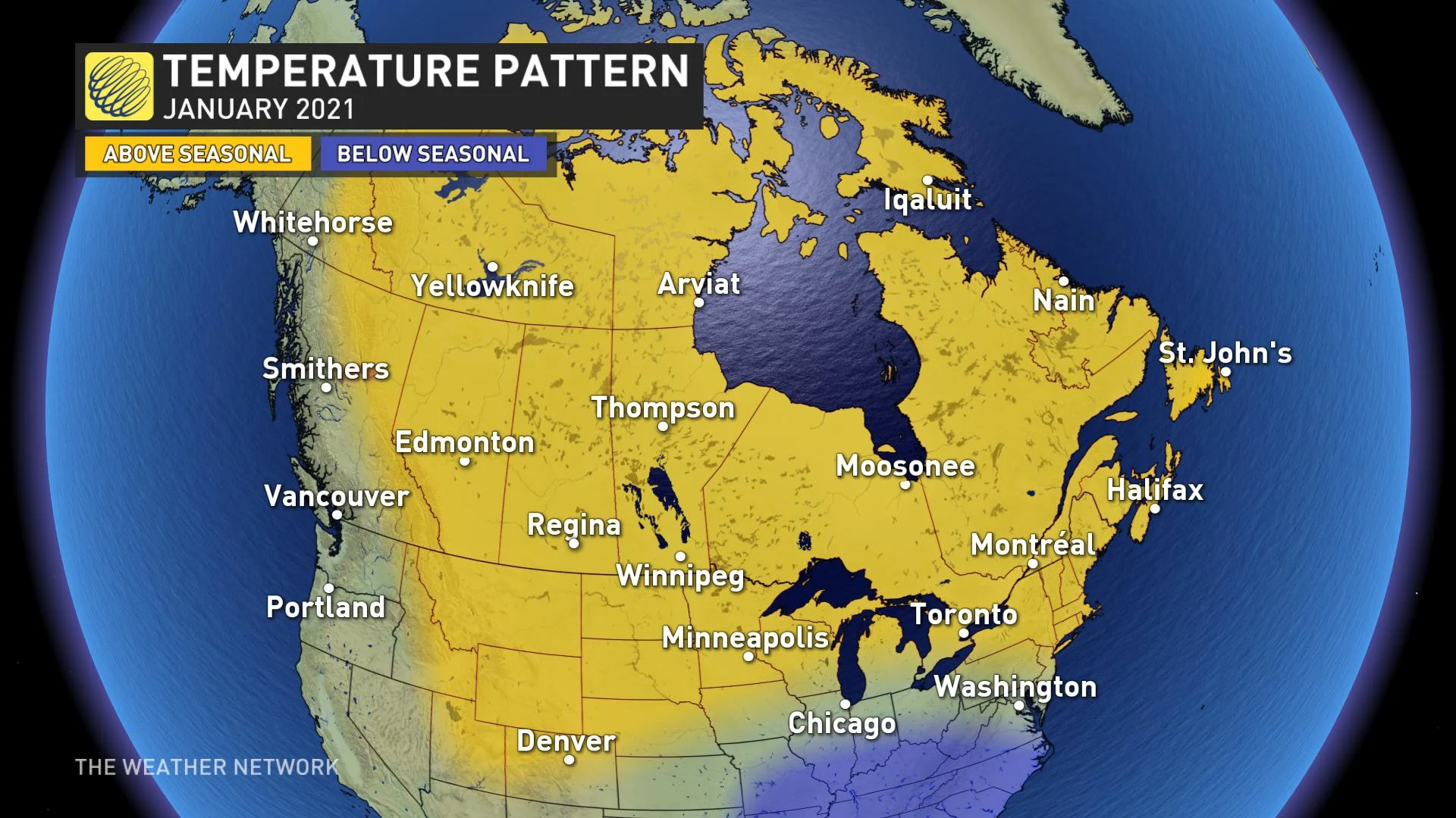
While the mild pattern during December was not a surprise, we were not expecting such a mild pattern to continue deep into the month of January across western Canada. Here is a look at our current forecast for the first half of January.
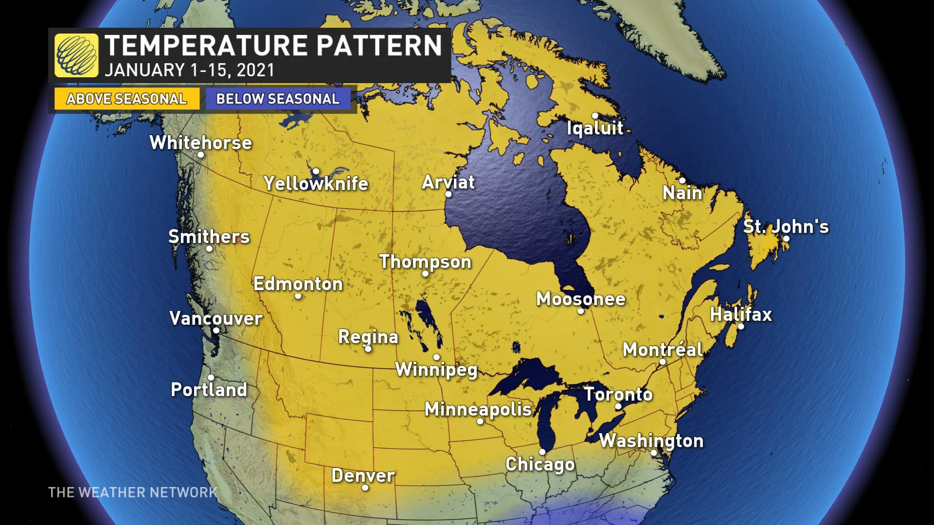
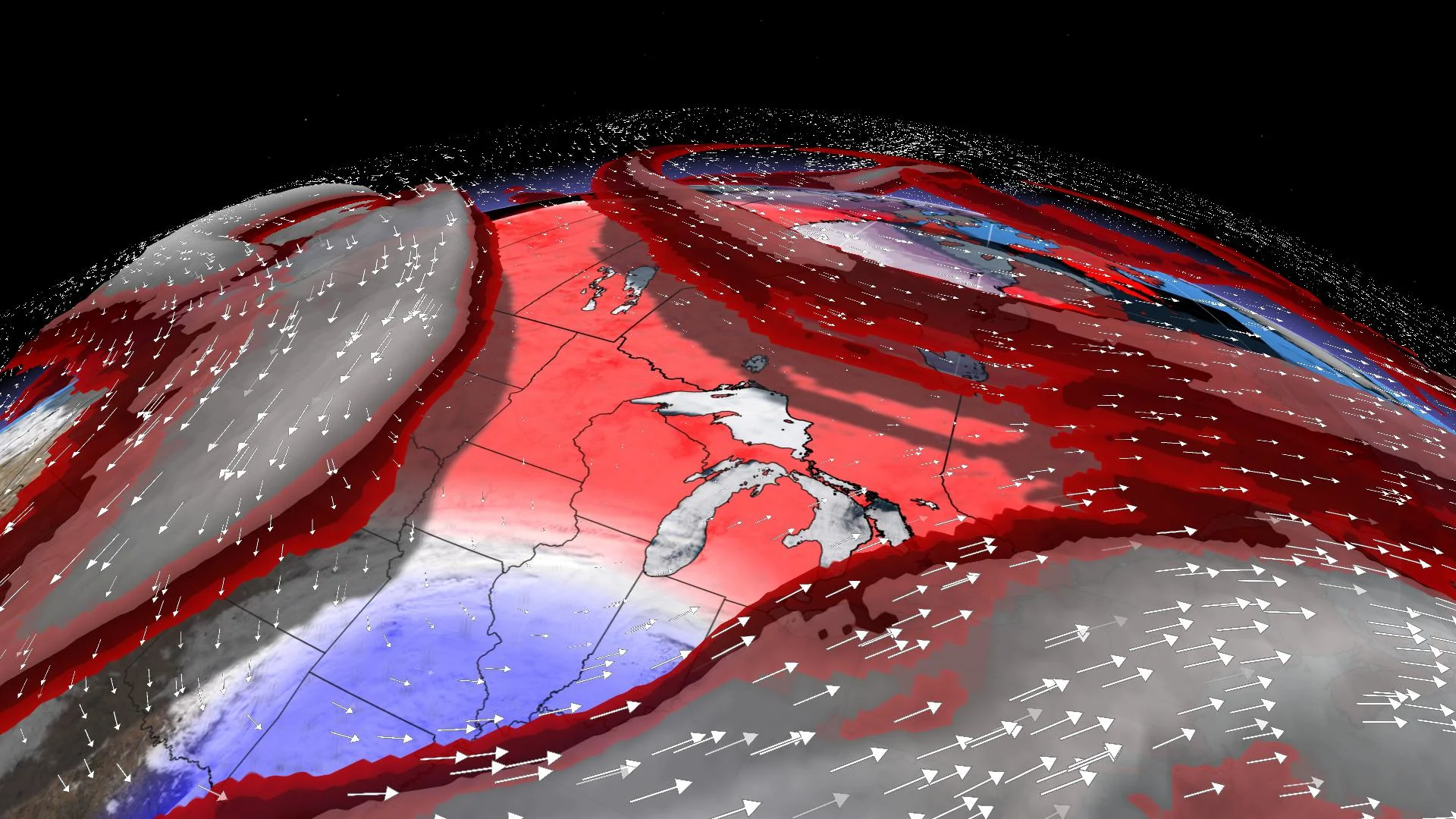
Yes, this forecast map looks a lot like what we saw during the month of December. The powerful jet stream across the northern Pacific Ocean will continue to flood the country with mild Pacific air into mid-January. This should keep nearly all of Canada warmer than normal except for the B.C. coast, which should be near seasonal.
This pattern is more typical of El Niño, despite the fact that we are in the middle of a moderate La Niña event. Our Winter Forecast did highlight mild temperatures across much of eastern Canada, but we expected that western Canada would turn much colder for the heart of winter, which is what we typically see during La Niña winters.
The question is whether or not the anticipated winter pattern is just slower to develop than expected, or will the expected pattern fail to develop.
WINTER PATTERN DELAYED, BUT NOT DENIED?
There are several long-range forecast models that show a major pattern change for the second half of January. These models support the idea that the winter pattern is delayed, but not denied.
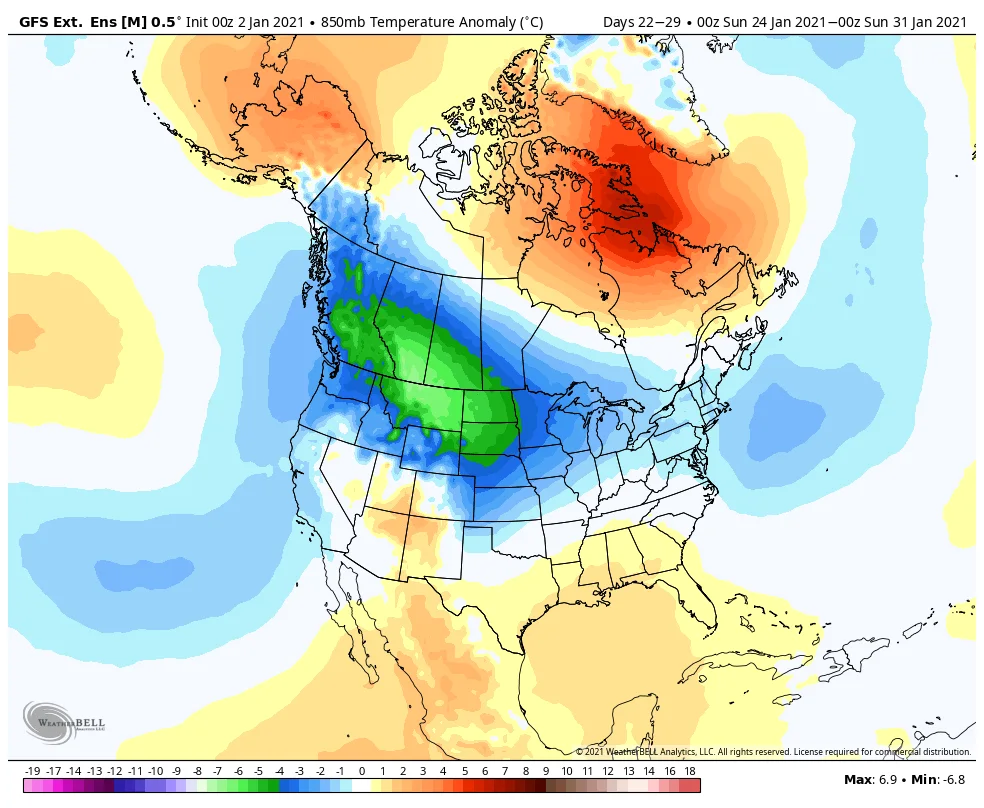
Here is an example of one model forecast for the final week of January, which shows widespread colder than normal temperatures. We think that a pattern change like this will eventually occur, but we have to keep in mind that models have had a tendency to falsely forecast cold patterns on occasion in the long range.
As we look at the global pattern, there are several drivers that are already in place to support a major pattern change that would send Arctic air plunging south into Canada. It is possible that will start to happen during mid or possibly late January. However, the Pacific jet stream will have to slow down and take on a different orientation before a consistently cold pattern can develop, and it is not showing signs of doing that just yet.
So, we are at a crossroads, uncertain if the mild pattern will continue to dominate or if the mild pattern will collapse during mid to late January. The answer to that question should become much clearer during the next several days. Of particular interest is a major disruption to the polar vortex that is starting to occur, which could be a precursor to a much colder pattern ahead.
Our forecast map for January as a whole shows above normal temperatures across most of Canada since it will be difficult to reverse the warm anomaly from the first half of January and pattern changes are often slower to develop than expected.
However, it would not come as a surprise if the second half of January ends up turning much colder than the first half of the month across much of Canada.


