La Niña revives to impact winter and the finale of hurricane season

The resurgent phenomenon typically has effects far from its normal Pacific Ocean locale.
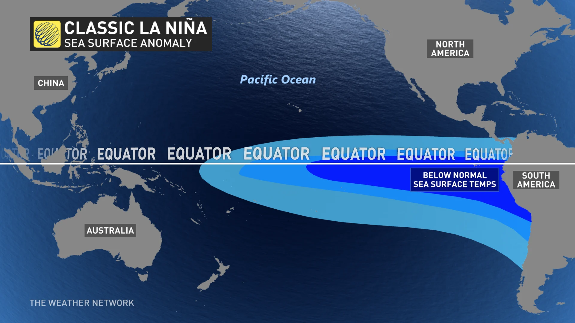
The famous colder-than-average Pacific Ocean temperature signal, known as La Niña, has officially revived at a crucial time, to impact Canada’s winter and the finale of the Atlantic hurricane season.
Although the revival of La Niña or El Niño is not uncommon, last year’s La Niña lays the groundwork for this year’s to possibly act in a more traditional La Niña pattern.
Often a key driver when it comes to winter weather, the current double-dipped La Niña year looks to take hold well through the upcoming winter.
“La Niña conditions have developed and are expected to continue with an 87% chance of La Niña in December 2021-February 2022,” the U.S. National Oceanic and Atmospheric Administration (NOAA) said in an advisory.
The timeliness of this La Niña revival may provide hints for the upcoming winter season as we follow the global heat and moisture displacements.
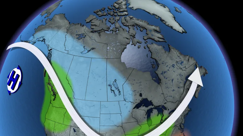
The cold signal La Niña brings in from the central Pacific tends to induce an amplified Pacific jetstream, an important weather factor for Canada’s west coast. A changeable pattern and a northward shift in pacific storm paths likely to head towards B.C. Therefore, La Niña hints at a wet pattern for most of BC’s southern coast.
The amplified jetstream La Niña brings, also tends to focus the cold in the west and central areas of Canada. We may expect the focus of winter’s consistent cold temperatures in the west and Prairies, as cold arctic air funnels south through deep troughs.
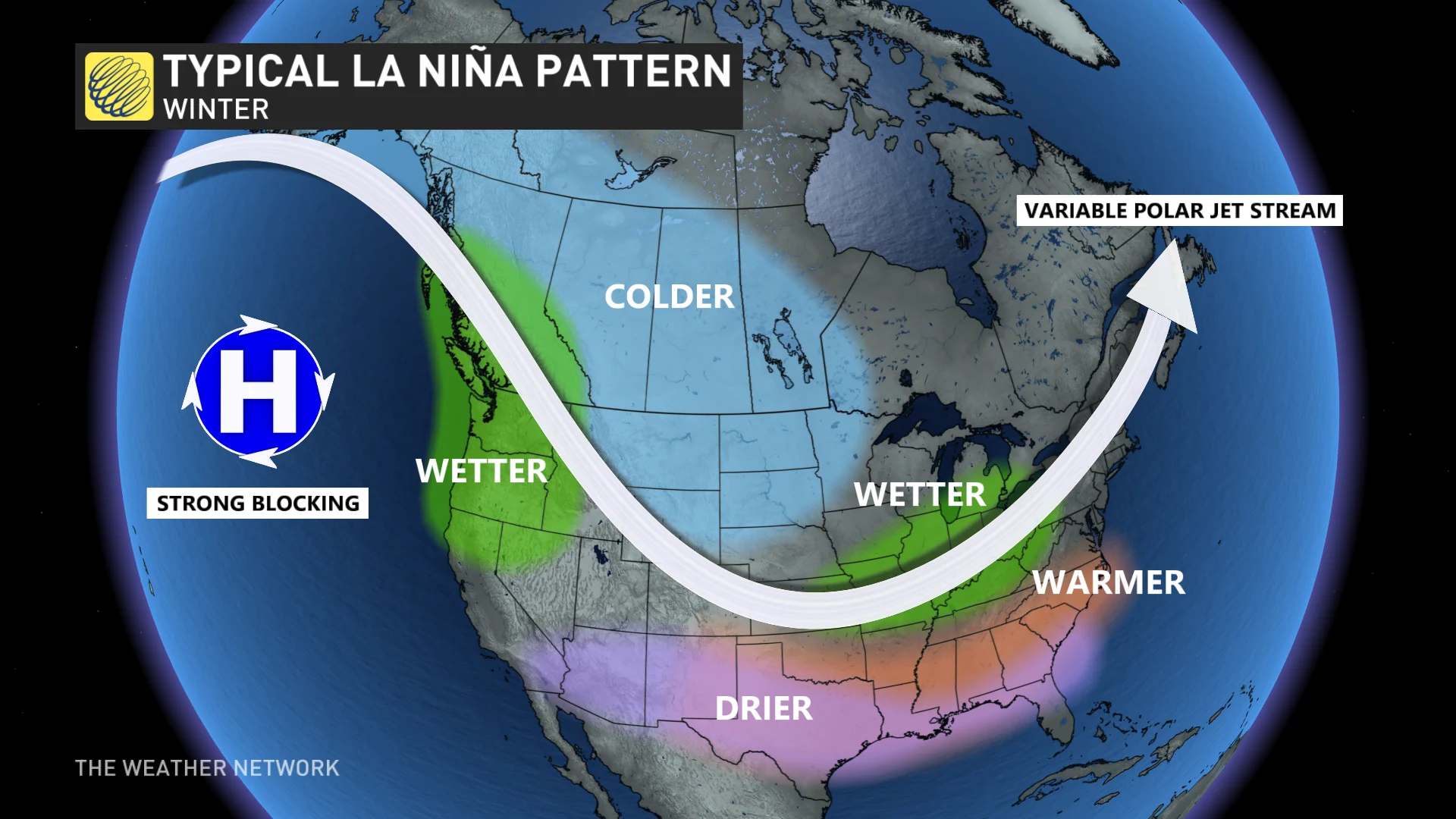
A deep western trough is often counteracted by a deep eastern ridge, and we can expect a battle between the strength of the two over the Great Lakes, though only time will tell which will be the dominant winter weather driver.
If the eastern ridge fights back, Ontario, Quebec and Atlantic Canada could see prolonged fairer temperatures. Although, it only takes one round won by the cold arctic trough to funnel in the ingredients necessary for snowy, wet signals across the great lakes.
Ontario and Quebec will have to monitor multiple favourable storm paths. Colorado lows and lake-effect snowfall, driven by the contrast between cold air and relatively warmer water temperature of the Great Lakes, which may tick up the moisture signal above average.
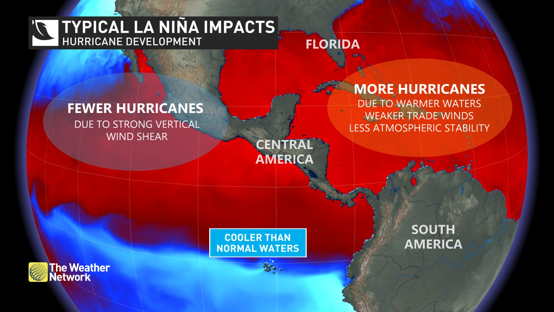
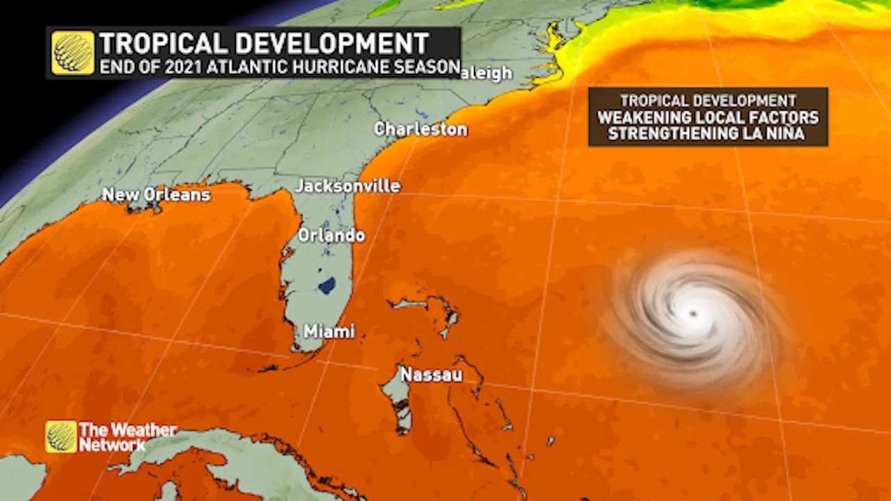
Atlantic Canada should continue its watch for a couple more tropical storms to develop. Historically, La Niña phases are a factor that contribute to more active tropical storms in the Atlantic Ocean, by creating an environment with low shear and warmer Atlantic Ocean waters that drive storm development.
How much will La Niña impact Canada's winter? Take a closer look with our Winter Forecast Sneak Peek, publishing Tuesday, October 19th
However, this driver tends to act more in the heart of hurricane season. We are now nearing November, our last tropical storm inning, with our main pitcher out and looking for energy deep in our bullpen.
Don’t rule out a few more tropical systems developing, but also don’t expect a superstar performance from La Niña this late in the game.
Combining all of this into a tropical storm season end and beginning of winter outlook, we can expect above-average rainfall on the west coast and great lakes, potentially in Atlantic Canada if favourable tropical storm paths develop, and a colder than average winter across the Prairies.