Travel not recommended amid dangerous wintry blast on the Prairies

The eastern Prairies have been dealt a significant wintry blow to start the week, with the second of two potent lows bringing another blast of heavy snow and gusty winds through Tuesday. This has lead to a poor travel conditions and school closures across the region, thanks to blowing snow and dangerous whiteout conditions. Several highway closures and travel advisories were also issued across southeastern Saskatchewan early Tuesday, including the Trans Canada Highway east of Regina where several collisions were reported. With the snowfall, some cities are on the hook for receiving double or triple their average accumulations for the entire month of April. More on the impacts and timing, below.
TUESDAY: WIDESPREAD SNOWFALL WARNINGS, BLOWING SNOW ADVISORIES IN EFFECT
A second system centred by the Great Lakes brought another wave of heavy snowfall into Saskatchewan and Manitoba during the overnight hours on Monday, peristing well into Tuesday for both regions as well. Travel will remain treacherous across the hardest-hit areas as snow and gusty winds greatly reduce visibilities and slick up the roads.
"Thanks to a stalled upper level low, bands of moisture will be pushed back into cold air in place across the region, bringing a persistent shield of snow that will last through much of Tuesday," says Michael Carter, a meteorologist at The Weather Network.
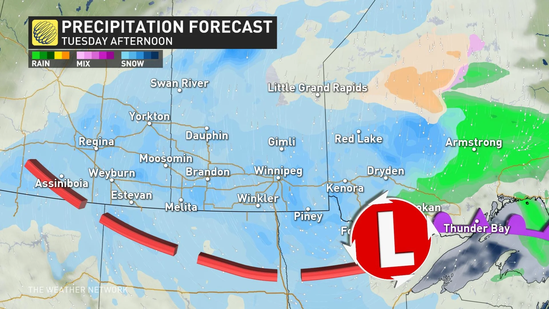
Total accumulations from this system will vary across the warned regions, with an additional 5-10 cm expected on top of what has already fallen through Tuesday.
Regardless of the final totals however, the prolonged period of snowfall and strong winds Tuesday will mean more blowing snow, periods of low visibility, and difficult travel conditions.
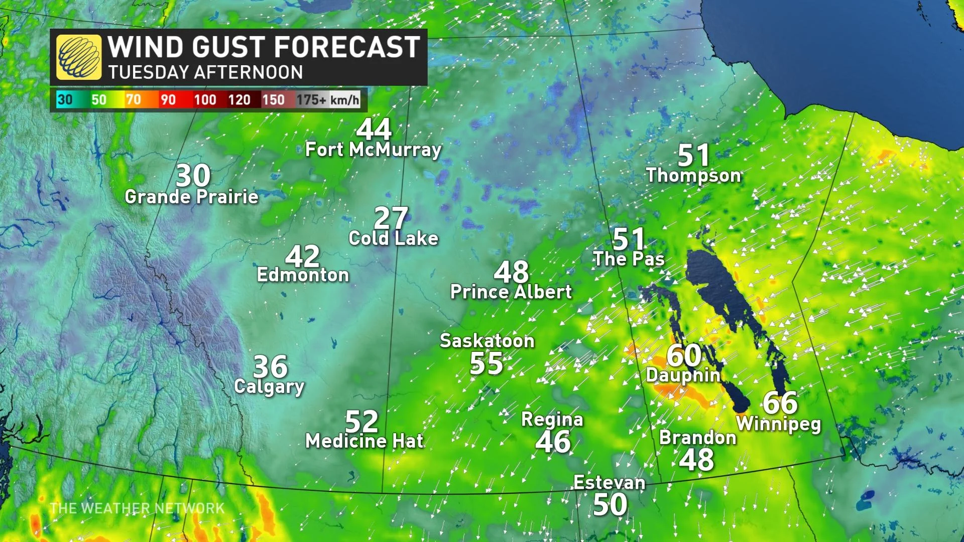
Widespread wind gusts in the 40-60 km/h range are expected Tuesday.
DRIVERS URGED TO POSTPONE NON-ESSENTIAL TRAVEL
"Travel is expected to be hazardous due to reduced visibility," says Environment Canada. "Be prepared to adjust your driving with changing road conditions. Consider postponing non-essential travel until conditions improve."
The quickly deteriorating conditions lead to several highway closures and travel advisories across southeastern Saskatchewan early Tuesday morning, including Highway 1, east of Regina. According to a RCMP news release, at least a dozen collisions were reported on the highway Monday night.
Poor road conditions were also reported across southern Manitoba Tuesday morning, prompting several school closures across rural areas.
In Saskatchewan, areas south of Regina will be the hardest-hit regions, where 20-25 cm is anticipated by the time all is said and done. Regina may see 10-15 cm, while regions west of the city, extending to Prince Albert, can expect to see 5-15 cm of snow.
Parts of southern Manitoba could see accumulative totals of 20-30 cm of snow. A good portion of the region, including Winnipeg and areas east of this city, may see 15-20 cm.
The silver lining? This system will be an infusion of much-needed moisture to this drought-stricken region, though many may have preferred it to come in the form of April showers rather than the heavy snow that's falling.
The snow will taper off to light snow by Tuesday evening as the system weakens and moves further into northern Ontario.
LOOK AHEAD: TEMPERATURES REBOUND SIGNIFICANTLY BY THE WEEKEND
Temperatures have also been well below seasonal with this system, with many parts of southern Saskatchewan and Manitoba not breaking above the freezing mark until Thursday.
Much warmer weather over B.C. will gradually spread east into Alberta late week however, with a spectacular Saturday expected across Alberta as temperatures soar near 20°C for both Edmonton and Calgary.
High pressure will also dominate the rest of the week, with no significant precipitation in sight for southern Alberta and southwest Saskatchewan where conditions remain very dry.
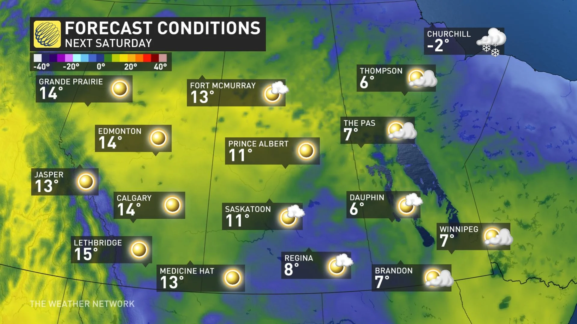
During the third week of April, a pattern shift will see temperatures start to rebound even further, as warmer weather will slowly spread east.
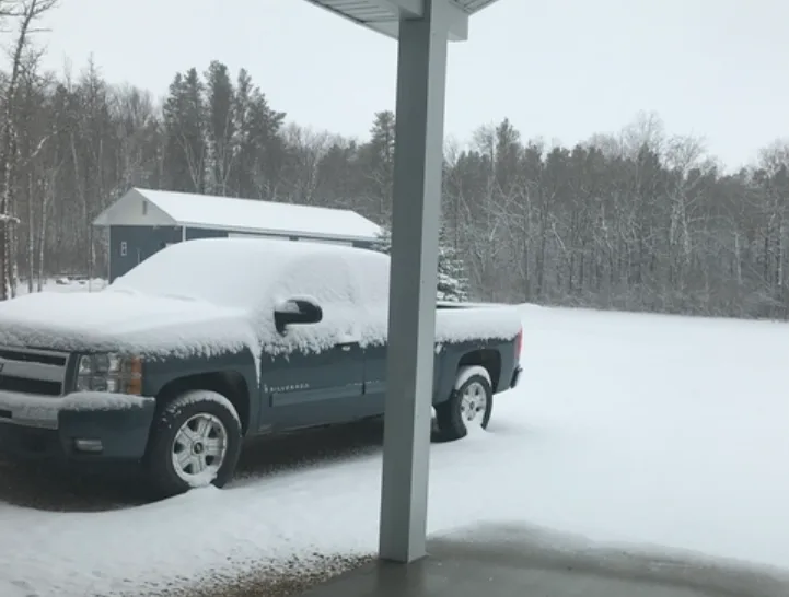
Thumbnail courtesy of Teresa O’Grady.
Check back as we continue to monitor the latest forecast on the Prairies.


