Teresa remnants aid system in delivering heavy rain to the Maritimes

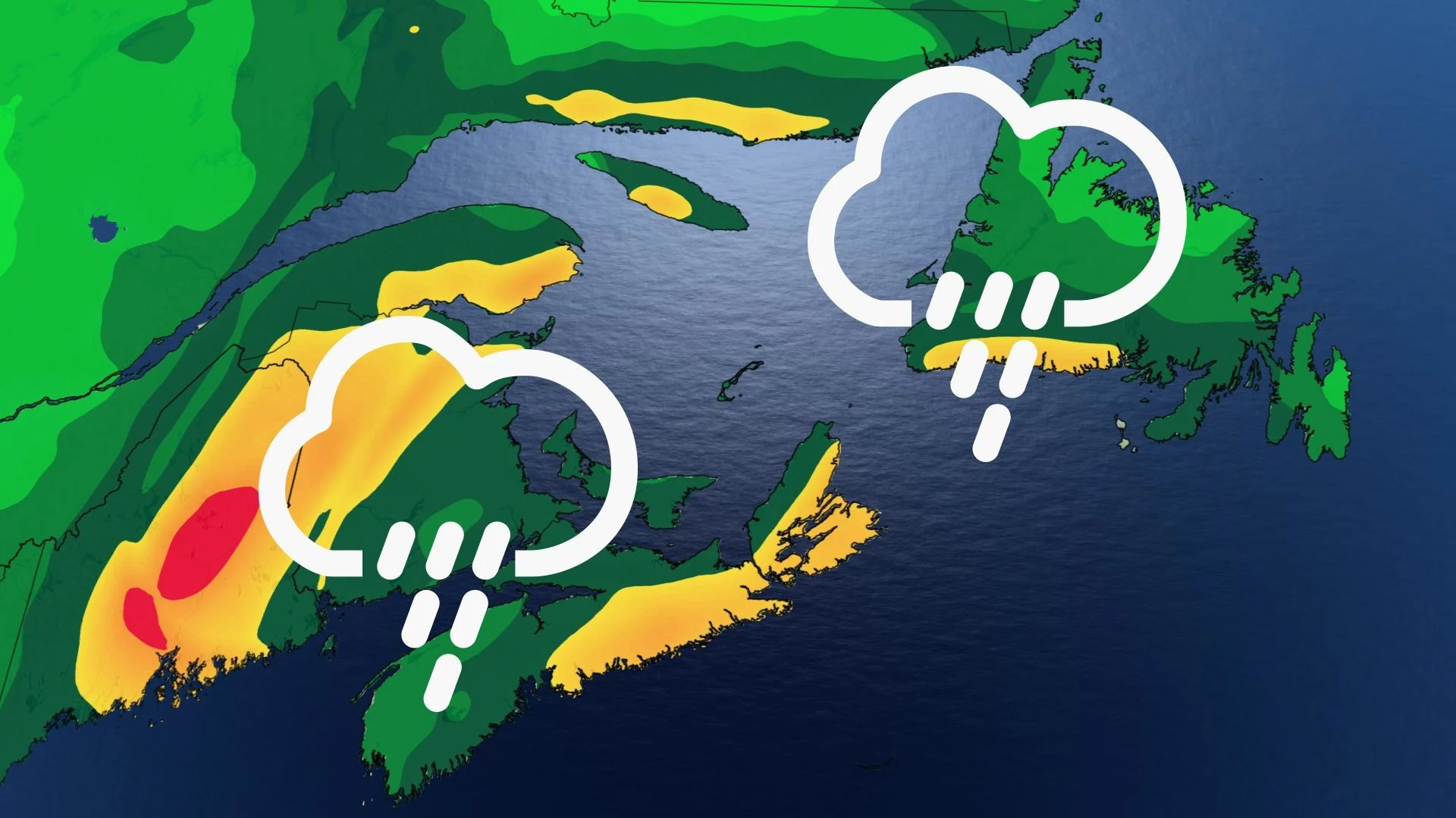
What was once Teresa will aid a system in bringing a moderate soaking to parts of Atlantic Canada Sunday. Most of the rain is targeting New Brunswick where some locales could see 50 mm by the time it departs. Rainfall warnings are in place. Conditions will also be fairly gusty, with 40-60+ km/h in most areas, with the potential for 70+ km/h on Cape Breton Island. Beyond the weekend, forecasters are keeping a watchful eye on Hurricane Sam and its track in the next 10-14 days. For details, read on.
SUNDAY: TERESA MOISTURE TO AMPLIFY RAINFALL AMOUNTS
A sluggish, elongated trough remains hovered over New Brunswick. Coupled with a low-pressure system that developed off the New England coast has moved into the southern Maritimes Sunday morning and will spread northward elsewhere by the afternoon.
What will make the system a bit more impactful will be the inclusion of moisture from post-tropical storm Teresa, a very short-lived subtropical system that came to fruition Friday and lost its tropical characteristics by Saturday.
The heaviest rains will be in western New Brunswick, where rainfall warnings are in place. Heaviest rain is expected in the afternoon before tapering off to showers and drizzle in the evening. A narrow swath of 50 mm is possible through Monday.
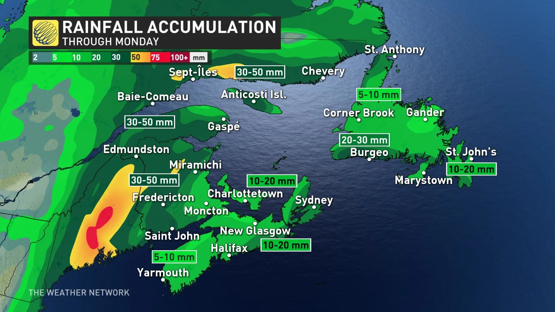
Most of northern and central New Brunswick may see 30-50 mm, with 20-30 mm anticipated in southern sections. P.E.I. and southern Nova Scotia shores could get 10-20 mm, with 5-10 mm elsewhere in the latter province.
There is also a chance of thundershowers, which could boost totals further in a few locations.
Rain from the system will depart the Maritimes by Sunday overnight as it makes its way into western Newfoundland. The island can expect rain to continue until late Monday afternoon. Western shores could see 20-30 mm when all is said and done, while 10-20 mm is possible for the southern Avalon.
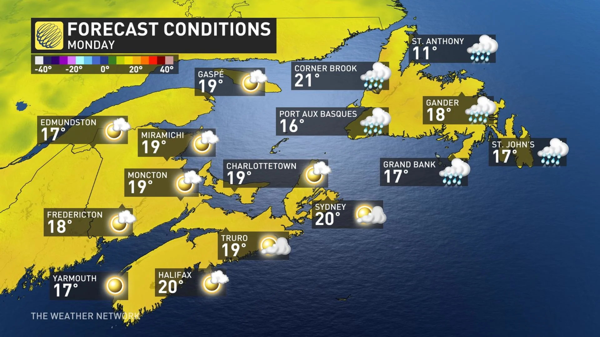
In addition to the rain, winds will pick up Sunday morning in Nova Scotia, then the rest of the Maritimes in the afternoon, with 40-60 km/h gusts. Cape Breton Island may see 70+ km/h gusts. Western Newfoundland will also see some strong winds, with gusts of 60+ km/h in the overnight hours, as they diminish in the Maritimes.
LOOK AHEAD: TEMPERATURES REMAIN NEAR OR ABOVE SEASONAL, KEEPING AN EYE ON SAM IN THE LONG RANGE
Near or above seasonal temperatures is expected for most of next week. There is the potential for unsettled conditions at times, but no major storms are anticipated.
Forecasters are keeping an eye on the tropics, but much too early to know whether the region will be threatened by Hurricane Sam in 10-14 days.
"The most likely scenario is that Sam will recurve and stay out to sea and not be a major threat to Canada or the U.S., but [pose] a threat to Bermuda. However, it is still possible that Sam will take a more southerly track and be a threat to the southeastern U.S. in roughly 9-12 days, or the storm could take a turn far enough to the west that it would be a threat to Atlantic Canada in 10-14 days," says Dr. Doug Gillham, a meteorologist at The Weather Network.
Stay tuned to The Weather Network for the latest forecast updates for Atlantic Canada.


