Hefty shot of 10-15 cm of snow likely to impact travel in Ontario

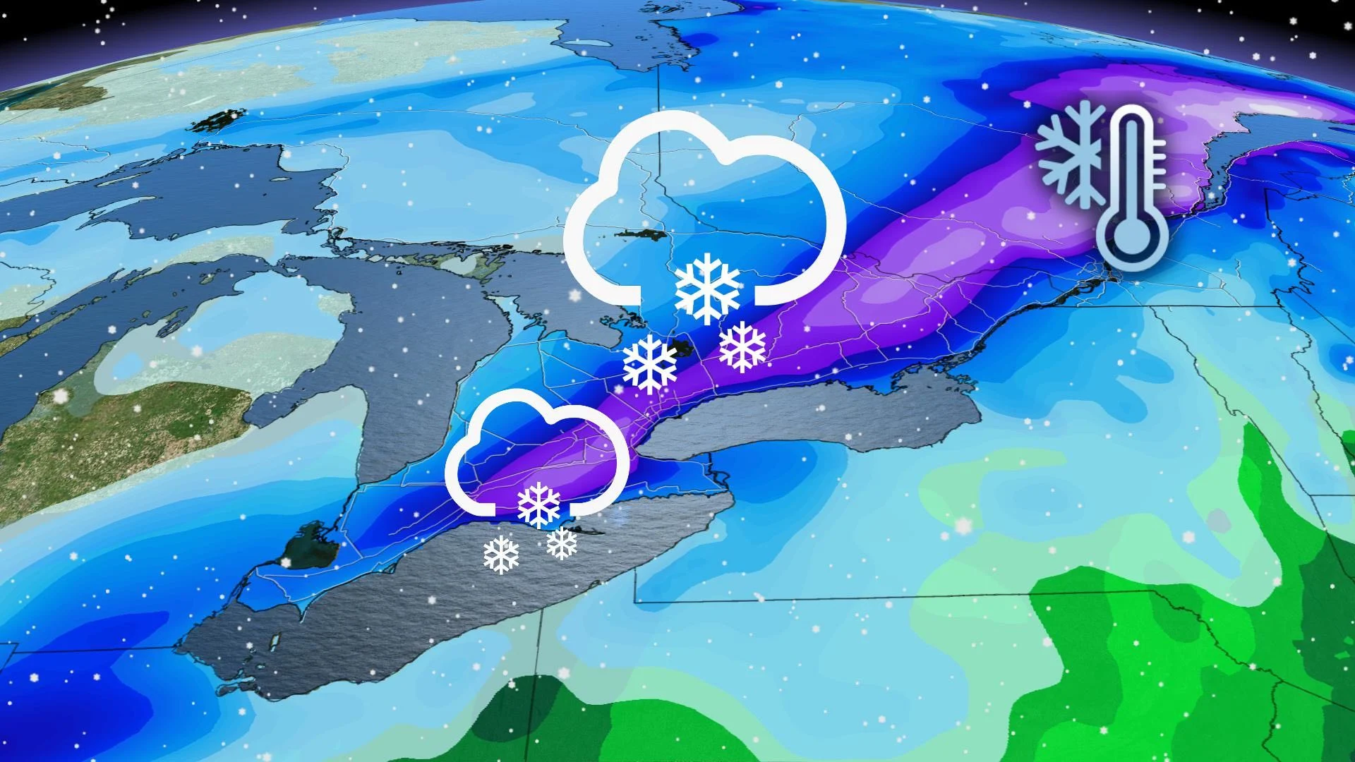
The week ended with a welcome surge of warmth – now Ontario is poised for a plunge into some very winter-like weather, starting Sunday morning as a low-pressure system begins to impact the province. Ahead is some of the first shovellable snowfall parts of the province have seen this season so far, but differences in temperature and elevation will make a real difference between accumulating snow, and either rain or a rain/snow mix. More on this system, and where the heaviest snow is likely, below.
WEATHER HIGHLIGHTS:
Snow will arrive early Sunday morning, first widespread accumulation of the season for parts of the south
Areas in the southwest and along the lakeshores will switch over to rain or a rain/snow mix in the afternoon
SUNDAY: WINTRY LOW WILL YIELD HEFTY SNOW FOR SOME
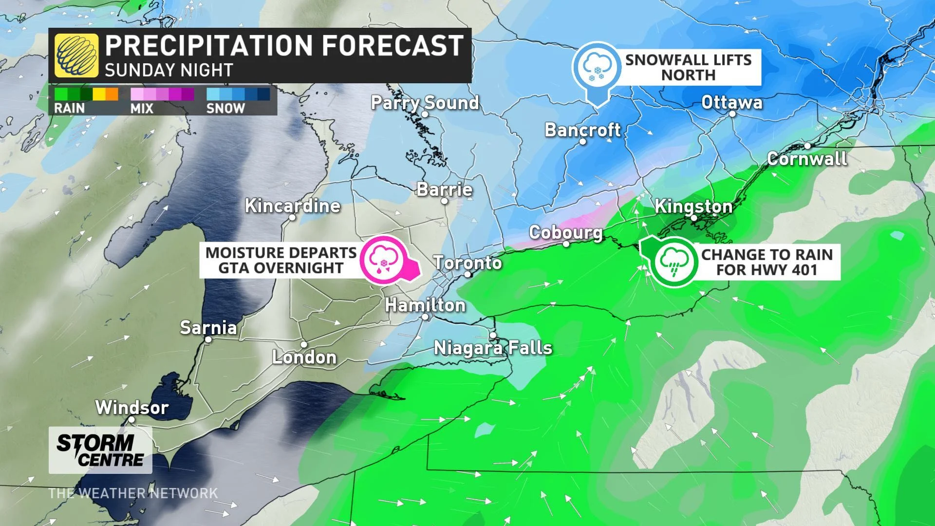
Temperatures will be such that not everyone in the province will see significant, or long-lived snow. It starts in the morning hours in the southwest, though quickly changing to rain along the shores of Lake Erie
By the time it reaches the GTA, precipitation looks to start off as a widespread snow. However, rising daytime temperatures will bring a transition to rain, or a rain/snow mix, or a back-and-forth between the two, for areas along and just inland of Lake Ontario.
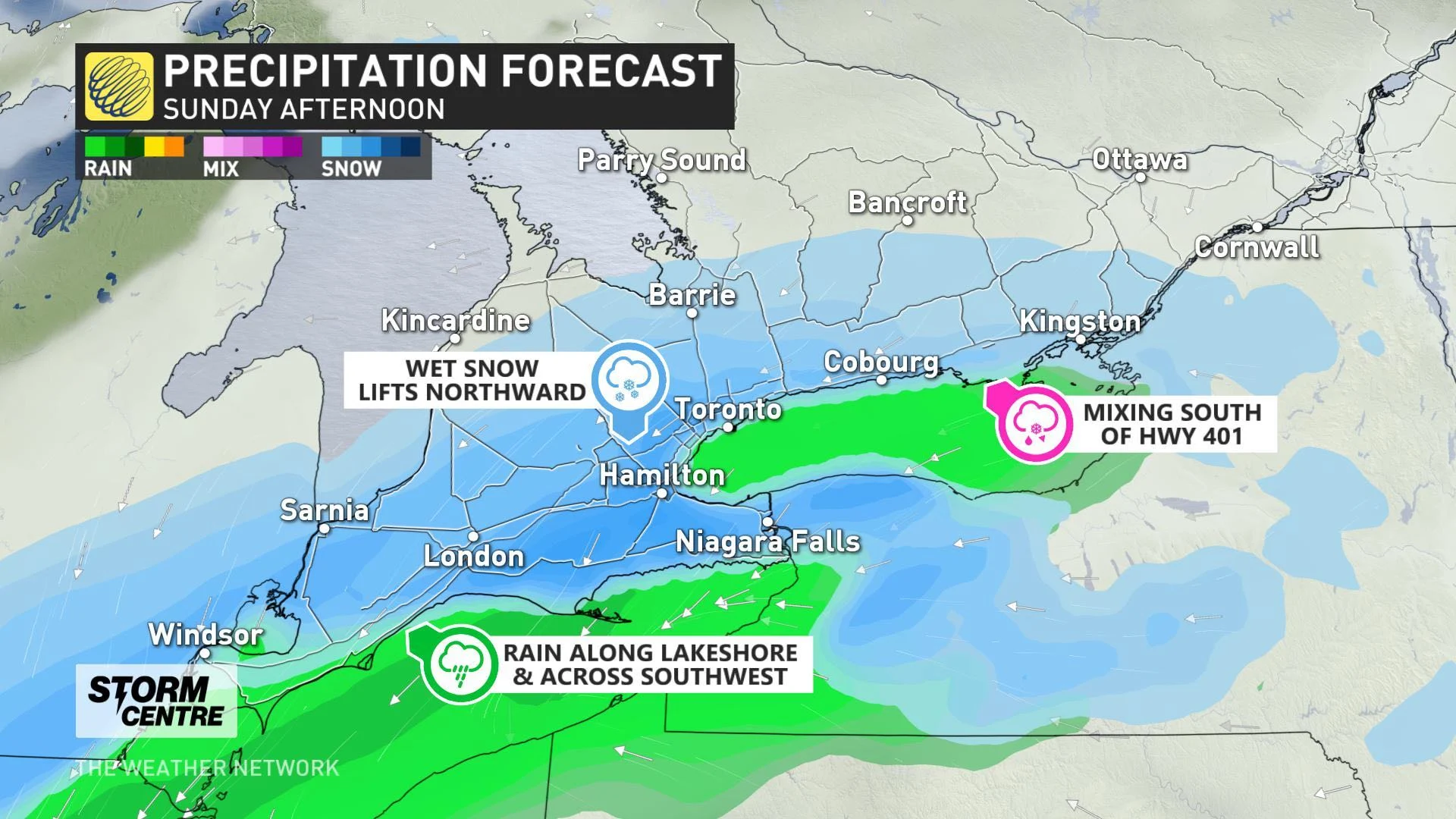
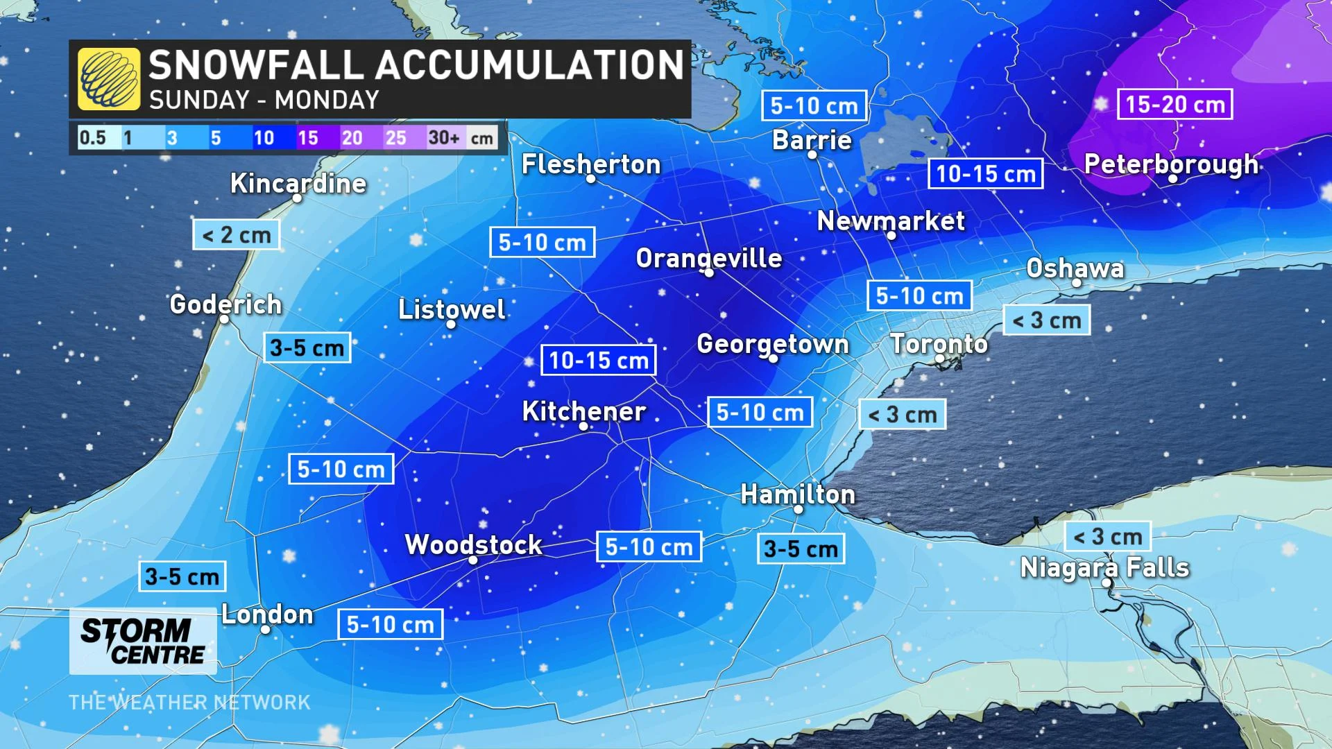
As such, snowfall totals will remain minimal for most of the GTA, and depressed even further by the rain. North of the 401 corridor, and up the higher elevations of the southwest, including the Niagara area, however, the system looks to remain mostly as snow through the afternoon hours.
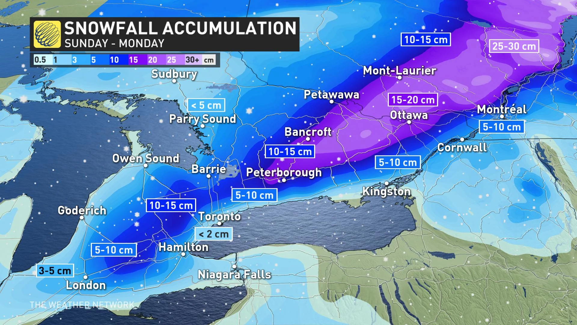
Some 5-10 cm is possible for these regions, and even higher amounts of 10-15 cm are possible for the Dundalk Highlands and central areas north of Highway 7, stretching east to the Ontario-Quebec border. Motorists in the regions should be prepared for poor driving conditions.
For eastern Ontario, the switcher to a light rain or a rain/snow mix will come through the evening hours, particularly for areas along and south of Highway 7, as well as along lakeshores. The GTA will see precipitation taper off Sunday overnight.
Due to a slight southward shift in the track, Peterborough and Ottawa will now see only snowfall through the system's duration after initially looking as though they, too, would see periods of rain or mixing. Precipitation will linger in these areas until Monday morning.
LOOK AHEAD: SNOW TO MAKE FOR A MESSY MONDAY COMMUTE
BEYOND: CHILLY START TO THE WEEK, POTENTIAL FOR MESSY WEATHER
The boundary between the warm and cold air will then press south of the region for early next week, and though Monday will feature a slight recovery in temperatures, Tuesday sees daytime highs not far above zero, and even below for a few communities.
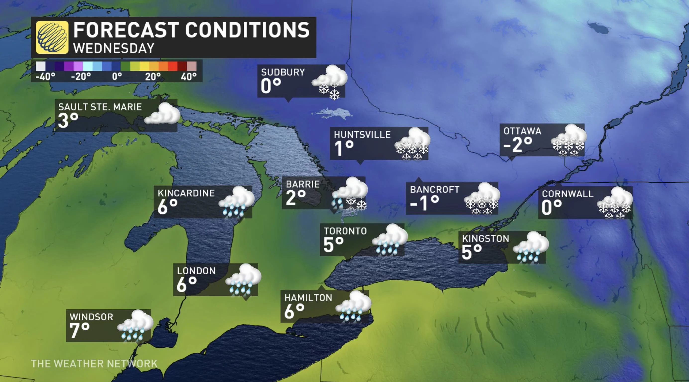
A somewhat disorganized system will track across the region Tuesday night into Wednesday with snow to the north and a rain-snow mix in the south, with all rain in southernmost areas. It is early to have confidence in snow totals, but this could bring 5-10 cm for Ottawa and much of eastern Ontario, as well as cottage country.
Another warmup looks to take hold for the second half of the week, though not as drastic as the one that will have preceded it the previous week.
Stay tuned to The Weather Network for the latest forecast updates.