Flooding rains subside across Ontario, but water remains high

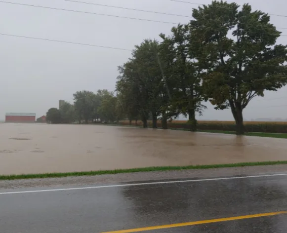
All Middlesex County roads have been re-opened after the region issued a local state of emergency Wednesday night, following 48 hours of persistent heavy rain, which left several roadways completely under water. Some areas recorded well over 100 mm of rain by early Thursday morning.
"While all County roads have been reopened, the County continues to urge the public to use caution while travelling, as there are a number of shoulder washouts along County highways in all regions," said the municipality in an updated statement Thursday morning. "County roads crews will be working today to address the damage caused."
The flooding has also impacted a number of local roads across the County and drivers are being urged to check with their local municipal website for details on possible impacts before heading out.
Visit our Complete Guide to Fall 2021 for an in-depth look at the Fall Forecast, tips to plan for it and much more!
HEAVIEST RAIN OF THE YEAR SPREADS ACROSS SOUTHERN ONTARIO, FLOOD THREATS CONTINUE
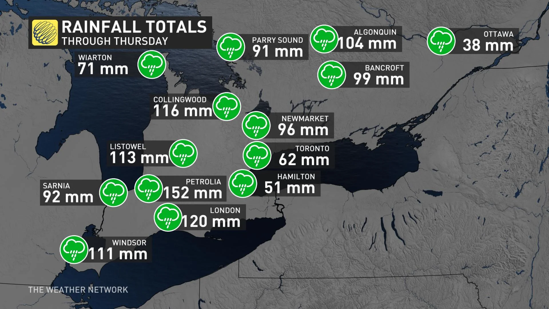
Wednesday was the rainiest day of the year so far for many communities across southern Ontario, as the potent and slow-moving moisture laden system dumped widespread heavy totals throughout the day. In fact, for some, the total monthly rainfall averages for all of September were blown away with this one weather event.
The last few drops are set to fall Thursday night for some areas, and in all, widespread totals of 75-100+ mm of rain will have fallen by Friday morning.
In addition to the rain, powerful winds also picked up on Wednesday, taking down tree branches and knocking out power throughout parts of the day. At the height of the storm, Hydro One reported more than 38,000 customers were left in the dark, with around 12,000 still affected by early Thursday morning but down to 3,700 by day's end.
With the ground already saturated and no ability to absorb extreme totals, the additional rain will runoff into low-lying areas and rivers, heightening the risk for more localized flooding as water levels remain dangerously high.
The Toronto and Region Conservation Authority issued a flood watch early Wednesday evening.
"Please exercise extreme caution around all bodies of water and avoid driving on flooded roadways or in low-lying areas and underpasses. Be alert for possible transportation delays and road closures. Stay safe," the TRCA said in a statement.
See below for the significant toll these first days of fall are taking on much of southern Ontario.
Be sure to check back for the latest updates on this slow-moving system that kicks off the fall season in Ontario.
Thumbnail image courtesy: Jamie@Photogr18810935


