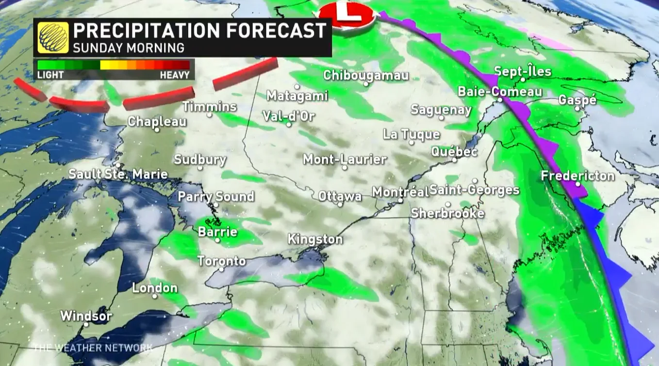
Rain pushes into Quebec on Sunday as cooler air, showers cover Ontario

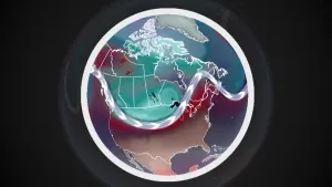
Temperatures finally took a tumble on Saturday as a cold front pushed away the unseasonably warm air that bathed southern Ontario for the first half of October. The potent system, in part fueled by the remnants of Hurricane Pamela from the eastern Pacific, will continue moving into eastern Canada for the second half of the weekend. The chilly air could also lead to lake-effect rain showers in parts of Ontario. More on what to expect for the rest of the weekend and into next week, below.
Visit our Complete Guide to Fall 2021 for an in-depth look at the Fall Forecast, tips to plan for it and much more!
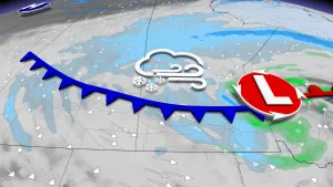
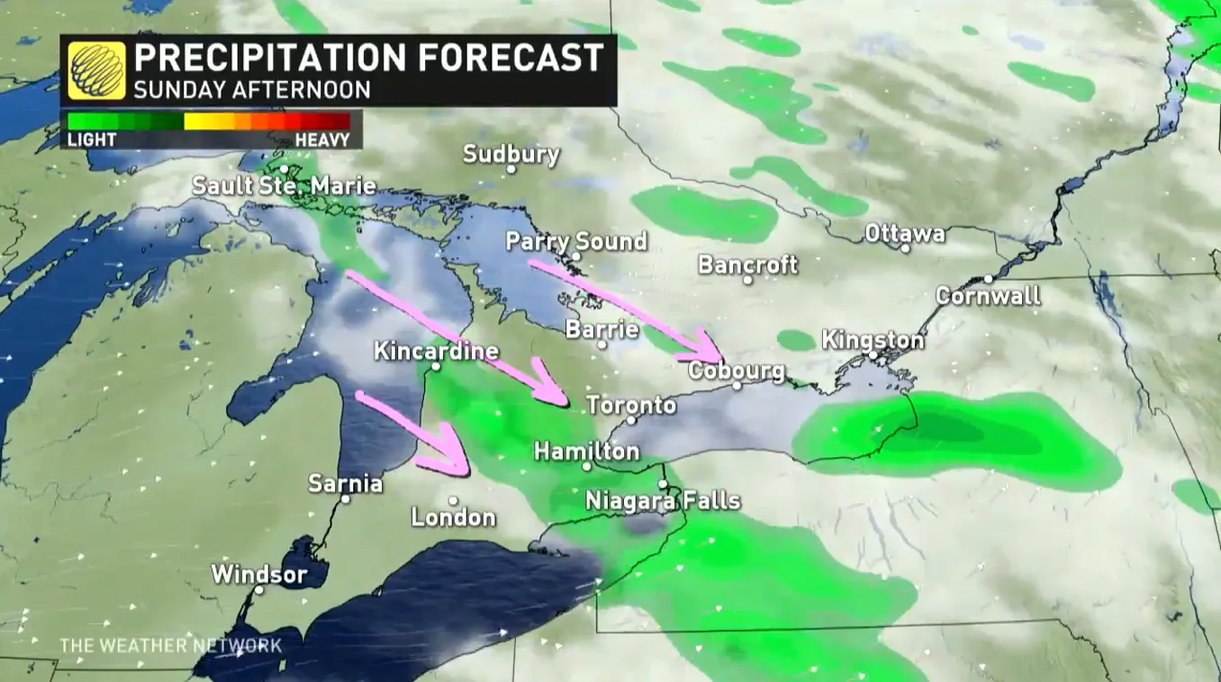
SUNDAY: HEAVY RAIN PUSHES EAST, LAKE-EFFECT SHOWERS IN ONTARIO
The system that brought severe thunderstorms to southern Quebec on Saturday afternoon will continue trekking east to end the weekend. The bulk of the precipitation will shift into Quebec and the Maritimes on Sunday.
MUST SEE: Waterspouts, lake-effect showers likely in Ontario as Great Lakes run a fever
Strong northwesterly flow over the warm Great Lakes will usher in a shot of Arctic air, which will be cool enough to trigger some lake-effect showers through Sunday.
Temperatures will remain cool for the remainder of the weekend in Eastern Canada.
NEXT WEEK: WARMER CONDITIONS MAKE A BRIEF RETURN
This weekend’s cooldown isn’t quite here to stay. High pressure will fight back to start next week and will clear the skies, also driving temperatures back to the 20°C by Tuesday.
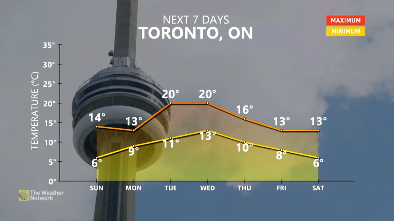
The warmth won't be sticking around for long this time, however, with conditions turning colder later in the week once again.
Overall, a more changeable pattern is expected for the second half of October, but temperatures will still tip to the warm side of seasonal.
Be sure to check back for the latest updates across Ontario and Quebec.