Major temperature drop in Ontario will stay locked for some time, beware of ice

A substantial 20-22-degree temperature dive across southern Ontario will lead to a hard freeze through Thursday after a brief warm-up melted existing snowpack. Icy surfaces will lead to tricky travel, whether on sidewalks or the roads.
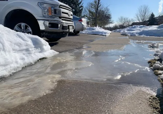
Wednesday offered a brief warm-up in southern Ontario, leading to the melting of some of Monday's impressive snowfall. While the bump in temperatures allowed for some melting, a sharp cold front that sliced through the region turned any standing water, slush or snow into ice. This has lead to slippery surfaces on the roads and sidewalks, so be mindful before venturing outside Thursday. Of note is the 20-22-degree drop across the region in 12-18 hours, so also be sure to bundle up if you're going out. As well, lake-effect snow will continue to add accumulations to the Lake Huron and Georgian Bay shorelines, with 5-15 cm possible through the day on Thursday. More on the timing and impacts of the hard freeze, and lake-effect snow, below.
PHOTOS: WINTER STORM WALLOPS ONTARIO, QUEBEC, DRIVERS SHOVEL ON THE SIDE OF THE HIGHWAY
THURSDAY: LAKE-EFFECT SNOW LINGERS AS FRIGID TEMPERATURES, ICY SURFACES ARISE
After a brief warm-up Wednesday, a sharp cold front that pushed through southern Ontario in the late afternoon sent temperatures plummeting back below freezing in a hurry.
The combination of accumulating snow -- or left over snow piles from Monday's blizzard -- freezing drizzle, and falling temperatures has made for some hazardous conditions, particularly for untreated surfaces.
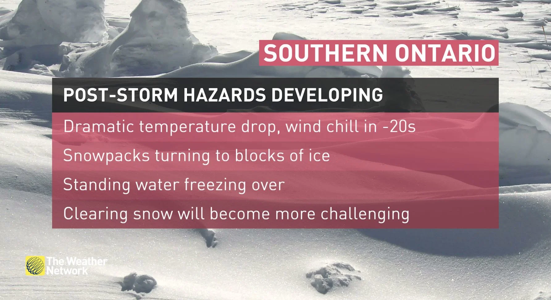
Any standing water has turned to ice due to the rapid drop in temperatures, leading to slippery surfaces on the roads and sidewalks.
Extreme cold warnings are in place for parts of southern Ontario.
Temperatures in Toronto went from 3°C-4°C Wednesday afternoon to -16°C or -17°C in most areas by Thursday morning. A 20-22-degree drop in 12-18 hours is quite substantial, so bundle up if you're going outside.
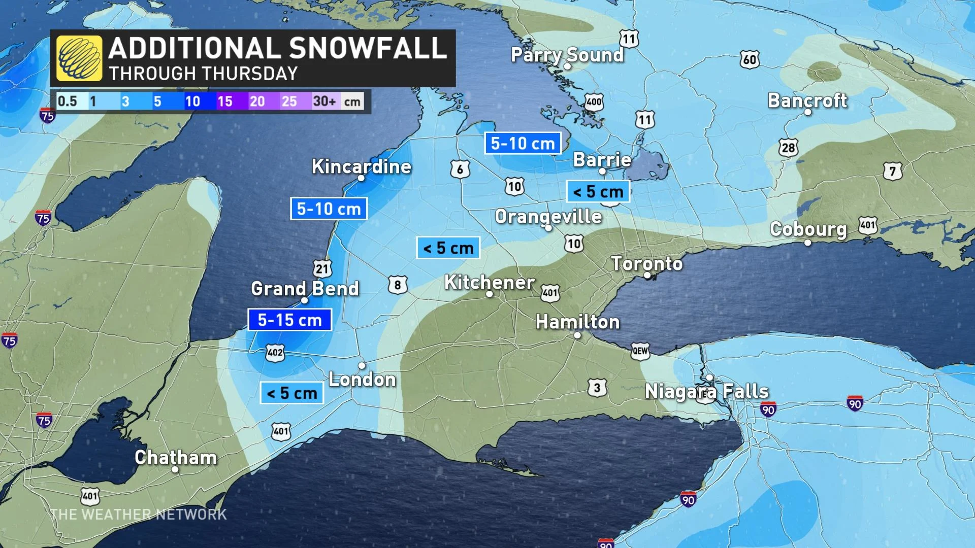
Meanwhile, lake-effect snow will persist Thursday across the Lake Huron shores, reaching into southwestern Ontario. Snow squall warnings are in effect. Snowfall amounts will fall within the 5-15 cm range across the shores of Lake Huron and Georgian Bay, with less than 5 cm expected for inland areas of the snowbelt regions, through Thursday.
"Snow squalls cause weather conditions to vary considerably; changes from clear skies to heavy snow within just a few kilometres are common. Travel may be hazardous due to sudden changes in the weather," Environment and Climate Change Canada (ECCC) says in the snow squall warning for Huron-Perth.
"Surfaces such as highways, roads, walkways and parking lots may become difficult to navigate due to accumulating snow."
WATCH | SNOW HEADACHE CONTINUES FOR GTA, ROADS FINALLY GETTING CLEARED
BEYOND: ANOTHER SHOT OF ARCTIC AIR LOCKS IN FOR THE WEEKEND
Frigid weather will continue through Saturday with temperatures that will rival the coldest weather that we have seen so far this winter.
High temperatures will struggle to reach -20°C for Ottawa and overnight lows will be near -30. They will be even colder rural areas.
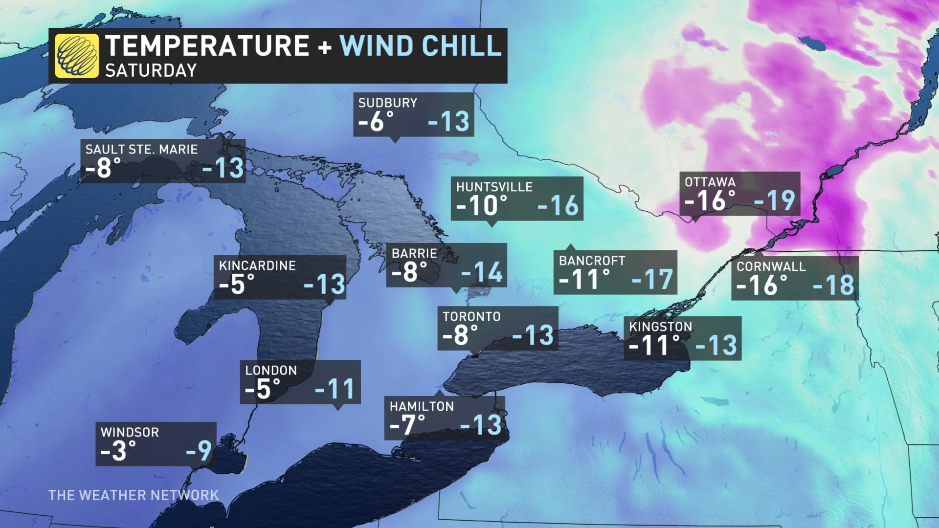
Temperatures in the GTA will drop to near or below -20°C, resulting in a noticeable increase in ice coverage on the Great Lakes. Another shot of Arctic air will keep temperatures well below seasonal early and mid-next week as well.
Also next week, forecasters are watching the potential for a clipper or two. A cold pattern will continue through the end of January and possibly into the first week of February, but a milder pattern should develop in early February. However, winter storms will still be possible.
Be sure to check back for the latest weather updates across Ontario.


