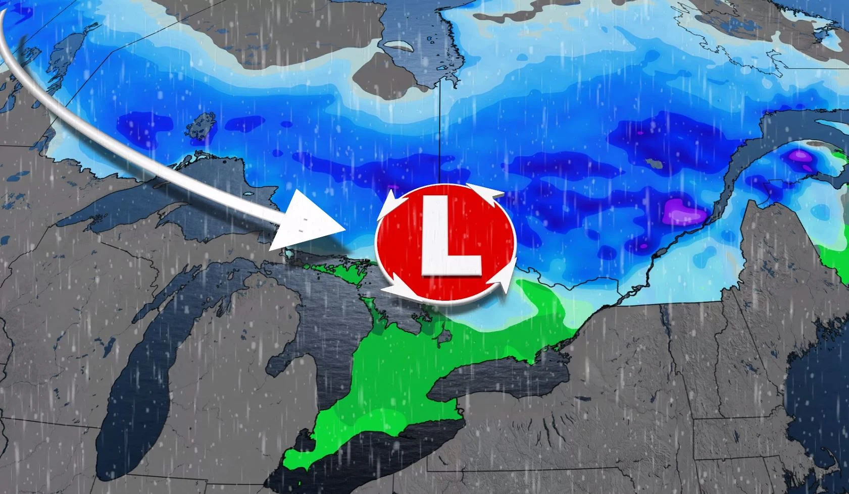
Multiple clipper systems take aim at Ontario and Quebec

A burst of unseasonal warmth is ahead for Thursday for southern Ontario, but we're back to a more chilly setup by the weekend. The flip-flopping temperatures will be part of an active storm track that will bring multiple shots of snow and rain into the first weekend of December – not excessive amounts, but enough to keep things unsettled. For a closer look, see below.
Hitting the slopes? Be sure to check conditions first with The Weather Network's Ski Report!
THURSDAY: SNOW SPREADS ACROSS NORTHERN ONTARIO AND QUEBEC, TEMPERATURES CLIMB IN SOUTHERN ONTARIO
A relatively dry Wednesday will give way to some unsettled weather on Thursday, with snow in northern sections of the province having begun Wednesday night, sliding south into eastern Ontario and southern Quebec through the overnight hours.
In all, between 10-15 cm of snow is likely to fall through Thursday, with even heavier amounts expected for areas north of Quebec City. for areas of southern Ontario, any snow that does fall will be limited to 3-5 cm, and then only in the higher elevations, while Quebec is in for more widespread totals.
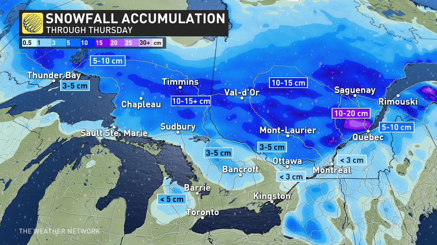
For most in southern Ontario, the system will manifest as rain showers through Thursday afternoon for southern Ontario, as temperatures remain mild, with some mixing expected for the higher elevations into the early evening.
Daytime highs could possibly reach the double-digits for areas in southwestern Ontario, with the mid to upper single digits for places like Ottawa and Montreal.
The snow across southern Quebec will also transition to rain through Thursday morning, as the system gradually makes its way out of both provinces by Thursday night.
FRIDAY INTO THE WEEKEND: LAKE-EFFECT SNOW SQUALLS RETURN, EYES ON A MESSY WEEKEND SYSTEM
Blustery and more seasonal conditions return for Friday, along with local lake-effect snow squalls for areas south and east of Lake Huron and Georgian Bay.
Another weaker clipper will spread some light snow across northern Ontario and then into southern Ontario early Saturday morning. Only minor accumulations are expected.
Forecasters are also watching the next messy system for Sunday, though with a wide range in computer model scenarios at this time. One shows a stronger system that tracks farther north, bringing snow first with a change to rain for more southern areas. Another scenario has a weaker system tracking south of the region, with just some light snow and minimal impacts expected.
"Regardless, this system should intensify and become a significant storm as it tracks into Atlantic Canada for early next week," says Dr. Doug Gillham, a meteorologist at The Weather Network.
WATCH BELOW: WHAT'S SO SPECIAL ABOUT WINTER TIRES? THIS EXPERT HAS THE ANSWER
Be sure to check back for the latest updates on the unsettled week across southern Ontario.


