Google Maps launches new feature for when an earthquake hits
Google wants to help Canadians in times of crisis. That’s why more visual crisis information will be available on Google Maps after Thursday, June 6th. This includes earthquake shakemaps, to be rolled out in the next few weeks on Android, iOS, desktop, and mobile web.
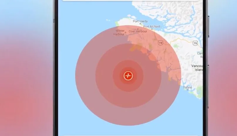
After an earthquake strikes, tapping on the crisis card will display the earthquake’s shakemap—a visualization that shows you its epicentre and magnitude, along with colour coding to indicate how intense the shaking was in surrounding areas. This information can help users quickly assess the reach of the earthquake, identify areas likely to have experienced the highest impact and navigate to safety.
“Often times when an earthquake hits, there’s concern about where to go, areas for safety and within Google Maps this will show Canadians how to do that,” says Alexandra Klein of Google Canada.
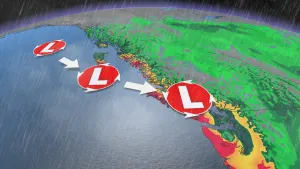
If you’re using Google Maps while driving when an earthquake strikes, you’ll soon receive a prominent warning if your route is likely to be impacted. The app will then try to reroute you if Google’s data or others in the area report road closures.
If you are outside of the impacted area, you can still see visualizations and other crisis details when you search Google for relevant terms such as the location or name of the disaster.
Seismologists detect more than 4,000 earthquakes every year in Canada and the surrounding areas, with roughly a quarter of them occurring in British Columbia.
“We talk about the big one out west all the time, it’s a major topic of conversation in Vancouver, but also across the country where there are earthquakes as well,” says Klein. “This is a really important experience for Canadians, this is a tool that they can just get on their phone.”
Along with earthquake shakemaps, Google Maps will eventually be alerting users about other natural disasters impacting navigation such as hurricanes and floods.