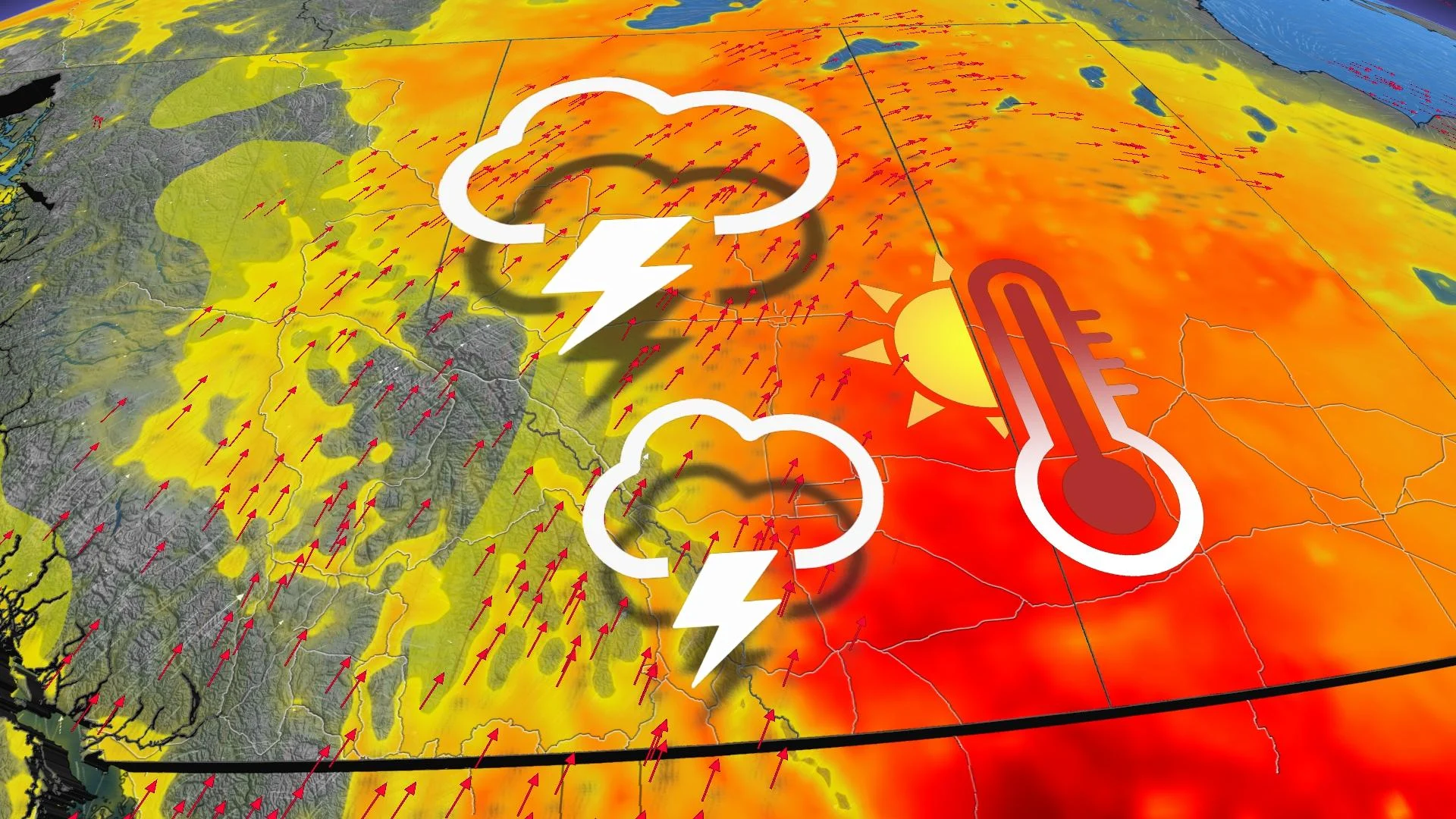
Heat warnings expand on the Prairies, storm risk ahead

Heat warnings expanded Sunday to cover parts of Alberta and Saskatchewan, as the Prairie region as a whole is in line for another burst of extreme heat this week. Daytime highs will approach, hit or exceed 30°C in Alberta and Saskatchewan first before moving east into Manitoba for mid-week. The conditions are ripe for some extreme storm risk, beginning in Alberta Monday and migrating to Saskatchewan by Tuesday. A look ahead to the incoming blast of heat and the severe weather setup for Monday and Tuesday, below.
Visit our Complete Guide to Summer 2021 for an in-depth look at the Summer Forecast, tips to plan for it and much more!
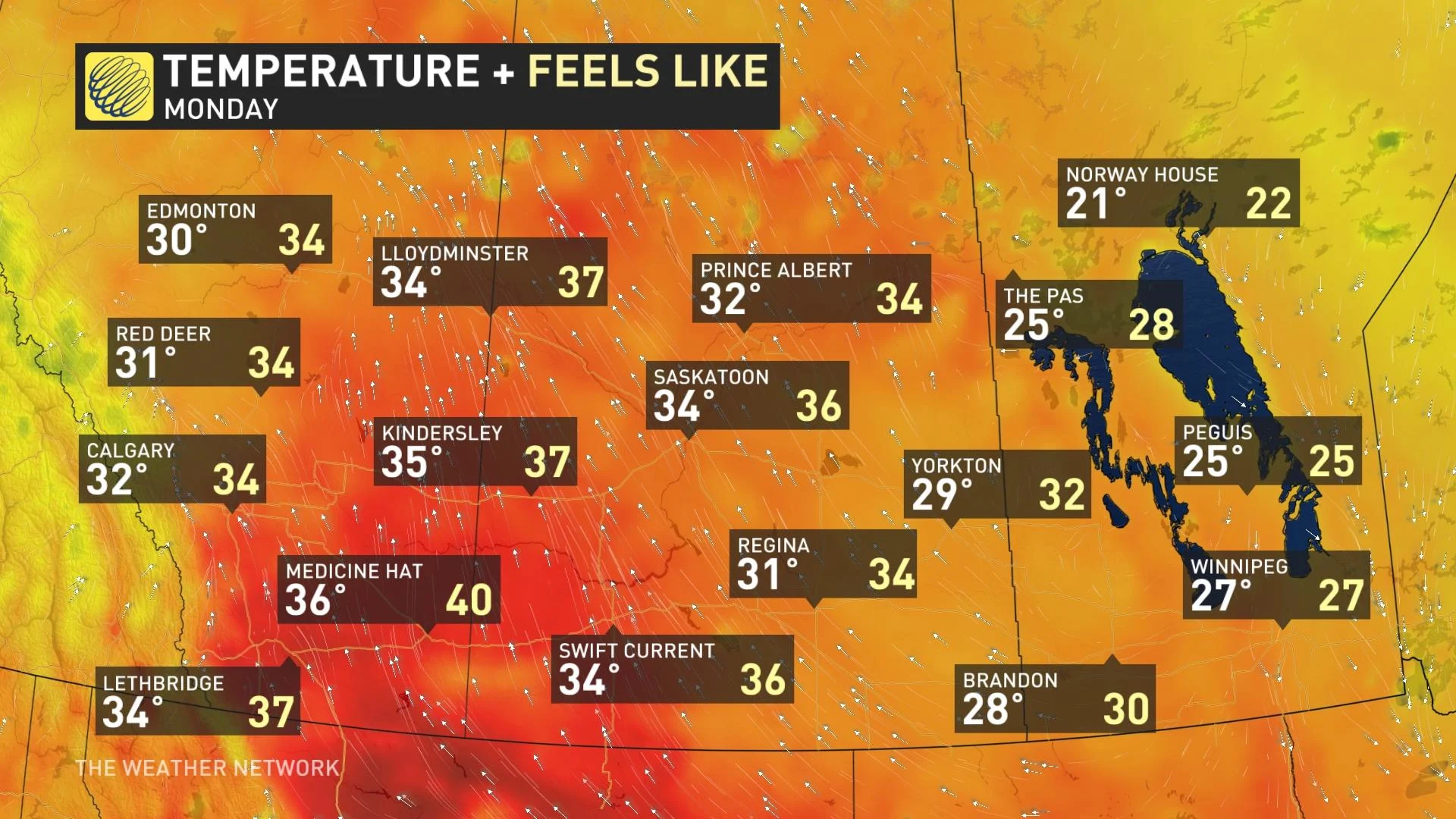
MONDAY: HEAT WARNINGS IN PLACE FOR 30-DEGREE TEMPERATURE RETURN, SEVERE STORM RISK
An upper ridge will be bringing the heat back onto the Prairies in the coming week, spreading east across the region into mid-week. Heat warnings are already in place for parts of Alberta.
Monday will see the heat reach Alberta and Saskatchewan first, though Manitoba won't be too far behind. Temperatures will be close to, at or above the 30-degree mark in Alberta and Saskatchewan.
Environment Canada offers tips for people to avoid possible heat stroke or heat exhaustion.
Consider rescheduling outdoor activities to cooler hours of the day
Take frequent breaks from the heat, spending time in cooled indoor spaces where possible
Drink plenty of water and other non-alcoholic, non-caffeinated beverages to stay hydrated
Check for your children or pets before you exit your vehicle. Do not leave any person or pet inside a closed vehicle, for any length of time
Along with the heat, a surface low will bring a widespread chance for thunderstorms in Alberta, with some spillover into B.C. and Saskatchewan, too. The threat for severe storms will be focused on parts of central and southern areas of Alberta.
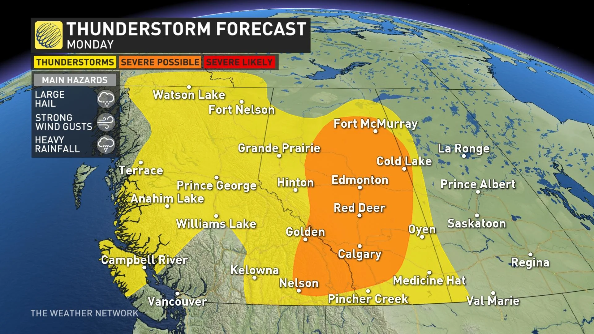
Any that do become severe in the afternoon and evening may bring large hail, strong wind gusts and heavy rainfall.
TUESDAY: SETUP FAVOURABLE FOR SEVERE STORMS
Besides the heat that people will have to contend with, the severe weather potential returns to Alberta Tuesday, thanks to a system tracking in. It will extend into Saskatchewan, as well, particularly along the adjoining borders.
Ingredients such as veering winds, instability, moisture and fronts are in place to create a favourable setup for severe thunderstorm development in the afternoon and evening hours.
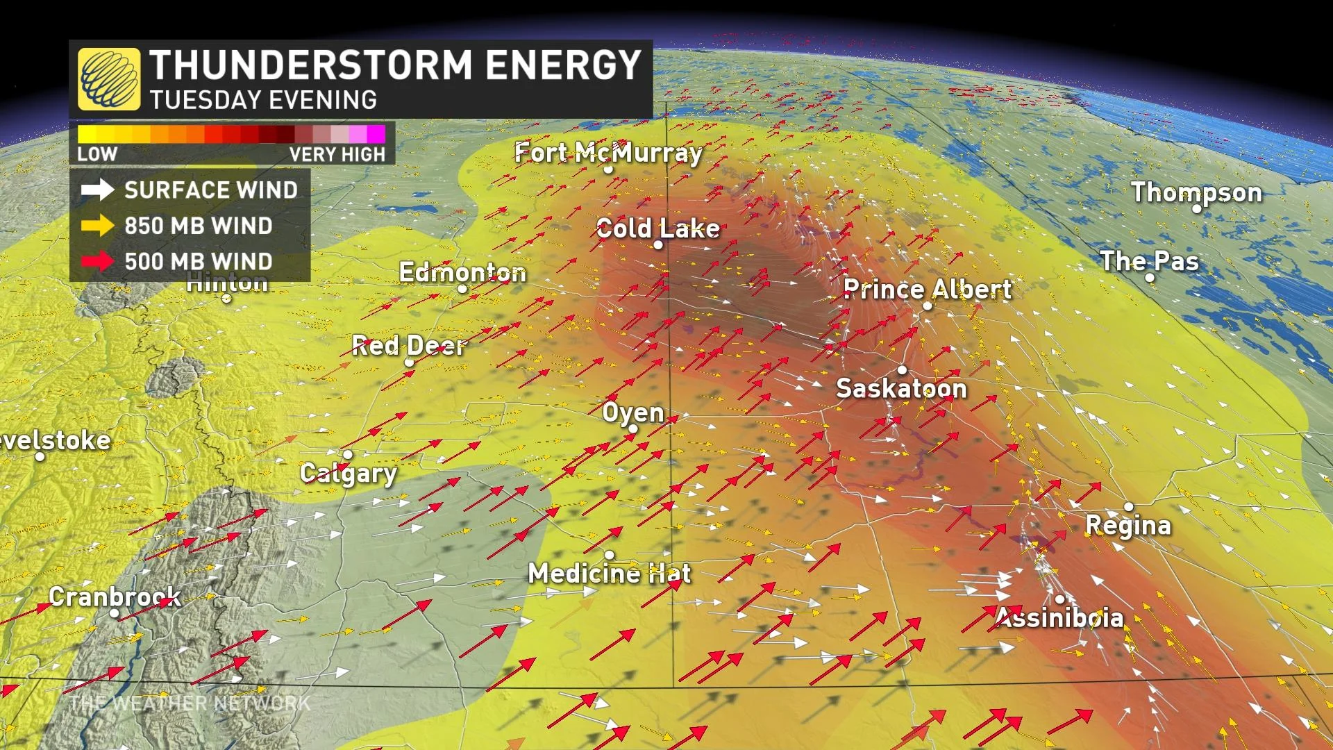
"This strong system will bring widespread heavy rain and strong winds as it tracks east across the Prairies, but primarily for northern parts of the region – north of the primary agricultural regions," said Dr. Doug Gillham, a meteorologist at The Weather Network.
By Wednesday, the heat will reach Manitoba, while the temperatures cool off in Alberta and Saskatchewan, as a result of a strong upper low swinging through.
LOOK AHEAD: DRY PATTERN IS BACK, HEAT MAY RESURFACE AT THE END OF THE MONTH
Cooler weather will quickly spread back into the region for the end of the week, persisting into Father’s Day weekend. However, western areas will quickly rebound again.
After a wet and stormy pattern this past week, a dry pattern will be firmly locked onto the southern Prairies through next week and beyond.
Forecasters are watching the potential for the hot weather to return to southern areas of the Prairies for the final week of June.
Stay tuned to The Weather Network for the latest forecast updates across the Prairies.


