Omega block set to deadlock the weather across Canada

The omega block will create a weather backlog in the West, while the East will see several rounds of rain.
Things are about to get a little weird in the weather department, Canada.
For starters, we're about to live under the letter omega, which is high above our heads in Eastern Canada.
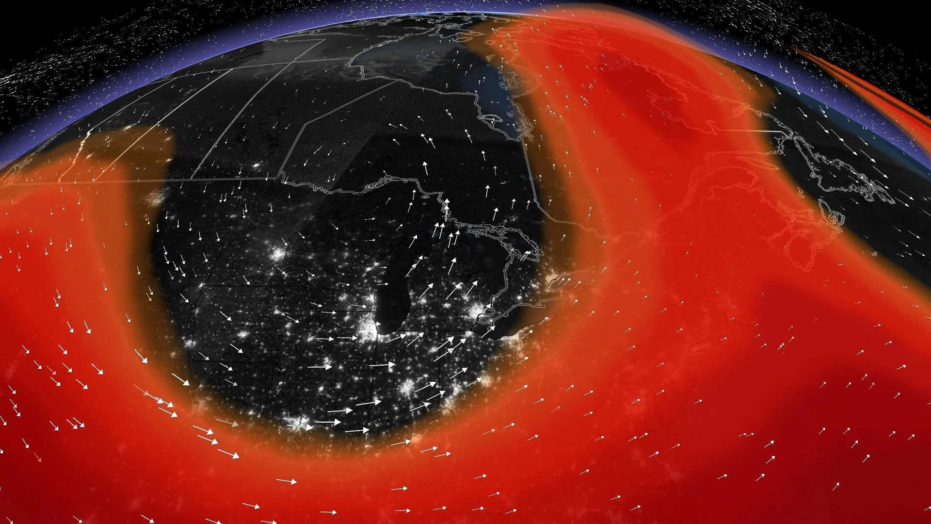
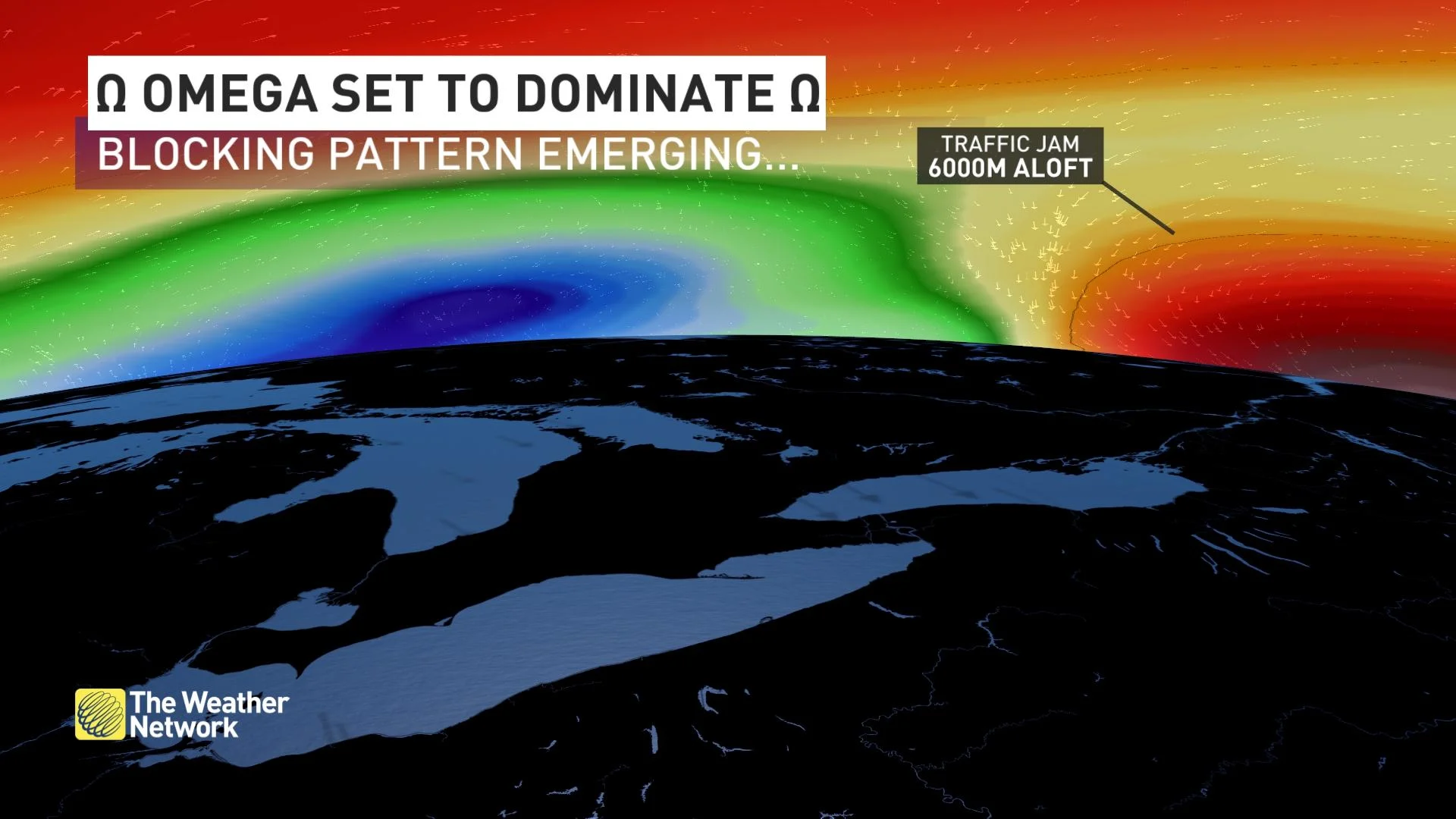
We're not talking about omega supplements or a reference to the end of times. We're referring to the unusual shape of the atmospheric-blocking pattern that is 6,000 metres above the ground.
The atmosphere generally likes to take shortcuts here or there. But, sometimes, akin to a river cutting through an uncharted path, the atmosphere can get a little lost.
A blocking pattern means that the same type of weather is repeated for days or even weeks. This omega blocking pattern will flourish over Eastern Canada and feature a final upper trough in the textbook omega configuration.
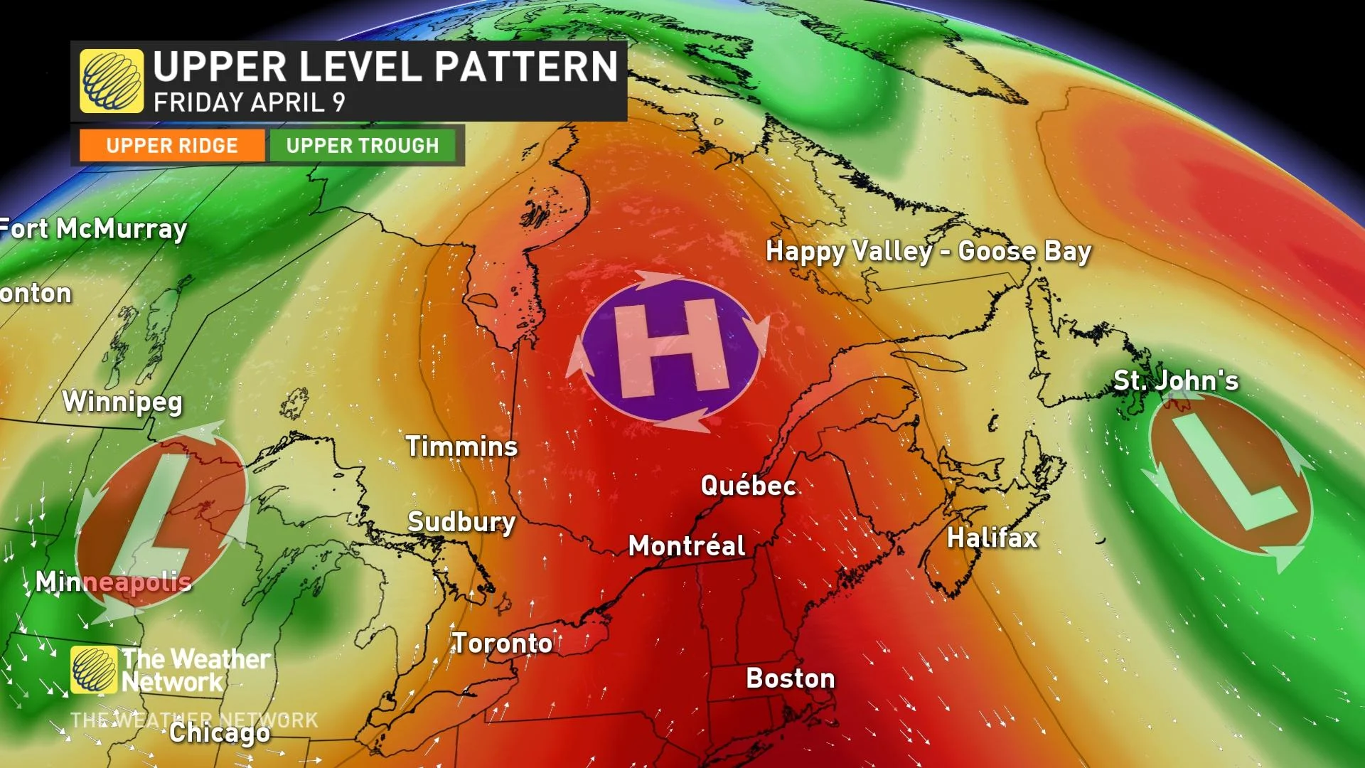
By Friday, the temperature near James Bay in northern Ontario, will exceed the temperature in downtown Toronto. Toronto will face a lake breeze off Lake Ontario, while Moosonee receives a warm, southerly wind.
Atlantic Canada happens to find itself in a pretty precarious position. The region will be within close proximity of the final upper trough completing the omega block, which means rounds of rain and even a little more wet snow over the next week.
UNUSUAL CHILL IN THE WEST
The omega block will create quite the weather backlog in the West and focus all the coldest air across Alberta, British Columbia, Yukon, and The Northwest Territories. It's conceivable that temperatures may plunge close to 20°C below seasonal across the Yukon by this upcoming weekend.

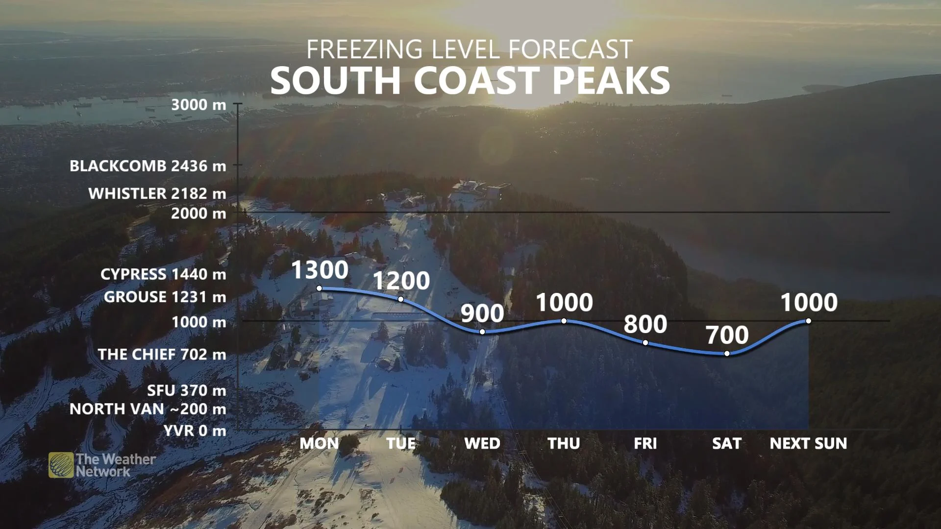
These troughs are so chilly across the coast of British Columbia that freezing levels will plunge to just a few hundred metres above sea level late-in-the-week, promoting a wintry mix just above sea level.