Strong winds linger, lake-effect snow en route to southern Ontario

Lingering impacts from the potent fall storm will be felt across southern Ontario on Monday morning. Strong winds will gust between 50-70 km/h and damages from shoreline flooding will continue, particularly along Lake Erie where a seiche formed near Port Dover. Power outages will continue to be widespread as the wind gusts knocked down trees that toppled power lines. After the winds diminish, lake-effect snow is expected to impact much of the region on Monday and Tuesday. Details and timing, below.
WEATHER HIGHLIGHTS:
Impacts from shoreline flooding, downed trees continue through Monday morning
Lake-effect snow for the early part of the week
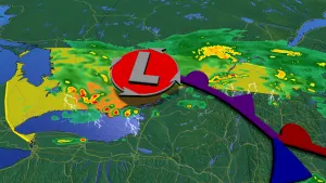
MONDAY: IMPACTS FROM COLORADO LOW CONTINUE
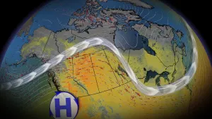
The intense winds will ease on Monday morning, but gusts between 50 to 70 km/h will linger throughout the day. The unsettled conditions will continue with lake-effect snow following the departing Colorado low.
When the low moves into Quebec, rain will transition back to snow in central Ontario and areas northwest of the GTA. In fact, the chilly winds of the still unfrozen, warm waters of Lake Huron and Georgian Bay will initiate lake-effect snow squalls.
PHOTOS: Intense winds shake ground, send debris flying in Ontario
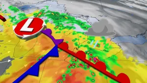
Coming from a west-southwesterly direction, the winds will be the launching point of the lake-effect snow, occurring through Monday afternoon across southern Georgian Bay and along Lake Huron shores.
From Monday night through Tuesday, the winds will change to a northwesterly direction and generate lake-effect snow from southern Georgian Bay into the GTA. The shores of Lake Huron, from Kincardine to Grand Bend and across to London, will also see some snowfall. As the wind changes directions, lake-effect snow will extend across the GTA on Tuesday.
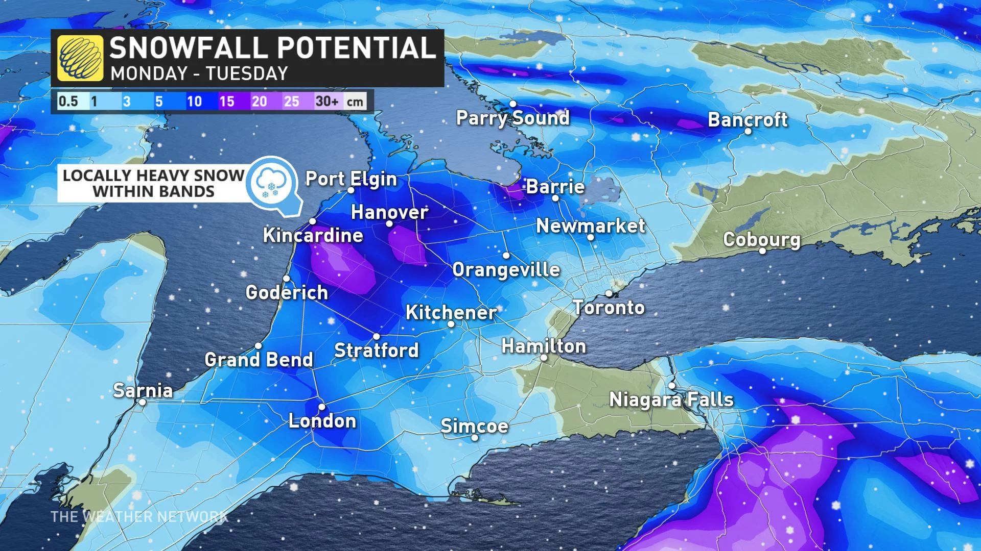
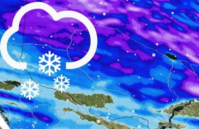
"Heavy snow and difficult travel are likely across the snow belts. Flurries and quick bursts of heavier snow will extend into parts of the GTA. Wednesday will be the coldest day with temperatures remaining well below freezing north of the GTA and across southern Quebec," says The Weather Network meteorologist Doug Gillham.
Some of the hardest-hit areas of the snow belt regions could see over 20 cm of snow through Tuesday.
Milder weather will return for late week and on the weekend with temperatures recovering to near or above seasonal. However, forecasters are keeping an eye on the warm front and possibly a system with the transition to milder weather around Thursday.
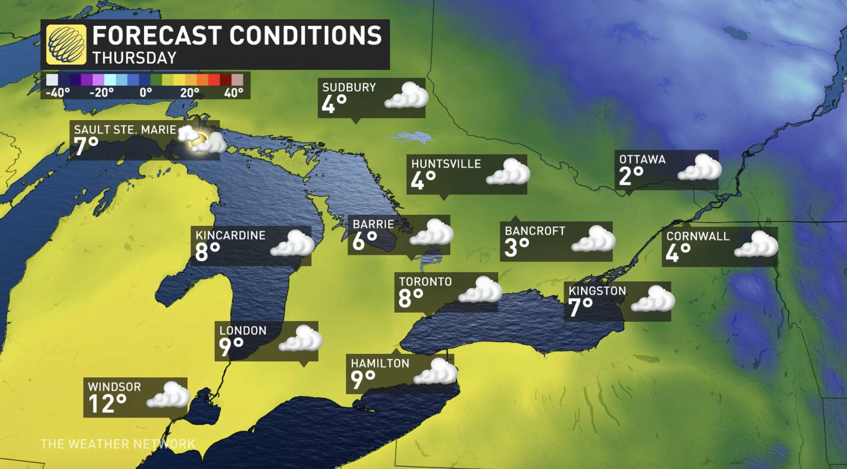
"The cold air could resist and bring a period of messy/wintry weather, especially for areas well north of the GTA, eastern Ontario and southern Quebec," Gillham says.
Check back as this system's impacts unfold.
Thumbnail courtesy: Darrell Parson, Hamilton, ON