
Winter's almost over, yet the East Coast is blasted with 50 cm of snow

The intense winter storm that powered through the Maritimes Monday -- the first day of meteorological spring -- also delivered a swift dose of heavy snow, howling winds and blizzard conditions to Newfoundland Tuesday.
Because of the storm, most government offices and municipal services were either delayed with opening or closed for the day early Tuesday. Conditions quickly began to deteriorate Monday overnight and into the pre-dawn hours Tuesday morning.
Visit our Complete Guide to Spring 2021 for an in-depth look at the Spring Forecast, tips to plan for it and much more!
Sections of the Trans-Canada Highway were also closed on the west coast, with drivers being urged to postpone travel until conditions improved. Some drivers had became stranded on the roads. Several flights and ferry crossings were cancelled, as well.
Winds were forecast to hit gusts of 80-100+ km/h, which made for dangerous travel from blizzard conditions that led to poor visibilities on the road.
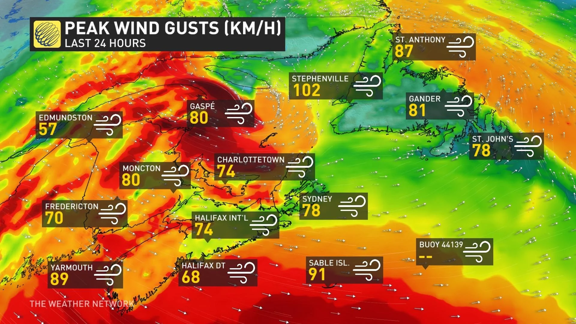
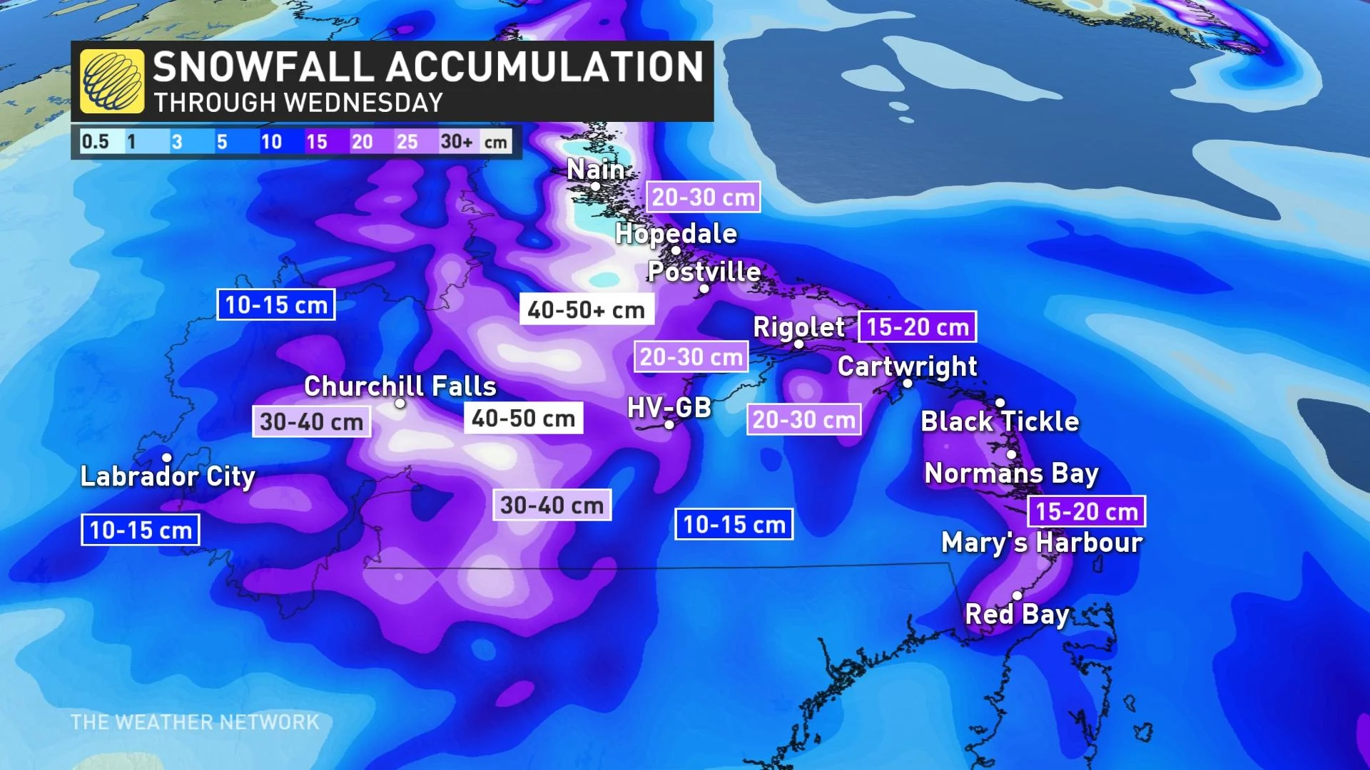
Some areas in Newfoundland were forecast to receive 20-30+ cm of snow by the time the system moved out. Conditions have since improved across most of the island, but heavy snow and intense winds are lingering in northern sections and across Labrador -- bringing more treacherous travel through Wednesday. Parts of Labrador are in line to see 40-50+ cm of snow by the time the system finally departs Thursday.
Here is a selection of visuals currently circulating on social media.
Thumbnail courtesy of Justin Boudreau, taken in Gander, Newfoundland.


