PHOTOS: Severe storms rip through the Prairies with menacing skies, large hail

The intense thunderstorms rolled through Saskatchewan and Manitoba Thursday afternoon and evening, darkening the skies with scary clouds and producing heavy rain, hail, and localized flooding in some locales.
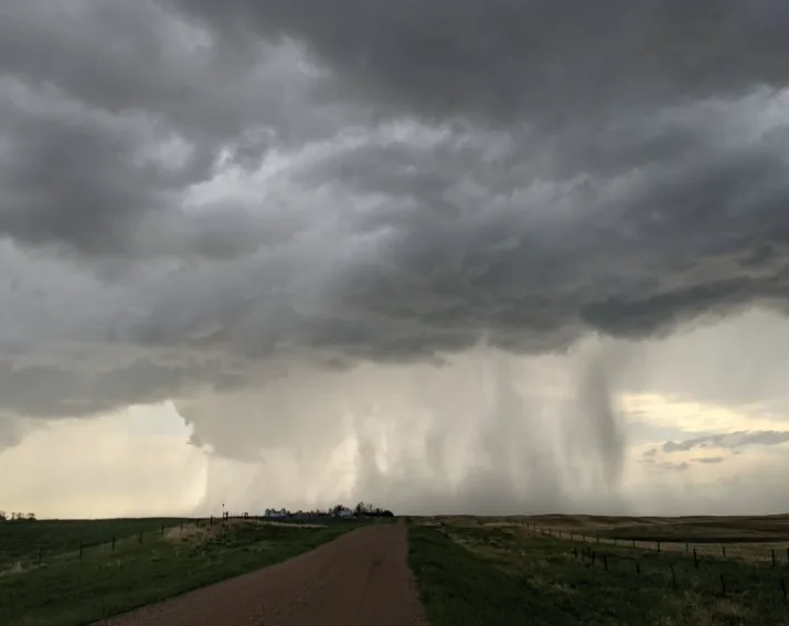
Severe thunderstorms marched across the American border into Saskatchewan Thursday afternoon and evening, bringing heavy rain, strong winds, hail and flooding in some locales.
A slow-moving system that inched into the Prairies Thursday to deliver some soaking, beneficial rains for parts of the drought-stricken region, also brought some intense storms to southern Saskatchewan, prompting Environment Canada to issue severe thunderstorm warnings.
SEE ALSO: Saskatchewan and Quebec nab Canada's first tornadoes in 2021
Areas near the U.S. border were at highest risk, where there was the threat of tornadoes and supercells. Although there were reports of rotation on radar and supercells, no tornado warnings were issued and there have been no reports of any twisters.
However, visuals surfaced of small hail in some areas, a downed hydro pole and flooding west of Regina, Sask. As part of the severe weather threat, forecasters were warning of the potential for hail up to ping pong ball-sized.
The threat for severe thunderstorms moved into southern Manitoba through the overnight hours, prompting widespread watches and warnings by early Friday. Frequent lightning and heavy downpours were reported, with the threat for some damaging winds, with gusts in excess of 90 km/h and large hail possible as well. The severe risk will subside as the storm threat pushes into northwestern Ontario Friday.
Below is a selection of visuals from the severe thunderstorms currently making the rounds on social media.
Thumbnail courtesy of Gunjan Sinha, taken near Crane Valley, Sask.


