Low heads into Newfoundland with soaking rains, snow, intense winds

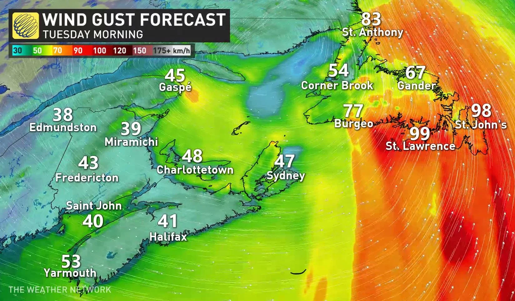
The final week of November started off on a soggy note in Atlantic Canada, with a strong low-pressure system dumping heavy rain, snow and intense winds Monday. Good news for the Maritimes is much of those impacts will be nearing the end by Tuesday morning, with much of the heavy rainfall confined to western Newfoundland through the day. New Brunswick will get a break from the heavy snow, but some sea-effect accumulations are possible in behind the low, impacting parts of Nova Scotia and Newfoundland, as well. Flooding will still be a concern in Newfoundland, as an additional 40-70 mm is still to come in areas hit hard by last week's event. On top of the heavy precipitation, winds will be blustery once again for parts of the region, with upwards of 100 km/h gusts possible for parts of Newfoundland. More on what's left of the poten system and a look ahead to the next potential storms already, below.
Visit our Complete Guide to Winter 2022 for an in-depth look at the Winter Forecast, tips to plan for it, and much more!
TUESDAY: LINGERING WIND, SNOW, RAIN EFFECTS AS POTENT SYSTEM PUSHES EAST
Weather warnings are continuing to drop across Atlantic Canada as the strong East Coast low makes its way out of much of the Maritimes and brings more impacts to Newfoundland Tuesday.
MUST SEE: Record storm severs highway links in N.L.
The heaviest rain will fall in the overnight hours Monday in eastern Nova Scotia and western Newfoundland -- areas that were hit with substantial flooding last week. Rainfall will subside through the day Tuesday. Additional rainfall totals of 20-30 mm is anticipated for eastern Nova Scotia, while western Newfoundland is still on the hook for 40-70 mm, so localized flooding remains a serious concern.
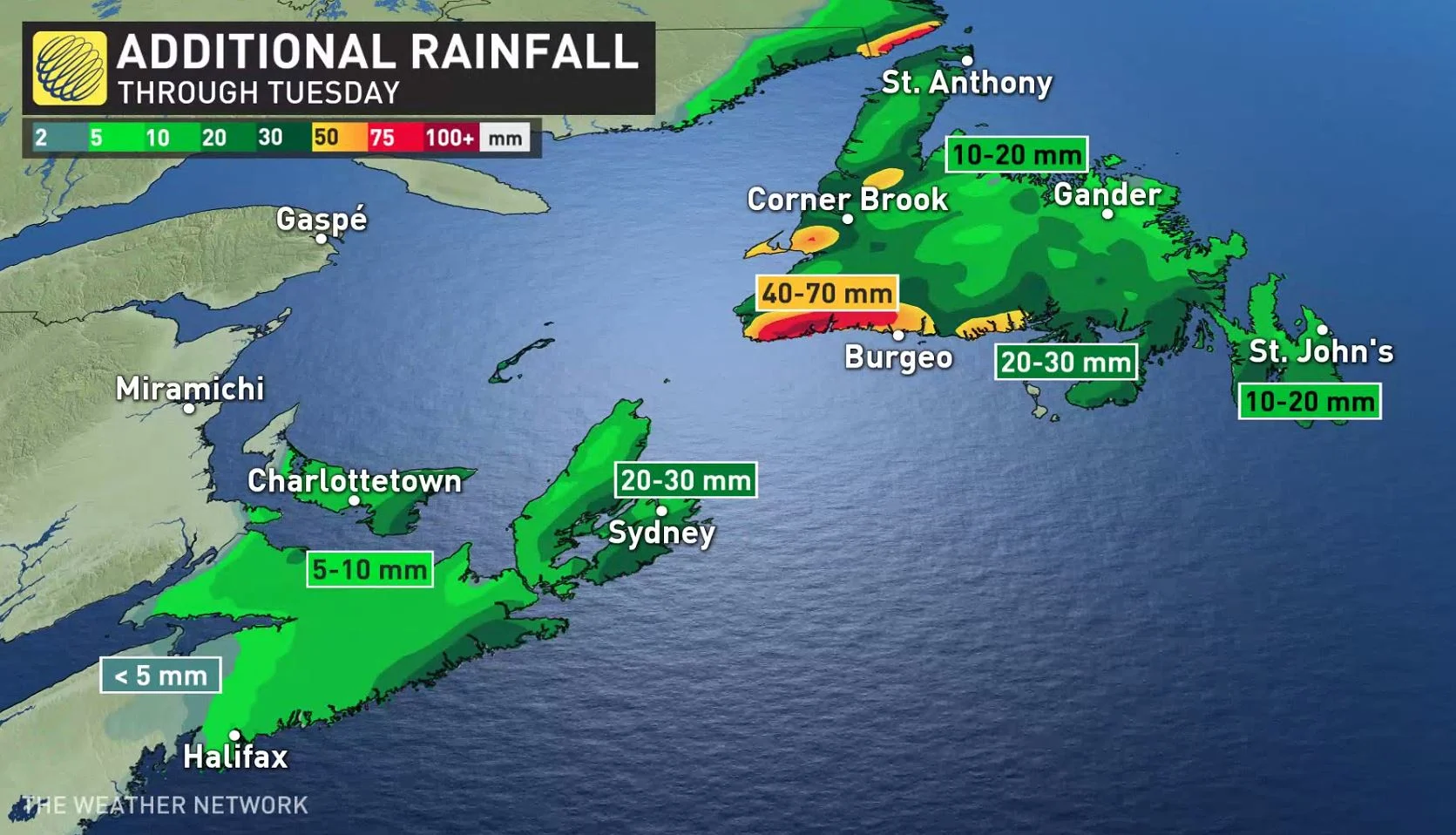
Elsewhere, 10-30 mm is possible for the remainder of Newfoundland, and just 5-10 mm for areas of central and southern Nova Scotia as the moisture will be exiting there through Monday overnight.
Meanwhile, most of the heavy snow in New Brunswick will be tapering by Monday overnight, with just light flurries and sea-effect through Tuesday for it, as well as in parts of Nova Scotia and Newfoundland.
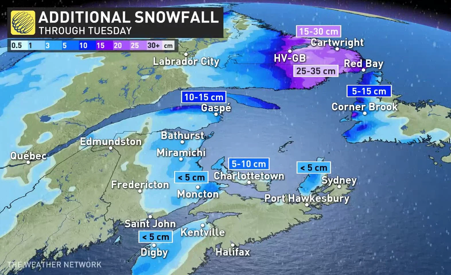
Moncton has seen 12 cm so far as of Monday evening, with less than 5 cm of additional snow left to fall there, as well as in southwestern and eastern Nova Scotia. An additional 5-15 cm is still to come for P.E.I., and western and northern coastal areas of Newfoundland.
Sea-effect snow will pick up in Newfoundland in the afternoon hours Tuesday as the low exits the province.
As well, winds will continue to be gusty overnight Monday, easing through Tuesday morning, for eastern Nova Scotia. On Tuesday, winds will pick up in eastern Newfoundland as the system tracks further in that direction, with southeasterly gusts upwards of 100 km/h for coastal sections in the afternoon.
LOOK AHEAD: UNCERTAIN TRACK FOR NEXT POTENTIAL SYSTEMS
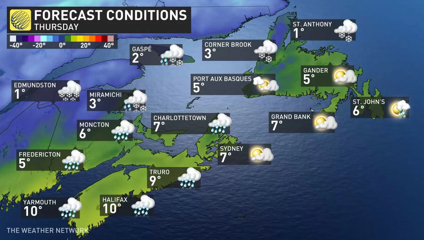
Another storm system(s) is anticipated to move into the region Thursday-Friday, but models are in disagreement on the outcome. One scenario has two lows pushing across the region, while the other has just one storm – but a larger and stronger system.
Regardless of the ultimate outcome, unsettled weather and windy conditions are likely with rain for a large part of the region, but a swath of significant snow, as well.
Another significant system is possible this weekend with a more southerly storm track, with the potential for significant snow for more populated areas. Another potent storm is possible early or mid-next week.
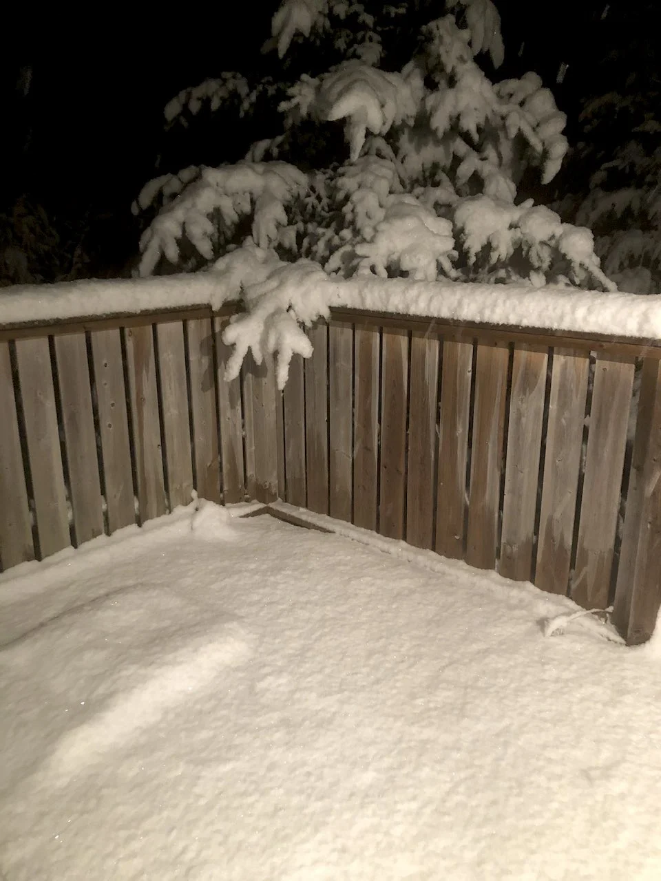
Thumbnail courtesy of Brad Grouchy/Twitter.
Check back as we continue to monitor these systems across Atlantic Canada.