First storm of 2021 heading to the East Coast, snowfall warnings in effect

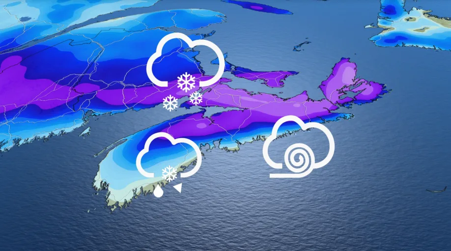
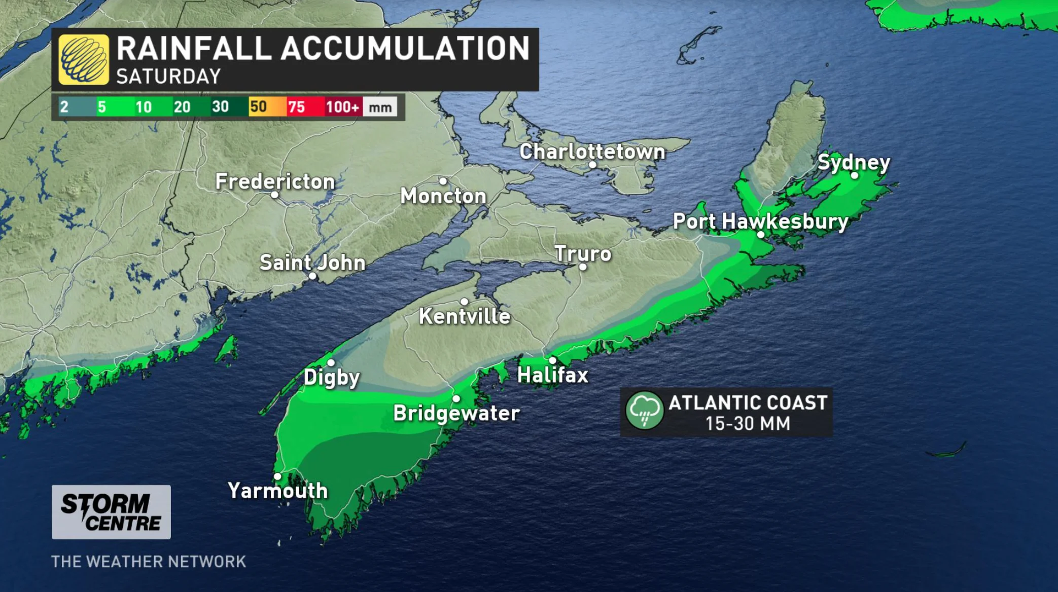
2021 started out mostly calmly for the Atlantic provinces, but snowfall warnings were issued ahead of a strong, snowy system that's set to slam the region Saturday. Much of Nova Scotia is looking at 20-30 cm, with hefty amounts in southern New Brunswick as well, though Newfoundland gets off relatively lightly. For people nearest the Atlantic coast, however, it will be more rain than snow to prepare for. Details and timing, below.
WEATHER HIGHLIGHTS:
Texas low begins impacting the Maritimes early Saturday, snowfall warnings in effect
Heavy snow for much of Nova Scotia and southern New Brunswick, amounts drop off near the shores and into northern areas
Another potent system on deck for early next week
SATURDAY: TEXAS LOW TRACKS IN, HEAVY SNOW LIKELY
A moisture-laden Texas low is set to roll through the Atlantic provinces, bringing some very heavy snow for parts of the Maritimes, though keeping south enough to only bring lesser amounts to Newfoundland.
Beginning early Saturday morning, the system will spread heavy snow over much of Nova Scotia and southern New Brunswick. The former looks to pick up 20-30 cm over the course of this event.
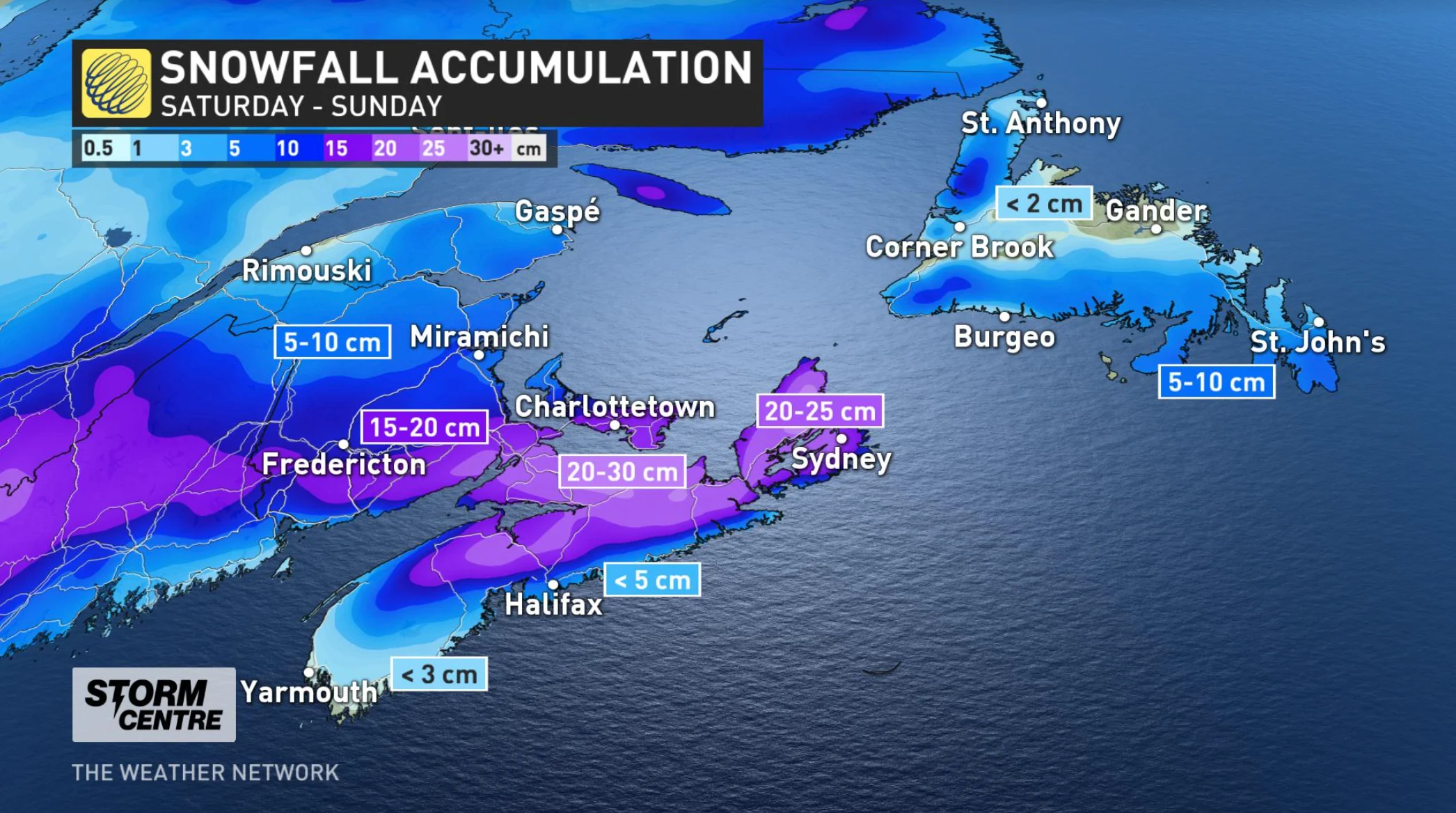
One thing to note is that snowfall amounts drop off quite drastically for areas near the Atlantic shores of Nova Scotia. The Yarmouth area might pick up less than 3 cm, and much of Halifax less than 5 cm over the course of this system.
Those areas and the rest of the Atlantic coastline will also see the most amount of rain from this system, further limiting accumulations there. In all, coastal Novas Scotia is set for 15-30 mm of rain from this system.
The system exits the Maritimes through the overnight hours, and its track looks to keep south enough to make for a minor impact on Newfoundland, though the Burin and Avalon peninsulas may see a few flakes into Sunday morning.
LOOK AHEAD: NEXT POTENT SYSTEM EARLY NEXT WEEK
Beyond the weekend, another significant system is expected to push into Atlantic Canada Monday afternoon. The exact track and impacts are still uncertain, but overall this will be a much milder and wet storm for the region.
Heavy snow is expected for the western Maritimes, including parts of New Brunswick, but primarily rain is likely for the rest of the region as very mild air surges north to Labrador with the potential for above freezing temperatures and rain extending to Happy Valley-Goose Bay during mid-next week.
Looking ahead further, there are no signs of any more Arctic air through early to mid-January.
Stay tuned to The Weather Network for the latest forecast updates.