Unseasonal warmth on the East Coast, but next system already in sight

The powerful system that brought record-breaking rain to the Maritimes, and downpours to Newfoundland and snow to Labrador, was all but exiting the region Thursday night, with some mild and well above-seasonal temperatures beyond it leading into the weekend. However, forecasters are already eyeing a new system that has some potential for a major impact into early next week. What we know at the moment, below.
WEATHER HIGHLIGHTS
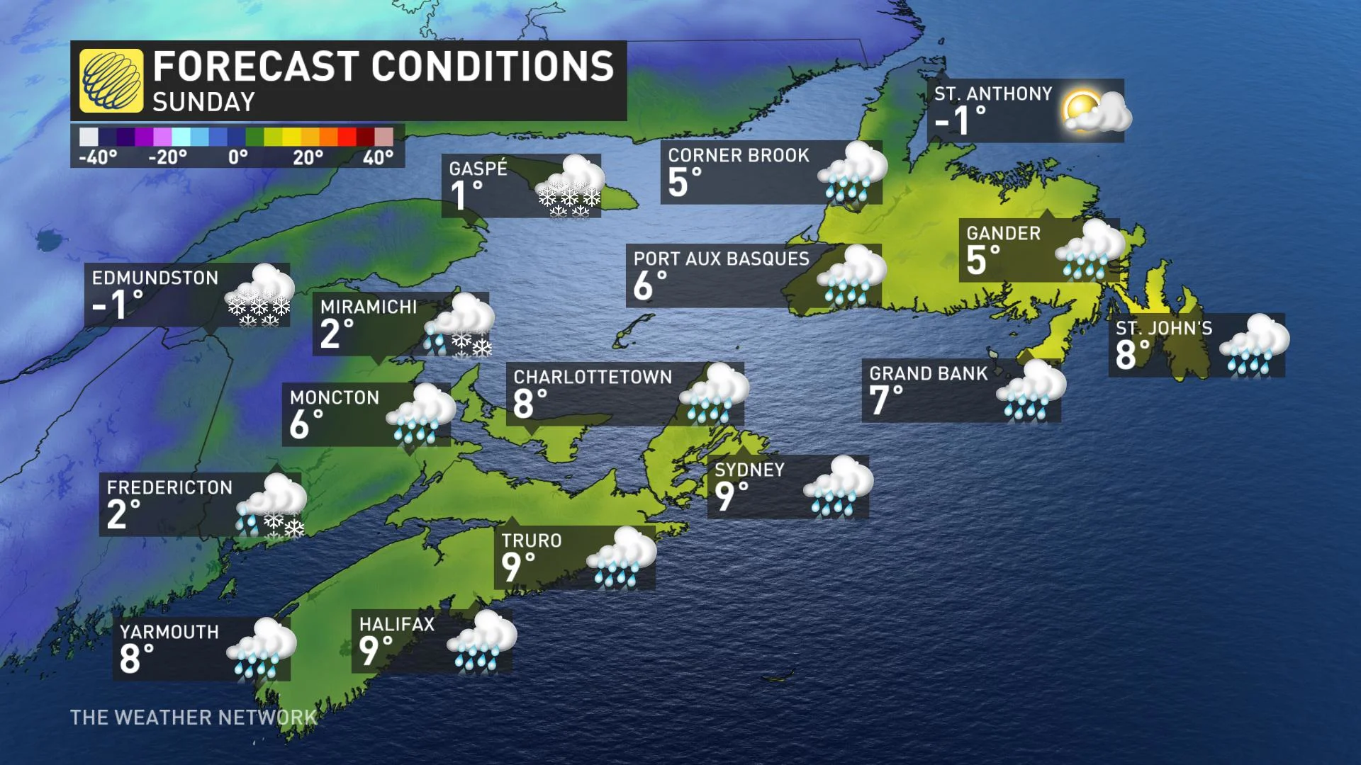
Temperatures remain well above seasonal this weekend, low to mid-teen potential for parts of the Maritimes
Watching for a potential rain and snowmaker for the weekend for Atlantic Canada, be sure to check back for updates
Visit our Complete Guide to Winter 2021 for an in depth look at the Winter Forecast, Canada's ski season, and tips to plan for everything ahead!
THE WEEKEND AND BEYOND: DOUBLE-DIGIT TEMPERATURES PREVAIL, EYES ON NEXT SIGNIFICANT SNOW MAKER
The one upside to the soggy conditions of the past few days has been some markedly above-seasonal temperatures, including stretches of double-digit daytime highs – and there's still some more warmth left for the region to bask in.
"We should even see low to mid teens across Nova Scotia on Saturday and double-digits into parts of Newfoundland for Sunday," says Weather Network meteorologist Dr. Doug Gillham.
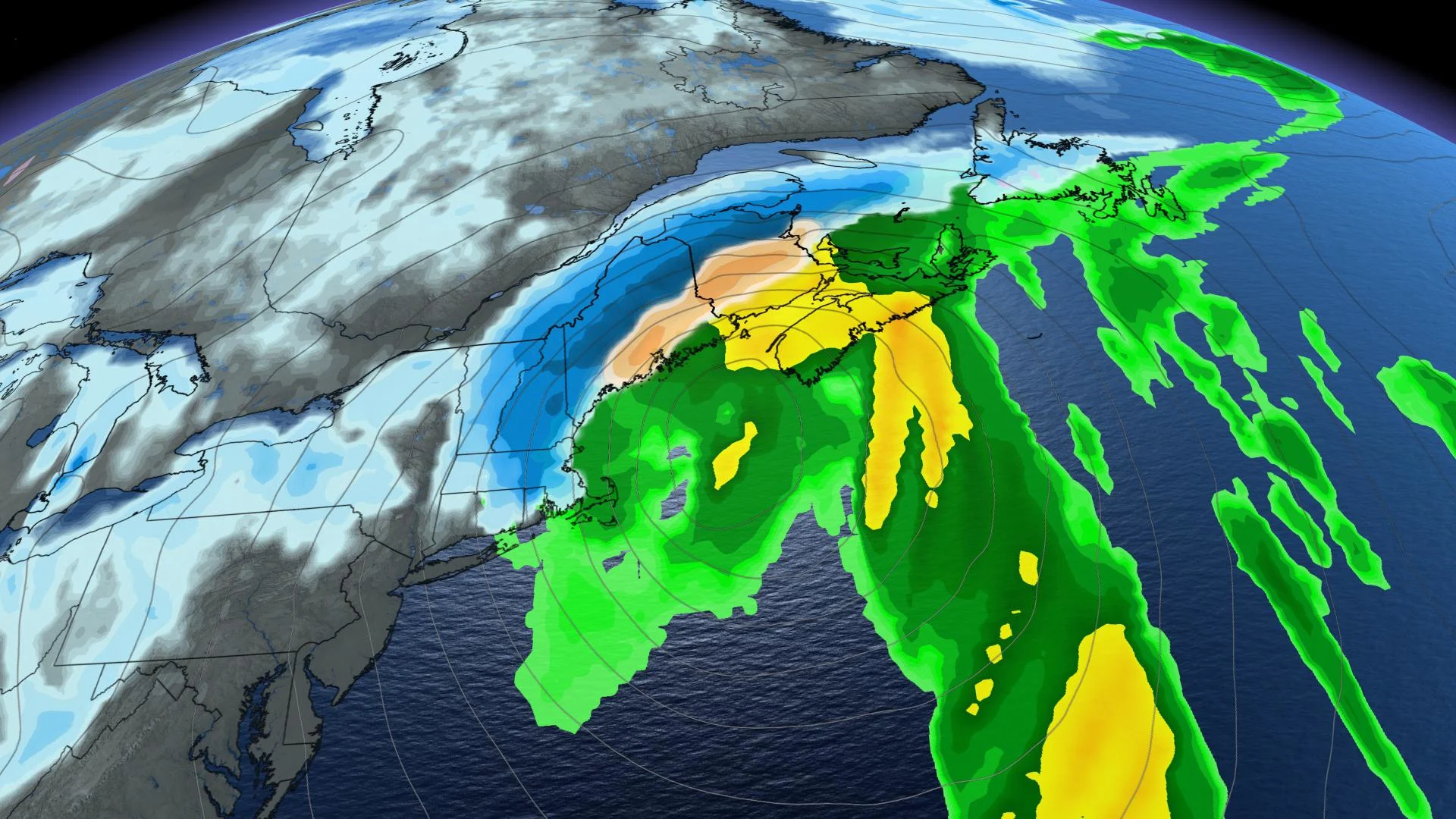
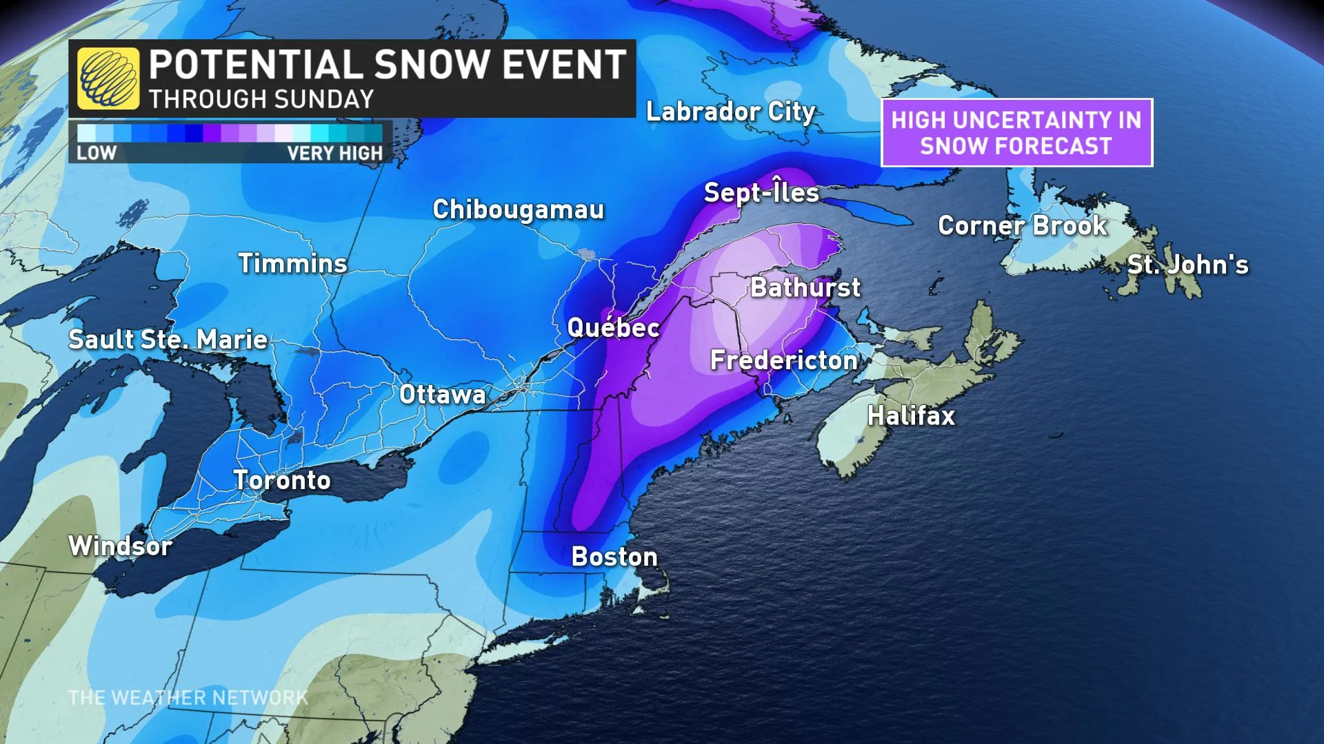
Forecasters are also keeping an eye on a major weekend storm that will track up the U.S. East Coast on Saturday, and into Atlantic Canada during Sunday and Monday.
"The exact track and impacts are still rather uncertain, but a track near the Bay of Fundy is most likely," Gillham adds.
The western side of this storm has the potential to bring very heavy snow, with the threat for 15-30+ cm across parts of northern and western New Brunswick (north and northwest of Fredericton).
As the milder temperatures dominate the south, primarily rain is expected for the rest of the region, accompanied by strong winds.
Behind this storm, conditions will turn much colder as we head into the second week of December.
Check back as we continue to monitor the incoming storm.


