Well-below seasonal cold floods the Prairies, little end in sight

After another shot of snow for parts of the southern Prairies Wednesday, Thursday sees the region continue to be flooded with cold, with a below-seasonal trend continuing through the weekend into next week. For snow, the next round looks to spill over the Rockies into parts of Alberta Frida. A closer look, below.
WEATHER HIGHLIGHTS:
Some snow lingers in southern Saskatchewan Thursday
Another shot is ahead Friday for Alberta, mostly confined to the southern foothills and mountains
Below seasonal temperatures continue through the end of the week to the weekend and beyond
THURSDAY AND FRIDAY: COLD CONTINUES, NEXT SHOT OF LIMITED SNOW AHEAD
Most of the snow that rolled through the southern Prairies will be just about done Thursday morning, with the exception of some parts of extreme southern Saskatchewan, which could see a few straggler snowflakes into the early afternoon.
Across the region, there'll be no relief from the cold that's flooded the region. Manitoba is the only part of the Prairies likely to see the warmer side of zero at the peak of the day, and then only just.
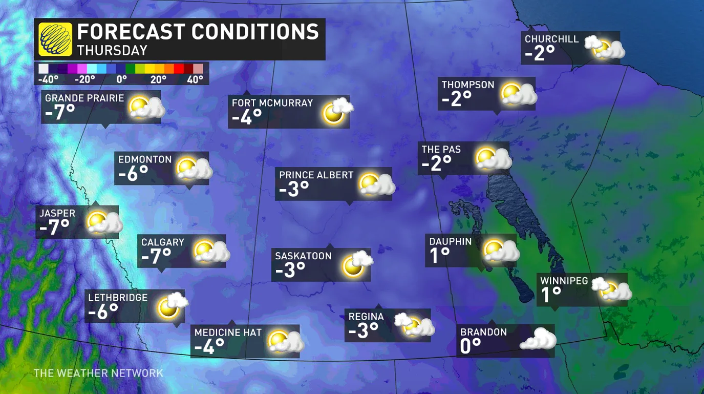
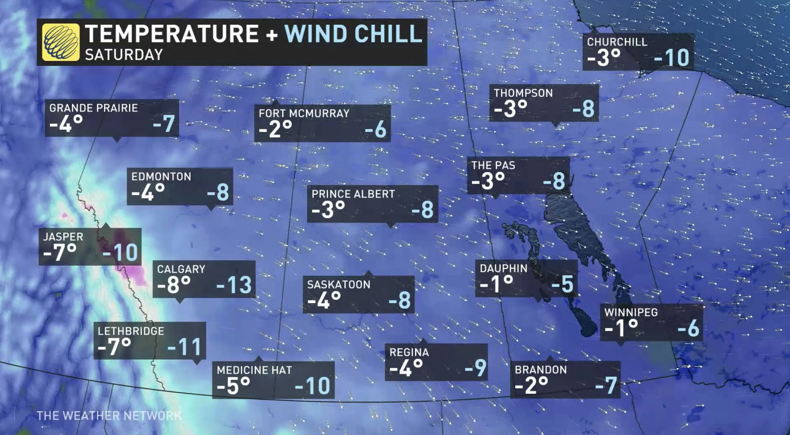
Beyond, Friday features similar widespread frigid conditions, as the cold air pivots in from northern British Columbia and sends temperatures tumbling into the weekend. Numerous temperature records are expected across the region once again.
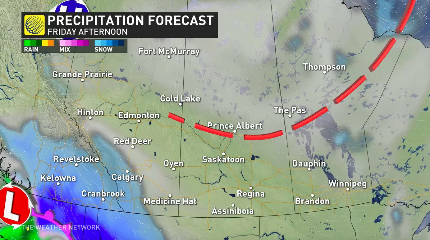
Forecasters say there's another round of snow ahead to close out the week, primarily confined to Alberta, as moisture spills over the Rockies to encounter the cold temperatures.
Some 5-10 cm is expected for areas along the southern foothills and peaks toward the U.S. border, possibly higher locally, while Calgary will pick up just a couple of centimetres.
WATCH BELOW: REPORTER KYLE BRITTAIN TAKES STOCK OF THE FRIGID COLD INBOUND
FINALLY CRACKING OUT OF THE DEEP FREEZE?
According to Weather Network meteorologist Dr. Doug Gillham, this is unusually early in the season to have such an extended stretch of sub-freezing temperatures. It's all part of a strong blocking pattern that is much more characteristic of winter.
"Blocking patterns in the Arctic are the key to dislodging Arctic air and sending frigid temperatures plunging south, and that is what we will see during the next two weeks," Gillham says, adding that several rounds of Arctic air will descend upon western and central Canada during the next 10 to 14 days.
Below seasonal temperatures will dominate the region into early next week, but with some milder weather finally spreading through for the final days of October and early November.
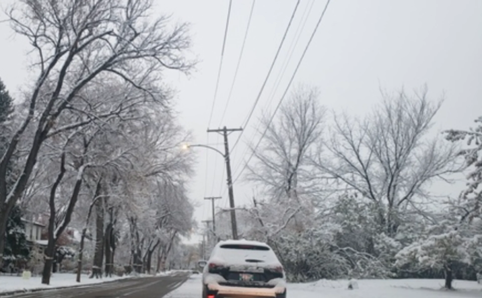
Thumbnail courtesy: Justin Bucklaschuk, Winnipeg, Man.
Be sure to check back as we provide updates on this extended period of winter-like weather.


