
While not tornadic, these storms can still create chaos

Shelf clouds make for some of the most captivating photos, but it’s important to leave that to the professionals.
Severe storms don’t always mean tornadoes are imminent. Sometimes, the storms are just one gigantic line and don’t spin. But that doesn't mean the storms can’t do damage. These spectacular storms are what meteorologists call arcus clouds and while these storms generally don’t produce the same kind of damage as supercells, they can still create chaos.
Tune in to full episodes of STORM-HUNTERS on The Weather Network, Sunday at 7pm and 10pm ET & PT.
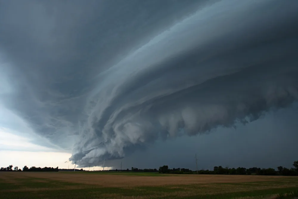
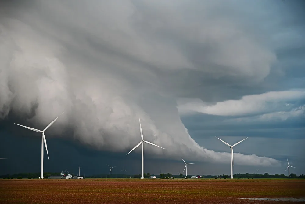
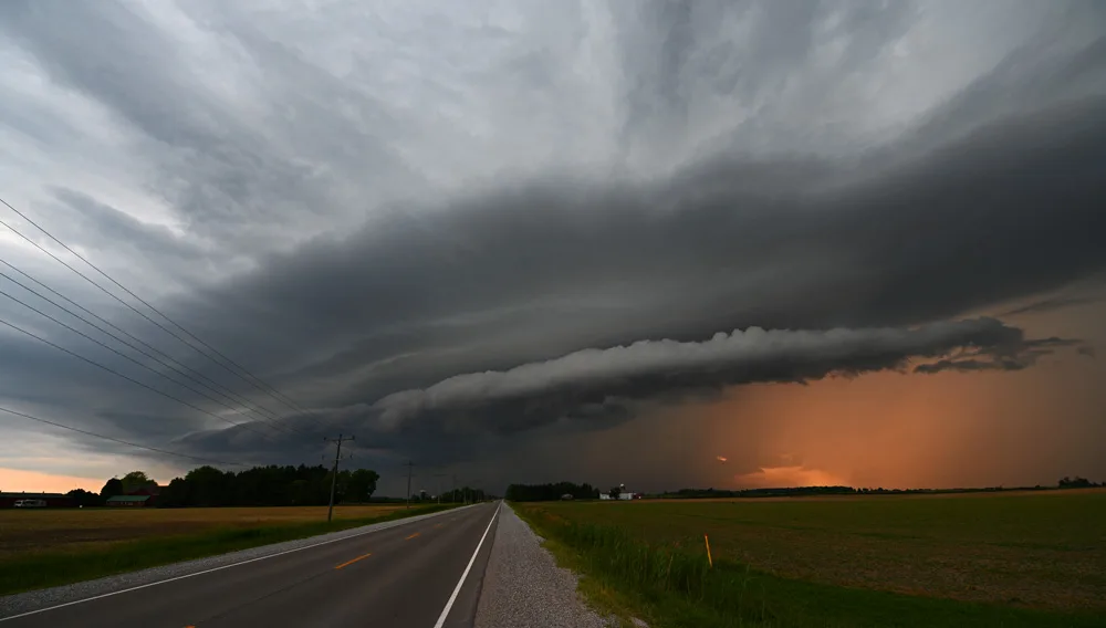
Shelf clouds form on the gust front of the linear storm system and are some of the most spectacular examples of what thunderstorms can look like. The shelf in the photo above built itself on a storm that raced across Essex County in Southwestern Ontario.
A shelf cloud forms as cold air from the storm slams into the ground and acts as a plow, pushing the warmer, less dense, air up and over itself. This moisture in the warm air condenses as it cools, creating the characteristic shelf-like look. The sheer drama of them creates some of the best opportunities for amazing photography and video.
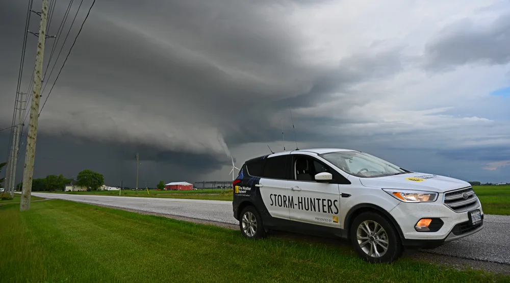
Shelf clouds form on the leading edge of the thunderstorm so as long as you’re ahead of it, there’s no rain and wind. However, these storm systems can move fast (up to 100 km/h) so you’ve usually got only a couple of minutes to grab a shot of your chase vehicle in front of them.
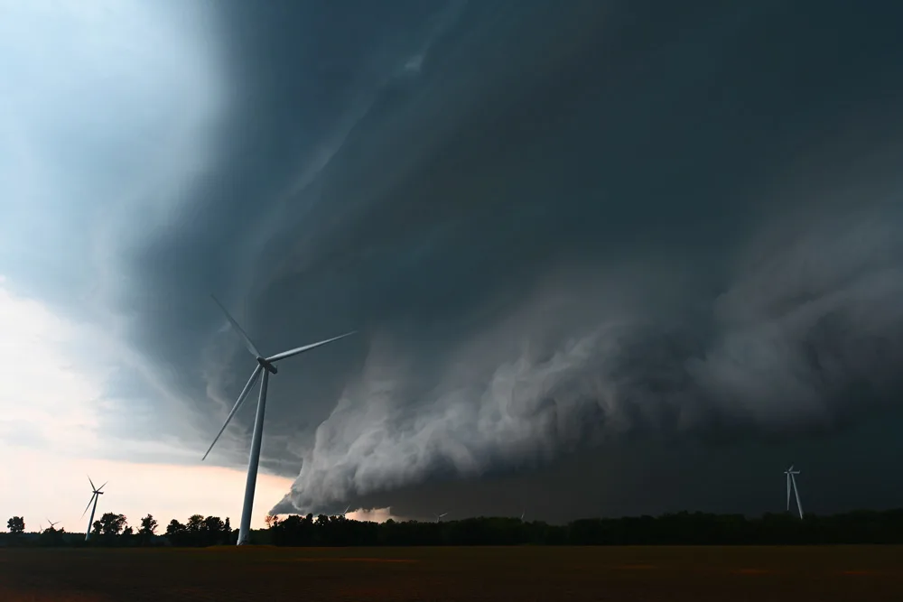
The smooth look to the cloud above (and often part of) the shelf is known as laminar flow. That means that the air motion through that part of the storm has little turbulence. Contrast that to the lower edge of the shelf; it’s often ragged and broken up, denoting the turbulent nature of the air closer to the surface of the earth.
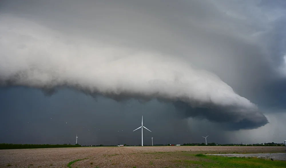
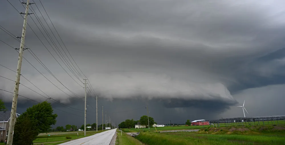
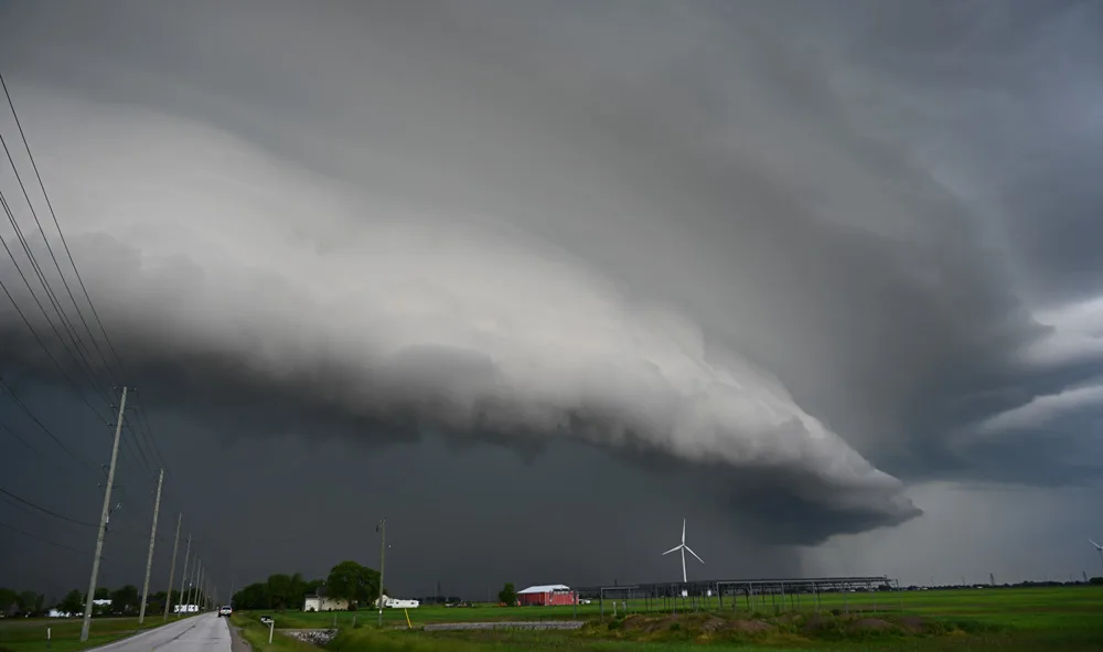
The vast scale of linear, gust front, storms is clear when they roll over human structures. The wind turbines are almost 40 stories tall and they are dwarfed by the front edge of the storm.
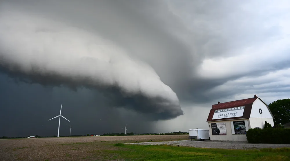
Wind speeds in the core of linear storms like this one can get as high as 120 km/h which can do damage to buildings, but most don’t have quite that punch. This repurposed little barn will likely survive this storm, but it’s impossible to tell how fast the wind is in the core without sampling it directly.
A bit of a shift in perspective as the storm rushes towards me. You can see a small “tongue” of clouds ahead of the main gust front in the shot above. It’s part of the inflow shelf, but because I’m looking down the length of the front, it takes on what looks to be an odd shape.

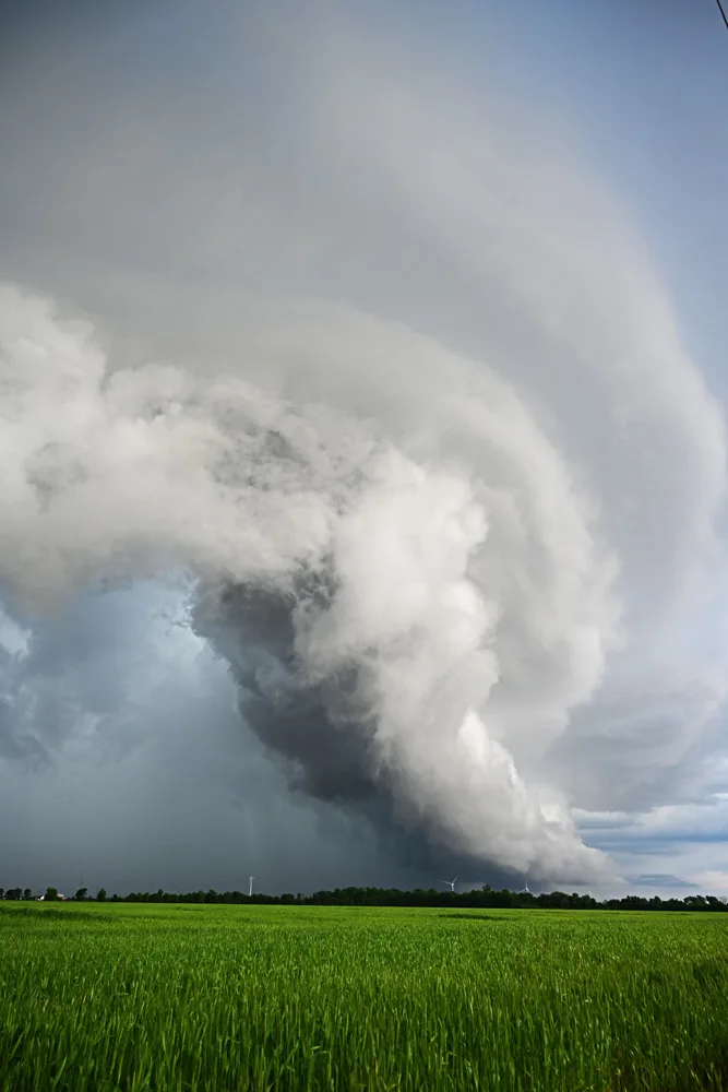
The dark core of the storm belies the violent winds and rain within it. The core is critical to the continuation of the storm as it acts to “plow” up the warm, less dense air in front of the thunderstorm.
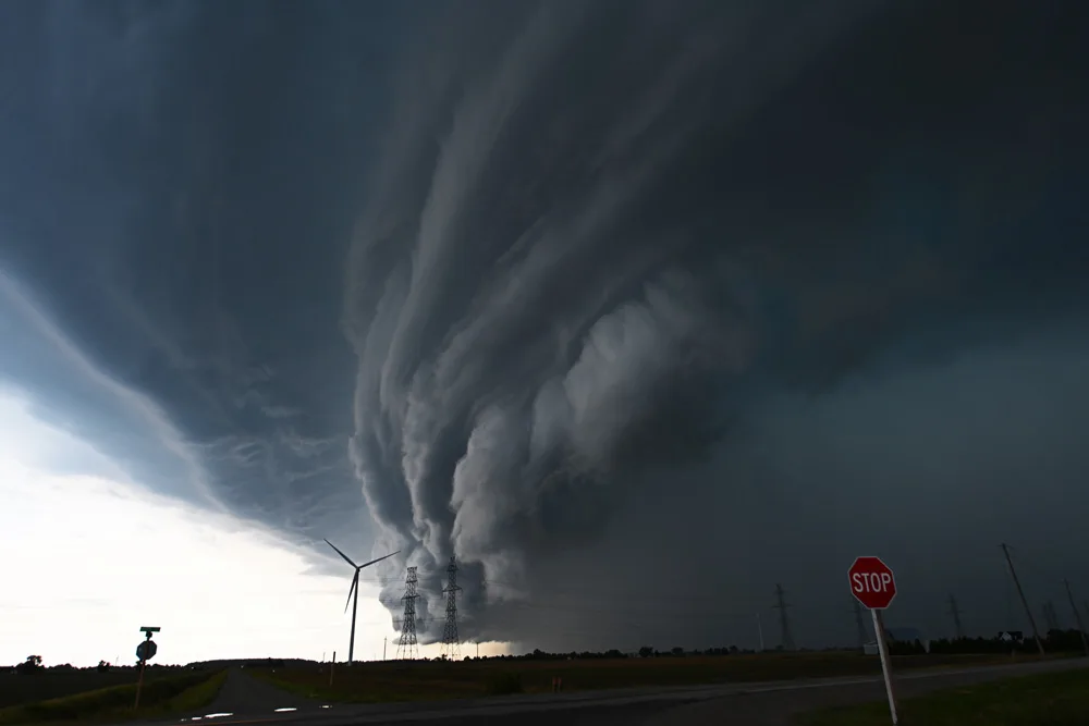
A gust front is not perfectly uniform. There are areas of rotation within the storm front and these take on the form of vortices that can resemble wall clouds and other structures that are usually part of supercells.
As the storms rush across the landscape, they usually head east and that means that they get lit up by the setting sun. If the storm doesn't have a massive core, they can light up with an almost surreal beauty.
If the storm is strong enough with enough turbulence in the leading edge, a type of tornado known as a gustnado can form. These are rarely very strong, but they can get up to EF-2 strength. To see them, you often need to get close to the gust front that it becomes a towering cliff of wind and water.
Standing beneath the leading edge of shelf cloud/gust front can be intimidating beyond what more dangerous storms can do. While they don’t produce very strong tornadoes or damaging winds, they can scare people who aren’t expecting the sheer spectacle of what these storms can be.
Tune in to full episodes of STORM-HUNTERS on The Weather Network, Sunday at 7pm and 10pm ET & PT.
All photos are courtesy of Mark Robinson


