End in sight to the intense snowstorm in Ontario as totals pile up

The multi-day storm in southern Ontario finally nearing its end after dropping considerable amounts of snow and rain Monday and Tuesday. The snow and strong winds from the slow-moving low were enough to cause poor visibility and hazardous conditions on the roads Tuesday, prompting the cancellation of school buses in the morning in several regions. Some hefty snowfall totals have been reported, with Wiarton officially recording 29 cm so far. However, it's not over, yet, with snow continuing through the overnight hours before beginning to ease off Wednesday morning. Some areas may pick up another 5-10 cm before the system moves out. More on Tuesday's snow, what's left of it and what lies ahead for the weekend, below.
WEATHER HIGHLIGHTS:
Snow to continue through the overnight, with additional accumulations of 5-10 cm in traditional snow belt regions
Wednesday morning will see snow taper off, clearing in the afternoon
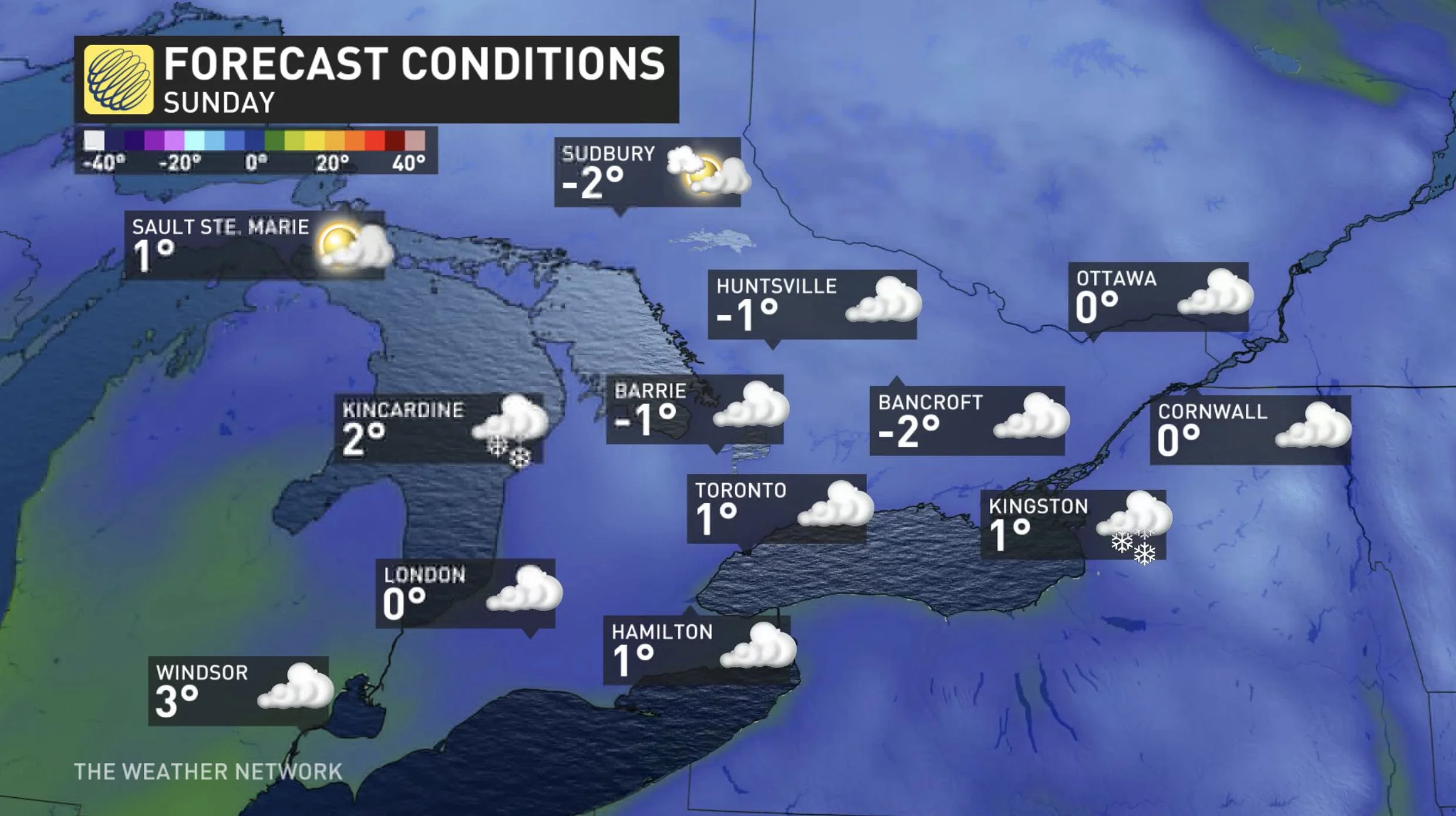
Near seasonal temperatures round out the week, with somewhat changeable, but near seasonal values, for the second week of December
THROUGH WEDNESDAY MORNING: SNOW LINGERS, THEN TAPERS OFF
After intense snowfall and blustery winds blasted southern Ontario during the day Tuesday, the storm is starting to ease off as the heaviest amounts have already fallen. As of Tuesday evening, Wiarton has recorded 29 cm of snow, London has seen 22 cm, 12 cm has fallen in Hamilton and 5 cm was reported at Toronto Pearson Airport.
The final tallies are likely to change as more snow is expected through the overnight hours before finally winding down Wednesday morning.
Visit our Complete Guide to Winter 2021 for an in depth look at the Winter Forecast, Canada's ski season, and tips to plan for everything ahead!
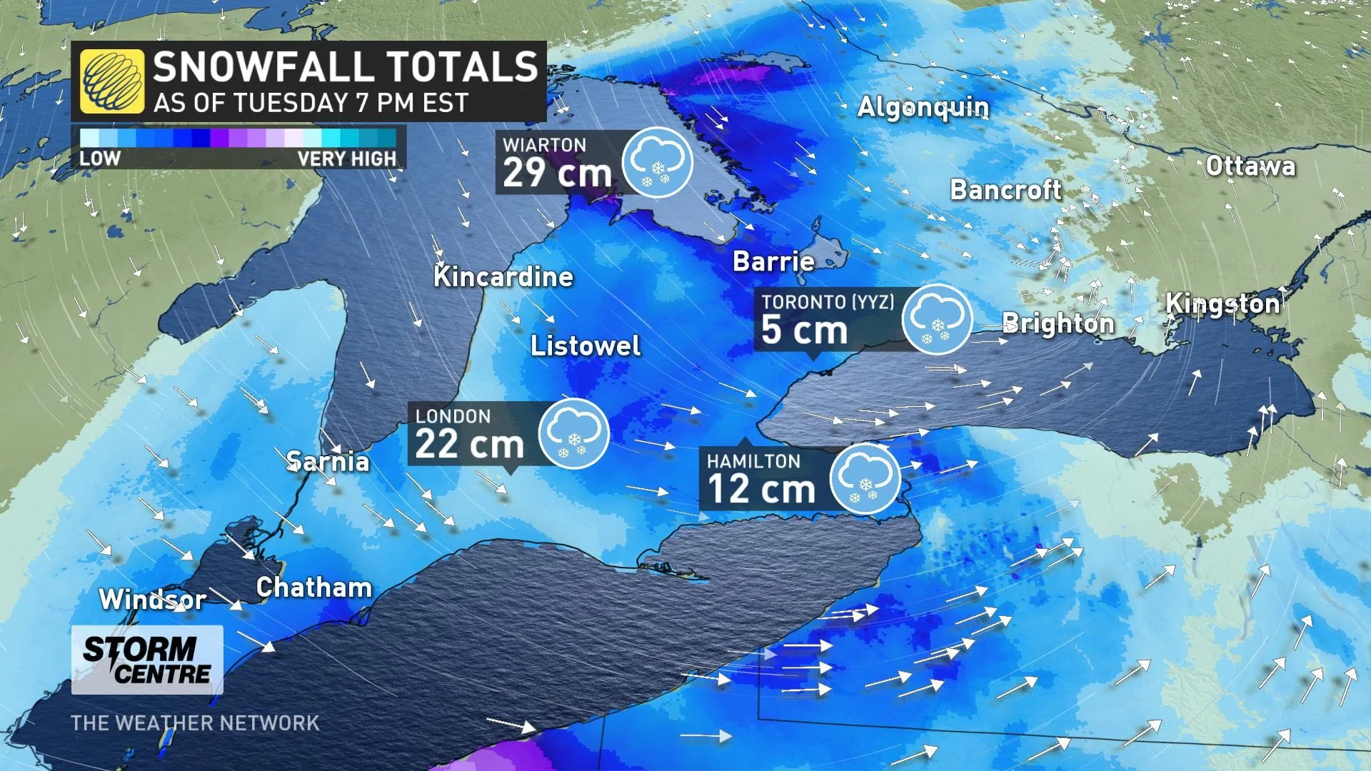
Snowfall and winter storm warnings are expected to drop through the overnight, but bands occurring south of Georgian Bay, Lake Huron and near London may bring these regions another 5-10 cm by Wednesday morning. Elsewhere in southern Ontario, further accumulations should remain less than 5 cm.
Conditions will dry out for the afternoon, though flurries may linger in eastern Ontario, as the effects of the sluggish low will have departed the province. Winds will then change to southwest behind the system.
Southern Ontario will see a quiet day on Thursday, but a weak system and cold front will track in Friday with a few centimetres of snow for much of the region.
ONE OF THE MOST INTERESTING METEOROLOGICAL EVENTS TO DOCUMENT
WEEKEND: SCATTERED SNOW SHOWERS AS TEMPERATURES HOVER NEAR SEASONAL
For the first weekend of December, temperatures will hover near seasonal values with some persisting rain and snow showers expected. At this point however, no significant snow accumulations are likely. A tricky forecast for Sunday, though, as a clipper has to potential to track across the region with some snow.
The start to the second week of December also looks to offer a more typical pattern, with early-winter temperatures and more unsettled conditions. But, there is the possibility of a few days of milder weather mid or late next week.
Looking further ahead, while still a ways off, the third week of December could feature a period of below seasonal temperatures. This may lead to significant lake-effect snow, possibly leading up in the days to Christmas.
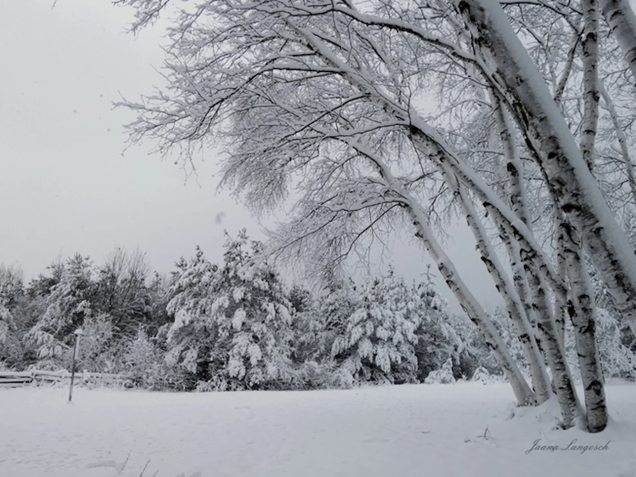
Thumbnail image courtesy: Jaana Langosch/Tiny, Ontario.
Be sure to check back for updates on this impactful multi-day storm.