
Temperature divide across Atlantic Canada, as heavy snow, rain tracks east

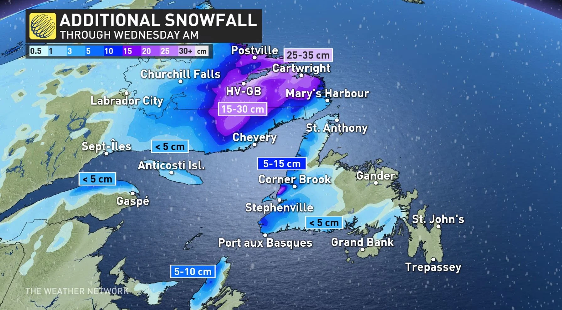
This final week of November remains active across much of Atlantic Canada, with the latest system pushing into Newfoundland for Tuesday, bringing strong winds, heavy rain and snow. Around 15 cm of snow had already fallen in parts of New Brunswick by the morning hours, with the rain winding down in the already flood-vulnerable areas of eastern Nova Scotia early Tuesday. Flooding will still be a concern in Newfoundland, as an additional 20-40 mm is still to come in areas hit hard by last week's event. On top of the heavy precipitation, winds will be blustery once again for parts of the region, with upwards of 100 km/h gusts possible for parts of Newfoundland. More on what's left of the potent system and a look ahead to the ongoing storm parade, below.
Visit our Complete Guide to Winter 2022 for an in-depth look at the Winter Forecast, tips to plan for it, and much more!
TUESDAY: LINGERING WIND, SNOW, RAIN EFFECTS AS POTENT SYSTEM PUSHES EAST
Weather warnings are continuing to drop across Atlantic Canada, as the strong East Coast low makes its way out of much of the Maritimes and brings more impacts to Newfoundland and Labrador through Tuesday.
MUST SEE: Record storm severs highway links in N.L.
Moderate rain will continue across Newfoundland, as the low pressure system continues to track east. Additional rainfall totals of 20-40 mm are anticipated, so localized flooding remains a concern. Heavy snow and the risk for freezing rain is forecast for Labrador through the day before gradually easing through the overnight hours.
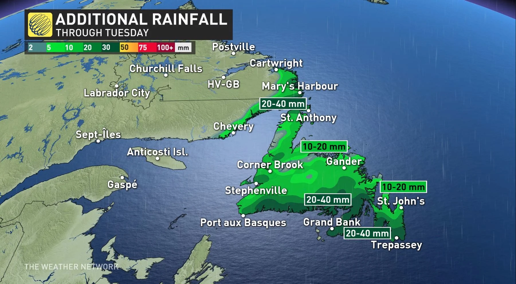
Sea-effect snow will also pick up in Newfoundland in the afternoon hours Tuesday, as the low exits the province.
Strong southerly winds ahead of a cold front will bring wind gusts of 70-120 km/h to the Avalon and exposed coastal areas. Behind this system, blustery west winds will continue into Wednesday and will produce sea-effect snow squalls across western Newfoundland and western Cape Breton.
LOOK AHEAD: STUBBORN STORM PARADE CONTINUES
Another strong storm is forecast for Atlantic Canada late this week, as low pressure over northeastern Ontario rapidly strengthens as it tracks across Quebec and into southern Labrador through Friday.
Widespread rain and very mild temperatures are expected across most of the region, along with strong winds. Wind gusts for southern and eastern Newfoundland could reach 90+ km/h on Friday and again Saturday.
Blustery and much colder conditions are expected behind the storm, with flurries and sea-effect snow forecast for western Newfoundland.
The storm parade doesn't end there either, with yet another strong system expected early to mid-week next week.
Check back as we continue to monitor these systems across Atlantic Canada.


