
Temperature turnaround coming in Ontario after showery, cool Sunday

Sunday isn't looking to be much of an improvement in southern Ontario, as lake-effect showers will continue to flow off Lake Huron and Georgian Bay in behind Saturday's system that generated heavy rainfall in the province and severe storms in Quebec. A northerly wind will allow for a shot of Arctic air, so chillier temperatures in store, a key component to the lake-effect setup. However, the unsettled weather won't be hanging around as a vast uptick in conditions and temperatures is around the corner for early this week. More on what to expect for the rest of the weekend and the week ahead, below.
Visit our Complete Guide to Fall 2021 for an in-depth look at the Fall Forecast, tips to plan for it and much more!
SUNDAY: FALL CHILL BRINGS LAKE-EFFECT SHOWERS IN ONTARIO
The unsettled conditions will continue Sunday across southern Ontario as temperatures take noticeable dive after the recent long-lasting bout of unseasonable warmth.
MUST SEE: Waterspouts, lake-effect showers likely in Ontario as Great Lakes run a fever
A northeasterly wind off the warm waters of Lake Huron and Georgian Bay, along with a blast of Arctic air, are coming together to produce lake-effect showers throughout Sunday.
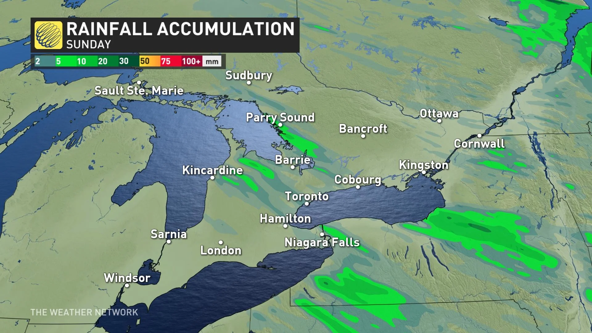
Not everyone will see the rain, but those that do encounter the narrow bands of precipitation may see rainfall totals upwards of 10+ mm locally, whereas other areas across southern Ontario may only see trace amounts, if any at all.
Temperatures will remain quite cool in the region Sunday, going no higher than the mid-teens in very locales, while other barely make it into the double digits.
However, a wind shift and warming air aloft will bring an end to the rainfall overnight Sunday, giving way to a transition day on Monday.
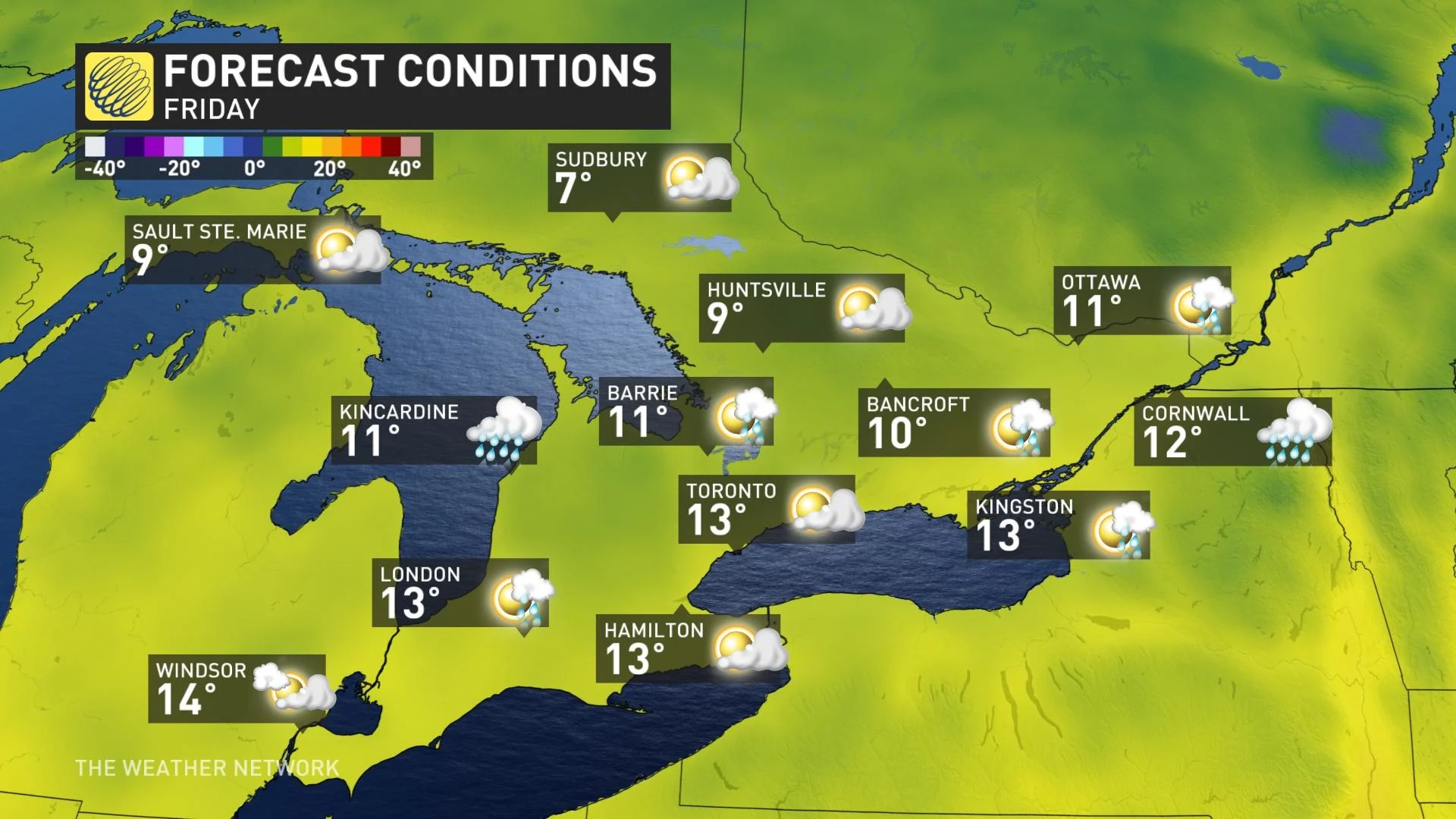
THIS WEEK: WARMER CONDITIONS MAKE A BRIEF RETURN
The weekend’s cooldown isn’t quite here to stay. Winds will shift from the northwest to the southwest as the next ridge of high pressure builds in. This will bring a return to sunshine and temperatures nearing 20°C for Tuesday and Wednesday.
The warmth won't be sticking around for long this time, however, with conditions turning colder later in the week once again.
Overall, a more changeable pattern is expected for the second half of October, but temperatures will still tip to the warm side of seasonal.
Be sure to check back for the latest updates across Ontario and Quebec.


