June-like warmth, along with some storm risk, persists across the Prairies

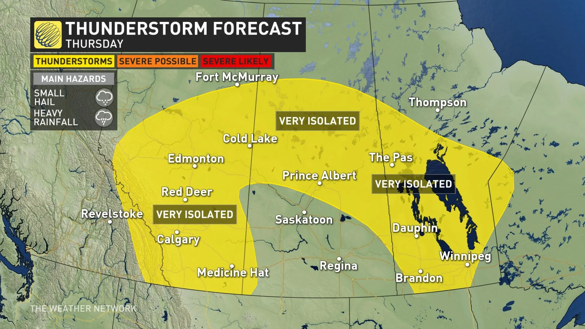
Thursday looks much like Wednesday across the Prairies, weatherwise, with daytime highs ranging from the mid-teens to mid-20s, and a slightly more widespread thunderstorm risk that nonetheless looks very isolated. The early June-like temperatures continue into next week, and the long range shows the earliest indications of a more potent system that could feature the region's first real rainfall in months. For a closer look, see below.
THURSDAY: THUNDERSTORM RISK REMAINS SLIGHT
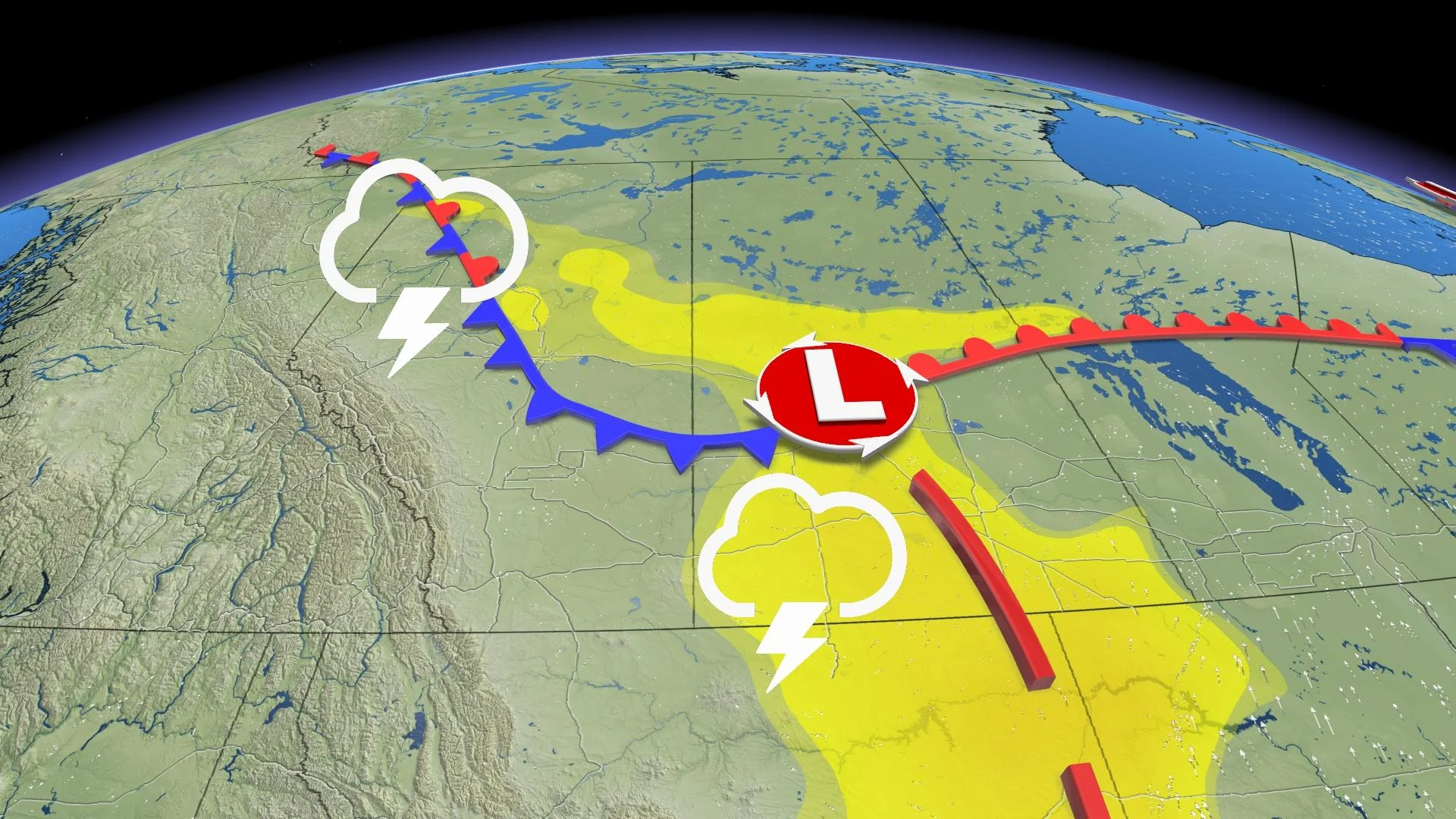
After a warm and pleasant day across the Prairie region Wednesday, albeit with a slight thunderstorm chance in Saskatchewan, Thursday looks to be something of a carbon copy.
Once again, daytime highs will be in the low-to-mid 20s across much of southern Saskatchewan and Manitoba. Alberta looks to be a little cooler, though with temperatures not straying too far down into the teens there, though Calgarians may have to content themselves with a maximum of 15°C.
There is the risk for showers and thunderstorms once again on Thursday, with a more widespread chance across all three Prairie provinces.
MUST SEE: Sputtering spring finally surges back to life across Canada
As with Wednesday, any storms that do pop up will feature small hail and locally heavy downpours.
However, we do stress that such storms will be very isolated indeed, and most people won't get one. Even in places that do see a brief downpour, it won't be enough to reverse the region's months-long dry spell.
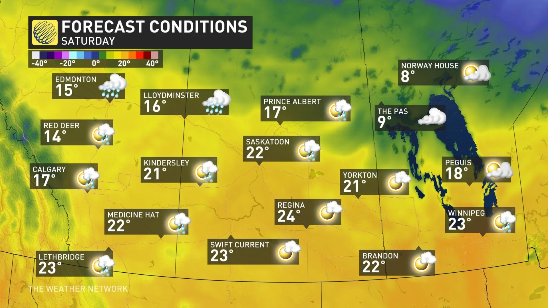
BEYOND: TASTE OF JUNE, CHANCE FOR BENEFICIAL RAIN NEXT WEEK
Warm temperatures will continue through the remainder of the week, with daytime highs well above seasonal across southern Saskatchewan and Manitoba. By early next week, in fact, daytime highs in the upper 20s are not out of the question, and there's a chance parts of the region may hit 30°C, which would be Canada's first shot at that threshold this year.
The warmth is giving the regions a taste of early June, but there will still be little opportunity for any much-needed rain.
However, forecasters are watching the potential for a significant system to develop over Alberta early next week and then track east across the region.
"The pattern next week has the potential to bring beneficial rain to large parts of the region, but rainfall totals will not erase the increasingly troubling deficits and southernmost areas are at risk to underachieve," says Dr. Doug Gillham, a meteorologist at The Weather Network.
Be sure to check back for the latest updates on the drought conditions across the Prairies.


