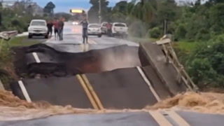
Treacherous travel, road closures as dangerous storm moves through Prairies

Widespread winter alerts span the Prairies, as gusty winds, heavy snow and dropping temperatures lead to a messy mix and dangerous travel conditions. Drivers are being urged to postpone any non-essential travel, with drifting snow and reduced visibility reported on major highways. An additional 5-10+ cm of snow is possible across parts of Saskatchewan and Manitoba through Tuesday, with howling 70-90+ km/h winds making for blizzard-like conditions. The lingering cold front in southern Alberta may produce some additional snowfall for the foothills as well. More on what's left of this clipper system and the impacts expected, below.
TUESDAY: DANGEROUS ROAD CONDITIONS AS SNOW, POWERFUL WINDS WHIP THROUGH, TRAVEL NOT RECOMMENDED
Freezing rain and blowing snow was widespread across Alberta on Monday, with some additional snowfall expected across the extreme southern foothills through the day on Tuesday. A sudden drop in temperatures created slick and icy surfaces, which threatens to impact commute times once again as well.
Roads and highways continued to deteriorate across southern and central Saskatchewan, as the clipper system pushed eastwards into early Tuesday. A combination of high winds and snow lead to some dangerous blizzard-like conditions, with several highways surrounding Regina and Moose Jaw closed first thing.
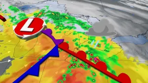
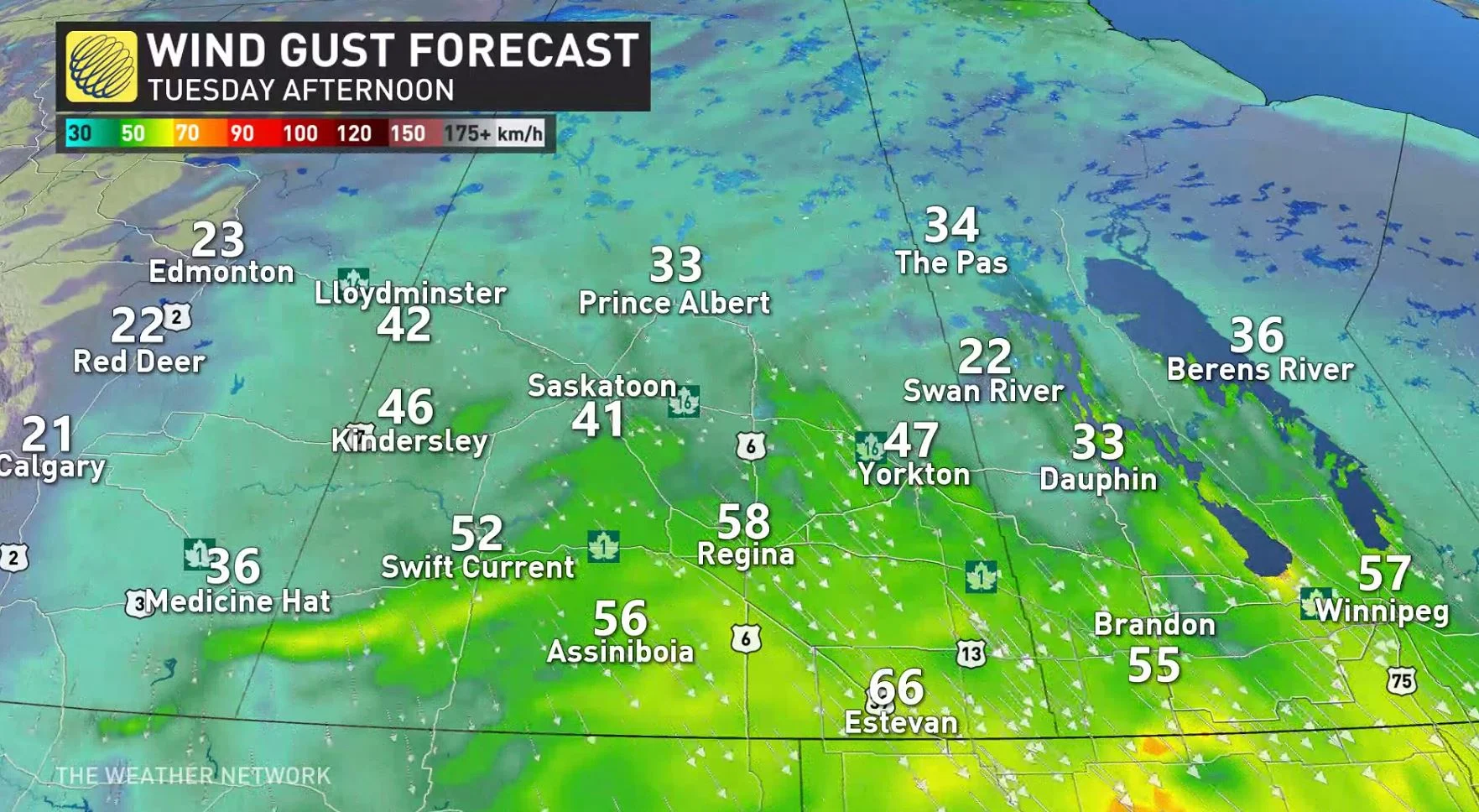
Northwesterly winds will be gusting between 70-90+ km/h and will continue over areas near and south of the Trans Canada Highway.
The strongest gusts are possible with the cold front in southwestern Saskatchewan, along the U.S. border and in the Wascana Basin.
"Avoid travel if possible," says Environment and Climate Change Canada (ECCC) in a winter storm watch that spans southern Saskatchewan. "Travel is expected to be hazardous due to reduced visibility in some locations. Surfaces such as highways, roads, walkways and parking lots may become icy and slippery. Extreme cold conditions are likely with extreme wind chill values."
A blizzard warning was issued in the Estevan and Carlyle regions Tuesday morning.
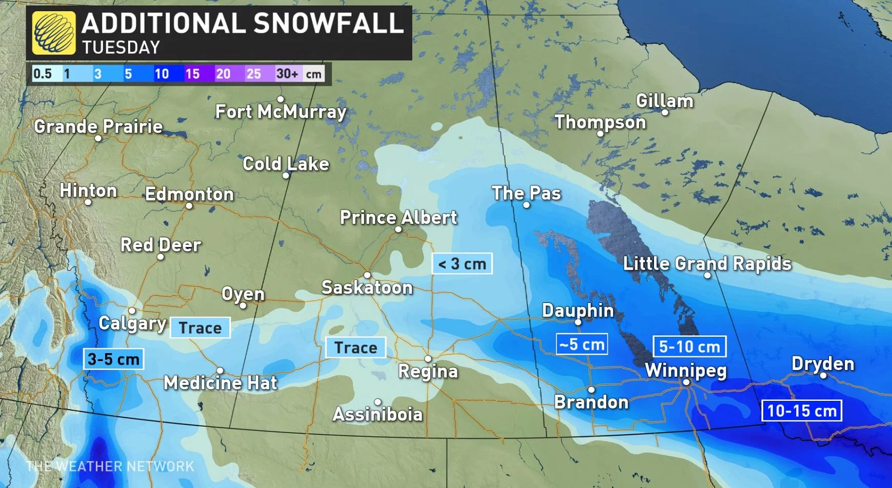
Central areas in the province can expect 5-10 cm of snow, while areas in the south will see less than 5 cm. A general swath of 5-10 cm of snow will fall across central Saskatchewan, with higher totals expected close to the Manitoba border.
The snow pushed into Manitoba overnight Monday, with Winnipeg already receiving 10 cm by Tuesday morning. Additional amounts of 5-10+ cm can be expected during the day.
"Behind the system, winds will continue to increase through Tuesday with gusts near 80 km/h expected," says Kelly Sonnenburg, a meteorologist at The Weather Network. "With the friction-less Manitoba lakes, winds may gust even stronger for areas just south of the lakes, which has prompted blizzard warnings over the water and winter storm warnings for the Red River Valley."
Poor visibility and dangerous travel can be expected for southern regions. Even within the city of Winnipeg, visibilities will likely be reduced by blowing snow, especially downwind of open areas.
Wind gusts will remain strong through Tuesday evening for both southern Saskatchewan and Manitoba before gradually easing later Tuesday night.
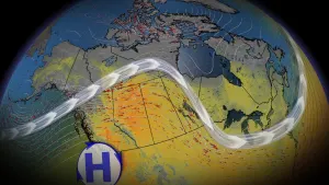
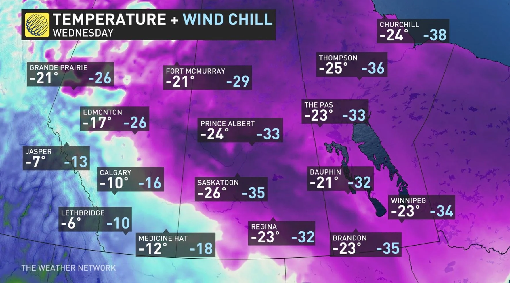
As the system continues to track eastwards, temperatures will drop throughout the day, with cold air will remaining in place through Wednesday before conditions warm up once again Thursday.
Very mild conditions are expected for Alberta this weekend, with temperatures climbing well above freezing again. Meanwhile, another blast of Arctic air is expected across the eastern Prairies this weekend and yet another shot for early next week. This will give a very impressive contrast in temperatures for the west versus eastern Prairies.
Check back for the latest updates on conditions across the Prairies.
Thumbnail image courtesy: Jenny Hagan