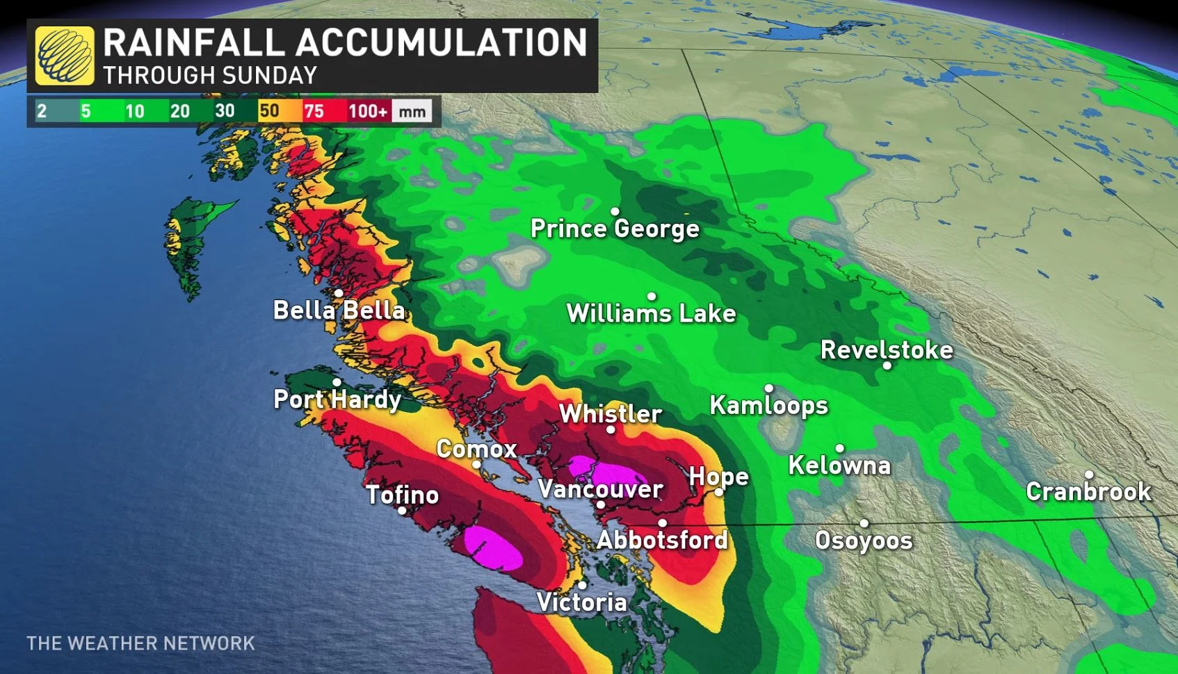
B.C. coast the 'bullseye' for long duration rain, 100+ mm coming

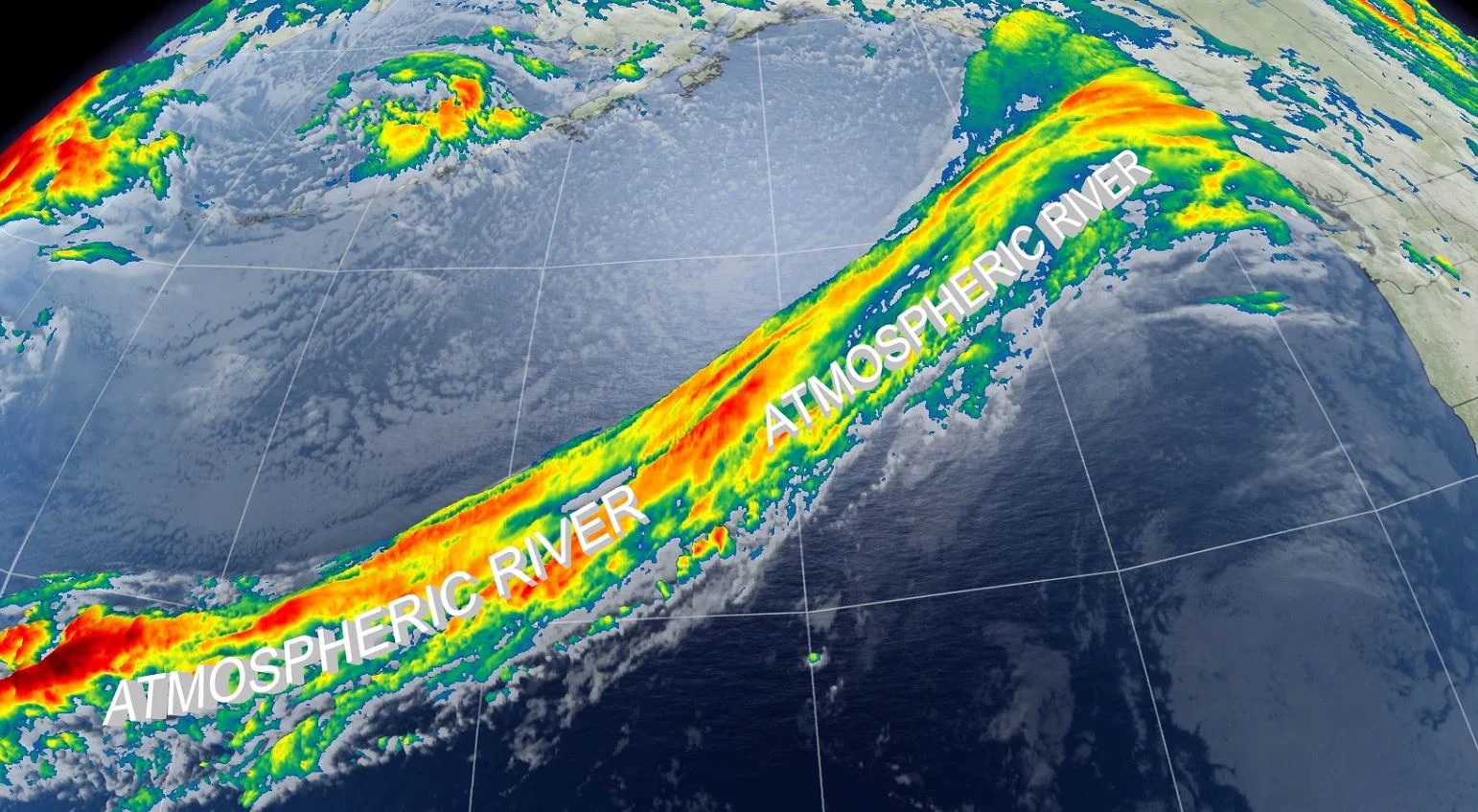
It's very much the fall season in British Columbia, and the incoming deluges are set to make that very clear. A pair of pulses of moisture are set to slam into the coasts, bringing very heavy rains, in excess of 100 mm in some areas, with some snow at the alpine level. Difficult travel and mudslides are possible. For a closer look, see below.
FRIDAY THROUGH THE WEEKEND: TWO PULSES OF MOISTURE BRING HEAVY RAINS, ALPINE SNOW
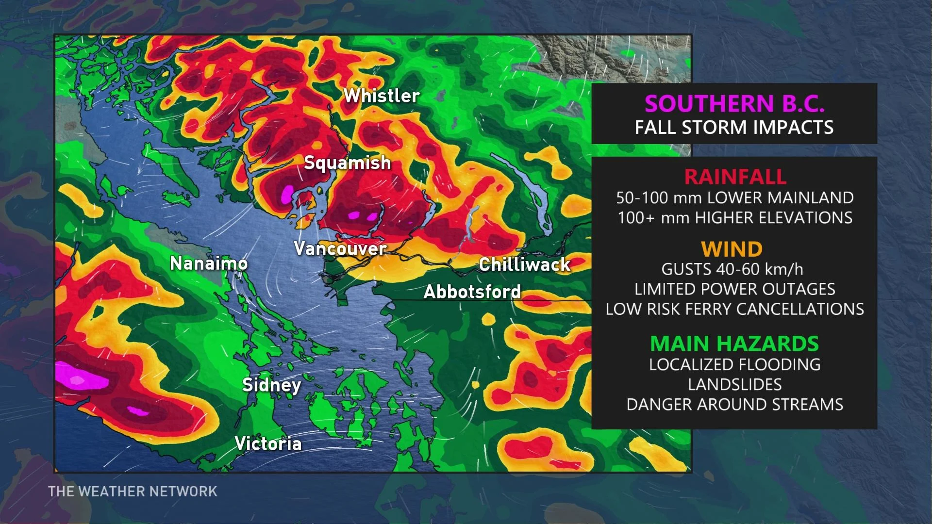
From Friday through Saturday, two slugs of significant moisture slam into coastal regions. By Saturday evening, over 100 mm of rainfall is likely to accumulate for some of those nestled below the North Shore mountains. Even heavier amounts are possible for the higher terrain.
Rainfall warnings and special weather statements have already been issued by Environment and Climate Change Canada (ECCC), warning of the wet and windy weekend ahead.
"This event could bring beneficial rain to the region, especially after such an exceptionally dry summer, but may also cause hazards like mudslides, road washouts, and rising river and stream levels, as copious amounts of moisture gets transported towards the coast," warns Matt Grinter, a meteorologist at The Weather Network.
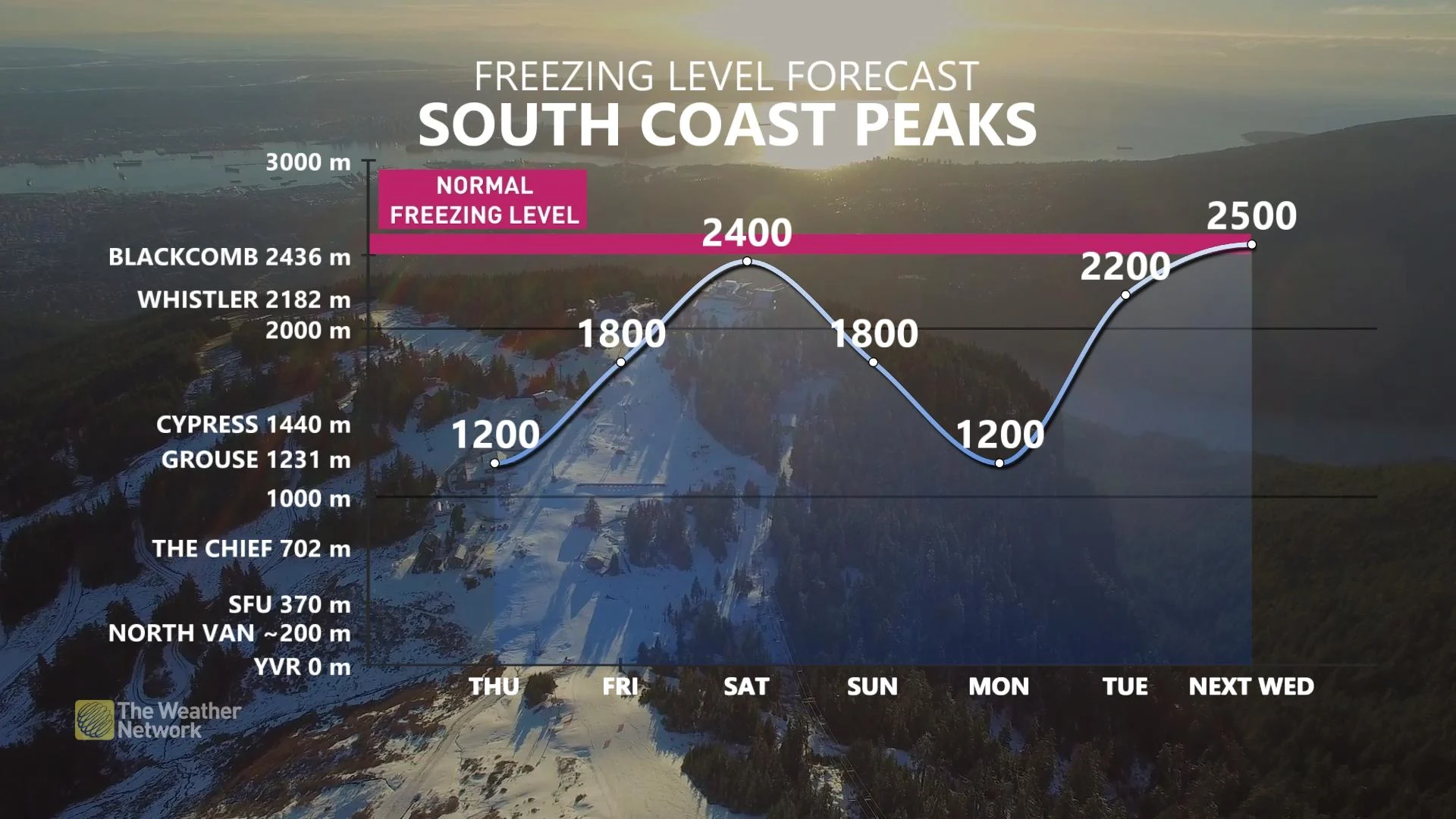
At the higher elevations, the freezing level has that classic roller-coaster vibe going on; it's easy to spot the warmer frontal system this weekend and that'll dash snowfall chances at the three local Vancouver ski hills: Cypress, Grouse and Seymour.
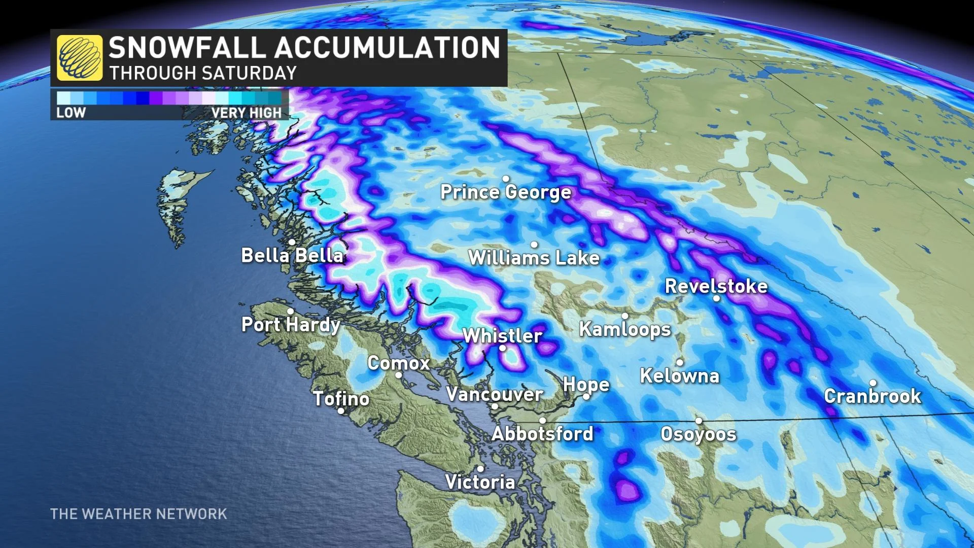
At higher terrain, near the peak of Whistler, it’ll be mostly a snow event, with upwards of 50 cm forecast across the higher mountainous terrain.
"As freezing levels rise over 2000 metres on Saturday, snow melt will also add to run off. Swelling of local streams and localized flooding are possible during this time," ECCC warns in the statement.
As for winds, they’ll gust their way below severe criteria, but a few gusts might clock close to 70 km/h through the Strait of Georgia. Between 40-60 km/h will be the typical wind speed along the water with these particular frontal systems. Enough for a rocky ferry ride, but unlikely to cancel sailings.
BEYOND: BRIEF IMPROVEMENT, BUT UNSETTLED PATTERN SOON RE-ESTABLISHES ITSELF
Conditions are expected to improve for early to mid week next week, but an active and unsettled pattern returns for the second half of the week and continues through the final week of October with below seasonal temperatures expected.
Be sure to check back for the latest updates on this soggy set-up in B.C.
With files from meteorologist Tyler Hamilton.


