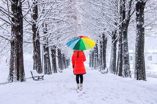
Will winter actually invade the heart of Ontario's fall season this year?
There are a lot of burning questions around this year's Fall Forecast for Ontario, with initial predictions of an earlier start to some wintry weather. Wondering exactly what it all means? Meteorologist Dr. Doug Gillham answers, here.
This year's official Fall Forecast has piqued the interest of many Ontarians in particular.
And it's not for the start of the new season that looks to offer plenty of opportunities for extended warmth and a prolonged patio season either. But rather the second half, which calls for an "earlier arrival to winter weather." We are Canadian afterall, and complaining about the snow and cold can be a national pastime, right?
Visit our Complete Guide to Fall 2021 for an in-depth look at the Fall Forecast, tips to plan for it and much more!
In the forecast, meteorologist Dr. Doug Gillham says, parts of Ontario could be looking at "more winter weather leading up to the holidays than we have often seen over the past 25 years." Gillham also calls for an "abundance of lake-effect snow" across the snow belt regions late fall and early winter.
So what does that mean exactly? Will we be seeing the first heavy snow by the time Halloween rolls around? Will any pre-holiday plans be affected by difficult travel and dangerous lake-effect snow? OR, have we just grown accustomed to much gentler Decembers in most recent years, and will the end of this fall in Ontario be more "typical" in terms of the normal weather for that time of year?
In this exclusive feature, we wanted to get right to the bottom of it all, asking Dr. Gillham first hand to explain how the seasonal forecasting works, and why this year might signal an earlier arrival to the winter weather in Ontario. Read on for every detail to these burning questions, below.
1. When you say warmer than normal conditions will dominate the heart of the fall, can we expect patio season to last right through until November?
Well, it all depends on what you consider "patio weather" to be, but for most people, the answer is no. We could get spoiled with a few days of patio weather in November, but fall is always a changeable season with up and down swings in temperatures, so even a warm fall will have stretches of weather that will drive us indoors. However, we expect that the periods of warmer than normal weather will outweigh the periods of colder than normal weather.
2. Is there an idea of when the season "flips the switch" and those above seasonal conditions end? Do we fast track right into winter by early December?
There is still a lot of uncertainty as to when the season will "flip the switch." November is the wild card in our Fall Forecast. At this point we are targeting mid-November for the pattern change, but pattern changes can readily happen 1-2 weeks slower or faster than expected – so that really leaves us with anytime during November. So, at this point, we are still unsure as to whether November will end up warmer or colder than normal across Ontario.
3. What sort of pattern change would lead to an earlier arrival of winter weather this year? And how early is early?
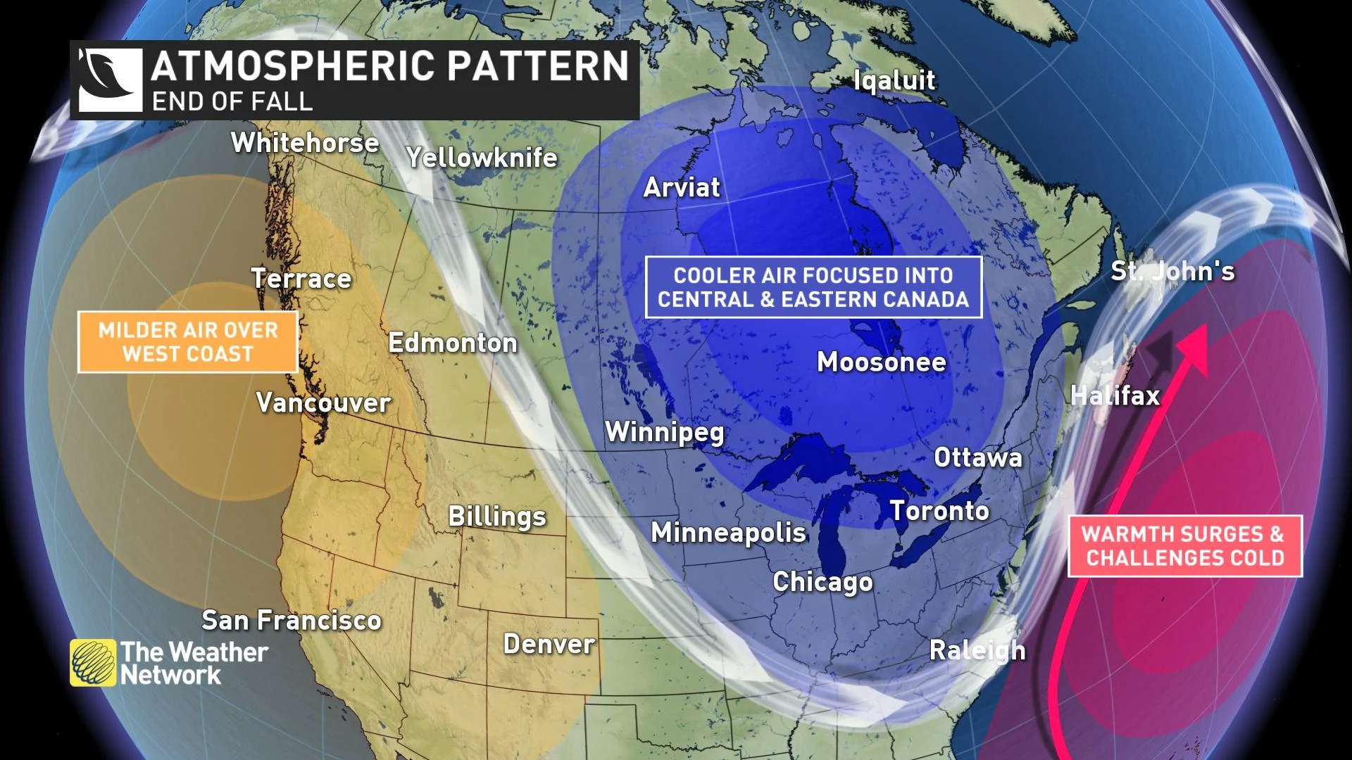
We expect a change in the jet stream pattern, with the dip in the jet stream centered on the Great Lakes region. This would allow colder air from northern Canada and the arctic to spill south into our region more frequently.
The exact timing of the pattern change is still uncertain, but we don’t expect that winter will invade during the heart of the fall season. We have seen some cold Novembers in recent years that were followed by very mild Decembers. We don’t think that will be the case this year. While the colder pattern may get started during November, we expect that once the pattern change does occur, it will stick around through the holidays.
4. What exactly do you mean by more winter weather leading up to the holidays than we have often seen over the past 25 years?
It is much too early to say whether the start of winter will end up being a doozy. However, we expect that the weather during the weeks leading up to the holidays will be more conducive to skiing than to golfing, which is in contrast to many Decembers over the past 25 years. While there have been some notable exceptions, we have gotten off rather easy during the majority of the recent Decembers.
5. Has it really been 25 years since we've had an abundance of winter weather before the holidays?
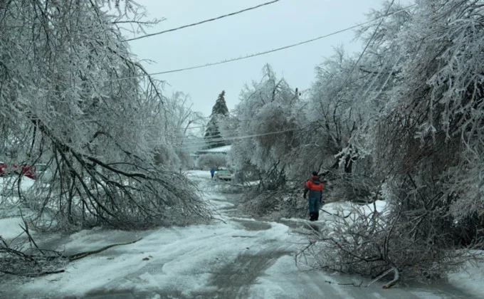
No, there have been a couple of notable and memorable exceptions to the recent trend of having milder and more gentle Decembers. For example, 2017 brought an abundance of snow and extreme cold before and during the holidays, and December 2013 brought an historic ice storm to parts of southern Ontario, including the Greater Toronto Area.
MUST SEE: The ice storm of 2013 was a nightmare before, during and after Christmas
Courtesy: George Kourounis
6. Do you expect a snowfall before or around Halloween?
It is too early to make that call. Most years we do see some lake-effect snow in the snow belts areas before Halloween and all that it takes is one quick shot of cold weather for it to snow. While it is unlikely that southern parts of the province will see any measurable snow, a mild October certainly does not rule out the possibility of seeing some flakes. However, we do not expect consistent cold to arrive until after Halloween.
7. Do you suspect pre-holiday travel will be difficult with this early arrival of winter weather/abundance of lake-effect snow?
If we do see near normal or colder than normal temperatures during late November and December, there will be an abundance of lake-effect snow in the snow belt regions. However, it is impossible to know this far out exactly when that will occur. I expect that travel around the holidays will be impacted at times, but there will be periods of fair weather as well when the weather won’t impact travel.
8. Will this be a December to remember in terms of snowfall? What is your confidence in that?
In seasonal forecasting, confidence is typically much higher in the temperature forecast rather than the precipitation forecast. Snowfall amounts will come down to the exact tracks of individual storms and that is difficult to pin down even just a few days out. At this point, we are leaning towards above normal snowfall for December, but it is possible that the storms will stay to our south and if that happens, snow totals will not be very memorable except for in the lake-effect areas.
9. How cold do you expect things to get for the second half of the fall season in relation to what's "normal."
It is still too early to get into details about how cold it will get. At this point we are keeping our forecast conservative and calling for near normal or slightly below normal temperatures. There are some indications that December could end up colder than that, but we also acknowledge that the jet stream might not evolve as expected. So, as we get closer to December, we will fine tune the forecast and provide more details.
10. If we do end up seeing an earlier arrival to winter weather this year, will that pattern hold through the rest of the winter season, or more so a strong start and softer heart of the season?
That’s the question we will strive to answer when we release our preliminary and final Winter Forecast. In 2017, we had a severe start to winter and then a very mild ending. In 2013, winter hit early, and the pattern held for most of the winter. Which will it be this year? Stay tuned!


