
Another quick shot of snow, rain and cold blasts through Atlantic Canada

Wednesday will offer much of the Maritimes a reprieve from the unsettled weather, but will be rather cold with frigid wind chills from a quick blast of Arctic air. The next system is already on deck, however, set to bring another round of rain and snow for the region Wednesday afternoon, with effects ongoing into Thursday. Amounts won't be too excessive but parts of Nova Scotia may see 10-20 cm of snow through Friday morning, as it contends with sea-effect snow before the next low moves in. More on what to expect with next system and a glimpse at a potential nor'easter that may impact Atlantic Canada this weekend, below.
WEDNESDAY AND BEYOND: TEMPERATURES PLUMMET BRIEFLY, MORE RAIN AND SNOW
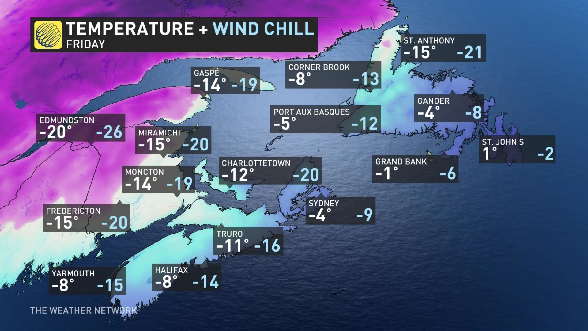
A strong northwesterly wind will sweep in following the departure of the early week system, bringing in the risk for sea-effect snow for western Newfoundland and Cape Breton into late Wednesday evening. This will lead to a quick shot of wind chills into the minus teens and -20s across the region.
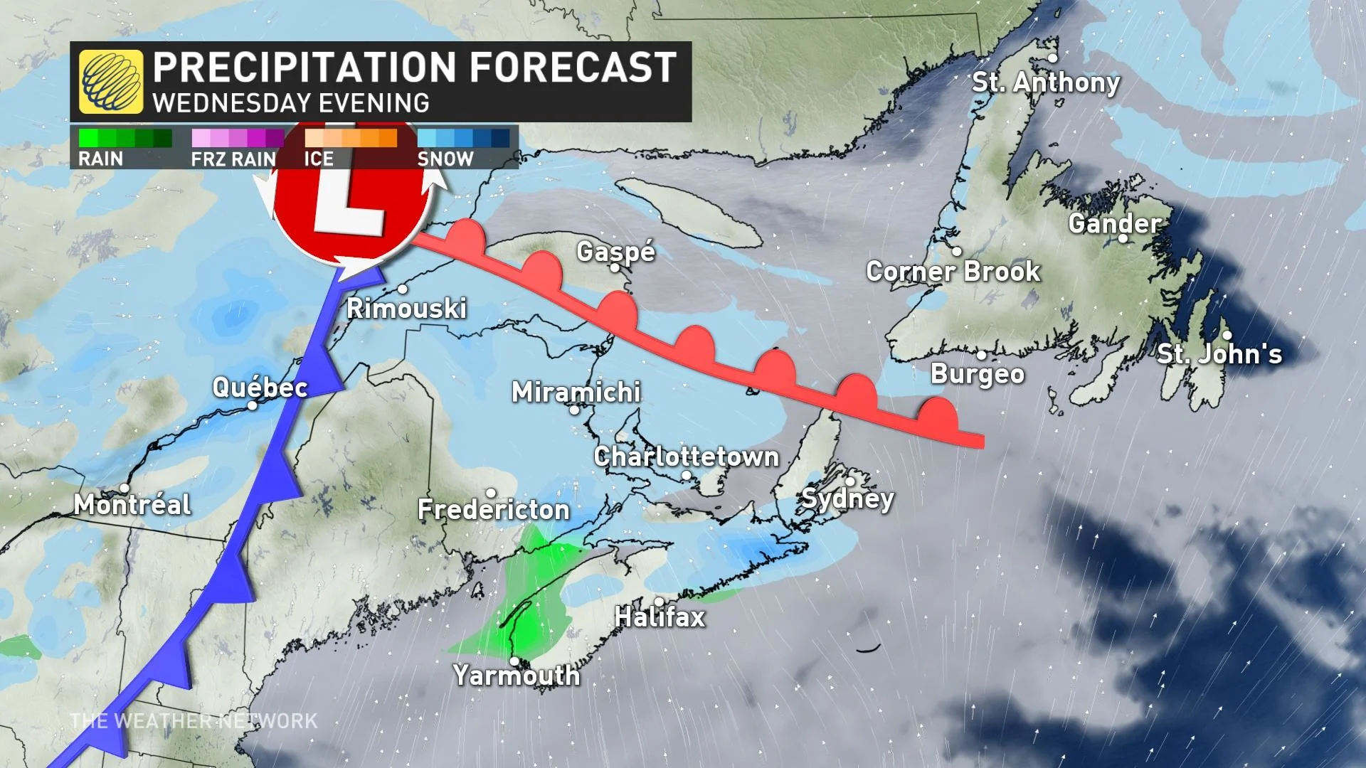
However, temperatures will quickly rebound Thursday as a new system moves in. The clipper will trek into the Maritimes Wednesday afternoon, bringing in snow for the region. As the front moves across Nova Scotia, the snow will transition over to light rain Wednesday overnight, lingering into Thursday morning.
Light snowfall is expected across Newfoundland on Thursday morning, while eastern areas of the province will transition over to rainfall by the afternoon.
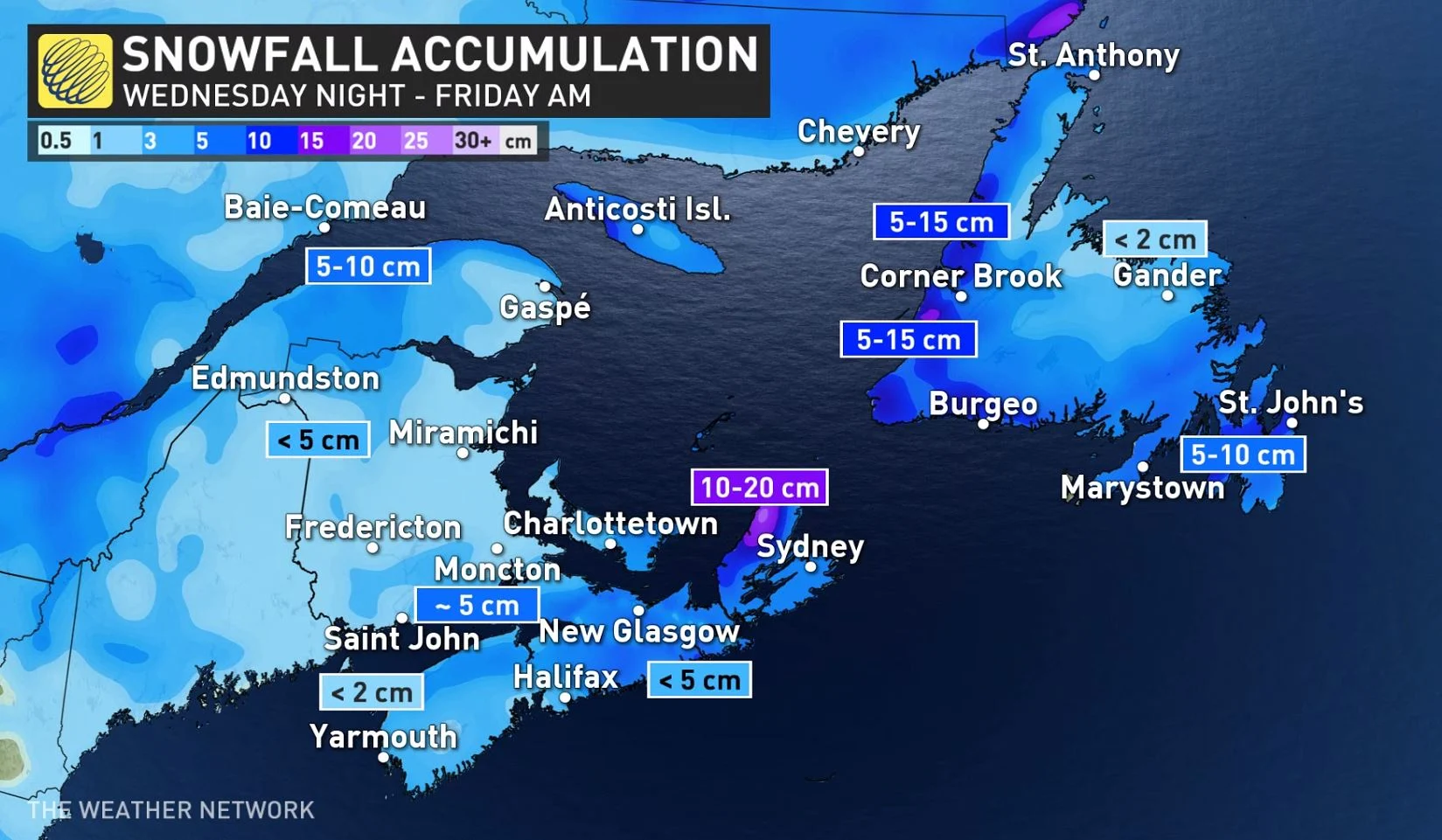
Snowfall amounts will be heaviest in eastern Nova Scotia, though its totals also include accumulations from the sea-effect snow. Through Friday morning, it may see 10-20 cm of snow, with 5-15 cm for western and southern Newfoundland. Around 5 cm or less is expected elsewhere in the Maritimes.
Temperatures will drop for a brief period in behind the system, plummeting into the minus teens for a good portion of the Maritimes and minus single digits for much of Newfoundland. Wind chills will also return, with feels-like values into the -20s for New Brunswick and P.E.I.
Beyond, forecasters are watching the potential for a nor’easter this weekend. This has the potential to be a high-impact storm for much of the region, but the storm track, timing and impacts are still highly uncertain.
Model scenarios range from a major snow and ice storm for the southern Maritimes and western Newfoundland with winds across the region versus a much weaker system that tracks too far out to sea to impact the region.
But then there is the potential for a significant system early next week. The overall pattern supports a significant storm.
An active and changeable pattern is expected through the end of January and into early February.
Stay tuned to The Weather Network for the latest forecast details for Atlantic Canada.


